Friday, September 16, 2022

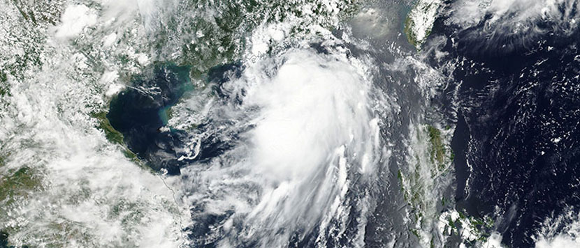
All eyes in Alaska will be on the remnants of Typhoon Merbok as the system moves over the southern Bering Sea on Thursday night – before becoming what’s expected to be the strongest storm to impact the state in more than a decade.
The National Weather Service in Fairbanks is urging coastal residents to complete preparations for the storm by Friday morning, as conditions will begin to rapidly deteriorate by Friday afternoon.
This is likely going to be the strongest storm in over a decade, with impacts likely rivaling impacts they saw in 2011 from what’s referred to as the Bering Sea Superstorm, Jonathan Chriest, a meteorologist with the weather service in Fairbanks, told a news media.
That 2011 Alaskan storm, with wind gusts over 90 mph, left behind a wide swath of destruction. Like Merbok, the 2011 system was an extratropical storm.
An extratropical storm or cyclone has cold air at its core – unlike a tropical storm or cyclone which has a warm core. Both can cause significant damage from strong winds, heavy rain and storm surge.
This week’s storm will not only rival the 2011 event, but is expected to reach a magnitude unlike any other for the month of September.
The storm’s central pressure, a metric which can indicate how much wind and storm surge a system can produce, is forecast to drop to a mind-bending 940 millibars – a number typically found in Category 3 and Category 4 hurricanes. Generally speaking, the lower the central pressure, the stronger the storm.
In September they have never had a storm with the central pressure in the Bering Sea below 960 millibars, Chriest said.
On Friday, the remnants of Typhoon Merbok are forecast to move into the Bering Sea and are forecast to “bomb out.”
That process is also known as bombogenesis, referring to a pressure drop of 24 millibars in 24 hours or less. That means the storm is rapidly strengthening and has the potential to cause significant damage.
The storm has the capability to generate major flooding, significant storm surge, 50-foot wave heights and hurricane-force winds.
Nome-Council Road runs along the coast and there’s potential that road may be washed out.
Since it’s September it’s still hunting season, so there’s likely hundreds of folks hunting in the mountains north of Nome where Nome-Council Road runs through, Chriest said.
Chriest said many of the hunters are off the grid and may not have access to the latest storm forecasts.
In addition to coastal flooding, shoreline erosion is also possible, Eric Drewitz, a meteorologist with the weather service in Anchorage told a news media.
Hurricane force winds are expected in the Bering Sea. The western and central Aleutians are under a high wind warning for winds of 50 to 70 mph, gusting to 90 mph.
The Pribilof Islands are under a high wind watch for winds of 50 to 65 mph, gusting to 85 mph.
Coastal flood watches have also been issued for all coastlines along the west coast of Alaska between just north of the Arctic Circle down through the Kuskokwim Delta coast.
While high winds and storm surge are expected to be the main impacts of this storm, rainfall accumulations cannot be ignored. Anchorage has already been exceptionally wet this year. In fact, it’s on track for its wettest year on record.
Even if no rain fell for (the remainder of 2022) they would finish in the top 10 wettest years all-time, the weather service said in a tweet.
While most areas will see around 1 inch of rain with this storm, some areas could pick up as much as 2 to 3 inches through the weekend.
Even if Anchorage only picks up 1 to 2 inches from this storm, it will push this year into the top five wettest years on record.
Thursday, April 18, 2024
Friday, April 19, 2024
Friday, April 19, 2024
Friday, April 19, 2024
Thursday, April 18, 2024