Saturday, July 2, 2022

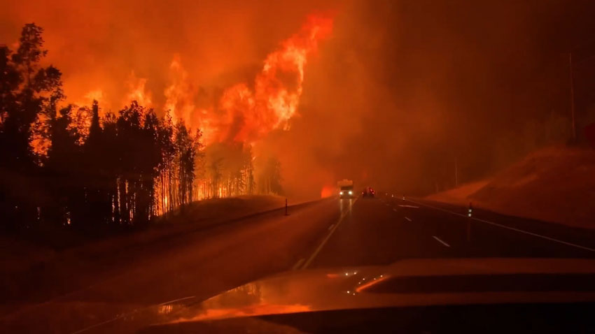
Dry and hot summer triggered a record number of wildfires this year across southern Alaska.
National Oceanic and Atmospheric Administration (NOAA) has sent their weather satellites to track the development of the blazes of these wildfires from space.
The geostationary satellites have captured exclusive images of the wildfires burning across south-central and south-western Alaska since early June.
According to a statement from NOAA, lightning strikes from thunderstorms are sparking these early-season wildfires These are then feeding on dry vegetation from a mild winter.
The officials wrote that this year has been an unprecedentedly active fire season with unusually dry and conditions. Such abnormal climatic factors led to over 300 wildfires burning across the country in the recent weeks.
NOAA’s satellites have captured images of the wildfire offering crucial insight into how they spread. As of Thursday (June 30), 157 active fires were burning across Alaska.
In just one month, wildfires in the state have burned more than 1.6 million acres. This number records a threshold that Alaska has not reached this early in the fire season in the last few decades.
The blazes include the East Fork Fire in the western part of the state near the Yukon Delta is one of the largest tundra fires on record and has burned more than 250,000 acres since May 31. Meanwhile, the Lime Complex Fire in the southwestern region of the state is even larger, spreading across more than 600,000 acres.
The smoke and debris from the fires have compromised air quality, leading the Alaska Department of Environmental Conservation to issue warnings for numerous regions in the state, according to the statement.
Scientists use data from the the Visible Infrared Imaging Radiometer Suite (VIIRS) instrument on the Joint Polar Satellite System’s NOAA-20 and Suomi NPP satellites to detect and track wildfires, especially in remote regions. VIIRS allows the instrument to detect smaller and lower-temperature fires.
Data from the satellites are helping forecasters monitor drought conditions, locate hot spots, detect changes in a fire’s behavior, predict a fire’s motion, monitor smoke and air quality, and monitor the post-fire landscape like never before.
Tags: Alaska tourism, noaa
Tuesday, April 16, 2024
Monday, April 15, 2024
Monday, April 15, 2024
Tuesday, April 16, 2024