
Kansas, Oklahoma and More Brace for Relentless Flash Flood Chaos as Slow-Moving Storms Cripple Travel Across the US

Published
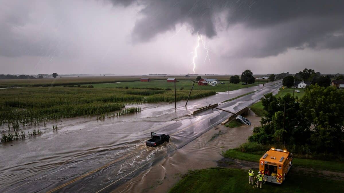
Image generated with Ai
Kansas, Oklahoma and more brace for relentless flash flood chaos as slow-moving storms cripple travel across the US. Torrential rain, severe thunderstorms and widespread flooding threaten flights, roads and daily journeys this week.
Kansas, Oklahoma and more are once again under threat as relentless flash flood chaos develops across the United States. Slow-moving storms continue to drench communities, while repeated downpours threaten to cripple travel across the US. Consequently, major roads, airports and rail corridors could face significant disruption. Heavy rainfall, damaging wind gusts and isolated hail are expected to worsen conditions in several states. Travellers, commuters and local authorities are preparing for rapidly changing weather. As the storms linger, the likelihood of dangerous flooding increases. Therefore, staying informed and adjusting travel plans will be essential throughout the week.
Advertisement
Advertisement
Heavy rain and repeated thunderstorms are once again creating dangerous conditions across large parts of the United States, with meteorologists warning that flash flooding, severe weather and widespread travel disruption could continue through the end of the week. From the Plains and Midwest to the East Coast and Southeast, slow-moving storm systems are expected to deliver intense rainfall over the same locations for hours, increasing the risk of flooded roads, flight delays and transport interruptions.
Forecasters say some communities could receive several inches of rain within only a few hours, while isolated severe thunderstorms may also bring damaging wind gusts and hail. The evolving weather pattern is expected to affect millions of residents and travellers across the country’s busiest transport corridors.
Advertisement
Advertisement
Why is the flash flood threat increasing across the central and eastern United States?
The latest weather pattern is being driven by a slow-moving frontal boundary stretching across parts of the central United States. Instead of progressing quickly, the front is expected to remain almost stationary, allowing thunderstorms to repeatedly develop and move over the same locations.
This phenomenon, commonly known as training thunderstorms, significantly increases rainfall totals because successive storms follow an identical path. Areas that experience multiple rounds of heavy rain within a short period can quickly become overwhelmed, especially where the ground is already saturated.
Advertisement
Advertisement
The greatest concern extends from parts of the central Plains into the Midwest, where rainfall could rapidly accumulate and create dangerous flash flooding.
Communities across portions of Kansas, Oklahoma, Missouri, Illinois and neighbouring states are among those facing the highest risk during the middle of the week.
Chicago and Midwest transport networks face significant weather disruption
Chicago is expected to be among the major metropolitan areas experiencing repeated rounds of heavy showers and thunderstorms.
As one of North America’s busiest aviation hubs, severe weather around Chicago frequently creates ripple effects across the national air travel network. Delays at major airports can spread quickly throughout airline schedules, affecting connecting passengers travelling across the United States and internationally.
Road travel could also become increasingly hazardous as heavy rainfall reduces visibility, floods low-lying streets and creates standing water on motorways.
Rail services may also experience delays where flooding affects tracks or signalling infrastructure.
Advertisement
Advertisement
Travellers planning journeys through the Midwest are being encouraged to monitor weather forecasts closely before departure.
Severe thunderstorms could bring hail and damaging winds
Alongside torrential rainfall, some thunderstorms are expected to become severe.
Forecasters indicate that parts of southern Kansas, northern Oklahoma and eastern Missouri face an elevated risk of severe storms capable of producing:
- Large hail
- Damaging wind gusts
- Intense cloudbursts
- Localised flash flooding
Strong wind gusts may bring down trees and power lines, creating additional hazards for motorists while also disrupting electricity supplies in affected communities.
Even where severe thunderstorms do not develop, repeated heavy rain remains the primary concern due to its ability to overwhelm drainage systems in urban areas.
Heavy rainfall spreads towards the eastern United States
While the central United States deals with repeated thunderstorms, a separate zone of increasing moisture is forecast to expand across the eastern half of the country.
Advertisement
Advertisement
Moist tropical air moving northwards from Florida and the Gulf Coast will combine with a sluggish weather pattern across the eastern states. At the same time, high pressure over the Atlantic and an upper-level weather disturbance across the Southeast will help keep storms developing over many of the same areas.
By the second half of the week, showers and thunderstorms are expected to extend from Florida through the Carolinas, the Appalachians, the Mid-Atlantic and parts of the Northeast.
Many locations that enjoyed dry and pleasant conditions earlier in the week could experience repeated afternoon and evening thunderstorms through Saturday.
Flash flooding remains the biggest danger for communities
The greatest hazard from this weather pattern is not necessarily severe winds or hail but the volume of rainfall falling over short periods.
Slow-moving thunderstorms can produce several inches of rain within only a few hours. Such intense rainfall often overwhelms drainage infrastructure before rivers and streams have time to respond.
Flash flooding can develop rapidly, particularly in:
Advertisement
Advertisement
- Urban streets
- Low-lying neighbourhoods
- Small streams and creeks
- Underpasses
- Poorly drained roads
- Rural valleys
Floodwater may appear with little warning, making travel particularly dangerous.
Even relatively shallow moving water can sweep vehicles away, while flooded roads frequently conceal damaged surfaces beneath the water.
Emergency officials consistently advise drivers never to attempt crossing flooded roadways.
Heat and humidity will add to weather challenges
Not every location will experience continuous rainfall.
Areas that receive longer periods of sunshine before thunderstorms develop could see temperatures climbing into the mid-80s to mid-90s Fahrenheit during the latter part of the week.
Combined with rising humidity, conditions will feel considerably hotter, with apparent temperatures approaching 100°F in some locations.
Advertisement
Advertisement
Meanwhile, communities remaining beneath persistent cloud cover and repeated rainfall are expected to stay noticeably cooler, with daytime temperatures generally remaining in the upper 70s to mid-80s.
The sharp contrast in temperature and humidity will continue providing fuel for afternoon thunderstorm development across much of the region.
Travellers should prepare for widespread delays
The combination of flooding rain, severe thunderstorms and reduced visibility is likely to create disruption across multiple transport sectors.
Airlines may experience delays because thunderstorms can temporarily halt airport operations, alter flight paths and create congestion across busy airspace.
Road travel is also expected to become more challenging as heavy rainfall reduces visibility and increases the likelihood of hydroplaning.
Public transport services in some cities may also experience temporary disruption where flooded streets affect bus operations or where severe weather impacts rail infrastructure.
Advertisement
Advertisement
Holidaymakers, business travellers and commuters are advised to:
- Check weather forecasts before travelling.
- Monitor airline and airport updates.
- Allow extra travel time.
- Avoid driving through flooded roads.
- Stay informed about local emergency alerts.
Those travelling during the afternoon or evening should remain particularly alert, as thunderstorms are expected to become most active during these periods.
Forecasters also monitoring possible tropical development
Meteorologists are also watching the western Atlantic and northern Caribbean for signs of possible tropical development between 9 and 15 August.
Although no direct impacts have yet been confirmed, weather patterns similar to the current setup have occasionally allowed weak tropical systems to drift into the southeastern United States.
Even relatively weak tropical disturbances can transport enormous amounts of moisture inland.
Should such a system develop and move towards the Southeast, rainfall totals could increase substantially, further heightening the risk of flash flooding across already saturated regions.
Advertisement
Advertisement
Forecasters stress that these systems often produce more flooding than damaging winds, making rainfall the primary concern.
Weather pattern likely to keep travel conditions unsettled
The widespread threat is being driven by a slow-moving weather front that allows thunderstorms to repeatedly pass over the same locations. As a result, rainfall accumulates quickly, overwhelming drainage systems and increasing flash flood risks. Warm, moisture-rich air flowing north from the Gulf further fuels intense storms, while atmospheric conditions prevent the weather system from moving away rapidly. Therefore, flooding becomes more likely across roads, neighbourhoods and transport corridors. This combination of persistent rain, saturated ground and repeated thunderstorms explains why travel disruption is expected to continue and why authorities are urging residents and visitors to remain alert.
The developing weather pattern highlights how prolonged rainfall can quickly transform into a major travel and public safety challenge. As Kansas, Oklahoma and more continue to experience relentless flash flood chaos, authorities are closely monitoring changing conditions and responding to local flooding incidents. Travellers should expect possible delays, road closures and transport disruptions until the storms weaken. Careful planning, regular weather updates and avoiding flooded routes will help reduce risks. With additional rainfall still forecast across the central and eastern United States, vigilance remains essential as communities work to minimise disruption and protect lives throughout this unsettled weather period.
The persistence of slow-moving weather systems means there is little opportunity for affected areas to dry out before additional rounds of rain develop.
Repeated thunderstorms across the central Plains, Midwest, Mississippi Valley, Ohio Valley and much of the eastern United States are expected to maintain an elevated flood risk through the remainder of the week.
For the travel industry, the outlook suggests continued operational challenges as airlines, airports, road authorities and emergency services respond to rapidly changing weather conditions.
Advertisement
Advertisement
With millions of people travelling during the summer season, staying informed about local forecasts and transport updates will remain essential. Travellers are encouraged to build flexibility into their itineraries, monitor weather advisories regularly and avoid unnecessary journeys through flood-prone areas until conditions improve.
Source
National Weather Service (NWS) – Flood Safety, Watches and Warnings
National Weather Service Flood Safety
Explains the differences between Flash Flood Watches, Flash Flood Warnings and Flood Advisories. NOAA Weather Prediction Center – Excessive Rainfall Outlook (ERO)
NOAA Weather Prediction Center Excessive Rainfall Outlook
Official NOAA maps showing the probability of excessive rainfall and flash flooding across the United States. National Weather Service – Excessive Rainfall Outlook Resources
NWS Excessive Rainfall Outlook Resources
Provides official Day 1–5 excessive rainfall outlooks and flood hazard guidance. NOAA/NWS Weather Prediction Center – Excessive Rainfall Discussions
Weather Prediction Center Forecast Products
Contains official forecast discussions and updates on excessive rainfall outlooks.
Advertisement
