Thursday, February 1, 2024

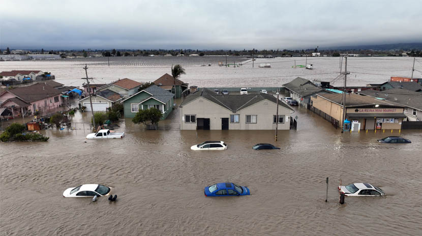
California is on high alert as it prepares for two major storms fueled by atmospheric rivers, marking potentially the biggest weather events of the winter. These back-to-back storms threaten to bring significant rainfall, snow, and consequent flooding, putting both lives and property at risk.
First Storm’s Onslaught
The initial storm, already underway, is directing a massive flow of moisture towards California, likened to a colossal firehose effect, which is expected to persist into Thursday night. Satellite imagery captured a vast expanse of clouds associated with this storm, stretching nearly 2,000 miles along the Pacific coast. Northern and Southern California are bracing for 1-4 inches of rain, with localized areas potentially receiving up to 7 inches, according to AccuWeather’s Local StormMax™. This deluge is set to cause flash flooding, mudslides, and road washouts.
Accompanying strong winds, particularly in Northern and Central California, could see gusts reaching 85 mph, posing a significant risk of fallen trees and power outages. Travel disruptions are anticipated across the state, with conditions worsening through Thursday, especially in urban areas and mountain passes like Donner Pass, where snow accumulation could reach 2-4 feet at higher elevations.
Rain and Snow Spread Inland
As the storm shifts inland from Friday to Saturday, its impact will extend across the southwestern United States. Rain and mountain snow will taper off in California, but not before affecting travel and conditions from Arizona to Montana. The Denver metro area could see substantial snowfall, ranging from a slushy coating to 12 inches in the Rockies, potentially impacting travel and causing airline delays.
Second Storm: A Greater Threat
The second storm, arriving Sunday into Monday, carries moisture from near Hawaii, signaling a more substantial impact with the possibility of even heavier rainfall and snow across California. The anticipated Pineapple Express could intensify flooding and travel disruptions, exacerbating conditions in areas already saturated by the first storm. This storm’s rapid succession could lead to more severe consequences, including widespread urban and stream flash flooding, road closures, and significant snow accumulation in the Sierra Nevada.
Cumulative Impact
Together, these storms promise to significantly bolster seasonal rainfall and snowfall totals, with the Sierra Nevada potentially receiving 5-10 feet of fresh snow. This boon for the snowpack contrasts sharply with the challenges posed by flooding and disruptions, highlighting the complex impact of atmospheric rivers on California’s winter weather landscape.
Tags: California, storm, Travel
Tuesday, April 30, 2024
Tuesday, April 30, 2024
Tuesday, April 30, 2024
Tuesday, April 30, 2024
Tuesday, April 30, 2024
Tuesday, April 30, 2024