 Somudranil Sarkar Somudranil Sarkar
Image generated with Ai
Travellers across New York City, Northern New Jersey and the wider tri-state area are being urged to prepare for significant travel disruption as a Flood Watch remains in effect through the morning of Wednesday, 29 July 2026. Forecasters warn that repeated rounds of heavy rain and thunderstorms could produce 2 to 5 inches of rainfall, with isolated locations receiving even higher totals, increasing the risk of flash flooding, transport delays and widespread disruption.
The most severe conditions are expected from Tuesday afternoon into Tuesday night, when intense downpours, thunderstorms and poor visibility are likely to affect airports, rail services, roads and urban transport across the region.
Advertisement
The National Weather Service has issued a Flood Watch for all five boroughs of New York City and parts of Northern New Jersey from 8:00 a.m. Tuesday until 8:00 a.m. Wednesday.
Heavy rainfall may flood streets, underpasses, highways, low-lying neighbourhoods and areas with poor drainage. Residents and visitors are advised to remain alert for rapidly changing conditions throughout the day.
Advertisement
Advertisement
Meteorologists warn that the slow-moving storm system could produce widespread heavy rainfall.
Forecasts indicate:
Urban areas remain especially vulnerable because intense rainfall can accumulate rapidly on roads and underground infrastructure.
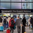
Air travellers should prepare for significant operational impacts at the region’s three busiest airports:
Low cloud, poor visibility, thunderstorms and lightning may prompt temporary FAA traffic management measures, including possible ground stops, leading to lengthy delays and some cancellations. Previous severe weather events this month caused widespread delays and prompted airlines to introduce flexible travel waivers.
Passengers should check their airline’s mobile app before travelling to the airport, as schedules may change rapidly.
Heavy rainfall frequently disrupts New York’s public transport network.
Potential impacts include:
Regional services including NJ Transit, Metro-North Railroad and the Long Island Rail Road (LIRR) could also experience delays because of flooded tracks, fallen tree branches or weather-related signal failures.
Travellers should monitor live operator updates before beginning their journeys.
Motorists should expect hazardous driving conditions across parts of New York and New Jersey.
Roads particularly vulnerable to flooding include:
Authorities strongly advise motorists not to drive through flooded roads, as water depth can change rapidly and vehicles can become stranded.
Demand for taxis and ride-hailing services is expected to rise sharply during the heaviest rainfall.
Travellers using services such as Uber and Lyft should anticipate:
Allowing additional travel time is recommended for anyone travelling to airports, railway stations or scheduled events.
The latest weather system follows earlier thunderstorms that produced heavy rainfall across parts of the metropolitan area.
Localised flooding, water rescues and flash flood warnings were reported in several communities after intense rainfall overwhelmed drainage systems.
The additional rainfall forecast over the next 24 hours increases the risk of renewed flooding in areas that have already experienced saturated ground.
Emergency management officials recommend several precautions during the Flood Watch:
Anyone travelling through the New York metropolitan area on 28–29 July should allow additional time for every stage of their journey.
Flights, commuter rail, subway services and road transport could all experience weather-related disruption as the storm moves across the region.
Checking transport providers before departure and remaining flexible with travel plans will help minimise inconvenience should conditions deteriorate.
With a Flood Watch covering New York City, the Bronx, Northern New Jersey and surrounding areas through Wednesday morning, travellers should prepare for a day of potentially severe weather and transport disruption. Heavy rain, thunderstorms and flash flooding may affect airports, roads and public transport across the region, while airlines and transit operators continue monitoring conditions. Remaining informed through official weather and transport updates, allowing extra travel time and avoiding flooded areas will be essential for anyone travelling during this period.
Advertisement
Tags: flash flooding, flood watch, jfk airport, laguardia, New Jersey
Advertisement
Advertisement













Saturday, September 5, 2026
Friday, September 4, 2026

Saturday, September 5, 2026

Saturday, September 5, 2026

Thursday, September 3, 2026

Wednesday, September 2, 2026

Saturday, September 5, 2026

Saturday, September 5, 2026


