
USA and Mexico Face a Fierce Gulf Coast Travel Shock as Edouard Unleashes Flash Flooding Across Texas

Published
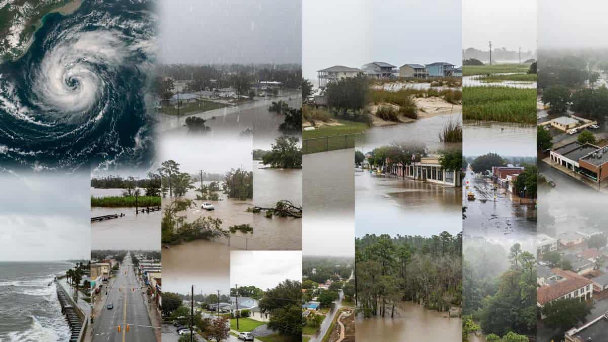
Image generated with Ai
The USA and Mexico are witnessing a very fierce Gulf Coast travel shock caused by Edouard, bringing flash flooding, torrential rain, dangerous flooding, and growing coastal chaos after hitting the coast of Louisiana at Johnsons Bayou. However, the risk was not over when Edouard moved inland, as rains kept pouring down, threatening communities in southeastern Texas. Beaumont, Port Arthur, Orange, Kountze, Village Mills, and Honey Island were among the cities with severe flood risks. There are reports from the area about rainfall amounts being up to 10 to 21 inches. Rivers are getting higher and higher, presenting yet another threat to people and tourists. But Edouard is much more than just a storm. It is a big Texas travel warning for people. Roadways could be flooded, services could be closed, coasts could turn dangerous. Travel arrangements might be changed literally in the blink of an eye. Travel And Tour World invites its readers to follow this story further as we are going to discuss the cities under the biggest risks, shocking rainfall amounts, official warnings, travel problems, and other important things tourists should know while visiting the Gulf Coast area.
Tropical Storm Edouard 2026 — Key Storm and Flooding Statistics
| 2026 Edouard Statistic | Government-Confirmed Figure | Location / Significance |
|---|---|---|
| Storm number in 2026 Atlantic season | 5th named storm | Atlantic basin |
| Edouard dates | 31 August–1 September 2026 | Atlantic basin |
| Maximum sustained wind at landfall | 60 mph | Near Johnsons Bayou, Louisiana |
| Landfall time | 2:20 p.m. CDT, 1 September 2026 | Johnsons Bayou, Louisiana |
| Distance from Port Arthur at landfall | About 15 miles | Southeast Texas |
| Maximum reported wind gust | 71 mph | Texas Point, Texas |
| Wind at Texas Point | 57 mph sustained | Texas coast |
| Rainfall rate forecast near strongest bands | 2–3+ inches per hour | Southeast Texas |
| Forecast rainfall near Beaumont–Port Arthur | 3–6 inches, locally higher | Southeast Texas |
| Potential isolated rainfall total | Up to about 9 inches | Near storm track |
| Rainfall later reported in Flash Flood Emergency area | 10–21 inches | Hardin and Tyler counties |
| Reported rainfall rate in emergency area | 1–5 inches per hour | Kountze, Village Mills and Honey Island |
| Edouard position at 7 p.m. CDT, 1 September | About 10 miles northwest of Beaumont | Texas |
| Wind speed at 7 p.m. CDT | 45 mph | Tropical Storm Edouard |
| Position at 10 a.m. CDT, 2 September | 125 miles northwest of Beaumont | East Texas |
| Distance from Lufkin at 10 a.m. CDT | About 40 miles west-northwest | East Texas |
| Wind speed as tropical depression | 35 mph | East Texas |
| Village Creek forecast crest | About 23.3 feet | Near Kountze |
| Village Creek flood stage | 17 feet | Near Kountze |
Edouard Slams the US Gulf Coast With a Sudden Flood Threat
Tropical Storm Edouard has turned the US Gulf Coast into a dangerous weather zone, with heavy rain, strong winds, and flooding spreading across southeastern Texas. The storm made landfall near Johnsons Bayou, Louisiana, at about 2:20 p.m. CDT on September 1, with maximum sustained winds of 60 mph. Yet the biggest danger did not stay at the coast. Edouard moved inland while its rain bands pushed into Texas. The National Weather Service warned that flash and river flooding could become severe, especially across southeastern Texas. For travellers, the message is simple. Roads can flood fast. Local services can close. Weather conditions can change within hours.
Anup Kumar Keshan Warns Travellers as Edouard Intensifies Texas Flood Risk
“Tropical Storm Edouard shows how quickly a weather event can disrupt travel across the US Gulf Coast. Travellers must look beyond wind speeds and watch flood alerts, road conditions and local closures. Safety should come first, especially as heavy rainfall continues to affect communities across southeastern and eastern Texas.”
Leading Texas Cities and Communities in Edouard’s Impact Zone
| City / Community | State | Population / Scale* | Edouard-Related Government Warning or Impact |
|---|---|---|---|
| Beaumont | Texas | 112,893 | Storm centre passed through the metropolitan area; heavy rain, gusty winds and ongoing city-service disruption |
| Port Arthur | Texas | 55,804 | Near direct landfall corridor; tropical-storm and coastal hazards |
| Nacogdoches | Texas | 32,381 | Inland flooding threat as Edouard moved into East Texas |
| Orange | Texas | 19,419 | Included in southeast Texas flood-watch area |
| Lufkin | Texas | Major East Texas city | About 40 miles east-southeast of Edouard’s centre at 10 a.m. CDT on 2 September |
| Kountze | Texas | Hardin County community | Flash Flood Emergency; 10–21 inches of rain reported |
| Village Mills | Texas | Hardin County community | Flash Flood Emergency |
| Honey Island | Texas | Hardin County community | Flash Flood Emergency |
| Nederland | Texas | Jefferson County city | Included in southeast Texas tropical-storm/flood warning area |
| Vidor | Texas | Orange County city | Included in flood-watch area |
| Bridge City | Texas | Orange County city | Included in flood-watch area |
| Lumberton | Texas | Hardin County city | Tropical-storm warning area |
| Silsbee | Texas | Hardin County city | Tropical-storm warning area |
| Buna | Texas | Jasper County community | Included in wider southeast Texas flood-watch area |
| Deweyville | Texas | Newton County community | Included in flood-watch area |
Johnson Bayou Landfall Puts Texas Directly in Edouard’s Path
Edouard crossed the north-western Gulf Coast near Johnson Bayou, Louisiana, close to the Texas border. The National Hurricane Center placed the storm only about 15 miles southeast of Port Arthur, Texas, at landfall. The storm carried maximum sustained winds of 60 mph. That was enough to create dangerous conditions near the coast. A National Ocean Service station near Texas Point, Texas, measured sustained winds of 57 mph and a gust of 71 mph. The location mattered greatly. Edouard arrived close to a heavily populated and industrial part of the Gulf Coast. Its path then pushed towards eastern Texas, carrying tropical moisture deep inland.
Advertisement
Advertisement
Southeastern Texas Becomes the Storm’s Main Danger Zone
Edouard quickly became more than a coastal storm. Heavy rain and gusty winds spread across southeastern Texas after landfall. The National Hurricane Center said the storm was moving northwest and would carry its centre farther inland over eastern Texas. The Weather Prediction Center warned that very heavy rainfall could cause urban flash flooding across southeast Texas. Radar and satellite information showed Edouard approaching the Upper Texas coast with growing rain activity. That created a serious travel problem. A city may remain open while roads around it become unsafe. Travellers should therefore check local warnings before moving through the affected area.
Advertisement
Advertisement
Beaumont Faces Closures as Edouard Disrupts Daily Life
Beaumont, Texas, became one of the key cities affected by Edouard. The storm passed directly through the wider Beaumont metropolitan area. By 7 p.m. CDT on September 1, the National Hurricane Center placed Edouard about 10 miles northwest of Beaumont, with maximum sustained winds near 45 mph. The impact continued into September 2. The City of Beaumont announced that several city facilities would remain closed because of ongoing power outages linked to Tropical Storm Edouard. Municipal Court, recreation facilities, event facilities, public health services and Beaumont Animal Care were among the affected facilities. The city also extended storm debris collection efforts as crews worked to restore normal services.
Port Arthur Takes a Direct Hit From Heavy Rain and Strong Winds
Port Arthur sits close to the Louisiana border and became one of the most exposed Texas communities. Before landfall, the National Weather Service listed Port Arthur among locations facing tropical-storm conditions and storm-surge risks. The National Hurricane Center later reported that Edouard passed extremely close to the city. At 4 p.m. CDT on September 1, the storm centre was only about five miles west of Port Arthur. The danger came from several directions. Rain created flooding risks. Strong winds threatened property and travel. Coastal water added another concern. For visitors, that combination can make even short journeys risky.
Orange and Bridge City Face a Dangerous Flooding Mix
The threat also stretched across Orange, Bridge City and nearby communities. The National Weather Service placed large parts of southeast Texas under a flood watch because excessive rainfall could continue to cause flooding. The warning area included Orange, Bridge City, Vidor, Nederland, Port Arthur, Silsbee, Buna, Woodville, Lumberton and Deweyville, among other places. This broad warning shows why Edouard should not be viewed only as a Port Arthur or Beaumont event. Rainfall can spread well away from the storm centre. Water can also collect quickly in low-lying areas. For travellers, checking the route is just as important as checking the destination.
Advertisement
Advertisement
Kountze Enters a Terrifying Flash Flood Emergency
The situation became especially serious around Kountze. On September 2, the National Weather Service issued a Flash Flood Emergency for Kountze, Village Mills, and Honey Island. Emergency management reports indicated that between 10 and 21 inches of rain had fallen in the affected area. Rainfall rates were expected to reach 1 to 5 inches in one hour. The NWS said flash flooding was already happening. This was not a routine rain warning. The NWS described the situation as particularly dangerous and told people in the affected area to seek higher ground. Such conditions can overwhelm roads and drainage systems very quickly.
Village Mills and Honey Island Face Life-Threatening Flooding
Village Mills and Honey Island were included in the same Flash Flood Emergency as Kountze. The warning covered central Hardin County and south-central Tyler County in southeastern Texas. The figures explain the seriousness. Rainfall had reached between 10 and 21 inches in the warned area. More heavy rain was possible at rates of up to five inches per hour. For visitors, this is the kind of weather that can turn a normal road into a dangerous water crossing. A flooded road may look shallow but hide strong currents or damaged surfaces. The safest choice is to avoid floodwater. Do not drive around barriers. Do not assume a familiar road remains safe during extreme rain.
Advertisement
Advertisement
River Flooding Adds Another Threat Across Southeast Texas
Rainfall was only part of the problem. Rivers and waterways also faced rising water. The National Weather Service issued flood warnings for the Neches River, Village Creek, and Pine Island Bayou. Major flooding was forecast for Village Creek near Kountze. The river was expected to rise above its 17-foot flood stage and reach a forecast crest of about 23.3 feet. The Neches River was expected to experience moderate flooding. Pine Island Bayou near Sour Lake faced minor flooding. This creates a longer-lasting travel risk. Even when rainfall becomes lighter, rivers can continue rising. Roads near waterways may therefore remain dangerous after the worst rain has passed.
Lumberton and Silsbee Remain Inside the Flood Risk Area
Lumberton and Silsbee were among the communities included in government flood and tropical-storm warnings. The National Weather Service identified both areas within the wider southeast Texas warning zone. The danger was driven mainly by excessive rainfall and the possibility of rapid flooding. This matters because tropical storms can create problems far beyond the strongest winds. Rain often becomes the bigger threat after a storm begins to weaken. For travellers, this means a weakening storm does not automatically mean safer roads. Floodwater can remain on streets. Rivers can rise later. Emergency crews may also need time to clear debris and inspect infrastructure. Travel plans should remain flexible while warnings continue.
Nederland and Sabine Pass Face Coastal Weather Risks
The communities of Nederland and Sabine Pass also faced significant weather threats. The National Weather Service included them in warnings covering the Lower Jefferson area. Before landfall, a storm-surge warning and tropical-storm warning were active for this area. Sea Rim State Park was also included in the warning area. That combination matters for coastal travel. Strong winds can make outdoor activities unsafe. Higher water can affect roads and low-lying areas. Heavy rain can then add another layer of flooding. Travellers heading towards the coast should pay close attention to official alerts. Beaches and parks can look calm one moment and become unsafe soon after weather conditions change.
Deweyville and Buna Stay Under a Wider Flood Watch
The flood threat reached beyond the immediate coastal cities. Deweyville and Buna were among the communities included in the wider southeast Texas flood watch. The warning covered several counties and included places such as Woodville, Evadale, Vidor, Spurger, China, Ivanhoe, Mauriceville, Warren, and Gist. The National Weather Service warned that flooding caused by excessive rainfall remained possible. This broad coverage shows the scale of Edouard’s rain threat. For road travellers, the risk can move with the rain. One town may have clear roads while another nearby community faces dangerous water. Checking official warnings before departure is therefore essential.
Lufkin and Nacogdoches: See Edouard’s Threat Move Inland
Edouard did not stop affecting Texas after moving away from the Gulf Coast. The storm’s remnants carried heavy rainfall farther inland towards Lufkin and Nacogdoches. National Weather Service warnings covered areas including Angelina and Nacogdoches counties. Communities identified in the wider warning area included Lufkin, Nacogdoches, Jacksonville, San Augustine and Rusk.
This inland movement is important for travellers. A tropical storm can lose wind strength while still producing dangerous rain. In fact, flooding can remain a major concern after the centre weakens. People travelling through eastern Texas should therefore watch rainfall and flood warnings, not just the storm category or wind speed.
Advertisement
Advertisement
Edouard Weakens, But the Flood Danger Does Not Vanish
Edouard began weakening after reaching land. The National Hurricane Center reported that the storm was moving inland over eastern Texas while heavy rainfall and gusty winds continued across southeastern Texas. That creates a common weather trap. People may hear that a tropical storm is weakening and assume the danger is ending. The flooding story can be very different. The National Weather Service continued issuing flood warnings after landfall. It also warned of major flooding along Village Creek near Kountze. For travellers, storm strength is only one part of the picture. Rainfall totals, river levels, road closures and local emergency alerts can matter far more.
Strong Winds Add More Pressure to Texas Communities
Although flooding became the major concern, Edouard also brought strong winds. At landfall, maximum sustained winds were estimated at 60 mph. A National Ocean Service station near Texas Point recorded a 71-mph gust. The storm weakened as it crossed inland. By 4 p.m. CDT, maximum sustained winds were near 50 mph. By 7 p.m., they had fallen to about 45 mph. Even these lower speeds can cause problems when combined with heavy rain. Wet ground can make trees more vulnerable. Debris can block roads. Power systems can also be affected. The City of Beaumont confirmed that ongoing power outages were still affecting city operations on September 2.
Power Outages Disrupt Beaumont Services
Power disruption became a clear part of Edouard’s impact in Beaumont. The city said ongoing power outages caused by Tropical Storm Edouard forced several municipal facilities to remain closed on September 2. The affected facilities included Municipal Court, Beaumont Animal Care Intake and Adoptions, recreation facilities, event facilities, and Public Health. This shows how storm impacts can continue after the centre moves away. A city may no longer face the strongest winds but still struggle with basic services. The city also extended the working hours of solid-waste crews to restore normal rubbish collection and remove storm debris. For travellers, service interruptions can affect planned visits, appointments and local transport.
Travel Plans Across Southeast Texas Face Sudden Changes
Edouard has created a difficult travel picture across the region. Flood warnings cover roads and communities from the coast towards inland eastern Texas. The risk is not limited to one city. Visitors may face changing road conditions, closures, debris, and delays. Coastal areas can also face additional water-related risks. Rivers may keep rising after heavy rain ends. The safest approach is to follow official local warnings. Travellers should avoid entering flooded roads. They should also allow extra time and check conditions before setting out. A short journey can become dangerous when water rises quickly. Flexibility is therefore essential while flood warnings remain active.
Why Edouard’s Rain Is More Serious Than Its Wind
Edouard shows how a tropical storm can change character after landfall. Its strongest winds weakened, but its rainfall continued to create major problems. The NWS documented rainfall of 10 to 21 inches around Kountze, Village Mills, and Honey Island. The Weather Prediction Center had already warned that very heavy rainfall could trigger urban flash flooding in southeast Texas. This is why travellers should not judge the threat only by wind speed. Floodwater can move quickly. Rivers can rise hours after rainfall. Roads can become unsafe without warning. Edouard’s most serious legacy may therefore be water rather than wind, particularly across low-lying communities and areas close to rivers.
Advertisement
Advertisement
US Gulf Coast Watches Edouard’s Final Inland Push
As Edouard moved deeper into Texas, the National Hurricane Center continued tracking its centre and the rainfall spreading around it. The storm’s movement towards the north-west carried it farther into eastern Texas. Meanwhile, local National Weather Service offices continued issuing flood watches and warnings. These alerts covered communities well beyond the original landfall point. The situation shows why official weather information matters during tropical systems. Conditions can change quickly from coastal wind threats to inland flood emergencies. For anyone travelling across Texas, the smartest move is to check the latest National Weather Service warning for the exact county or city on the route before leaving.
Edouard Becomes a Major Warning for Texas Travellers
Tropical Storm Edouard has produced a sharp mix of heavy rain, flash flooding, strong winds, coastal hazards, river flooding and power disruption across the Texas-Louisiana border region. Its landfall near Johnsons Bayou placed it close to Port Arthur before the storm moved inland. The strongest flood emergency emerged around Kountze, Village Mills and Honey Island, where officials reported 10 to 21 inches of rain and flooding already occurring. Beaumont also faced ongoing service disruption from power outages. For travellers, the lesson is direct: do not rely on the storm weakening as a signal that conditions are safe. Follow official warnings, avoid floodwater and check roads before travelling through affected parts of Texas.
USA and Mexico Must Watch Texas Closely as Edouard Leaves a Dangerous Flooding Threat
Although Edouard may dissipate, the threat posed to Texas may continue. Rain showers may keep on causing river levels and roadways to rise and flood even as the wind speeds decrease. Weather dangers have been witnessed in Beaumont, Port Arthur, Kountze, Village Mills, and other areas surrounding them. As such, travellers need to verify travel advisories before embarking on travel and stay away from flooded roadways. Travel to the Gulf Coast area requires great caution since things can change very fast. Travel And Tour World encourages travelers to take heed and prioritize their safety.
Advertisement
