
Iceland Mirrors Denmark and Others as Atlantic Storm Brings Ferry Cancellations Amid Coastal Travel Disruptions

Published
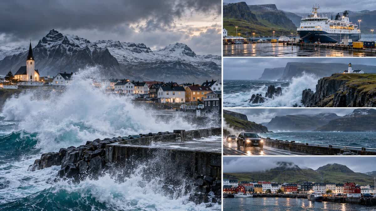
An exceptionally deep North Atlantic storm has brought dangerous weather and transport concerns across Iceland, Denmark’s Faroe Islands, the United Kingdom, Ireland and maritime areas associated with Norway. The UK Met Office analysed the storm at 931 hPa on 14 October. Iceland faced blizzard conditions, road closure risks and coastal flooding concerns. The Faroe Islands confirmed ferry and bus cancellations, including services on an airport connection. Scotland experienced strong winds and hazardous seas, while Ireland issued marine warnings. Severe offshore conditions also extended towards the Norwegian Basin. By 15 October, the storm was weakening and moving north-east.
North Atlantic Storm Reaches Exceptional Intensity as Travel Risks Spread Across Five Countries
The powerful weather system developed east of Newfoundland and intensified rapidly while travelling towards Iceland. According to the UK Met Office, the depression underwent explosive cyclogenesis, with its central pressure forecast to fall by approximately 30 hPa in 24 hours.
A marine analysis placed the storm at 931 hPa at 12:00 UTC on 14 October. The Icelandic Meteorological Office had warned of severe winds, heavy precipitation and blizzards. However, the analysed pressure does not establish a new national pressure record at an Icelandic observation station.
By 15 October, the depression had begun to weaken. Yet its effects remained important for travellers because strong winds, heavy swell and disrupted local transport could outlast the period of greatest storm intensity.
Advertisement
Advertisement
| Time (UTC) | Official storm information | Travel significance |
|---|---|---|
| 14 October, 12:00 | Low-pressure centre analysed at 931 hPa | Exceptional Atlantic storm intensity |
| 15 October, 00:00 | Met Office analysis placed the centre at 943 hPa | Storm moving north-east, with offshore warnings continuing |
| 15 October, 03:00 | Met Éireann reported a 945 hPa depression east of Iceland | Strong winds affecting Irish marine areas |
| 15 October, 09:00 | Met Éireann reported the depression near 950 hPa north-east of Iceland | Easing Irish wind conditions, but Atlantic swell remained |
Sources: UK Met Office marine forecasts and Met Éireann sea-area forecasts issued on 14–15 October 2026. The figures describe the developing and weakening cyclone, not recorded pressure at each country’s weather stations.
Iceland Travel Alert: Blizzard Conditions, Dangerous Coastal Waves and Road Closure Risks
Iceland experienced the storm’s most direct land-based effects. The Icelandic Meteorological Office issued orange warnings for north-western areas as strong easterly winds changed to northerly winds, bringing snow, sleet and poor visibility. The national road authority, Vegagerðin, warned on 14 October that several roads could close at short notice. The Westfjords faced particularly difficult conditions. Holtavörðuheiði, Brattabrekka, Svínadalur and Vatnaleið were among the routes identified as potentially affected. Travellers were advised to avoid unnecessary journeys during the worst weather.
Advertisement
Advertisement
Coastal Flooding Creates Additional Risks for Iceland’s Tourism Routes
Coastal flooding presented another serious concern. On 14 October, Vegagerðin forecast waves of approximately eight metres near Vík í Mýrdal, with the highest waves expected around evening high tide. Waves exceeding ten metres were also forecast near parts of the south-eastern coastline. The authority identified potential flooding around the Ring Road near Vík and possible impacts at northern and eastern harbours. These were forecasts, not verified measurements or confirmed closures. By 15 October, winds and snowfall were expected to ease gradually, although travellers still needed updated road and weather information before departure.
Denmark’s Faroe Islands Confirm Ferry and Airport Bus Cancellations as Atlantic Storm Disrupts Local Connections
Denmark’s autonomous Faroe Islands faced significant disruption to their island transport network. The Danish Meteorological Institute forecast severe winds on 14 October, including hurricane-strength gusts in exposed mountain areas. The strongest conditions were concentrated around the Faroes rather than mainland Denmark, where weather remained comparatively settled. Dangerous winds and seas created problems for passengers relying on ferries and regional buses to move between islands and reach onward transport connections.
Advertisement
Advertisement
The Faroese public transport operator Strandfaraskip Landsins confirmed several cancellations for 15 October. Route 300, connecting Tórshavn, the airport and Sørvágur, lost departures from Tórshavn at 05:40 and 06:45 and from Sørvágur at 06:45 and 07:50. Early ferry departures between Klaksvík and Kalsoy were cancelled, while Route 66 between Sandur and Skúvoy was temporarily suspended. Additional bus routes faced cancelled morning services. This is confirmed ground and sea transport disruption, not evidence that flights themselves were cancelled.
United Kingdom Travel Alert: Scotland’s Coastal Routes and Northern Seas Face Powerful Winds
The United Kingdom experienced a different part of the same Atlantic weather system. According to the UK Met Office, a yellow wind warning applied to north-western Scotland on 14 October, when gusts of 50–60 mph were forecast, potentially reaching 70 mph in the most exposed Outer Hebrides locations. Such conditions create particular concerns for high-sided vehicles, exposed bridges and coastal transport. Weather fronts also brought rain into western Scotland and Northern Ireland, although the storm’s centre remained far from the British mainland.
Marine risks continued into 15 October. The official UK shipping forecast listed gale warnings affecting the Hebrides, Fair Isle and northern offshore areas. A separate inshore forecast described very rough or high seas around exposed parts of Shetland. This raised operational concerns for vessels and coastal journeys, even as atmospheric conditions began improving farther south. No nationwide airport shutdown or general suspension of Scottish ferry services has been established from the official sources reviewed.
Ireland Travel Alert: Atlantic Swell and Irish Sea Gales Challenge Maritime Journeys
Ireland was exposed mainly through the storm’s wider circulation and associated fronts. At 03:00 UTC on 15 October, Met Éireann placed Ireland within a strong southerly airflow generated by the depression near Iceland. Its marine forecast warned that winds could reach gale force 8 in the northern Irish Sea. Small-craft warnings also covered several coastal sectors, including western and northern waters, while Atlantic swell was expected along the south-western, western and northern coasts.
Advertisement
Advertisement
By 09:00 UTC, the marine outlook had improved. Met Éireann’s updated forecast listed no active gale warning, although small-craft warnings and Atlantic swell remained relevant. The weakening winds demonstrated why Ireland’s conditions could not be treated as identical to Iceland’s or the Faroes’. For Irish tourism operators, the principal consideration was whether coastal activities, smaller vessels and connecting sea journeys could operate safely. The warnings did not establish widespread disruption to inland tourism or international airports.
Norway’s Maritime Travel Exposure Grows as the Deep Depression Moves Into Northern Waters
Norway’s connection to the storm was primarily maritime. The depression continued moving north-east towards the Norwegian Sea on 15 October. The UK Met Office’s high-seas forecast reported westerly or south-westerly winds reaching severe gale force 9 initially in the north-western Norwegian Basin. Very high seas were forecast there, with very rough or high conditions across other parts of the area. Such conditions matter to offshore shipping, passenger vessel planning and operators navigating northern maritime routes.
The World Meteorological Organization’s official maritime warning service also carried high-seas information issued by Norway’s meteorological authority on 15 October. Norway therefore belongs in the wider maritime risk assessment, but its exposure should not be overstated. The evidence reviewed does not establish comparable severe weather across mainland Norway or confirm Norwegian port closures. Operators should distinguish offshore forecast hazards from actual disruptions at individual ports and coastal terminals.
Five-Country North Atlantic Travel Risk Comparison: Where Conditions Differ
The following comparison brings together the primary meteorological and public transport evidence available on 15 October.
| Country | Principal exposure | Verified operational position | Official authority |
|---|---|---|---|
| Iceland | Snow, strong winds, coastal flooding and difficult roads | Road closure risks and severe weather warnings | Icelandic Meteorological Office |
| Denmark — Faroe Islands | Severe winds and dangerous sea conditions | Confirmed ferry and bus cancellations | Strandfaraskip Landsins |
| United Kingdom | Exposed Scottish coasts and northern maritime areas | Official wind and marine warnings | UK Met Office |
| Ireland | Irish Sea gales, coastal winds and Atlantic swell | Marine warnings, with conditions easing on 15 October | Met Éireann |
| Norway | Norwegian Basin and surrounding offshore routes | Severe marine conditions forecast; no verified general port shutdown | Norwegian Meteorological Institute |
The Overlooked Travel Industry Risk: One Storm Can Break Several Transport Connections
The most important commercial lesson is not simply the strength of the Atlantic storm. It is the way different transport systems can become vulnerable at different times.
In Iceland, snow and possible road closures threatened access to tourist destinations. In the Faroe Islands, actual bus and ferry cancellations affected local mobility. Around Scotland, Ireland and Norway, maritime forecasts created operational decisions for vessels using exposed waters.
Advertisement
Advertisement
These problems do not have to occur simultaneously to affect an international itinerary. A traveller may complete a flight successfully but miss a ferry because of rough seas. Another may arrive at an airport and discover that the scheduled ground transfer is unavailable.
This creates a particular challenge for travel agents selling multi-stage holidays with separately booked services. A warning affecting one journey component may create additional accommodation costs, missed connections or revised excursion schedules.
The Faroese airport bus cancellations offer a clear example. The confirmed loss of selected Route 300 departures could affect access to the airport even without a flight cancellation.
For tourism businesses, this suggests that operational resilience should be measured across the complete journey rather than through airport status alone. These implications are editorial analysis of the documented transport conditions, not confirmed financial losses.
Travel Passenger Rights: Severe Weather Does Not Remove Every Protection
Weather-related disruption also requires careful attention to passenger rights. The European Commission’s air passenger guidance explains that flights covered by EU rules may qualify for reimbursement, alternative transport and assistance when cancelled. Severe weather can constitute extraordinary circumstances, potentially removing an airline’s obligation to pay fixed compensation, but not automatically ending its duty to provide applicable assistance.
EU air passenger rules also extend to relevant journeys involving Iceland and Norway. The Faroe Islands are outside the EU, despite their constitutional relationship with Denmark, and the applicable protection depends on the specific flight. The United Kingdom operates its own passenger rights framework, explained by the UK Civil Aviation Authority. Ferry rights depend on route, jurisdiction and the circumstances of cancellation.
Advertisement
Advertisement
Critical Risk-Management Takeaways for Travel Agents and Tour Operators
- Iceland: Check official weather warnings, road conditions and coastal access before arranging transfers or sightseeing excursions.
- Denmark’s Faroe Islands: Verify ferry departures and bus services individually, particularly airport connections and island-to-island journeys.
- United Kingdom: Review marine warnings and exposed Scottish coastal routes before confirming departures or transfers.
- Ireland: Follow updated small-craft warnings and Atlantic swell forecasts, even after gale warnings expire.
- Norway: Review Norwegian Sea forecasts and obtain direct operational confirmation before treating offshore conditions as a port disruption.
- Across all markets: Preserve flexible booking arrangements, provide alternative connections where possible and communicate confirmed changes promptly.
North Atlantic Tourism Outlook: Resilience Becomes Central to Future Travel Planning
As the storm weakens and moves north-east, attention shifts towards transport recovery, marine safety and the reliability of connecting journeys. The UK Met Office expects stronger high pressure to produce calmer conditions across much of Britain towards the weekend, while the affected northern markets require their own local assessments.
The longer-term significance is the importance of joining weather intelligence with transport information. Tourism growth across remote islands, coastal regions and northern destinations depends on reliable connections. Better coordination between meteorological agencies, ferry operators, road authorities and tourism businesses can help reduce avoidable disruption during future Atlantic storms.
FAQs
1. Which countries are associated with the October 2026 North Atlantic storm?
Iceland, Denmark through the Faroe Islands, the United Kingdom, Ireland and Norway are connected to the storm through land-based weather, transport disruption or maritime conditions. Their levels of exposure differ.
2. Did the storm actually reach 930 hPa?
The UK Met Office analysed a central pressure of 931 hPa at 12:00 UTC on 14 October. That supports the description of an exceptionally intense cyclone, but does not prove that an Icelandic land station recorded 930 hPa.
3. Were ferry and airport transport services cancelled?
Yes. The Faroese public transport operator confirmed ferry cancellations and several bus cancellations on 15 October, including services on Route 300 linking Tórshavn with the airport corridor.
4. Is it safe to travel to Iceland, Scotland, Ireland or Norway now?
Safety depends on the exact destination, travel time and transport service. Travellers should consult official weather warnings and obtain direct confirmation from operators before starting journeys through exposed areas.
5. Will the North Atlantic storm continue affecting travel after 15 October?
Some marine hazards may continue as the storm moves away. Conditions are forecast to ease in several areas, but travellers should monitor local forecasts because improving weather does not guarantee immediate restoration of every transport service.
Advertisement
