

Alberta Alongside Edmonton, Calgary and Jasper Braces for a Powerful Thanksgiving Snowstorm as Up to 25 cm of Snow Puts Canada Travel at Risk

Published
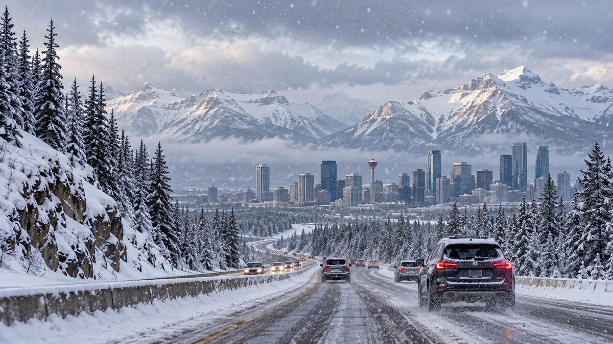
Alberta, Edmonton, Calgary and Jasper are preparing for a major Thanksgiving weekend weather change as Environment and Climate Change Canada (ECCC) warns that accumulating snow could disrupt holiday journeys across western Canada from Friday, 9 October, to Sunday, 11 October 2026. A powerful southward movement of cold air is expected to turn rain into snow across large parts of Alberta, with 10–25 centimetres forecast for some western districts, including Hinton, Grande Cache, Nordegg and Rocky Mountain House. The approaching system could bring slippery highways, reduced visibility, difficult mountain driving and possible local utility outages just before Canadian Thanksgiving on Monday, 12 October, placing regional tourism, family travel and outdoor holiday activities under pressure.
Alberta Faces a Major Thanksgiving Weather Change as Early Winter Snow Sweeps Across the Province
Alberta is heading into the Thanksgiving holiday period under the threat of its first widespread accumulating snowfall of autumn. Official weather statements indicate that colder air will spread southwards, allowing rain to change into snow across west-central Alberta on Friday before affecting more communities on Saturday.
The western part of the province is expected to experience the heaviest accumulation, with mountain communities and foothill destinations facing the greatest risks. For the travel sector, the timing presents challenges. The long weekend is an important period for family visits, self-drive holidays, mountain sightseeing and short breaks. Travellers heading towards the Canadian Rockies could encounter a very different environment from the relatively mild conditions earlier in autumn. Although snow is expected to weaken by Sunday, the rapid change in weather could leave roads slippery and make journeys more difficult throughout parts of the weekend.
Jasper, Hinton and Grande Cache Prepare for Heavy Snowfall With Up to 25 Centimetres Forecast
Western Alberta is expected to bear the greatest impact from the developing snowfall event. ECCC has identified Grande Cache, Hinton, Nordegg and Rocky Mountain House among the communities where 10–25 centimetres of snow could accumulate. A separate snowfall warning for the Hinton–Grande Cache area forecasts 10–20 centimetres by Saturday night. The warning highlights a gradual change from rain to snow on Friday, with higher elevations experiencing accumulation first.
Advertisement
Advertisement
By Friday evening, snow could become widespread across the warned district. Approximately 10 centimetres may accumulate initially, followed by an additional 5–10 centimetres on Saturday. The warning also highlights the possibility of poor visibility and challenging driving conditions. For Jasper and neighbouring mountain communities, snowfall could affect travellers using regional highways to access accommodation, outdoor attractions and scenic routes. The heaviest snow is not necessarily expected in every town. Elevation, precipitation intensity and local temperatures will determine actual accumulation.
Edmonton, Calgary and Red Deer Enter the Snowfall Risk Zone as Highway Travel Comes Under Pressure
The developing storm could extend its influence beyond western Alberta and into the Edmonton–Calgary corridor. ECCC has warned that accumulating snow is possible across much of Alberta on Saturday, potentially including the province’s two largest cities and communities along Highway 2. The preliminary regional outlook suggests that many corridor locations could receive approximately 2–5 centimetres, with isolated amounts potentially reaching 5–10 centimetres.
Advertisement
Advertisement
Edmonton may experience locally higher accumulation if heavier precipitation develops, while Calgary and Red Deer could encounter snow mixed with rain before temperatures fall. However, these city-specific estimates remain preliminary. ECCC has not established a uniform official snowfall total for the entire corridor. The uncertainty is important because relatively small changes in temperature can determine whether precipitation falls as rain, wet snow or accumulating snow.
Alberta Snowfall Forecast: Regional Accumulations and Thanksgiving Weekend Travel Outlook
Snowfall totals are expected to vary considerably across Alberta, with the greatest confirmed risk concentrated in western foothill and mountain districts.
The latest regional outlook highlights the following areas:
| Destination or region | Forecast accumulation | Main travel concern |
|---|---|---|
| Hinton and Grande Cache | 10–20 cm under a regional snowfall warning | Heavy snowfall, reduced visibility and difficult driving |
| Nordegg and Rocky Mountain House | 10–25 cm in the ECCC regional outlook | Significant snow accumulation and changing highway conditions |
| Jasper and Rocky Mountain parks | Locally significant snow possible; exact amounts uncertain | Mountain road conditions and visibility |
| Grande Prairie, Whitecourt and Peace Region | Preliminary estimate of 10–20 cm; not uniformly confirmed by ECCC | Slippery roads and possible heavy wet snow |
| Edmonton | Preliminary estimate of 2–5 cm, locally 5–10 cm | Urban and intercity travel delays possible |
| Calgary | Preliminary estimate of 2–5 cm | Rain-snow transition and slippery surfaces |
| Red Deer and southern Alberta | Preliminary estimate of 2–5 cm | Mixed precipitation and variable highway conditions |
| Lloydminster and neighbouring Saskatchewan areas | Accumulations uncertain | Changing conditions near the provincial boundary |
The difference between official alerts and preliminary estimates remains important. ECCC has explicitly forecast 10–25 centimetres in specified western Alberta areas, while snowfall elsewhere remains subject to changes in the weather system.
Jasper National Park and the Icefields Parkway Face Difficult Conditions as Mountain Snow Arrives
The approaching storm could create challenging conditions for tourists travelling through Jasper National Park and the Canadian Rockies. Jasper is covered by an ECCC special weather statement, while additional statements apply to sections of Highway 93 between Jasper, Saskatchewan River Crossing and Lake Louise. These routes serve an important role in Alberta’s mountain tourism network, connecting visitors with scenic viewpoints, national parks and accommodation destinations.
The Icefields Parkway extends approximately 232 kilometres between Jasper and Lake Louise, crossing elevated terrain where snow can arrive earlier than in surrounding lower-altitude communities. Parks Canada advises that weather can change quickly along the route and that services and mobile phone reception are limited. Snow tyres or chains are compulsory on the Icefields Parkway from 1 November to 31 March, and at other times whenever snow or ice covers the road. As snowfall is expected during October, visitors should consider these requirements before entering mountain routes.
Advertisement
Advertisement
Alberta Highways Face Slippery Roads and Reduced Visibility During the Holiday Travel Rush
Road travel is expected to be the main area of concern as accumulating snow spreads across Alberta. ECCC has warned that conditions could deteriorate quickly, particularly where rain changes into snow and temperatures fall. Major highways connecting Edmonton, Calgary, Red Deer and western mountain communities could experience slower traffic if snow begins settling on road surfaces.
The risk may be greater on exposed routes and higher elevations where temperatures are lower and snow accumulation is more likely. Drivers may encounter wet pavement, slush, reduced visibility and snow-covered sections. Alberta’s official 511 service provides information about changing highway conditions, including snow and ice coverage, poor visibility, travel restrictions and closures. However, the current weather warnings do not establish that any entire highway corridor has closed. Actual restrictions depend on road conditions and decisions made by the relevant authorities.
Alberta Temperatures Could Fall Below Freezing as Sunday Night Wind Chill Intensifies
The snowfall will be accompanied by a noticeable change in temperature across parts of Alberta. According to the preliminary forecast, daytime temperatures in some locations could approach or fall below 0°C during Saturday and Sunday. The cold weather may become particularly noticeable overnight, when wind chill could make conditions feel colder than minus 10°C in exposed areas. These specific wind-chill values have not been independently confirmed for every affected location and may change with updated forecasts.
The falling temperatures could affect travellers participating in outdoor sightseeing, hiking and mountain activities. Wet surfaces may become slippery where temperatures drop below freezing, especially on bridges, shaded roads and higher routes. Heavy, wet snow could also create local problems for trees and overhead infrastructure. ECCC has highlighted possible utility outages in its Hinton–Grande Cache warning. Nevertheless, widespread power failures have not been confirmed, and the extent of any disruption will depend on local accumulation.
Saskatchewan, British Columbia and Manitoba Monitor a Wider Cold Weather Shift Across Western Canada
The changing weather pattern is not confined entirely to Alberta. A broader southward movement of cold air could influence neighbouring parts of Saskatchewan and British Columbia, with conditions varying by location and elevation. The Lloydminster area, near the Alberta–Saskatchewan border, has been included in an official weather statement concerning the developing early-season snowfall.
Northern and central Saskatchewan may experience colder conditions as the weather system evolves, although the confirmed western Alberta snowfall totals cannot be applied directly to Saskatchewan. British Columbia could also encounter colder weather in some areas, especially across higher mountain terrain. Meanwhile, the preliminary regional outlook suggests that southern Manitoba may remain comparatively milder. Drivers moving between Alberta, Saskatchewan and British Columbia should therefore monitor the official forecasts and road reports for each province before beginning longer journeys.
Advertisement
Advertisement
Thanksgiving Tourism Faces Potential Delays as Hotels, Tour Operators and Ground Transport Prepare
The approaching snow creates additional planning requirements for tourism businesses operating across Alberta. Hotels in Jasper and other mountain communities may need to accommodate guests arriving later than originally planned if highway conditions deteriorate. Tour operators offering scenic drives and outdoor excursions could face itinerary adjustments when snow affects access to mountain routes. Ground transport providers connecting airports, cities and national park destinations may also need to account for slower journeys.
The disruption is not expected to affect every destination equally. Western Alberta faces the greatest confirmed snowfall risk, while Edmonton, Calgary and Red Deer may experience more variable precipitation and smaller accumulation totals. No widespread cancellation of tourism services has been confirmed by the weather alerts alone. The principal concern for businesses is the possibility of short-notice operational changes as weather conditions evolve. Clear updates about journey times, road accessibility and outdoor activities could help travellers manage holiday plans during the weekend.
Alberta Thanksgiving Snowstorm Timeline Reveals When the Worst Weather Could Arrive
The developing snowfall event is expected to progress across Alberta over several days.
Friday, 9 October: Rain gradually changes to snow across west-central Alberta. Higher elevations begin accumulating snow first, while western districts prepare for heavier precipitation during the evening.
Saturday, 10 October: Snow spreads across a larger part of Alberta. Hinton, Grande Cache and other western communities face significant accumulation, while snow may also reach Edmonton, Calgary and Red Deer.
Sunday, 11 October: Snowfall gradually weakens from north to south. Some areas may continue experiencing slippery roads and colder temperatures as the main system moves away.
Advertisement
Advertisement
Monday, 12 October: Canadian Thanksgiving arrives after the main forecast snowfall period. Residual snow, ice or wet road conditions may remain locally, depending on temperatures and the speed of improvement.
The preliminary longer-range outlook indicates that milder weather and sunshine could return to parts of the Edmonton–Calgary corridor early next week. However, the exact timing and extent of the temperature recovery remain uncertain.
Canada’s Thanksgiving Travel Outlook Hinges on Snowfall Intensity and Highway Accessibility
Alberta’s Thanksgiving weekend is shaping up to be an important early-season winter weather event, with western communities facing the greatest risk of heavy snow. Hinton, Grande Cache, Nordegg and Rocky Mountain House are among the locations where ECCC has forecast 10–25 centimetres, while Jasper National Park and surrounding highways could encounter challenging mountain travel conditions. Edmonton, Calgary and Red Deer remain within the wider area where accumulating snow is possible, although official snowfall totals for these cities remain uncertain.
The storm is expected to weaken from north to south on Sunday, potentially allowing conditions to improve ahead of Thanksgiving Monday. For the travel industry, the immediate priority is the effect of changing weather on road accessibility, journey times and visitor movements rather than snowfall totals alone. As western Canada moves from autumn towards winter, the event shows how rapidly seasonal conditions can change across the Prairies and Rocky Mountains. The latest ECCC weather alerts, Parks Canada guidance and provincial highway reports will remain essential for monitoring the holiday travel situation as the snow develops.
Advertisement
