
Santa Ana Winds Put Southern California on High Alert as Extreme Heat and Wildfire Threats Intensify, Along With Sundowner and Others: Travelers Must Know Everything

Published
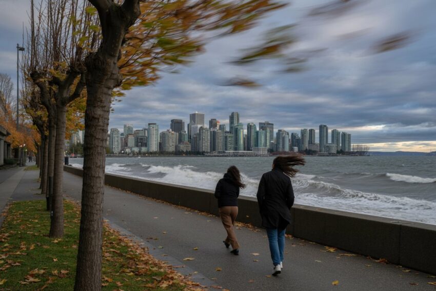 Image generated with Ai
Southern California is facing another period of hazardous weather as powerful Santa Ana winds sweep through mountain passes, inland valleys, and coastal communities, creating conditions that could allow wildfires to spread rapidly. The combination of strong winds, extremely low humidity, dry vegetation, and unusually warm temperatures has raised concerns across several counties, particularly in areas where residential neighborhoods border fire-prone hillsides.
The National Weather Service (NWS) has identified significant offshore wind activity during October 16–17, 2026, with some exposed mountain locations potentially experiencing gusts of 70 to 90 mph. Relative humidity could fall into the single digits in particularly vulnerable areas, increasing the potential for dangerous fire behavior if a wildfire starts.
Although Santa Ana winds are a familiar feature of Southern California’s climate, their intensity varies considerably. Some events produce moderate breezes and dry conditions, while others generate damaging gusts, widespread fire-weather warnings, and serious threats to communities.
Which winds create the greatest heat and wildfire danger in Southern California?
| Wind phenomenon | Principal locations | Characteristics | Wildfire significance |
|---|---|---|---|
| Santa Ana winds | Los Angeles, Ventura, Orange, Riverside, San Bernardino and San Diego counties | Strong, dry easterly or north-easterly offshore winds; often warm or hot at lower elevations | Major regional driver of fast-moving wildfires and extreme fire behaviour |
| Sundowner winds | Southern Santa Barbara County, particularly the Santa Ynez Mountains and adjacent coast | Dry, gusty downslope winds, often intensifying during the late afternoon and evening | Can cause sharp local temperature increases and rapid fire spread |
| Other northerly downslope winds | Santa Barbara, San Luis Obispo and adjacent mountain areas | Terrain-enhanced northerly or north-westerly gusts with localised warming and drying | Can produce critical fire weather, especially where vegetation is dry |
| Diablo winds | Mainly Northern California, including the Bay Area | Hot, dry offshore winds descending from inland higher terrain | Important California wildfire wind, but not the main wind affecting Southern California |
What Are Santa Ana Winds, and Why Are They Affecting Southern California?
Santa Ana winds are strong, dry offshore winds that generally develop when high atmospheric pressure forms over the Great Basin and lower pressure exists toward the Southern California coast. This pressure difference pushes inland air toward the Pacific Ocean, often producing easterly or northeasterly winds across the region.
Advertisement
Advertisement
As the air moves through mountain passes and descends toward lower elevations, atmospheric compression causes it to warm. Its relative humidity decreases, sometimes dramatically, creating conditions that can rapidly dry grasses, shrubs, and other vegetation.
The winds commonly affect Southern California between fall and spring, although their timing, duration, and intensity vary from year to year.
Advertisement
Advertisement
Unlike ordinary coastal breezes, Santa Ana winds move from inland areas toward the ocean. This reverses the region’s more familiar marine airflow and can replace cool, humid coastal conditions with much drier air.
Not every Santa Ana event produces extreme heat. Some winter events bring cool offshore air, while fall episodes can coincide with unusually high temperatures.
Which Southern California Counties Face the Greatest Threat From These Powerful Winds?
Los Angeles, Ventura, Orange, Riverside, San Bernardino, and San Diego counties are among the areas most closely associated with Santa Ana wind events. Their mountain ranges, canyons, foothills, and inland valleys create geographical conditions that can strengthen offshore winds and expose nearby communities to dangerous fire weather.
In Los Angeles County, Santa Clarita, the San Fernando Valley, the San Gabriel foothills, Malibu, and Calabasas can experience significant offshore wind activity. Ventura County communities, including Simi Valley, Moorpark, Ojai, and Santa Paula, also face substantial exposure.
Orange County’s Santa Ana Mountains and canyon communities are particularly vulnerable to terrain-enhanced gusts. Farther inland, the Cajon Pass in San Bernardino County and the Banning Pass near Riverside County can channel strong winds through narrow geographical corridors.
In San Diego County, inland communities such as Ramona, Alpine, and Julian frequently experience dry offshore conditions.
Advertisement
Advertisement
The severity of any particular event depends on local terrain, vegetation, wind direction, and atmospheric pressure patterns.
How Strong Could Wind Gusts Become During the October 2026 Weather Event?
The National Weather Service Los Angeles/Oxnard forecast information for October 16–17, 2026, indicates the potential for exceptionally strong offshore winds in exposed mountain and foothill locations.
Some mountain areas could experience gusts reaching 70 to 90 mph during the most intense periods. Elsewhere, gusts between 40 and 60 mph may create hazardous conditions, particularly near canyon openings and mountain passes.
These figures represent forecast possibilities for particular locations rather than expected wind speeds throughout Southern California.
Strong gusts can damage trees, disrupt transportation, create flying debris, and increase the likelihood of power interruptions. They also present serious difficulties for firefighters because sudden changes in wind speed and direction can alter wildfire behavior.
Mountain roads and exposed highways may become particularly hazardous for high-profile vehicles.
Advertisement
Advertisement
Residents should distinguish between forecast peak gusts and sustained wind speeds. Short-lived extreme gusts can produce significant damage even when average wind speeds remain considerably lower.
Why Do Santa Ana Winds Increase the Risk of Dangerous Wildfires?
Santa Ana winds increase wildfire danger by combining strong airflow with low atmospheric humidity and, frequently, dry vegetation. Together, these conditions can create an environment in which fires ignite more easily and spread much faster.
When relative humidity falls, fine vegetation such as grasses, leaves, and small branches can lose moisture. These materials may become more receptive to ignition, particularly after prolonged dry weather.
Strong winds then accelerate fire spread by pushing flames toward unburned vegetation. They can also carry burning embers ahead of the main fire, potentially starting additional fires at considerable distances.
This process, known as spotting, can allow a wildfire to move beyond roads, firebreaks, and other obstacles.
However, strong winds do not automatically cause wildfires. An ignition source must still be present.
Advertisement
Advertisement
The greatest danger arises when powerful winds coincide with dry fuels, extremely low humidity, and an active ignition.
How Does Extreme Heat Make Southern California’s Fire Conditions More Dangerous?
High temperatures can intensify fire-weather conditions by accelerating the drying of vegetation and increasing the atmosphere’s capacity to hold water vapor.
During warm Santa Ana events, descending air becomes warmer through compression, while relative humidity can fall sharply. The resulting conditions may increase the flammability of vegetation, particularly where grasses and brush have already dried.
Southern California’s coastal communities can experience unusual temperature patterns during these events. Instead of receiving cooling breezes from the Pacific Ocean, they may encounter warm, dry winds arriving from inland areas.
However, extreme heat is not a defining feature of every Santa Ana wind event. Temperature outcomes depend on the characteristics of the incoming air mass and the prevailing weather pattern.
Fire danger also depends on longer-term environmental conditions, including rainfall, drought, seasonal vegetation growth, and fuel moisture.
Advertisement
Advertisement
Consequently, meteorologists evaluate temperature alongside wind, humidity, and vegetation conditions rather than treating heat alone as a reliable indicator of wildfire risk.
What Do Red Flag Warnings Mean for Residents Across Southern California?
A Red Flag Warning indicates that critical fire-weather conditions are occurring or expected within a specified forecast area.
The National Weather Service issues these warnings when atmospheric conditions, combined with sufficiently dry fuels, could support rapid wildfire growth.
For the October 2026 offshore wind event, NWS forecast information identifies significant fire-weather concerns across portions of Southern California, including areas within Los Angeles and Ventura counties.
Warnings can apply to particular valleys, mountain slopes, foothills, or coastal zones rather than entire counties.
A Red Flag Warning does not mean that a wildfire has started. Instead, it alerts residents, emergency agencies, and land managers that fires could become particularly difficult to control if an ignition occurs.
Advertisement
Advertisement
Residents should avoid activities that could generate sparks or flames and follow local restrictions on outdoor burning.
They should also monitor official forecasts because warning boundaries, expiration times, and expected wind speeds may change as weather conditions evolve.
Why Are Mountain Passes and Canyon Communities Especially Vulnerable?
Southern California’s complex geography plays an important role in determining where Santa Ana winds become most dangerous.
Mountain passes, narrow canyons, and exposed ridgelines can accelerate airflow as offshore winds move toward lower elevations. These terrain effects sometimes produce much stronger gusts than those experienced in nearby sheltered neighborhoods.
The Cajon Pass, connecting the San Bernardino Valley with the Mojave Desert, is one of the region’s prominent wind corridors.
Other vulnerable locations include the Santa Ana Mountains, the San Gabriel foothills, and mountain communities across Riverside and San Diego counties.
Advertisement
Advertisement
Strong winds in these locations can create transportation hazards and complicate emergency evacuation efforts.
Wildfire exposure becomes particularly significant where homes, businesses, and roads meet undeveloped vegetation. These areas are commonly described as the wildland-urban interface.
During severe offshore wind events, fire can move rapidly through brush-covered hillsides, while airborne embers may threaten structures beyond the immediate flame front.
Are Sundowner Winds Another Major Wildfire Threat in Santa Barbara County?
Although Santa Ana winds dominate much of Southern California’s regional fire-weather discussion, Santa Barbara County faces another important wind phenomenon known as Sundowner winds.
These locally intensified downslope winds develop along the southern slopes of the Santa Ynez Mountains and can affect communities including Santa Barbara, Goleta, Montecito, and the Gaviota Coast.
Sundowner events frequently intensify during the late afternoon or evening, although their precise timing varies.
Advertisement
Advertisement
As air descends from the mountains toward the coast, it can warm and dry rapidly, producing sudden temperature increases and strong gusts.
These conditions can create significant wildfire hazards, especially when vegetation is dry and winds remain elevated overnight.
Sundowner winds differ from Santa Ana winds in their geographical distribution and atmospheric development.
Understanding this distinction is important because Southern California’s wildfire danger does not depend on a single wind system. Different counties face different combinations of local terrain, atmospheric circulation, and seasonal vegetation conditions.
What Does Scientific Research Reveal About Santa Ana Winds and Major Wildfires?
Scientific studies have established a strong relationship between Santa Ana wind conditions and some of Southern California’s most destructive wildfire events.
Research examining historical Santa Ana-associated fires has found that hot Santa Ana events account for a disproportionately large share of major wildfire activity within the studied datasets.
Advertisement
Advertisement
One analysis found that approximately 90% of large Santa Ana-spread wildfires in its historical sample were associated with hot Santa Ana conditions. Those fires represented approximately 95% of the burned area within the relevant large-fire dataset.
These findings should not be interpreted as percentages for all California wildfires.
Additional research published through the U.S. Geological Survey has identified wind speed, drought, and ignition patterns as important factors influencing the size and severity of Santa Ana-associated fires.
The evidence reinforces an important conclusion: wildfire danger reflects the interaction of weather, vegetation, and ignition sources.
Consequently, preventing ignitions during severe offshore wind events remains an essential part of reducing wildfire losses.
How Could These Dangerous Winds Affect Travel, Roads, and Tourism?
Santa Ana wind events can disrupt transportation and outdoor recreation across Southern California, particularly in mountain communities, canyon corridors, and destinations close to wildfire-prone vegetation.
Advertisement
Advertisement
Strong crosswinds can make driving difficult on exposed highways, especially for trucks, recreational vehicles, and other high-profile vehicles.
Falling branches, airborne debris, reduced visibility from dust, and emergency road closures may also affect travel.
Visitors planning hiking, camping, cycling, or scenic drives should carefully review weather forecasts before entering exposed terrain.
Popular outdoor destinations in the San Gabriel Mountains, Santa Monica Mountains, and San Diego County’s backcountry may experience substantially different conditions from nearby urban centers.
Wildfire smoke, when fires occur, can also affect air quality and visibility across wider areas.
Travelers should consult the National Weather Service, Caltrans QuickMap, local emergency management agencies, and CAL FIRE for verified updates.
Advertisement
Advertisement
Travel disruptions should not be assumed without an official closure, warning, or incident report.
What Precautions Should Residents Take During Severe Santa Ana Wind Events?
Residents living in wildfire-prone communities should prepare for potentially rapid changes in conditions when strong offshore winds are forecast.
Emergency officials recommend maintaining defensible space around properties, reducing combustible vegetation near structures, and securing loose outdoor objects before damaging winds arrive.
Households should establish evacuation plans, identify alternative escape routes, and prepare essential supplies, including medications, identification documents, drinking water, and communication equipment.
Residents should also register for local emergency alerts and keep mobile devices charged.
During Red Flag Warning periods, avoiding unnecessary ignition sources is particularly important. Outdoor burning, activities that produce sparks, and improperly maintained equipment can increase wildfire risk.
Advertisement
Advertisement
People should never wait for visible flames before responding to an evacuation order.
Those traveling through mountain passes or remote areas should check road conditions and avoid unnecessary exposure during the strongest winds.
Preparedness cannot eliminate wildfire danger, but early action can reduce vulnerability.
Will Santa Ana Winds Continue to Threaten Southern California Beyond October?
Santa Ana winds are a recurring feature of Southern California’s climate and can return throughout the cooler months.
Their frequency and intensity depend on atmospheric pressure patterns, seasonal circulation, and the position of weather systems across the western United States.
Although autumn is particularly significant because vegetation may remain dry after summer, dangerous offshore wind events can also occur during winter and spring.
Advertisement
Advertisement
The wildfire consequences of future events will depend on fuel conditions, recent rainfall, drought, and the presence of ignition sources.
The October 2026 episode highlights the importance of continuous weather monitoring and regional emergency preparedness.
For communities across Los Angeles, Ventura, Orange, Riverside, San Bernardino, and San Diego counties, understanding Santa Ana winds is essential to managing wildfire exposure.
Ultimately, Santa Ana winds remain one of Southern California’s most consequential natural weather hazards because their combination of powerful gusts, dry air, and occasional extreme heat can transform a small ignition into a rapidly spreading wildfire emergency.
What Precautions Should Travelers Take Before Visiting Southern California During Santa Ana Winds?
Travelers planning to visit Southern California should take extra precautions as powerful Santa Ana winds increase the risk of wildfires, extreme heat, hazardous driving conditions, and potential travel disruptions across Los Angeles, Ventura, Orange, Riverside, San Bernardino, and San Diego counties.
Before departure, visitors should check the latest weather forecasts and Red Flag Warnings issued by the National Weather Service (NWS). They should also monitor CAL FIRE for active wildfire incidents, evacuation notices, and emergency advisories.
Advertisement
Advertisement
Travelers planning road trips should consult Caltrans QuickMap for highway closures, strong wind advisories, and traffic disruptions, particularly along mountain passes and exposed routes.
Those booking flights should confirm their flight status directly with airlines, as severe weather and wildfire smoke may occasionally affect airport operations.
Visitors should avoid hiking, camping, and other outdoor activities in fire-prone mountain areas during critical fire-weather conditions. Carrying drinking water, essential medications, portable chargers, and emergency supplies is also advisable.
Travelers should consider flexible accommodation bookings, identify alternative routes, and follow local evacuation instructions immediately.
Southern California’s escalating fire weather concerns highlight the dangerous relationship between offshore winds, low humidity, and dry vegetation. Santa Ana winds develop when inland high pressure drives air toward the Pacific coast. As descending air warms and dries, powerful gusts can accelerate wildfire spread and threaten vulnerable communities. Los Angeles, Ventura, Orange, Riverside, San Bernardino, and San Diego counties face varying levels of exposure. Travelers should monitor official forecasts, verify road conditions, and avoid high-risk outdoor activities. Although these winds do not automatically cause fires, their intensity makes early preparation, responsible travel decisions, and emergency awareness essential for safety.
Advertisement
