
UK Alongside Iceland, Netherlands and More Countries in Europe Face Powerful Winds as Travel Disruption Risks Rise

Published
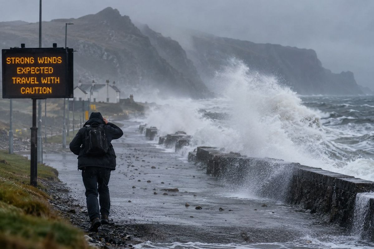
UK Alongside Iceland, Netherlands and More Countries in Europe Face Powerful Winds as Travel Disruption Risks Rise as an unsettled Atlantic weather pattern brings different levels of wind exposure across northern Europe. Scotland is under a Met Office yellow warning, with gusts of 50–60mph widely and around 70mph possible on exposed coasts and hills. Iceland is facing the more serious situation, with yellow and orange alerts, exceptionally low pressure and gale to strong-gale winds. The Netherlands is experiencing a much more limited event, with an official Force 6 marine warning around Rottum rather than a nationwide public wind alert. For travellers, that difference matters when assessing road, rail, ferry and aviation risks.
Why is Scotland facing the most important UK wind warning?
The Met Office’s current yellow wind warning covers Highland and Na h-Eileanan Siar from 10am until 7pm on Wednesday, 14 October 2026. Strong south to south-westerly winds are expected, with gusts of 50–60mph widely and approximately 70mph in exposed coastal and upland locations during the late morning and early afternoon.
The warning has a 50–75% likelihood and a moderate expected impact. The Met Office specifically says delays to road, air and ferry transport are likely, while some bus and train services may also be affected. High-sided vehicles can face particular difficulty on exposed roads and bridges.
| Scotland warning factor | Official detail |
|---|---|
| Warning level | Yellow |
| Area | Highland and Western Isles |
| Time | 10am–7pm |
| Typical gusts | 50–60mph |
| Exposed areas | Around 70mph |
| Likelihood | 50–75% |
| Impact level | Moderate |
The Met Office expects winds to ease from the west later in the afternoon and early evening.
Advertisement
Advertisement
How could Scotland’s ferries, roads and trains be affected?
The greatest travel sensitivity lies on exposed western and island routes.
The Met Office warns of likely delays to road, air and ferry transport, while bus and rail journeys can also take longer. High-sided vehicles are particularly vulnerable on open roads and bridges.
Advertisement
Advertisement
Ferry disruption is already relevant to the wider Scottish network. Adverse weather led to cancellations on CalMac’s Arran service immediately before the warning period, showing how quickly coastal conditions can affect operations. However, travellers should not assume every route in the Highlands or Western Isles is cancelled; ferry status can change sailing by sailing.
Road travel is also complicated by planned works. Traffic Scotland lists resurfacing beginning on the A87 between Invergarry and Bun Loyne from 14 October, with overnight restrictions running into December. Separate A889 works between Dalwhinnie and Catlodge also begin on 14 October.
Scotland travel picture
| Mode | Current official position |
|---|---|
| Roads | Wind-related delays possible; exposed vehicles vulnerable |
| Rail | Longer journeys and some service effects possible |
| Ferries | Weather disruption possible; individual sailings should be checked |
| Air | Delays possible under Met Office warning |
| Additional issue | Roadworks affect A87 and A889 |
For tourists, the key advice is to check individual services rather than interpreting a weather warning as a universal shutdown.
Why is Iceland facing a more severe weather event?
Iceland’s situation is substantially more serious than Scotland’s.
The Icelandic Meteorological Office says an unusually deep low-pressure system, potentially reaching around 934 hPa, is affecting the country. Yellow weather alerts cover much of Iceland, while orange alerts are active for South Iceland, Breiðafjörður, the Westfjords and northwest Iceland.
The national forecast calls for increasing easterly and northeasterly gales or strong gales, heavy rain and mountain sleet or snow. Later, winds in north-west Iceland are forecast to turn northerly at 18–25 metres per second, equivalent to roughly 40–56mph sustained, with substantial snowfall or sleet and possible blizzard conditions.
Advertisement
Advertisement
The meteorological office also warns of high waves near the coast, possible high sea states and a risk of localised coastal flooding along southern, eastern and northern shores.
| Iceland weather factor | Official information |
|---|---|
| Lowest forecast pressure | Around 934 hPa |
| Warning levels | Yellow and orange |
| Northwest sustained winds | 18–25 m/s |
| Other hazards | Heavy rain, sleet, snow, blizzard conditions |
| Coastal risk | High waves and possible local flooding |
| Main system | Very deep Atlantic low |
Iceland therefore represents the strongest confirmed weather threat among the countries in this comparison.
What does Iceland’s weather mean for travellers on the ground?
Iceland’s road authority warns that strong winds can create hazardous driving conditions, especially for vehicles with trailers, campervans and large exposed sides. Gusts can destabilise vehicles, while snow, sleet and poor visibility can lead to sudden road restrictions or closures.
The official advice is clear: travellers should consider delaying journeys during severe weather and continuously monitor road and weather conditions when travel cannot be avoided. Loads, doors, windows and hatches should be secured before departure.
Aviation is also highly sensitive to these conditions. The Icelandic Meteorological Office serves as Iceland’s formal Meteorological Watch Office for aviation, supplying warnings used by air-traffic and airport operations.
However, unless an airline or airport confirms a cancellation, travellers should treat flight interruption as a risk rather than a certainty.
Advertisement
Advertisement
The combination of orange alerts, gale-force winds, snow and a forecast central pressure near 934 hPa means road travel in Iceland deserves more caution than the comparatively localised Dutch marine warning.
Is the Netherlands facing the same scale of wind warning?
No, and this distinction is essential for factual reporting.
The Royal Netherlands Meteorological Institute, KNMI, reported on 14 October that most of the country was experiencing dry and relatively sunny autumn weather. The Netherlands is not under a Scotland-style nationwide yellow public wind warning.
There is, however, an official maritime warning for the Rottum coastal district, where west to north-westerly winds reached Beaufort Force 6. Other Dutch coastal districts and North Sea sectors had no warning in the 05:35 local-time bulletin.
KNMI’s marine forecast showed Rottum at Force 4–5, temporarily possibly reaching Force 6, with winds later easing before potentially strengthening again overnight.
Netherlands versus Scotland and Iceland
| Location | Warning type | Wind severity |
|---|---|---|
| Scotland | Public yellow warning | Gusts 50–60mph, around 70mph exposed |
| Iceland | Yellow + orange warnings | Gale/strong gale; 18–25 m/s later in northwest |
| Netherlands | Local marine warning | Force 6 near Rottum |
| Most of Netherlands | No public wind warning | Generally dry, lighter conditions |
This means the Netherlands belongs in a broader northern-European wind story only with careful qualification. It is not experiencing the same warning level or widespread travel threat as Scotland or Iceland.
Advertisement
Advertisement
Which transport systems face the greatest disruption risk?
The table below separates verified warnings from operational risk.
| Country | Rail | Ferries / marine | Aviation | Road travel |
|---|---|---|---|---|
| UK – Scotland | Some delays possible | Ferry disruption likely on exposed routes | Delays possible | High-sided vehicles vulnerable |
| Iceland | Limited rail relevance | High seas and coastal impacts | Weather-related disruption possible | Strong risk from gales, snow and poor visibility |
| Netherlands | No broad weather disruption confirmed | Rottum marine Force 6 warning | No broad wind disruption confirmed | No nationwide wind alert |
For Scotland, the Met Office explicitly identifies possible disruption across road, rail, ferry and air transport.
For Iceland, the combination of orange warnings, snow and strong sustained winds creates the highest overall surface-transport risk.
For the Netherlands, the current warning is primarily maritime. KNMI reports no warnings for the other named coastal districts or North Sea sectors.
The practical lesson is that travellers should not assume identical consequences simply because several countries are experiencing windy weather.
The strongest current examples
| Rail network / route | Country | Problem / work | Current disruption | Official end date | Similarity to Merseyrail |
|---|---|---|---|---|---|
| Cumbrian Coast Line – Bransty Tunnel | UK | Unstable ground beneath tunnel; track and drainage renewal | Buses replace trains Corkickle–Whitehaven | 15 May 2027 | Very high |
| Waterloo–Exeter / West of England Line | UK | Track stability affected by extremely dry conditions and soil movement | Reduced timetable and speed restrictions | Until further notice | Very high |
| Cévennes Line | France | Tunnel-vault strengthening and sleeper renewal | Rail traffic suspended on affected sections; coaches provided | 6 Nov 2026 | Very high |
| Train Jaune | France | Earthwork strengthening, rock-wall work and signalling renewal | Entire line closed | 30 Oct 2026 | High |
| Zurich–Munich / Lindau–Munich | Switzerland/Germany | Major engineering and line works | Cancellations, amended services and replacement buses | 6 Nov 2026 for current phase | High |
| Tackley station / GWR | UK | New permanent footbridge and lifts | Southbound trains skip Tackley | 30 Apr 2027 |
Why are Atlantic systems creating such different conditions across northern Europe?
The contrast comes from each country’s position relative to the pressure system.
Advertisement
Advertisement
Scotland is seeing strong south to south-westerly winds associated with Atlantic low pressure, producing the strongest gusts across exposed western Highlands and islands.
Iceland is much closer to the centre of an exceptionally deep system. The Icelandic Meteorological Office forecasts the low over the country during the afternoon, explaining the combination of heavy rain, strong gales, later northerly winds and blizzard conditions in the northwest.
The Netherlands, by contrast, sits farther from the most intense part of the disturbance. KNMI’s maritime forecast describes a ridge over the North Sea moving eastwards, leaving only a limited Force 6 warning around Rottum.
This explains why one broad European headline can hide major differences. Northern Europe’s weather is connected through Atlantic circulation, but the travel impacts remain highly localised.
Comment From Anup Keshan, Founder and Editor-in-Chief of Travel And Tour World
“Strong-wind events across northern Europe show why travellers increasingly need to treat weather monitoring as part of normal journey planning. Scotland and Iceland are facing the clearest current risks, particularly for exposed roads, ferries and aviation, while the Netherlands illustrates how conditions can remain much more localised. The most important point for travellers is not to assume that one European weather story applies equally everywhere. Official national forecasts, road authorities, ferry operators, airports and rail companies should always be checked before departure. Better preparation can help travellers avoid missed connections, difficult road conditions and unnecessary disruption while allowing transport operators to prioritise safety.”
Conclusion: Why are travel disruption risks rising across northern Europe?
UK Alongside Iceland, Netherlands and More Countries in Europe Face Powerful Winds as Travel Disruption Risks Rise because a strong Atlantic weather pattern is affecting each location differently.
Advertisement
Advertisement
The cause is deep low pressure and strong regional pressure gradients. The answer for travellers is close monitoring of official warnings and individual transport services. The reason the risks differ is geography. Scotland faces gusts approaching 70mph in exposed areas. Iceland has yellow and orange alerts, gale-force winds, snow and exceptionally low pressure. The Netherlands has only a limited Force 6 maritime warning near Rottum, with no equivalent nationwide yellow alert.
The wider message is therefore caution rather than panic: northern Europe is windy, but the severity and travel consequences are not uniform.
Advertisement
