
Vietnam Faces Travel Disruption As Local Floods And Landslide Risks Mean Better Route Checks Are Now A Must

Published
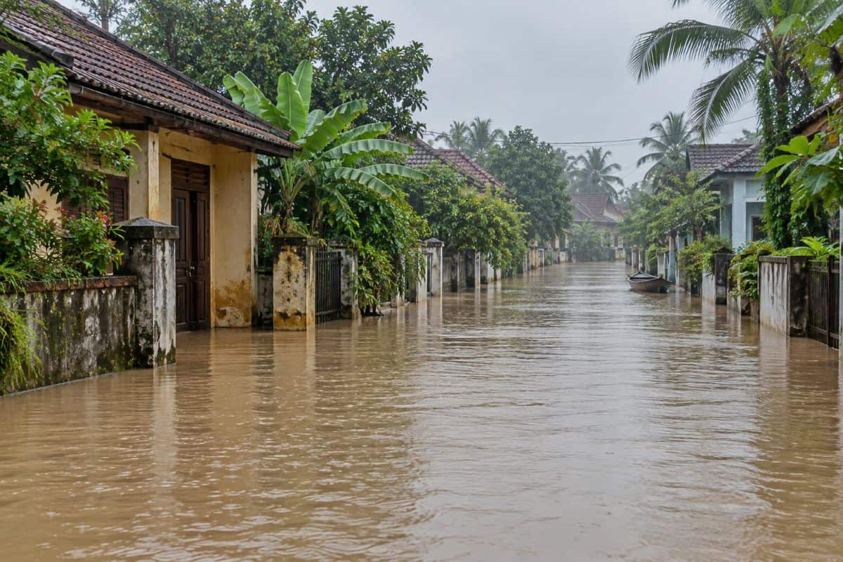
Vietnam Faces Travel Disruption following local flooding and fresh weather warnings affecting journeys in parts of the country. As of 14 October 2026, official information identifies flash-flood and landslide risks in central areas, alongside tidal flooding concerns in the south. For visitors, the immediate issue is safe access to accommodation, excursions and onward transport. The available evidence does not establish a nationwide tourism shutdown. It describes separate hazards that require checks on individual destinations and routes before departure.
An internationally published disaster-report summary links heavy rain on 10–11 October with local flooding, landslides and transport disruption. Its full assessment was inaccessible during verification, so detailed impact totals are excluded. Separate national weather guidance covers vulnerable slopes and small streams. Southern tidal warnings concern low ground near rivers and coasts. These events should not be combined into one continuous flood emergency. Equally, a warning about possible flooding cannot establish that every road within the named area has closed.
Official Evidence Defines the Scale of Travel Disruption
The table separates current warnings, documented earlier impacts and longer-term measures. Its percentages represent an editorial assessment of this article’s emphasis. They are not official measurements of flooded territory, cancelled trips or tourism losses. The allocation totals 100%, with the greatest weight assigned to immediate weather hazards and road safety. Sources support the factual findings, while the travel implications explain their practical relevance.
| News component | Editorial share | Verified finding | Relevance to travellers | Official source |
|---|---|---|---|---|
| Central warnings | 25% | Six-hour warning names five provinces and cities, from Quang Tri to Gia Lai. | Check vulnerable slopes and stream crossings. | National weather bulletin. nchmf.gov.vn |
| Southern tides | 20% | Vung Tau recorded 4.17 metres on 12 October; later forecasts indicate easing. | Low areas can still flood. | Coastal tide bulletin. thoitietvietnam.gov.vn |
| Can Tho monitoring | 10% | Published tidal-warning period covers 12–17 October. | Monitor updated local conditions. | Local warning. hoinongdan.cantho.gov.vn |
| Documented road impacts | 15% | September flooding slowed vehicles and stalled motorbikes in Can Tho. | Supports caution around submerged roads. | Local safety guidance. congan.cantho.gov.vn |
| Drainage background | 10% | July 2025 review identified eight groups of drainage problems. | Explains existing infrastructure constraints. | Municipal assessment. sokhcn.cantho.gov.vn |
| Flood protection | 10% | City project reported over 95% complete; November remains its target. | Future benefits remain conditional. | Government project update. baochinhphu.vn |
| Visitor guidance | 10% | Seasonal floods can obstruct roads and adventure routes. | Follow warnings and local instructions. | Government travel advice. GOV.UK |
| Additional references | — | Rainfall-report summary; separate entry requirements. | Neither establishes a weather-related immigration change. | Disaster summary; entry guidance. Heavy rainfall caused flooding #3 (2026-10-12) |
The figures describe different places, dates and measurements. The 4.17-metre observation is a tide-gauge reading, not water depth on a street. Likewise, the drainage review provides historical context rather than proof of what caused every October incident. No verified total for cancelled holidays, affected tourists or lost visitor spending appears in the material reviewed. The evidence supports local safety concerns without establishing a national tourism crisis.
Advertisement
Advertisement
Vietnam Faces Travel Disruption Across Distinct Weather Zones
The central warning names Quang Tri, Hue, Da Nang, Quang Ngai and Gia Lai. It identifies possible flash floods, landslides and ground subsidence around slopes and small streams during a six-hour window. Subsidence means the ground may sink or give way. That short period makes publication time important. Travellers should consult the replacement bulletin before setting out, rather than treating an earlier alert as an indefinite closure. The notice does not confirm damage across all five administrative areas.
The southern coastal bulletin records Vung Tau’s 4.17-metre high water at 15:00 on 12 October. It forecasts 4.05–4.10 metres from the evening of 13 October through 14 October, followed by a possible 3.95–4.05 metres over its subsequent forecast period. These remain predictions. The warning identifies low coastal and riverside land, including areas outside protective embankments. It also flags strong currents moving offshore as tides fall. Lower forecast tides therefore do not automatically remove risks at beaches or river access points.
Advertisement
Advertisement
Why Local Access Matters for Tourism
Travel Disruption can affect a visitor’s day even when the destination itself remains accessible. A flooded approach road may complicate a hotel transfer or an excursion departure. These are potential consequences, not verified cancellation figures for this event. The distinction matters for tourism businesses because a local access problem requires specific information about location and timing. It does not justify assuming that every attraction, accommodation property or boat service has suspended operations. The practical question is whether each planned transfer, walking route or excursion crosses an affected area at the intended departure time, rather than elsewhere.
Can Tho’s earlier official records help explain the concern. A notice dated 30 September documents flooding after heavy rain and high tides on 28 September. Vehicles slowed, some motorbikes stalled, and travellers faced detours or waits. Separately, a July 2025 municipal review examined drainage at 11 roads and areas and two pumping stations. Its eight problem groups included restricted outlets, low road levels and overloaded drains. Those findings show longstanding weaknesses, but do not prove a single cause for the latest flooding.
Advertisement
Advertisement
Practical Steps to Reduce Travel Disruption
Travellers heading towards affected areas should base decisions on current local instructions. Official guidance advises avoiding flooded areas and monitoring regional forecasts. It also identifies swollen rivers, landslides and remote terrain as risks for adventure activities. The immediate priority is checking whether the specific journey can proceed safely, with particular care around rural roads, stream crossings and riverside access.
- Check the warning’s issue time and geographical coverage.
- Avoid deeply flooded roads and fast-flowing water.
- Follow traffic diversions and instructions from local authorities.
- Check weather conditions before trekking or water activities.
- Confirm insurance covers the activities you have planned.
- Keep emergency contact details accessible throughout the journey.
The reviewed weather notices announce no changes to visas, passport rules or immigration procedures. Travellers should still check entry requirements for their nationality and circumstances separately. Flood warnings do not replace those requirements. Nor does the absence of a nationwide closure confirm that a particular road is safe. Decisions should follow conditions at the destination and along the route, including any instructions to avoid hazardous areas.
Vietnam Faces Travel Disruption: What Happens Next
The coastal bulletin schedules its next update for 15:30 on 14 October, Vietnam time. Can Tho’s published tidal-warning period extends to 17 October. These dates guide monitoring, not a promised return to normal. Longer term, an official 13 October update reports Ho Chi Minh City’s major tidal-control project as over 95% complete, with completion targeted for November 2026. Planned protection covers 570 square kilometres and around 6.5 million residents. Those are intended benefits, not proof that flood risks have ended.
Vietnam Faces Travel Disruption through a series of local hazards that demand careful, current information. Central warnings identify vulnerable terrain, while southern tidal forecasts highlight low coastal and riverside areas. The tourism concern is access and safety, with wider commercial effects still unmeasured. Future flood protection may improve resilience, but construction targets cannot guarantee safe journeys today. Visitors should distinguish observed conditions from forecasts and check the latest instructions before moving through affected places. The next official bulletins will clarify changing risks. Until then, route-specific information offers a firmer basis for travel decisions than sweeping claims about the whole country.
Advertisement
