
Memphis Along with St. Louis and Others Face US River Cruise Crisis as Mississippi and More Rivers Hit Low Water Levels in 2026

Published
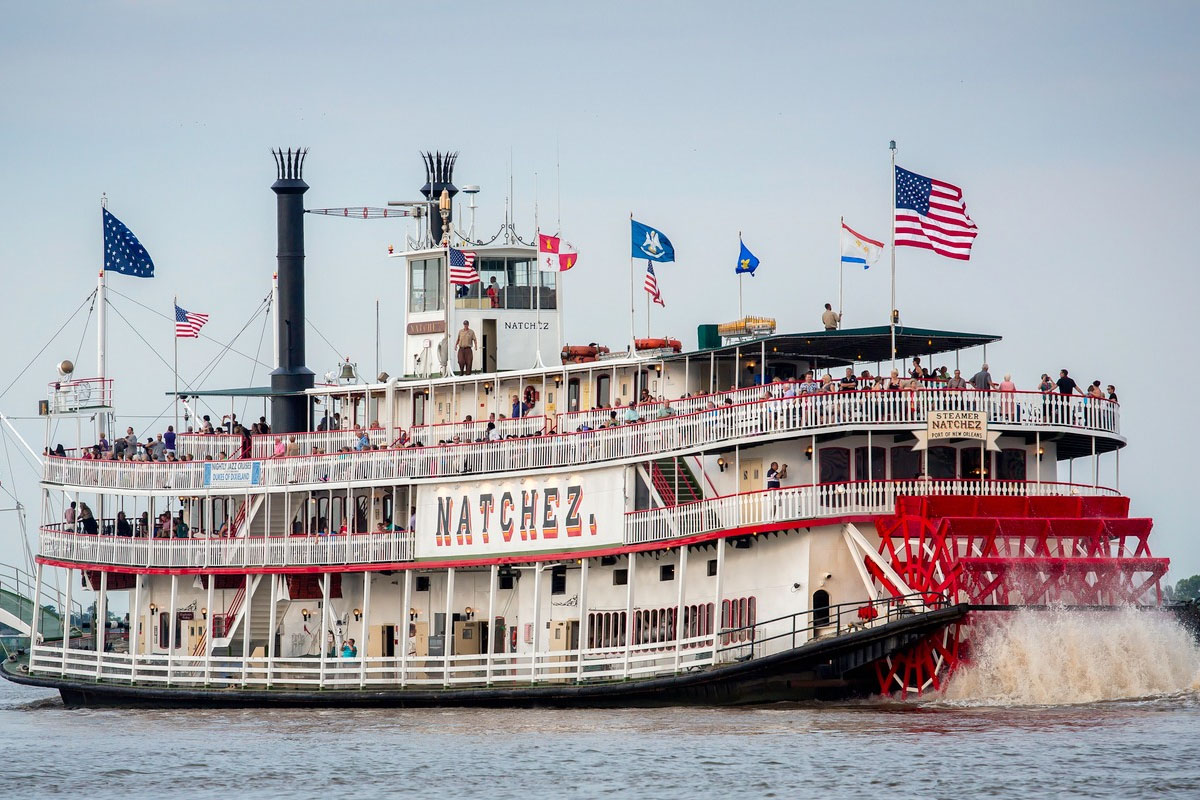
Extremely low water levels on the Mississippi River have compounded problems at the busy ports of Memphis and St. Louis. Cruise lines have been forced to cancel multiple river cruises for the 2022 season and into 2023. Record-low precipitation in the Midwest has left water levels dangerously low and has stranded cruise ships and hindered river tourism. As if this were not enough, the U.S. Army Corps of Engineers is conducting emergency dredging efforts to remove sand and mud built up along the Mississippi River bottom, leaving inadequate water for river traffic. The U.S. Coast Guard has increased its efforts and is strictly enforcing limits on the amount of water cruise ships can use. These conditions have negatively impacted the economy along the Mississippi River and are likely to continue for several months.
Background: The Hydrological Vulnerability of America’s Great River Highway
The Mississippi River stands as the undisputed arterial spine of North American commerce, culture, and inland navigation. Stretching 2,340 miles from Lake Itasca in Minnesota to the Gulf of Mexico, the river system drains approximately 41 per cent of the contiguous United States, spanning 31 states and two Canadian provinces. While historically viewed primarily through the prism of bulk agricultural freight, industrial chemicals, and energy transportation, the past two decades have witnessed a monumental transformation. The waterway has evolved into a world-class destination for inland waterway passenger travel, drawing hundreds of thousands of domestic and international visitors annually to iconic riverboat itineraries connecting historic port cities such as St. Louis, Memphis, Vicksburg, Natchez, and New Orleans.
Advertisement
Advertisement
However, the natural hydrology of the Mississippi River basin is inherently dynamic and increasingly vulnerable to systemic climatic shifts. The river relies on a delicate balance of precipitation, snowmelt, and tributary inflow from major feeder systems—most notably the Missouri, Ohio, Arkansas, and Red Rivers. When sustained hydrological droughts strike the upper catchment areas, the Middle and Lower Mississippi River segments experience rapid, severe stage declines. Low-water crises are not entirely unprecedented; major historical droughts in 1988–1989, 2012–2013, and 2022–2023 severely tested the limits of commercial navigation and channel maintenance.
The current situation unfolding in late 2026 represents one of the most acute hydrologic contractions on record. Unlike industrial barges, which can periodically adjust draft depths by shedding cargo, modern overnight passenger riverboats require consistent, guaranteed channel depths and wide maneuvering corridors to operate safely. The combination of prolonged high-pressure weather systems across the Central Plains, diminished tributary discharges, and persistent upper-basin rainfall deficits has compressed the navigable channel to depths that endanger both vessel hulls and steering capabilities. Consequently, the convergence of environmental pressures has catalyzed a full-scale US river cruise crisis, threatening the economic vitality of inland port municipalities and altering the operational landscape for America’s premier cruise lines.
Advertisement
Advertisement
Current Hydrological Emergency: Verified Gauge Readings from USGS and NOAA
Verified hydrological data published by the U.S. Geological Survey (USGS) and the National Oceanic and Atmospheric Administration (NOAA) National Water Prediction Service paint a stark picture of the condition of the Mississippi River basin. River gauge height measurements across key monitoring stations in Missouri, Illinois, Tennessee, and Mississippi indicate that river stages have plummeted near historical record low thresholds, triggering emergency operational protocols across multiple federal agencies.
+-----------------------------------------------------------------------------------+
|               MISSISSIPPI RIVER STAGE MONITORING (VERIFIED USG/NOAA DATA)         |
+------------------------------------+--------------------+-------------------------+
| Monitoring Location                | Gauge Identifier   | Observed Water Status   |
+------------------------------------+--------------------+-------------------------+
| St. Louis, Missouri                | USGS 07010000      | Critical Low Stage      |
| Memphis, Tennessee                 | NOAA MEMT1         | Severe Low Threshold    |
| Cairo, Illinois (Ohio Confluence)  | USACE Stage Data   | Below 10-Foot Stage     |
| Hickman, Kentucky                  | USACE River Gauge  | Emergency Channel Depth |
| Vicksburg, Mississippi             | NOAA VICM1         | Shallow Draft Corridor  |
+------------------------------------+--------------------+-------------------------+
At the USGS monitoring station at St. Louis, Missouri (USGS-07010000), gage height readings throughout late September 2026 have registered near-zero to negative relative values, reflecting extreme flow reduction from the Upper Mississippi and Missouri rivers. The Middle Mississippi River reach—the critical 195-mile stretch between the confluence of the Missouri River above St. Louis and the confluence of the Ohio River at Cairo, Illinois—acts as a bottleneck for all north-south river traffic. When the St. Louis gage drops below zero feet, natural sedimentation accelerates, causing sandbars and shoal formations to rise rapidly within the main navigation channel.
Advertisement
Advertisement
Further downriver, the official NOAA gauge at Memphis, Tennessee (NWSLI: MEMT1), records equally critical parameters. Water levels at Memphis have plunged to +6.6 feet and below, approaching historical low-water thresholds that severely restrict access to public docking infrastructure, including Beale Street Landing and Mud Island. Under normal spring and early summer conditions, the Memphis gauge routinely operates between 20 and 30 feet, with flood action stages designated at 28 feet. The drop to single-digit and sub-zero relative stages fundamentally alters the river’s cross-sectional profile, exposing dangerous wing dikes, rock pinnacles, and expansive sand formations that make passage hazardous for large passenger vessels.
+-----------------------------------------------------------------------------------+
|                 HISTORICAL vs. CURRENT WATER LEVEL PARAMETERS (MEMPHIS GAUGE)     |
+------------------------------------+----------------------------------------------+
| Hydrological Category              | Stage Height (Feet)                          |
+------------------------------------+----------------------------------------------+
| Record Flood Stage (Historic High) | +48.70 ft                                    |
| Moderate Flood Stage               | +40.00 ft                                    |
| Normal Seasonal Action Threshold   | +28.00 ft                                    |
| Late September 2026 Observed       | +6.60 ft (Critical Low Flow)                 |
| Record Low Water Threshold         | -8.00 ft                                     |
+------------------------------------+----------------------------------------------+
The underlying hydrologic driver remains a severe, multi-season Mississippi basin drought. Precipitation reports from the National Weather Service highlight that core tributary catchments—including the Ohio River Valley, the Illinois River basin, and the Des Moines River watershed—received less than 50 per cent of their normal seasonal rainfall during the spring and summer months. Because the Ohio River historically supplies over 60 per cent of the Lower Mississippi’s total water volume at Cairo, Illinois, precipitation deficits in Ohio, Indiana, and Kentucky have directly compounding effects on downriver depths at Memphis, Vicksburg, and Baton Rouge.
Advertisement
Advertisement
Federal Directives: Emergency Dredging and Navigation Directives
In response to the escalating crisis, federal agencies led by the U.S. Army Corps of Engineers (USACE) Mississippi Valley Division and the U.S. Coast Guard (USCG) have enacted emergency response measures to keep the federal navigation channel open. Under statutory authority, USACE is mandated to maintain a federal navigation channel that is at least 9 feet deep and 300 feet wide throughout the Middle and Lower Mississippi River systems. However, sustaining these dimensions during extended low-water events requires continuous, resource-intensive intervention.
Deployment of Federal Dredging Assets
USACE has deployed its primary fleet of heavy-duty dustpan dredges to clear critical choke points along the river corridor. Key vessels currently engaged in round-the-clock dredging operations include:
- The Dustpan Dredge Jadwin: Stationed along problematic reaches near Mile 710 (Nelms) and lower transit sectors, operating 24 hours a day to clear migrating sandbars.
- The Dredge Potter: Operating out of the St. Louis District, deployed to critical shoal areas near Hickman, Kentucky (Mile 922), along the right descending bank to remove sediment buildups blocking southbound traffic.
- The Dredge Hurley: Mobilised by the Memphis District to execute high-priority emergency dredging across shallow crossings in Tennessee and Arkansas waters.
+-----------------------------------------------------------------------------------+
|             USACE DREDGING ASSET MOBILISATION & OPERATIONS (2026 CRISIS)         |
+-------------------+---------------------------+-----------------------------------+
| Vessel Name       | Operating District        | Primary Assigned Duty Sector      |
+-------------------+---------------------------+-----------------------------------+
| Dredge Jadwin     | Vicksburg / Memphis       | Lower River Shoals (Mile 710)     |
| Dredge Potter     | St. Louis District        | Hickman Troublespots (Mile 922)   |
| Dredge Hurley     | Memphis District          | Middle Mississippi Crossings      |
+-------------------+---------------------------+-----------------------------------+
Dredging operations involve lowering a wide suction head equipped with high-pressure water jets to agitate sand on the riverbed, pumping the resulting slurry through floating pipelines out of the navigation channel. While highly effective, dredging creates temporary, rolling river closures. The Coast Guard must periodically halt all vessel transits for 12- to 24-hour windows to allow dredges to work safely across the narrow channel, introducing substantial delay backlogs for both cruise ships and commercial barge tows.
Coast Guard Marine Safety Information Bulletins and Restrictions
The U.S. Coast Guard, through Sector Lower Mississippi River and Sector Upper Mississippi River, has issued formal Marine Safety Information Bulletins (MSIB) imposing strict mandatory vessel operational limits:
Advertisement
Advertisement
- Draft Restrictions: Southbound vessel drafts have been restricted to a maximum of 10 feet (and down to 9 feet in high-risk zones between Cairo, Illinois, and Lake Providence, Mississippi).
- Tow Size Limits: Commercial tow sizes have been reduced from typical 35- to 40-barge configurations down to a maximum of 20 to 25 barges south of St. Louis, and strict width caps of six barges wide.
- One-Way Traffic Schemes: One-way vessel transit corridors have been established through narrow dredged cuts, prohibiting ships from passing or overtaking each other in shallow reaches.
- Daylight-Only Movement: Daylight-only navigation orders have been enforced for deep-draft vessels through hazardous sectors containing exposed rock pinnacles and sharp channel bends.
These regulatory directives are essential to prevent vessel groundings, which can completely block the navigation channel for days and cause severe economic harm to the entire inland marine transport system.
Crisis in the Passenger Sector: Impacts on Cruise Lines and Itineraries
The US river cruise crisis has dealt a direct blow to the rapidly growing American river cruise industry. Over the past decade, major cruise lines invested billions of dollars in modernising their domestic fleets, launching state-of-the-art riverboats designed to offer premium multi-state journeys along the Mississippi River. The ongoing low-water emergency has severely disrupted these planned operations.
+-----------------------------------------------------------------------------------+
|               PASSENGER CRUISE LINE OPERATIONAL ADJUSTMENTS (LATE 2026)          |
+-----------------------+-----------------------------+-----------------------------+
| Cruise Operator       | Flagship Vessels Affected   | Primary Operational Contingency|
+-----------------------+-----------------------------+-----------------------------+
| Viking River Cruises  | Viking Mississippi          | Segment Truncation & Coaches|
| American Cruise Lines | American Symphony / Serenade| Port Rerouting to Vicksburg |
| Heritage Paddlewheel  | Legacy Riverboats           | Itinerary Modifications     |
+-----------------------+-----------------------------+-----------------------------+
Major Operators Affected
The primary passenger lines operating on the Upper, Middle, and Lower Mississippi River systems have been forced to implement comprehensive emergency operational plans:
- Viking River Cruises: Operating the Viking Mississippi—a custom-built, 386-passenger luxury vessel designed specifically for American river itineraries—the line has faced severe navigation challenges in the shallow Middle Mississippi stretch between St. Louis and Memphis.
- American Cruise Lines: Managing the largest domestic fleet of modern riverboats and modern paddlewheelers (including the American Symphony, American Heritage, and American Serenade), the operator has had to modify dozens of scheduled 8-day and 15-day river voyages.
Operational Pivots and Ship-to-Bus Transfers
To safeguard passengers and prevent hull groundings in shoal waters, cruise lines have enacted drastic operational contingency measures:
- Segment Cancellations: Journeys along the Middle Mississippi between St. Louis, Missouri, and Memphis, Tennessee, have been systematically canceled or truncated. Ships are increasingly unable to navigate the shallow channels near Hickman, Kentucky, and Cairo, Illinois.
- Motorcoach Ground-Transfers: Operators are deploying fleets of luxury motorcoaches to transport passengers via interstate highways between port cities. In many instances, guests who booked a seamless river voyage from St. Louis to New Orleans find themselves disembarked at St. Louis, bussed hundreds of miles south around hazardous river sectors to rejoin the ship at lower ports such as Vicksburg or Baton Rouge.
- Port Bypass Protocols: Scheduled port calls at historic communities such as Hannibal, Missouri; Cape Girardeau, Missouri; and Paducah, Kentucky, have been eliminated from vessel schedules due to inaccessible landing docks and shallow approach channels.
- Passenger Financial Compensation: Cruise lines have been forced to issue substantial financial remedies, including partial refunds, future cruise credits, and complimentary land excursions, placing a heavy financial strain on corporate operating margins.
+-----------------------------------------------------------------------------------+
|                  ANATOMY OF A CRUISE ITINERARY ALTERATION PROTOCOL               |
+-----------------------------------------------------------------------------------+
| 1. Original Route: Continuous 15-Day Voyage (St. Paul / St. Louis to New Orleans)  |
| 2. Shallow Bottleneck Identified: Middle Mississippi / Memphis Shoals (-0.5 ft)   |
| 3. Operational Change: Vessel Halts Transit at St. Louis or Vicksburg             |
| 4. Passenger Contingency: 350-Mile Motorcoach Highway Transfer Bypass             |
| 5. Re-boarding Phase: Passengers Re-embark Vessel South of Low-Water Zone          |
+-----------------------------------------------------------------------------------+
Commercial Freight Interdependence and Economic Multipliers
While the US river cruise crisis represents a high-profile disruption to national tourism, it is inextricably linked to the broader commercial shipping crisis gripping America’s inland waterways. Passenger cruise vessels and commercial freight tows share the exact same federally maintained navigation channels, locks, and mooring facilities. When channel conditions deteriorate, the resulting economic impacts ripple across both passenger tourism and agricultural supply chains.
USDA Agricultural Transport Findings
Data published by the U.S. Department of Agriculture (USDA) Agricultural Marketing Service in its Grain Transportation Report highlights the severe economic consequences of low water during the critical autumn harvest season. The Mississippi River corridor carries over 60 per cent of all U.S. grain exports, serving as the primary export route for Midwestern corn, soybeans, and wheat heading to international markets via Gulf Coast terminals.
Advertisement
Advertisement
+-----------------------------------------------------------------------------------+
|                  BARGE DRAFT REDUCTION & CAPACITY LOSS METRICS                    |
+------------------------------------+----------------------------------------------+
| Operating Parameter                | Standard vs. Restricted Value                |
+------------------------------------+----------------------------------------------+
| Standard Loaded Draft              | 12.0 Feet                                    |
| Low-Water Restricted Draft         | 9.0 Feet to 10.0 Feet                        |
| Cargo Loss Per Foot of Draft Reduction| 150 to 200 Short Tons (5,000–6,700 Bushels)   |
| Total Load Loss Per 15-Barge Tow   | 75,000 Bushels (Equivalent to 3 Farms)       |
| Standard Tow Capacity (15 Barges)  | 750,000 Bushels                              |
| Restricted Tow Capacity (15 Barges)| 675,000 Bushels (10% Total Capacity Reduction)|
+------------------------------------+----------------------------------------------+
The Math of Barge Capacity Reduction
The physics of river navigation create a harsh economic dynamic during drought events:
- Draft-to-Weight Ratio: Every single foot of draft reduction forced by shallow water forces barge operators to reduce cargo weight by 150 to 200 short tons (equivalent to 5,000 to 6,700 bushels of grain per barge).
- Cumulative Load Losses: When Coast Guard regulations reduce allowable drafts from a normal 12 feet down to 9 feet (a 3-foot loss), a standard 15-barge tow loses up to 225,000 bushels of carrying capacity.
- Tow Size Cutbacks: In addition to lighter loads per barge, total tow sizes south of St. Louis have been reduced from 35 or 40 barges down to 20 or 25 barges due to narrowed channel widths.
This dramatic contraction in total river transport capacity triggers severe spot freight rate spikes. Agricultural shippers are forced to compete for limited barge space, driving up grain transportation costs and lowering basis prices paid to Midwestern farmers. Furthermore, when commercial tows run aground in shallow channels, the resulting river closures trap nearby cruise vessels for hours or days, throwing passenger schedules into complete disarray.
Regional Tourism, Municipal Harbours, and Local Business Impacts
The regional economic fallout from the US river cruise crisis extends far beyond the cruise lines and shipping conglomerates. Municipalities along the Mississippi River have invested tens of millions of dollars in recent years to build state-of-the-art riverfront docks, visitor centers, and promenade attractions specifically designed to capture high-spending riverboat passengers. When cruise ships are forced to cancel dockings, local economies experience immediate financial shortfalls.
+-----------------------------------------------------------------------------------+
|               MUNICIPAL PORT DOCKING & TOURISM IMPACT ANALYSIS                    |
+-------------------+----------------------------+----------------------------------+
| Municipal Port    | Key Infrastructure Asset   | Primary Economic Threat          |
+-------------------+----------------------------+----------------------------------+
| Memphis, TN       | Beale Street Landing / Mud Island | Hospitality & Excursion Loss|
| St. Louis, MO     | Gateway Arch Riverfront    | Docking Fee & Retail Shortfall   |
| Natchez, MS       | Natchez-Under-the-Hill     | Historic District Foot-Traffic   |
| Vicksburg, MS     | City Front Passenger Dock  | Excursion Bus Revenue Decline    |
+-------------------+----------------------------+----------------------------------+
Memphis Riverfront Disruptions
In Memphis, Tennessee, the impact on Memphis riverfront disruptions has been particularly pronounced. The city’s signature landing facility, Beale Street Landing—a modern $43 million infrastructure asset constructed to welcome overnight passenger vessels—faces severe operational constraints. As the Memphis gauge drops near single-digit and zero levels, the floating dock ramps reach steep incline angles that complicate passenger disembarkation, while shallow approach waters prevent larger cruise ships from mooring safely alongside the structure.
+-----------------------------------------------------------------------------------+
|                 ECONOMIC LOSS VECTORS FOR RIVER MUNICIPALITIES                   |
+-----------------------------------------------------------------------------------+
| 1. Direct Port Wharfage & Passenger Docking Fee Losses                            |
| 2. Retail & Dining Revenue Contraction in Historic Downtown Districts             |
| 3. Contracted Local Tour Bus & Cultural Site Ticket Sales Cancellations           |
| 4. Municipal Hotel Tax & Local Sales Tax Collection Deficits                      |
| 5. Maritime Supply Procurement & Victualing Reductions at Local Docks             |
+-----------------------------------------------------------------------------------+
The loss of passenger dockings impacts downtown Memphis hospitality businesses:
- Excursion Disruption: A typical passenger call generates significant direct spending through contracted city bus tours, museum visits (such as the National Civil Rights Museum and Graceland), and retail sales along Beale Street.
- Victualing and Dock Services: Cruise ships rely on local municipal suppliers for fresh produce, fuel, waste management, and potable water. Canceled calls strip local vendors of lucrative recurring service contracts.
St. Louis Port Operations and Riverfront Disruption
In St. Louis, Missouri, St. Louis port operations have faced a double burden. As the primary northern gateway for Lower Mississippi cruise itineraries, the Port of St. Louis serves as a critical embarkation point. Low water levels around the Gateway Arch riverfront have restricted sight-seeing riverboat cruises and forced overnight operators to alter embarkation sites to alternative industrial terminals with deeper water, undermining the visitor experience.
Advertisement
Advertisement
Downriver Impact: Natchez, Vicksburg, and Hannibal
Smaller, historic river ports suffer proportionally higher losses during low-water crises:
- Vicksburg, Mississippi: Serves as a primary excursion stop for Civil War national military park tours. Modified vessel calls directly reduce municipal dock fee collections and localized retail tax receipts.
- Natchez, Mississippi: Renowned for its historic architecture and antebellum home tours, Natchez relies heavily on autumn cruise stops. Low-water bypasses deprive local tour operators, restaurants, and artisan shops of essential seasonal income.
- Hannibal, Missouri: The historic hometown of Mark Twain located on the Upper Mississippi experiences near-total cessation of passenger boat calls when upper river pools drop below operational lock thresholds.
Policy Implications and Infrastructure Governance
The persistent recurrence of low-water operational emergencies along America’s internal river systems has elevated navigation policy to a high national priority. Federal lawmakers, state governors, and maritime industry leaders are increasingly recognizing that traditional reactive dredging is insufficient to address multi-year hydrologic volatility.
+-----------------------------------------------------------------------------------+
|             FEDERAL INFRASTRUCTURE & LEGISLATIVE GOVERNANCE FRAMEWORK             |
+-----------------------+-----------------------------------------------------------+
| Legislative / Entity  | Core Mandate & Policy Focus                               |
+-----------------------+-----------------------------------------------------------+
| WRDA Legislation      | Bi-annual Capital Allocation for Inland Navigation Asset  |
| USACE MVD Division    | Channel Maintenance, Rock Pinnacle Removal, Dike Systems  |
| RIAC / LOMRC Committees| Industry-Government Real-Time Operational Coordination   |
| USDA / USDOT MARAD    | Agricultural Supply Chain Resilience & Freight Tracking   |
+-----------------------+-----------------------------------------------------------+
Water Resources Development Act (WRDA) Priorities
Congress utilizes the bi-annual Water Resources Development Act (WRDA) to authorize and fund USACE civil works projects. In light of recurring drought cycles, legislative priorities are shifting toward permanent structural remedies:
- Rock Pinnacle Removal Projects: Accelerating the removal of hazardous bedrock pinnacles along critical river sections such as Thebes Reach and Grand Tower in Illinois. By blasting and excavating underwater rock formations, USACE can widen and deepen navigation channels without requiring dangerous water level elevations.
- Construction of River Training Structures: Increasing the deployment of permanent stone dike structures, bendway weirs, and chevron dikes. These engineered structures funnel natural river currents into the center of the main channel, using the river’s own hydraulic energy to scour away sandbars and naturally maintain required navigation depths.
- Expanded Dredging Fleet Modernisation: Directing capital funds toward building modern, highly efficient dustpan and cutterhead dredges to replace aging federal vessels, ensuring greater operational readiness during severe drought cycles.
Multi-Agency Co-ordinated Governance
Managing a multi-state hydrologic crisis requires sophisticated real-time coordination across federal, state, and private sectors:
- River Industry Action Committee (RIAC): Serves as a vital operational bridge between USACE, the U.S. Coast Guard, and commercial barge operators to schedule emergency channel closures and coordinate dredge movements.
- Lower Mississippi River Committee (LOMRC): Works directly with maritime pilots, cruise vessel captains, and port authorities to set daily draft limits and manage one-way vessel queuing through active dredging sites.
- National Water Center & NWS Forecasting: Deploying advanced hydrological modeling systems to provide 16-day and 28-day river stage forecasts, allowing cruise lines and freight dispatchers to make informed routing decisions well in advance.
Beneficial Reuse of Dredged Sand and Environmental Stewardship
An unexpected outcome of intensive emergency dredging along the Mississippi River is the environmental stewardship framework surrounding sediment management. Historically, sand dredged from the navigation channel was simply deposited into deep river holes or piped to distant side channels. However, under modern environmental mandates, USACE works closely with state wildlife agencies and non-profit conservation groups to execute beneficial sediment reuse projects.
+-----------------------------------------------------------------------------------+
|               BENEFICIAL DREDGED MATERIAL REUSE (MCGREGOR LAKE EXAMPLE)           |
+------------------------------------+----------------------------------------------+
| Project Metric                     | Value / Environmental Feature                |
+------------------------------------+----------------------------------------------+
| Total Dredged Material Utilised    | 500,000 Cubic Yards of Clean River Sand      |
| Total Project Investment           | $25 Million Federal/State Allocation         |
| Artificial Islands Constructed     | 7 Designed Wildlife Habitats                 |
| Total Aquatic Habitat Restored     | 270 Acres of Backwater Ecosystems            |
| Protected Wetland Area             | 22 Acres of Shielded Marshlands              |
| Target Species Benefited           | Migratory Waterfowl, Overwintering Fish      |
+------------------------------------+----------------------------------------------+
A prime example of this integrated engineering approach is the recently completed $25 million McGregor Lake habitat restoration project executed by USACE. Engineers utilized approximately 500,000 cubic yards of clean sand dredged directly from the Mississippi River navigation channel to construct seven artificial island structures. These engineered islands reduce wind-wave erosion, shield fragile backwater wetlands, and establish over 270 acres of vital aquatic habitat for overwintering fish species, migratory waterfowl, and nesting bald eagles. By converting channel maintenance sediment into ecological assets, federal engineers demonstrate that keeping commercial waterways open can directly support river basin conservation goals.
Advertisement
Advertisement
Long-Term Outlook, Technological Solutions, and Strategic Adaptation
As atmospheric conditions stabilize heading into late autumn 2026, the long-term outlook for the Mississippi River passenger cruise industry will depend on a combination of climate adaptation, structural river engineering, and fleet innovation. Hydrological models from the Lower Mississippi River Forecast Center indicate that stages at Memphis, St. Louis, and Cairo will remain below seasonal norms until sustained, widespread autumn and winter precipitation returns to the upper Midwest catchment basins.
+-----------------------------------------------------------------------------------+
|                   FUTURE RESILIENCE STRATEGIES FOR RIVER CRUISING                 |
+------------------------------------+----------------------------------------------+
| Strategic Domain                   | Implementation Framework                     |
+------------------------------------+----------------------------------------------+
| Next-Gen Vessel Engineering        | Ultra-Shallow Draft Hulls (<6.0 ft Draft)    |
| Operational Routing Flexibility    | Seasonal Itinerary Switching (Lower vs Upper)|
| Infrastructure Investments        | Permanent Rock Pinnacle Removal & Dike Systems|
| Multi-Modal Logistics Integration  | Pre-Contracted Luxury Bus Fleet Contingencies |
+------------------------------------+----------------------------------------------+
To build long-term resilience against future low-water events, the river cruise sector and federal managers are pursuing several key strategic initiatives:
- Ultra-Shallow Draft Vessel Architecture: Naval architects are designing next-generation inland passenger vessels equipped with advanced lightweight composite materials, flat-bottomed hull profiles, and z-drive azimuth thrusters. These design innovations allow future ships to maintain full passenger loads while operating safely in draft depths of under six feet.
- Flexible Seasonal Itinerary Mapping: Cruise lines are restructuring booking schedules to reduce operational dependence on the Middle Mississippi during historically dry autumn months. Ships will increasingly be deployed on deep-water Lower Mississippi segments (between New Orleans and Vicksburg) or shifted to alternative navigable tributaries during late summer and autumn.
- Expanded Federal Infrastructure Funding: Continued bi-partisan congressional support for inland waterway capital investments will ensure that USACE maintains continuous dredging readiness, advanced hydrographic survey capabilities, and permanent channel stabilization structures.
- Integrated Public-Private Hydrological Monitoring: Real-time satellite imagery, automated riverbed sonar mapping, and predictive AI river stage modeling will provide riverboat captains and dispatchers with unprecedented visibility into shifting sandbars, dramatically reducing grounding risks and itinerary disruptions.
Through these combined technological, operational, and structural measures, the inland marine transportation sector aims to navigate ongoing environmental volatility, ensuring that America’s iconic riverways remain open for commerce, travel, and public enjoyment for generations to come.
Advertisement
