

Baguio and More Cities Transform Philippine Tourism With Climate Risk Mapping and Data-Driven Conservation

Published
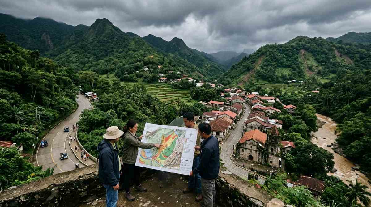
All over the Philippines people who belong to government agencies in local levels can be seen shifting from using guesswork as a basis for promoting tourism to tourism planning based on research that is scientific. For years the rise in number of visitors had been a strain on municipal resources putting historic buildings like centuries old churches at risk and creating ecological problems. In recent times the Philippine government has mandated that for any municipality to consider expansion of tourism it must perform risk assessment in terms of space, environment carrying capacity and potential income. By incorporating climate science analysis into the framework of development local government authorities make sure that an increase in the number of tourists will have a positive effect on the communities being hosted.
The Institutional Shift: Transcending Cosmetic Tourism Promotion
Municipal administration across the Philippine archipelago has undergone a structural transformation, shifting destination development from cosmetic promotion to empirical territorial management. For decades, municipal tourism offices operated predominantly as marketing mechanisms incentivized to maximize gross visitor headcounts, peak holiday arrivals, and headline leisure spending. This single-minded focus on visitor volumes developed largely in isolation from the statutory responsibilities assigned to Local Government Units (LGUs) under the Local Government Code of 1991 (Republic Act No. 7160) and the Philippine Disaster Risk Reduction and Management Act of 2010 (Republic Act No. 10121). Under these statutory statutes, local authorities are legally mandated to mitigate environmental exposure, manage land sustainably, and protect resident populations from preventable hazards.
Advertisement
Advertisement
The systemic flaws of uncalibrated tourism promotion became increasingly apparent across prominent tourist hubs. Coastal destinations in northern Luzon experienced accelerated beach erosion, saltwater intrusion, and repeated inundation from typhoon storm surges. Concurrently, high-altitude mountain corridors suffered catastrophic slope destabilization, while centuries-old colonial brick and coral-stone architecture underwent rapid micro-structural decay driven by unmitigated vehicular vibrations and uncontrolled visitor concentrations.
This traditional model produced an unsustainable spatial dynamic. Municipal capital investments routinely subsidized access roads, utility connections, and commercial frontage in geologically vulnerable and flood-prone territories, while financial gains flowed away to external travel agencies, airline consortiums, and multinational hospitality chains. host communities were left to absorb the localized environmental damage and cover the fiscal costs of disaster cleanup and emergency utility repairs.
Advertisement
Advertisement
To address these vulnerabilities, national oversight institutions executed a synchronized policy realignment. The Department of the Interior and Local Government (DILG), alongside the Department of Human Settlements and Urban Development (DHSUD), the National Economic and Development Authority (NEDA), the Department of Budget and Management (DBM), and the Department of Finance (DOF) Bureau of Local Government Finance, issued Joint Memorandum Circular No. 1, Series of 2024. This joint issuance established the Synchronized Local Planning and Budgeting Calendar, directly integrating local spatial development, sector financing, and hazard management into an interconnected statutory process. Under this harmonized system, tourism initiatives must be anchored directly within the municipal Comprehensive Development Plan (CDP) and Comprehensive Land Use Plan (CLUP), both driven by a verified Climate and Disaster Risk Assessment (CDRA).
This administrative restructuring was highlighted during the 37th National Statistics Month, when regional authorities reiterated that local planning must rely on rigorous statistical data rather than political expediency. DILG Ilocos Norte, through Local Government Operations Officer V Micah Janina A. Corpuz, stated that local administrations must substantiate every capital outlay and zoning clearance with verifiable metrics. Corpuz emphasized that the agency examines baseline data to confirm whether interventions effectively served vulnerable residents, noting that CDRA integration allows local governments to evaluate both visual appeal and environmental safety profiles before committing resources to tourist expansion.
Advertisement
Advertisement
Methodological Integration: Mainstreaming CDRA into Multi-Year Development Plans
The Comprehensive Development Plan functions as the foundational medium-term multi-sectoral development blueprint through which Philippine municipalities delineate their social, economic, environmental, physical, and administrative objectives. Historically, tourism development blueprints operated independently of municipal disaster offices and engineering departments, creating significant planning misalignments. National evaluations by the DILG Bureau of Local Government Development underscored this policy divide. Out of 849 municipal CDPs formally assessed across the country, only 241 local administrations (28 per cent) had integrated multi-hazard disaster information into their operational masterplans. An additional 400 CDPs (47 per cent) were determined to be only partially risk-informed, while 208 plans (25 per cent) contained no hazard data whatsoever.
The institutional adoption of evidence-based tourism planning addresses this gap by requiring the standard 5-Step CDRA methodology to be embedded into the statutory CDP process. Designed by DHSUD and the Climate Change Commission, this assessment protocol evaluates hazard probabilities across exposed spatial assets to guide land-use decisions.
Advertisement
Advertisement
The process begins with hazard profiling, in which municipal planners compile climate projections and geological mapping from the Philippine Atmospheric, Geophysical and Astronomical Services Administration (DOST-PAGASA) and the Philippine Institute of Volcanology and Seismology (DOST-PHIVOLCS). These datasets model critical variables, including shifting precipitation volumes, tropical cyclone tracks, projected sea-level rise, tectonic fault lines, liquefaction risks, and rain-induced landslide trajectories.
Planners then compile an exposure database within Geographic Information Systems (GIS), recording municipal assets across five sectors: population concentrations, urban use areas, natural resource production areas, critical social facilities, and lifeline utilities. In major tourist destinations, the urban use database catalogues lodging houses, heritage streets, coastal resorts, and recreational enclaves, evaluating their replacement valuation and structural attributes alongside historical hazard data.
These exposed assets are subsequently cross-referenced against hazard layers to evaluate physical sensitivity and local adaptive capacity. Planners analyze structural integrity, access to backup power, storm-drainage capacities, and emergency egress routes to assign vulnerability ratings across a standardized continuum.
Risk estimation models then evaluate probabilities and projected damages. Climate-induced weather threats are analyzed through exposure-vulnerability matrices, while seismic and geological hazards are evaluated against probabilistic recurrence models to calculate potential asset losses and commercial interruptions.
Advertisement
Advertisement
Finally, the assessment establishes Major Decision Areas, which identify critical friction points where planned tourism development intersects with acute hazard exposure. These geographic zones dictate zoning changes in the CDP, establishing strict construction setbacks, structural building code upgrades, seasonal access limitations, or environmental exclusion zones where commercial development is prohibited by municipal law.
To build reliable exposure databases, Philippine LGUs are adopting advanced satellite remote sensing and Earth observation technologies. Through the CopPhil initiative, supported by DOST, the Philippine Space Agency (PhilSA), and the European Union, municipal planning personnel apply Copernicus Sentinel satellite imagery to monitor dynamic environmental risks. Synthetic Aperture Radar (SAR) data from Sentinel-1 penetrates cloud cover and tracks nocturnal events, mapping storm inundation margins, river flooding, and ground subsidence along active faults. Concurrently, Sentinel-2 multispectral imagery at 10-metre spatial resolution monitors coastal vegetation boundaries, mangrove health, and forest clearance across expanding tourist enclaves.
Municipal engineering units combine these satellite observations with hydrologic and hydraulic modeling suites, including HEC-HMS and two-dimensional HEC-RAS systems, to simulate flood dynamics and storm surges across estuarine basins and tourist beachfronts. By evaluating 5-, 25-, 50-, and 100-year return periods, local authorities develop accurate hazard-depth grids, replacing speculative zoning decisions with empirical environmental measurements.
Macroeconomic Context: Tourism Satellite Accounts and Fiscal Realities
The transition toward risk-calibrated destination governance operates within a major economic sector. Official macroeconomic datasets released by the Philippine Statistics Authority under the Philippine Tourism Satellite Accounts (PTSA) confirm that the travel and leisure economy serves as a cornerstone of national production and employment. In its May 2026 reporting release, the PSA established that the Tourism Direct Gross Value Added (TDGVA) reached PHP 2.27 trillion in 2025, accounting for 8.1 per cent of the country’s Gross Domestic Product. This followed an exceptional period of post-pandemic recovery in 2024, when TDGVA registered PHP 2.35 trillion, representing an 8.9 per cent share of the national macroeconomy and expanding 11.2 per cent above 2023 figures.
Employment generated by tourism-characteristic industries constituted 13.8 per cent of total national employment in 2024, supporting approximately 5.7 million workers across accommodation, passenger transportation, food and beverage, and cultural entertainment services.
| Macroeconomic Account Metric | Calendar Year 2022 | Calendar Year 2023 | Calendar Year 2024 | Calendar Year 2025 |
| Tourism Direct Gross Value Added (Current Prices) | PHP 1.41 Trillion | PHP 2.12 Trillion | PHP 2.35 Trillion | PHP 2.27 Trillion |
| Share of Philippine Gross Domestic Product | 6.4% | 8.6% | 8.9% | 8.1% |
| Tourism Employment Share of National Workforce | 11.1% | 12.9% | 13.8% | 13.4% |
| Domestic Tourism Expenditure | PHP 1.55 Trillion | PHP 2.67 Trillion | PHP 2.91 Trillion | PHP 2.84 Trillion |
| Inbound (Foreign) Tourism Expenditure | PHP 371.58 Billion | PHP 697.46 Billion | PHP 745.99 Billion | PHP 698.46 Billion |
A detailed examination of these national accounts reveals emerging structural challenges. Inbound foreign tourism spending contracted by 6.4 per cent in 2025, dipping to PHP 698.46 billion from PHP 745.99 billion in 2024. Meanwhile, domestic tourism expenditure settled at PHP 2.84 trillion, amid rising outbound expenditures by Filipino travellers seeking international destinations.
Advertisement
Advertisement
These economic shifts underscore why local government units cannot afford capital allocations compromised by disaster risks. Unplanned tourism growth that strains municipal infrastructure, accelerates coastal erosion, or provokes slope instability creates fiscal burdens for local administrations, diverting capital into infrastructure repairs rather than community development.
Highland Vulnerabilities: Baguio City and Slope Carrying Capacity
Baguio City, situated 1,500 metres above sea level in the Cordillera mountain range of Benguet, illustrates the systemic tensions between mass tourism growth and physical carrying capacities. Planned during the American colonial period by architect Daniel Burnham for a baseline urban population of 25,000 to 30,000 residents, Baguio has experienced rapid demographic growth. The 2020 national census registered a resident population of 366,358, which rose past 380,000 by 2024. Carrying-capacity audits executed by the City Planning and Development Sustainability Office (CPDSO) indicate that during dry-season peaks, long weekends, and the annual Panagbenga Festival, Baguio’s daytime population swells to more than 764,301 individuals. This transient influx represents twenty-five times the demographic load envisioned in the city’s original spatial design.
This demographic pressure converges with extreme environmental conditions. Meteorological data from DOST-PAGASA show that Baguio City records the highest average annual precipitation in the country at 3,914 millimetres. The city lies squarely in northern Luzon’s typhoon corridor, where intense seasonal downpours saturate the region’s steep hillsides. Under continuous saturation, Baguio’s complex network of geological fault lines experiences elevated shear stress, frequently triggering destructive landslides. CPDSO assessments project that if current urbanization and visitor trends continue unchecked, the municipality faces irreversible urban decay by 2043. During peak holiday periods, central urban density reaches 13 to 14 people per square metre, and visitors generate nearly 20 per cent of all municipal solid waste. Furthermore, the city’s vehicular road network, built to serve approximately 145,416 people, experiences gridlock when more than 70,000 tourist vehicles enter via Kennon Road, Marcos Highway, and Naguilian Road in a single holiday week.
In response, the city administration introduced data-driven carrying-capacity controls. Planning researchers deployed the Enhanced Urban Carrying Capacity Load Number (EUCCLN) model to track localized environmental thresholds across the city’s 129 barangays. The EUCCLN framework analyzes nighttime light intensity, ambient air pollution readings, aquifer extraction rates, and slope-stability variables, notifying administrators when specific districts reach environmental saturation.
This data modeling connects directly to the Baguio V.I.S.I.T.A. (Visitor Information and Travel Assistance) online registration portal. Managed by the local government alongside the Baguio Tourism Council, the system requires prospective travellers to pre-register and confirm bookings with licensed, structurally certified accommodations. This platform enables administrators to cap daily tourist admissions when forecast precipitation increases landslide hazards, keeping visitors away from compromised mountain passes during extreme weather.
Coastal Frontiers: Laoag City and Pagudpud Under Hydrometeorological Stress
At the northern edge of Luzon, the coastal destinations of Ilocos Norte face persistent oceanic and atmospheric hazards. The provincial capital of Laoag City and the coastal resort municipality of Pagudpud sit along the primary trajectory of western Pacific typhoons, exposing shorelines to severe storm surges, rapid coastal erosion, and heavy monsoon flooding. Historically, unmonitored private developments along the beaches of Pagudpud and the riverbanks of Laoag cleared protective sand dunes and mangrove buffers, stripping away critical coastal defenses.
Advertisement
Advertisement
Under updated CDRA regulations, the Provincial Government of Ilocos Norte, in partnership with municipal planning departments, revamped local land-use maps by overlaying satellite storm-surge data and dynamic wave-runup projections onto coastal development zones. In Pagudpud, the municipal council enacted a 50-metre construction setback from the high-water line, prohibiting permanent commercial foundations along exposed beachfronts. This policy followed geodetic surveys and Sentinel-1 SAR observations that documented up to 1.5 metres of coastal retreat per year during major typhoon events.
In Laoag City, where the Laoag River discharges heavy sediment volumes into the South China Sea, CDRA modeling demonstrated that unchecked commercial developments along the river corridor worsened flooding in adjacent residential barangays. Using two-dimensional hydrodynamic modeling, the Laoag City Planning and Development Office designated the entire estuarine channel as an environmental protection zone, restricting high-density commercial construction.
Additionally, the provincial tourism network adopted dynamic seasonal steering. During the southwest monsoon (Habagat) and typhoon months between July and October, municipal promotional campaigns shift focus. Digital channels divert travellers away from exposed beaches and toward inland museums, heritage centers, and culinary sites in Laoag’s urban core, ensuring visitor safety while maintaining hospitality revenues across the province.
Heritage Asset Preservation: Engineering Safeguards and Structural Thresholds
Managing visitor traffic against physical asset limits is equally critical within the country’s historic architectural centers. Many Spanish-colonial buildings constructed from coral stone, volcanic tuff, and clay brick were designed using “Earthquake Baroque” methods to withstand horizontal seismic movement. However, these ancient structures were not engineered to sustain the constant mechanical vibrations caused by combustion traffic, heavy tour buses, or concentrated pedestrian crowds. The National Cultural Heritage Act of 2009 (Republic Act No. 10066) established protections for these historic sites, but ongoing preservation demands empirical monitoring and local regulatory enforcement.
Continuous traffic vibrations cause micro-cracks in historic lime mortars, while heavy group tours produce mechanical wear on centuries-old stone pavements. In unventilated heritage interiors, high visitor densities trap humidity and carbon dioxide, destabilizing soft-fired bricks and historic lime washes. Furthermore, unmonitored seismic activity risks causing sudden shearing along aging stone walls.
In Vigan City, Ilocos Sur, a UNESCO World Heritage site recognized for its planned colonial layout, seismic vulnerability remains an enduring challenge. On 27 July 2022, a magnitude 7.0 earthquake centered in Abra province shook northern Luzon, damaging Vigan’s historic district. Multiple ancestral residences on Calle Crisologo shed sections of brick masonry, the bell tower of Bantay suffered significant cracks, and the Vigan Cathedral’s facade sustained structural fissures.
Advertisement
Advertisement
Following the earthquake, the Vigan City Government collaborated with the National Historical Commission of the Philippines (NHCP) and the National Commission for Culture and the Arts (NCCA) to institute a data-driven inspection framework. Structural engineers applied a color-coded evaluation method across 189 heritage structures within the historic core. Structures marked Code Green were verified as structurally safe for normal public use; those designated Code Yellow had access restricted pending specific timber and masonry stabilization; and properties marked Code Red showed critical damage, requiring immediate shoring, stabilization, and public exclusion.
Engineering analyses showed that years of vehicular vibrations had compromised the lime mortar in several historic facades, exacerbating their vulnerability to earthquake damage. The city government responded by passing ordinances permanently barring motorized traffic from Calle Crisologo and adjacent historic lanes, restricting access entirely to pedestrians and traditional horse-drawn carriages (calesas). Working with the NHCP, the local administration installed electronic strain gauges and vibration sensors on key monuments to monitor structural movements, establishing automated visitation caps whenever structural vibrations approach safety thresholds.
In Ilocos Norte, the Church of Saint Augustine in Paoay, inscribed on the UNESCO World Heritage list, exhibits monumental Earthquake Baroque construction. Built with twenty-four massive exterior buttresses composed of coral blocks, fired bricks, and sugarcane-infused mortar, the church was engineered to endure strong earthquakes. Nevertheless, conservation assessments by the NCCA and heritage engineers identified vulnerabilities linked to contemporary traffic and tourism loads. Vibrational sensor audits confirmed that heavy tourist vehicles on the public road fronting the complex sent low-frequency ground vibrations directly into the foundations of the detached coral-stone bell tower, loosening historical mortar and triggering localized settling.
Acting on this assessment, the Municipal Government of Paoay redirected heavy vehicular traffic away from the heritage grounds, converting the perimeter into a landscaped pedestrian precinct. Inside the church, municipal tourism staff introduced carrying-capacity limits, admitting visitors in regulated intervals to prevent the build-up of interior humidity and avoid excessive weight loads on historic terracotta and stone floors.
In the capital city of Manila, the Intramuros Administration oversees the preservation of the historic walled district pursuant to Presidential Decree No. 1616. The district encompasses major national landmarks, including Fort Santiago and the UNESCO-inscribed San Agustin Church. To safeguard these structures, the Intramuros Administration developed the Registry of Intramuros Cultural and Historical (RICH) Properties, compiling architectural attributes, historical records, and structural conditions into a comprehensive spatial database.
A key initiative within this preservation strategy was the pedestrianization of Heneral Luna Street, a critical corridor passing directly beside San Agustin Church. Technical studies demonstrated that vehicular exhaust degraded the church’s volcanic tuff (adobe) facade, while heavy traffic vibrations caused stress on the building’s stone vaults.
Advertisement
Advertisement
The Intramuros Administration conducted a structured Citizen Assembly and applied data mining to analyze feedback from residents, business operators, and tourists. The empirical results supported closing the street to private combustion motor vehicles, converting Heneral Luna into a pedestrian and micro-mobility corridor reserved for pedestrians, bicycles, and light electric shuttles. This intervention eliminated damaging vibrational stresses on the monument while increasing pedestrian traffic and local retail spending within the artisan shops of Plaza San Luis.
Urban Revitalization: Calle Real in Iloilo and Colon Street in Cebu
Evidence-based heritage preservation frameworks have also been implemented in urban destination centers across the Visayas. In Iloilo City, the municipal administration implemented a downtown revitalisation masterplan focused on the J.M. Basa Street (Calle Real) Heritage Zone. Backed by local conservation ordinances, the city supported the restoration of early-twentieth-century Art Deco and Neoclassical commercial buildings, using spatial carrying-capacity models to manage pedestrian access, outdoor dining, and utility networks.
By pedestrianizing Calle Real during weekends and cultural festivals, Iloilo City protected historic facades from vehicular emissions while establishing a walkable commercial corridor that strengthened local businesses.
In Cebu City, municipal authorities focused conservation planning on Calle Colon, the oldest commercial street in the Philippines, and the historic San Nicolas heritage district. Fast-paced metropolitan expansion and commercial traffic had placed mounting pressure on downtown Cebu’s surviving heritage fabric. Through the Cebu City Comprehensive Land Use Plan and specialized heritage studies, the local government introduced spatial carrying-capacity regulations across the historic district.
Recognizing that Central Visayas recorded a 7.6 per cent economic growth rate in 2022 with a regional GDP of PHP 1.29 trillion, local planners noted that tourism expansion must not overwhelm urban services. By routing public transport vehicles into designated peripheral terminals and expanding pedestrian corridors around historic plazas, Cebu City protects its cultural assets while improving downtown mobility.
Local Community Micro-Economies and Artisan Value Chains
A cornerstone of the DILG’s evidence-based tourism governance model is tracking and curtailing economic leakage. In standard tourism operations, up to 70 per cent of gross visitor spending leaves host municipalities, flowing to external tour operators, distant corporate headquarters, and imported supply vendors. DILG policy directives instruct local governments to use economic surveys to verify that tourism spending directly benefits resident households. DILG Officer Micah Janina Corpuz pointed out that municipal tourism initiatives must open genuine economic pathways for local communities by showcasing homegrown crafts, traditional skills, and regional culture. Corpuz highlighted that balancing modernization with heritage preservation is essential, noting that authentic development means protecting and sustaining the assets a municipality already holds.
Advertisement
Advertisement
This local development strategy is supported by Republic Act No. 11960, known as the One Town, One Product (OTOP) Philippines Act, signed into law on 25 August 2023. The law establishes comprehensive support packages for micro, small, and medium enterprises (MSMEs) rooted in local traditions, cultural heritage, and endemic raw materials. Under its provisions, local governments establish dedicated OTOP Hubs in high-traffic tourist transport junctions, municipal squares, and heritage parks. This initiative connects independent artisans directly to visitor spending, insulating traditional crafts against cheap, imported merchandise.
In Ilocos Norte, municipal administrations use supply-chain metrics to support the traditional Inabel hand-loom weaving industry. Crafted on antique wooden foot-treadle looms, Inabel textiles feature historic patterns, such as the geometric binakol and swirling kusikos motifs, that represent prized regional artistry. Previously, independent weavers in towns like Pinili and Paoay were marginalized by intermediary traders who acquired textiles at deflated rates to resell in metropolitan centers at large markups.
Under DILG value-chain monitoring guidelines, municipal planning offices now track local sourcing percentages across hospitality providers and government facilities. Municipal ordinances throughout Ilocos Norte encourage accredited hotels and municipal offices to source curtains, staff uniforms, table linens, and institutional gifts directly from certified weaving cooperatives. By connecting master weavers directly with visiting tourists through municipal OTOP Hubs and provincial craft showcases, artisan household revenues have grown substantially. This predictable market demand provides younger generations with sustainable livelihood opportunities, ensuring the continuity of this ancestral weaving tradition.
In San Nicolas, Ilocos Norte, traditional clay pottery, locally termed damili, serves as the town’s registered One Town, One Product economic anchor. Tracing its heritage to the late 16th century, the local pottery industry produces cooking vessels (banga), water jars, and construction bricks (ladrillo) made from local alluvial clay by generations of agdamdamili (potters). To keep the craft competitive against mass-produced plastics and imported ceramics, the Municipal Government of San Nicolas partnered with the Department of Trade and Industry and Mariano Marcos State University (MMSU) to introduce scientific product development.
Through the DTI Malikhaing Pinoy program and MMSU research laboratories, potters such as Nanay Crisanta Duldulao received hands-on training in clay refining, lead-free glazing, temperature-controlled electric kiln firing, and architectural brick production. Rather than producing only low-margin cookware, the artisans expanded into high-value decorative tiles and architectural pottery. The San Nicolas local government collaborates with building contractors and regional hotel developers to specify local damili tiles in commercial projects, embedding traditional craftsmanship directly into modern tourism facilities.
In Mindanao, the City Government of Davao has integrated spatial risk analysis and cultural mapping into its Comprehensive Development Plan and Comprehensive Land Use Plan 2019–2028 (Volume 4: CDRA) to protect indigenous lands. Davao City spans 2,440 square kilometres, making it one of the largest municipal jurisdictions in the world, with expansive forested uplands and tribal territories. The city’s land-use zoning establishes cultural conservation overlay zones around the territories of its eleven recognized ethnolinguistic indigenous and Moro communities, including the Bagobo-Tagabawa, Klata, and Matigsalug peoples.
Advertisement
Advertisement
Instead of allowing uncontrolled commercial resorts across highland ancestral domains, the Davao City council conditions development approvals on Free, Prior, and Informed Consent (FPIC) and local hiring quotas. Community-based ecotourism initiatives in upland areas such as Marilog and Paquibato are operated directly by tribal organizations, with city regulations requiring visitor fees to support indigenous mountain guide associations, community agroforestry farms, and traditional handicraft collectives. This governance framework prevents disruptive land conversion while ensuring upland tourism strengthens indigenous cultural heritage.
Comparative Governance Frameworks: Conventional Versus Evidence-Based Planning
The shift from subjective tourism promotion to data-driven spatial governance has reshaped administrative workflows across Philippine local governments. By anchoring municipal actions in measurable ecological and structural limits, local authorities replace discretionary policies with systematic decision-making models.
| Administrative Dimension | Traditional Subjective Planning | Evidence-Based LGU Risk Planning (DILG Framework) |
| Development Siting & Sizing | Driven by aesthetic appeal, promotional marketing, and unconstrained private land development. | Directed by the 5-Step Climate and Disaster Risk Assessment (CDRA) and multi-hazard overlays. |
| Hazard Management & Safety | Relies on reactive disaster response, civil defense relief, and post-event cleanup. | Proactive spatial screening evaluating landslides, storm surges, and active fault traces. |
| Carrying Capacity Limits | Uncapped visitor volumes, causing seasonal traffic gridlock, water shortages, and utility breakdowns. | Calibrated thresholds based on the Enhanced Urban Carrying Capacity Load Number and pre-registration. |
| Community Value Retention | High economic leakage to international resort operators, external tour firms, and imported supplies. | Mandatory supply tracking under the OTOP Act (RA 11960), retaining revenue within local artisan groups. |
| Heritage Asset Care | Unregulated vehicular traffic, visual promotion, and high visitor density until structural damage occurs. | Structural health sensor audits, vehicular vibration bans, pedestrianization, and timed entry caps. |
| Spatial & Statistical Tools | Static land zoning maps, unverified visitor headcounts, and subjective revenue estimates. | Cloud GIS platforms, Copernicus Sentinel-1/2 SAR mapping, 2D hydrodynamic simulations, and PTSA data. |
| Inter-Agency Governance | Fragmented municipal tourism desks operating independently of engineering and planning offices. | Synchronized multi-sector planning through Joint Memorandum Circular No. 1 s. 2024 across CDPs and CLUPs. |
Future Strategic Outlook: Automated Earth Observation and Policy Enforcement
Looking across the remainder of the 2026–2030 planning cycle, the execution of evidence-based tourism planning will increasingly rely on automated Earth observation and artificial intelligence systems. The Department of Science and Technology and the Philippine Space Agency are testing automated machine-learning models trained on Sentinel-1 and Sentinel-2 satellite archives to track environmental changes across sensitive tourism areas. These algorithms detect unauthorized forest clearance, sand dune encroachment, and building development inside municipal setback buffers, generating automated compliance alerts for municipal engineering and zoning teams.
Municipal management frameworks are also transitioning from historical reporting to predictive scenario simulations. By connecting Internet of Things (IoT) rain gauges, river-depth sensors, and pedestrian counting sensors with municipal traffic management centers, cities like Baguio, Vigan, and Iloilo can automate carrying-capacity measures. Under these systems, digital travel portals and dynamic parking fees adjust automatically during high-risk weather, directing incoming visitors toward secondary cultural attractions before municipal carrying limits are exceeded.
On the administrative side, the DILG has established that risk-informed CDPs, CDRA mainstreaming, and verified carrying-capacity policies will serve as key performance requirements for the prestigious Seal of Good Local Governance (SGLG). Municipalities that do not integrate multi-hazard assessments or enforce heritage protection rules will face restricted access to national infrastructure allocations and disaster mitigation grants. By linking municipal funding directly to environmental compliance and community retention metrics, the Philippines is establishing a resilient model for sustainable destination governance. This data-driven approach ensures that the country’s coastal resources, mountain landscapes, historic monuments, and artisan livelihoods remain protected and productive for the long term.
Conclusion
The development of Philippine municipal government witnessed the need for sustainable tourism growth based on objective evidence. Thus, instead of focusing on short-term superficial marketing, it is more useful to pay attention to long-term strategies, such as hazardous area delineation, tourist attraction carrying capacity assessment, and load analysis of a specific structure. With the help of these initiatives, local governments of northern Luzon, the central Visayas region, and Mindanao’s highlands can ensure that economic growth, ecological footprint, and heritage value are balanced. After that, in the context of changing climatic conditions, it is more important to take evidence-based spatial planning into account to maximize welfare, protect cultural heritage, and preserve a consistent tourism-based economy for generations.
Advertisement
