


New Zealand has begun a new stage of marine environment protection on the Otago coast with the establishment of Te Au Roa o Te Rakihouia, a chain of five completely protected marine parks occupying an area of 308 sq. km. The parks were created on the 28th of May in 2026 and became effective from the 1st of July in 2026. This network occupies nearly four per cent of the Otago coastal marine area and is governed by the cooperation of Kāi Tahu and the Department of Conservation (DOC), integrating Indigenous knowledge, traditional relationships, and conservation efforts carried out by the government into the management of the protected water bodies. This step follows over ten years of work conducted to develop marine protection policies along the southeast coast of Te Waipounamu. The activities started in 2014 through the South-East Marine Protection Forum and involved representatives of Kāi Tahu, fisheries sectors, scientists, environmental organisations, tourism communities, and local community representatives.
Official Website – https://www.doc.govt.nz/parks-and-recreation/places-to-go/otago/places/te-au-roa-o-te-rakihouia/te-au-roa-o-te-rakihouia-marine-protection-network
Te Au Roa o Te Rakihouia comprises the Waitaki, Papanui, Ōrau, Ōkaihae and Hākinikini marine reserves. Together they create a connected set of protected areas across different coastal environments rather than concentrating protection around a single ecosystem.
Advertisement
DOC identifies river mouths and estuaries, coastal feeding areas, sandy beaches, rocky headlands, volcanic cliffs, rock pools and an offshore seabird sanctuary among the protected environments. The network also includes unique canyon ecosystems, bryozoan thickets and large kelp forests.
As marine reserves, the five areas receive New Zealand’s highest level of marine protection. Taking marine life is prohibited, while activities that damage natural habitats are not permitted. Visitors can still access the reserves for activities such as boating, diving, swimming and snorkelling when conducted within the applicable rules.
Advertisement
Advertisement
The protection provides a baseline for ecological recovery and scientific research while safeguarding habitats used by species associated with Otago’s coastal waters.
A defining feature of the network is the formal partnership between Kāi Tahu and DOC.
The coastline sits within the takiwā of Kāi Tahu Whānui and encompasses the rohe moana of Te Rūnanga o Moeraki, Te Rūnaka o Ōtākou, Kati Huirapa Te Rūnaka ki Puketeraki, Te Rūnanga o Arowhenua, Te Rūnanga o Waihao and Āwarua Rūnanga. DOC states that the partnership recognises Kāi Tahu rakatirataka, or authority, and kaitiakitaka, or guardianship, alongside its responsibilities under Te Tiriti o Waitangi.
Kāi Tahu and DOC rangers will undertake education, surveillance and ecological and cultural monitoring. Future management can draw on scientific research alongside mātauraka Kāi Tahu, allowing environmental information and traditional knowledge to inform decisions about the marine network.
Customary provisions also allow Kāi Tahu continued access for organised wānaka and the strengthening of traditional maritime knowledge.
The protected coastline supports habitats important to several species associated with southeastern New Zealand.
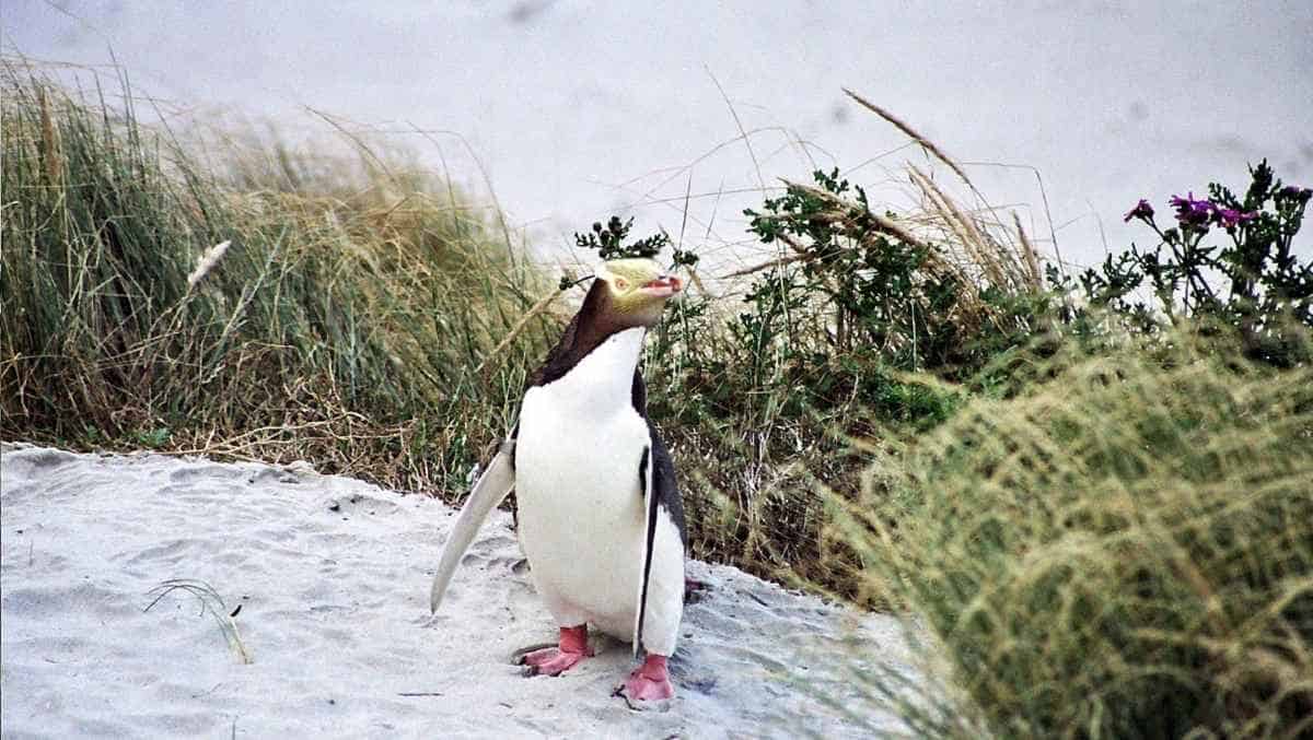
DOC identifies hoiho, or yellow-eyed penguins, toroa, or northern royal albatross, and pakake, or New Zealand sea lions, among wildlife dependent on healthy marine environments in the region. The broader marine protection network is also intended to safeguard biodiversity and improve the long-term health of the moana.
For visitors, the reserves create opportunities for wildlife observation and water-based experiences under a conservation-first framework. Rather than treating protected waters primarily as high-volume sightseeing routes, the network places ecological protection at the centre of access.
Boating, diving and snorkelling remain possible, but the fundamental purpose of the reserves is to keep marine life and habitats free from extraction and harmful disturbance.
Te Au Roa o Te Rakihouia is only one component of a broader proposed protection system for southeastern New Zealand.
The wider plan includes five Type 2 marine protected areas and a kelp protection area, alongside existing mātaitai and taiāpure areas. Those additional areas are subject to separate processes under the Fisheries Act and are not part of the five fully protected marine reserves established in July 2026.
The network therefore represents an important stage rather than the completion of the entire regional marine protection programme.
Its name also carries cultural significance. Te Au Roa o Te Rakihouia refers to the enduring ocean pathway associated with Te Rakihouia, son of the explorer Rākaihautū, and reflects Kāi Tahu connections with the coastal landscape of Te Waipounamu.
Te Au Roa o Te Rakaihautū introduces 308 square kilometres of Otago waterways into the highest category of marine protection, while establishing a long-lasting partnership for the management of resources between DOC and the people of Kāi Tahu. For the marine tourism industry in New Zealand, the implications are greater than the addition of new areas for visitors to visit. The series of five reserves has created a system that relies on ecological monitoring, scientific research, indigenous knowledge and preservation of habitats of animal species.
Advertisement
Tags: Dunedin, Kāi Tahu, kelp forests New Zealand, Māori co-management, marine conservation New Zealand
Advertisement
Advertisement













Monday, September 7, 2026

Monday, September 7, 2026

Monday, September 7, 2026

Monday, September 7, 2026

Monday, September 7, 2026

Monday, September 7, 2026

Monday, September 7, 2026

Monday, September 7, 2026

