

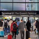
Image generated with Ai
New York City is under a Flood Watch until 6.00am Tuesday after official forecasts signalled heavy rain, thunderstorms and possible flash flooding through Monday. The highest travel risk sits around roadways, underpasses, airport access routes and low-lying subway areas, while FAA status pages showed only minor general delays at JFK, LaGuardia and Newark at the time checked. This is therefore a verified weather-risk and travel-advisory story, not yet a confirmed full-scale airport breakdown.
The immediate travel issue in New York City is not simply rain. It is the combination of saturated urban surfaces, possible high rainfall rates, poor-drainage zones, airport ground access vulnerability and peak commuter timing. Official city emergency information places the most serious travel-impact window from Monday morning through Monday night, with heavy rain expected to continue affecting mobility into the early Tuesday period.
The National Weather Service point forecast for New York NY listed a Flood Watch from Monday morning until Tuesday at 6.00am EDT. It also showed heavy rain for Monday, a high near 73°F, a 100 per cent chance of precipitation and possible new rainfall amounts between one and two inches during the day.
For travel businesses, the key editorial distinction is important. The official language supports a strong travel alert headline. It does not support a claim that airports, subway lines or roads have already suffered widespread shutdowns unless that is verified later by operating agencies.
Advertisement
Advertisement
| Official area | Verified detail | Travel relevance |
|---|---|---|
| NWS hazard status | Flood Watch in effect for New York City until 6.00am Tuesday | Supports a verified USA travel alert rather than a speculative weather story. |
| Monday forecast | Heavy rain, thunderstorms possible, high near 73°F, precipitation chance 100 per cent | Strong risk for airport access delays, wet-road congestion and walking-transfer disruption. |
| Rainfall potential | NYC Emergency Management cited two to three inches citywide, with isolated locations up to four inches | Raises risk for flooded streets, underpasses, low-lying areas and poor-drainage corridors. |
| Rainfall intensity | Brief rainfall rates of one to two inches per hour possible in stronger storms | Short-duration downpours can overwhelm drainage and disrupt surface transport quickly. |
| Highest risk window | Monday morning through Monday night | Directly overlaps business travel, tour departures, airport transfers and evening commute flows. |
| City preparedness | Flash Flood Emergency Plan activated, with catch-basin inspections and interagency coordination | Indicates official operational readiness rather than routine rainfall monitoring. |
The National Weather Service forecast discussion adds further operational weight. It identifies a continuing flash-flood threat, multiple rounds of heavy rain and thunderstorms through late Monday, and the possibility of scattered to numerous flash-flooding instances. It also places New York City, Long Island and southern Connecticut under a moderate excessive-rainfall risk for Monday.
The aviation angle needs careful framing. New York airports are exposed to weather-related delay risk, especially because the NWS aviation outlook points to IFR conditions, possible LIFR conditions later and showers with embedded thunder across the New York metro terminal area. The same NWS aviation discussion noted that amendments were likely for the timing of showers, thunderstorms and gusts at Newark, LaGuardia, JFK and Teterboro terminals.
However, early FAA airport status pages did not show widespread disruption at the time checked. JFK, LaGuardia and Newark each showed no destination-specific delays, departure gate-hold and taxi delays of 15 minutes or less, and arrival airborne delays of 15 minutes or less. The FAA also notes that its airport status information reflects general airport conditions and is not flight-specific.Airport Official FAA status at check time Operational reading for travel sellers John F Kennedy International Airport No destination-specific delays; departure and arrival delays at 15 minutes or less Keep JFK itineraries active, but monitor airline-specific changes and ground transfer times. LaGuardia Airport No destination-specific delays; departure and arrival delays at 15 minutes or less Short-haul and domestic schedules may remain fluid if thunderstorm timing shifts. Newark International Airport No destination-specific delays; departure and arrival delays at 15 minutes or less Cross-Hudson ground access may be the bigger traveller pain point than the terminal itself. New York metro aviation outlook IFR expected, possible LIFR later, embedded thunder and gust timing uncertainty Same-day schedule protection and flexible transfer buffers are recommended.
For travellers already in the city, the most immediate disruption risk sits on the ground. NYC Emergency Management identifies roadways, underpasses, highways and poor-drainage areas as possible flash-flood impact points. It also advises extra travel time, avoidance of flooded streets and close monitoring of official transit alerts during heavy rainfall periods.
This matters because New York’s visitor economy depends on short but complex connections. A traveller may land at JFK, connect through AirTrain and subway, transfer by car to Manhattan, or move between hotels, meeting venues and railway terminals. Heavy rain can turn a normal forty-five-minute airport-to-hotel transfer into a missed meeting, a delayed tour departure or a failed same-day connection.
The MTA dimension is also material. New York City Transit manages subway and bus service in the city. Its network includes 472 subway stations, 665 miles of track, 5,800 buses, 238 local bus routes, 20 Select Bus Service routes and 75 express bus routes. The subway carried around 3.4 million daily riders and 1.2 billion annual riders in 2024, which shows why even localised flooding can produce a wider commuter and visitor impact.
New York’s travel system is not standing still. The Port Authority’s 2026 budget points to major airport and regional transport investment, including the ongoing $19 billion JFK transformation, new terminal openings, roadway-network completion, a new AirTrain at EWR, Northeast Corridor station access by the end of 2026, ground-access work at LaGuardia and PATH reliability improvements.
That capital context matters for B2B travel. Weather events test the very systems being upgraded. Flood-risk days expose where airport access roads, rail transfers, subway stations, hotel coach movements and bridge-tunnel approaches still need resilience, redundancy and real-time traveller communication.Infrastructure area Official development context Travel-industry significance JFK Ongoing $19 billion transformation, new terminals and roadway-network completion Strong long-term gateway upgrade, but construction-era access planning remains important during storms. Newark Liberty New AirTrain and NEC station access targeted in Port Authority plans Better future rail access could reduce road-transfer exposure during extreme weather. LaGuardia Ground-access initiatives included in 2026 capital planning Surface access is central to disruption management on rain-heavy days. Subway and bus network Largest public transportation agency in North America, with dense subway and bus operations Localised flooding can affect residents, visitors, crews, guides and MICE delegates at scale.
For MICE organisers, the issue is less about destination demand and more about operational certainty. New York remains a high-value meeting, incentive, conference and event market, but heavy rain during a weekday creates pressure across airport arrivals, hotel check-ins, staff movement, delegate transfers, venue access and evening hospitality schedules.
Corporate travel managers should protect Monday and early Tuesday arrivals with wider buffers. Destination management companies should review coach staging areas, avoid underpasses where possible, and move walking-heavy itineraries indoors. Hotels should expect staggered check-ins if airport transfers slow, even if flights remain technically operational.
Inbound tour operators should also distinguish between flight disruption, airport disruption and city access disruption. The official FAA data available early Monday did not show major airport delay escalation, while the weather and city emergency data clearly showed a surface-travel and flash-flood risk. That distinction protects accuracy and prevents over-warning clients.
Looking ahead, this New York weather alert shows how climate-sensitive urban travel disruption is becoming a core planning issue for global tourism, aviation and MICE operators. Major gateways such as New York City are not judged only by flight capacity or hotel supply. They are increasingly judged by how well airports, roads, rail systems, hotels and event organisers can absorb short-notice weather stress. For the international travel market, the long-term lesson is clear: resilience, flexible routing and verified real-time communication will define competitive destination management as much as route growth and visitor demand.
Advertisement
Tags: JFK airport delays, LaGuardia Airport Travel, New York City travel disruption, New York Flash Flood Risk, New York Flood Watch
Advertisement
Advertisement













Saturday, September 5, 2026
Friday, September 4, 2026

Saturday, September 5, 2026

Saturday, September 5, 2026

Thursday, September 3, 2026

Wednesday, September 2, 2026

Saturday, September 5, 2026