
New York City Braces for Nor’easter as Heavy Rain, Strong Winds and Coastal Flooding Threaten Weekend Travel

Published
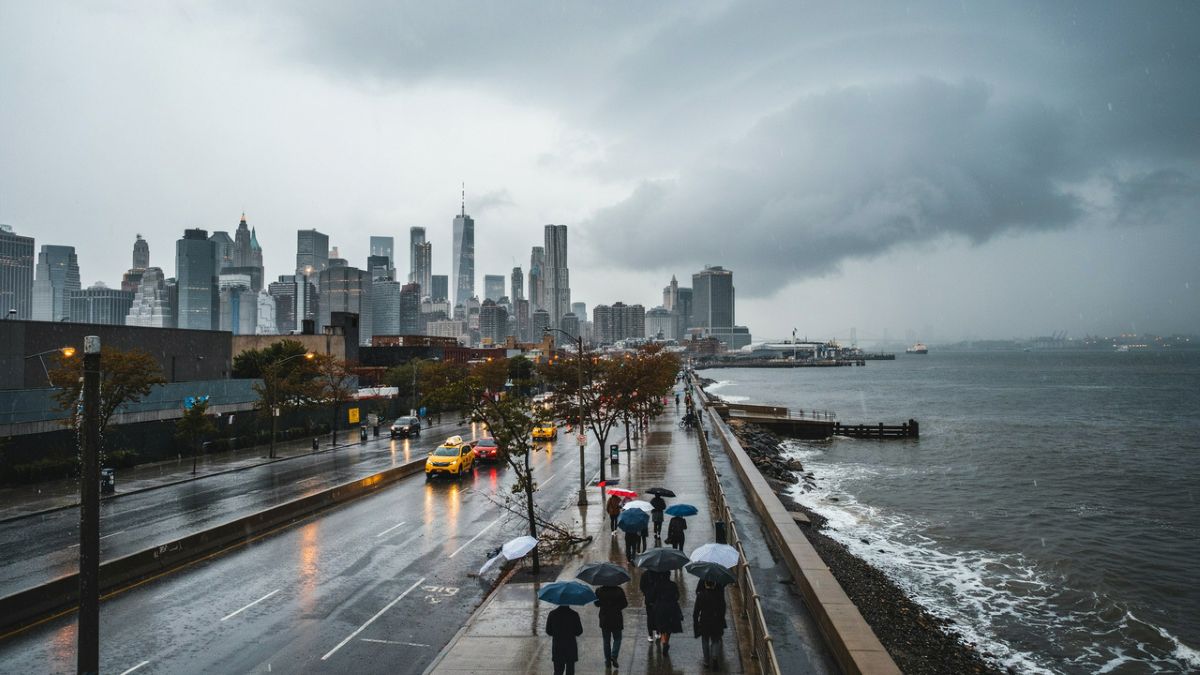
Image generated with Ai
New York City is preparing for a stormy weekend as a developing nor’easter moves closer to the metropolitan area, bringing the prospect of heavy rain, powerful wind gusts and coastal flooding. For visitors arriving for a weekend break, residents heading across the city and travelers trying to catch flights or trains, the weather could make getting around significantly more challenging.
Mayor Zohran Kwame Mamdani and New York City Emergency Management issued a Travel Advisory beginning at 2 p.m. Friday, September 25, and continuing through Sunday morning. The warning follows an update from the National Weather Service indicating that the storm’s projected path has shifted farther west and closer to the city.
Storm forecast shifts closer to the city
The latest forecast represents a notable change from the earlier outlook. NYC officials initially expected approximately 1 to 1.5 inches of rain, with the heaviest precipitation remaining east of the city. The updated forecast calls for roughly 2 to 3 inches of rain across New York City, with locally higher totals possible where heavier rainfall persists over the same areas.
The National Weather Service has also placed Manhattan under a Wind Advisory from Friday afternoon through early Sunday morning. Its latest forecast calls for a high probability of rain on Saturday, with wind gusts potentially reaching around 70 km/h, or approximately 43 mph, in Manhattan.
Advertisement
Advertisement
For travelers, the combination is particularly important because rain alone may be manageable, but strong winds and water accumulation can create delays across roads, bridges and transportation networks.
Strong winds could complicate road and transit journeys
The strongest winds are expected from Friday night through Saturday night, with NYC officials forecasting gusts of 40 to 50 mph. Exposed locations, bridges and elevated roadways could experience stronger winds than more sheltered parts of the city.
Advertisement
Advertisement
That creates several potential problems for people moving around New York. Fallen branches or trees could block roads, while power lines brought down by strong winds could result in localized disruptions. Saturated ground and trees that remain in full leaf are additional concerns identified by city emergency officials.
Visitors using taxis, rideshares or private airport transfers should therefore allow additional time, particularly during periods of heavier rain and stronger winds.
Advertisement
Advertisement
Coastal flooding adds another layer of travel disruption
Flooding is expected to become more noticeable around Friday evening and Saturday morning high tides. City officials identify the Rockaways, Jamaica Bay, parts of southern Queens, sections of Staten Island and Brooklyn’s shoreline among the areas that could experience moderate coastal flooding.
Flushing Bay could also see minor to moderate flooding, while minor flooding is possible around the Battery in Lower Manhattan. The anticipated high-tide periods are generally around 7:30 to 8:30 p.m. Friday and 7:30 to 8:40 a.m. Saturday, although exact timing varies by location.
Notify NYC has separately reported a coastal flood advisory for Manhattan, warning that water could reach approximately 1 to 2 feet above ground level in affected locations, potentially inundating shore roads and nearby properties.
For tourists, this makes waterfront sightseeing and driving through low-lying coastal neighborhoods particularly risky during high tide.
Advertisement
Advertisement
Travelers heading to New York airports should check before leaving
The storm could also affect journeys to and from the New York area’s major airports, including John F. Kennedy International Airport, LaGuardia Airport and Newark Liberty International Airport.
There is currently no official indication that these airports are being closed because of the storm. However, NYC officials are explicitly advising travelers to check flight, train and ferry status before setting out and to allow extra time for journeys.
That advice is particularly relevant to international visitors, who may have connecting flights, airport transfers or tightly scheduled itineraries. Even when an aircraft operates normally, weather-related congestion on roads or public transportation can still make reaching an airport more difficult.
Public transportation prepares for weather-related problems
New York’s extensive public transportation network is also preparing for the storm. MTA officials say agencies will assess weather conditions in real time, with strong winds considered a significant concern.
Crews have been positioned at strategic locations, while flood-prone areas are being monitored. The city’s bus operations are also preparing rerouting plans should flooding affect particular roads.
This does not mean that New York’s entire transit system is expected to shut down. Instead, travelers should be prepared for localized delays, rerouting or temporary service changes if conditions deteriorate.
Advertisement
Advertisement
Beaches and outdoor activities face additional hazards
The storm is also expected to produce dangerous surf and a high risk of rip currents. NYC’s public beaches officially closed for the season on September 13, meaning lifeguards are no longer on duty and swimming is prohibited.
Travelers planning outdoor activities should also check with event organizers because weather conditions could lead to schedule changes or cancellations. City officials are urging people to reconsider unnecessary travel during the most hazardous periods.
What visitors should know before traveling
The city is not imposing a blanket ban on travel. Instead, officials are asking people to plan carefully and allow more time than usual.
Travelers should check their airline and transportation status before leaving, avoid flooded roads and never attempt to walk or drive through floodwater. NYC Emergency Management warns that six inches of moving water can knock a person off their feet, while about one foot of rushing water can move a vehicle.
Visitors staying near coastal areas should pay particular attention to high-tide periods and avoid low-lying waterfront roads when flooding is possible.
New York’s weekend plans depend on how the storm evolves
For a city accustomed to busy weekends, the approaching nor’easter is creating an unusual layer of uncertainty for travelers. Restaurants, hotels and attractions may continue operating, but reaching them could take longer, particularly during periods of heavy rain, high winds and coastal flooding.
Advertisement
Advertisement
City officials say they will continue monitoring the storm and updating the public as the forecast develops. For travelers already in New York, the safest approach is to keep itineraries flexible, monitor official alerts and check transportation conditions before setting out.
For those arriving from elsewhere, the weekend may require more patience than a typical September visit. New York remains open, but the weather could determine how easily visitors move through the city, especially along its roads, bridges and waterfront neighborhoods.
New York City is preparing for a stormy weekend as a developing nor’easter moves closer to the metropolitan area, bringing the prospect of heavy rain, powerful wind gusts and coastal flooding. For visitors arriving for a weekend break, residents heading across the city and travelers trying to catch flights or trains, the weather could make getting around significantly more challenging.
Mayor Zohran Kwame Mamdani and New York City Emergency Management issued a Travel Advisory beginning at 2 p.m. Friday, September 25, and continuing through Sunday morning. The warning follows an update from the National Weather Service indicating that the storm’s projected path has shifted farther west and closer to the city.
Storm forecast shifts closer to the city
The latest forecast represents a notable change from the earlier outlook. NYC officials initially expected approximately 1 to 1.5 inches of rain, with the heaviest precipitation remaining east of the city. The updated forecast calls for roughly 2 to 3 inches of rain across New York City, with locally higher totals possible where heavier rainfall persists over the same areas.
The National Weather Service has also placed Manhattan under a Wind Advisory from Friday afternoon through early Sunday morning. Its latest forecast calls for a high probability of rain on Saturday, with wind gusts potentially reaching around 70 km/h, or approximately 43 mph, in Manhattan.
Advertisement
Advertisement
For travelers, the combination is particularly important because rain alone may be manageable, but strong winds and water accumulation can create delays across roads, bridges and transportation networks.
Strong winds could complicate road and transit journeys
The strongest winds are expected from Friday night through Saturday night, with NYC officials forecasting gusts of 40 to 50 mph. Exposed locations, bridges and elevated roadways could experience stronger winds than more sheltered parts of the city.
That creates several potential problems for people moving around New York. Fallen branches or trees could block roads, while power lines brought down by strong winds could result in localized disruptions. Saturated ground and trees that remain in full leaf are additional concerns identified by city emergency officials.
Visitors using taxis, rideshares or private airport transfers should therefore allow additional time, particularly during periods of heavier rain and stronger winds.
Coastal flooding adds another layer of travel disruption
Flooding is expected to become more noticeable around Friday evening and Saturday morning high tides. City officials identify the Rockaways, Jamaica Bay, parts of southern Queens, sections of Staten Island and Brooklyn’s shoreline among the areas that could experience moderate coastal flooding.
Flushing Bay could also see minor to moderate flooding, while minor flooding is possible around the Battery in Lower Manhattan. The anticipated high-tide periods are generally around 7:30 to 8:30 p.m. Friday and 7:30 to 8:40 a.m. Saturday, although exact timing varies by location.
Advertisement
Advertisement
Notify NYC has separately reported a coastal flood advisory for Manhattan, warning that water could reach approximately 1 to 2 feet above ground level in affected locations, potentially inundating shore roads and nearby properties.
For tourists, this makes waterfront sightseeing and driving through low-lying coastal neighborhoods particularly risky during high tide.
Travelers heading to New York airports should check before leaving
The storm could also affect journeys to and from the New York area’s major airports, including John F. Kennedy International Airport, LaGuardia Airport and Newark Liberty International Airport.
There is currently no official indication that these airports are being closed because of the storm. However, NYC officials are explicitly advising travelers to check flight, train and ferry status before setting out and to allow extra time for journeys.
That advice is particularly relevant to international visitors, who may have connecting flights, airport transfers or tightly scheduled itineraries. Even when an aircraft operates normally, weather-related congestion on roads or public transportation can still make reaching an airport more difficult.
Public transportation prepares for weather-related problems
New York’s extensive public transportation network is also preparing for the storm. MTA officials say agencies will assess weather conditions in real time, with strong winds considered a significant concern.
Advertisement
Advertisement
Crews have been positioned at strategic locations, while flood-prone areas are being monitored. The city’s bus operations are also preparing rerouting plans should flooding affect particular roads.
This does not mean that New York’s entire transit system is expected to shut down. Instead, travelers should be prepared for localized delays, rerouting or temporary service changes if conditions deteriorate.
Beaches and outdoor activities face additional hazards
The storm is also expected to produce dangerous surf and a high risk of rip currents. NYC’s public beaches officially closed for the season on September 13, meaning lifeguards are no longer on duty and swimming is prohibited.
Travelers planning outdoor activities should also check with event organizers because weather conditions could lead to schedule changes or cancellations. City officials are urging people to reconsider unnecessary travel during the most hazardous periods.
What visitors should know before traveling
The city is not imposing a blanket ban on travel. Instead, officials are asking people to plan carefully and allow more time than usual.
Travelers should check their airline and transportation status before leaving, avoid flooded roads and never attempt to walk or drive through floodwater. NYC Emergency Management warns that six inches of moving water can knock a person off their feet, while about one foot of rushing water can move a vehicle.
Advertisement
Advertisement
Visitors staying near coastal areas should pay particular attention to high-tide periods and avoid low-lying waterfront roads when flooding is possible.
New York’s weekend plans depend on how the storm evolves
For a city accustomed to busy weekends, the approaching nor’easter is creating an unusual layer of uncertainty for travelers. Restaurants, hotels and attractions may continue operating, but reaching them could take longer, particularly during periods of heavy rain, high winds and coastal flooding.
City officials say they will continue monitoring the storm and updating the public as the forecast develops. For travelers already in New York, the safest approach is to keep itineraries flexible, monitor official alerts and check transportation conditions before setting out.
For those arriving from elsewhere, the weekend may require more patience than a typical September visit. New York remains open, but the weather could determine how easily visitors move through the city, especially along its roads, bridges and waterfront neighborhoods.
Advertisement
