
Colorado Carries Losses with New Mexico, Utah and Arizona as Dangerous Floods Trigger Travel Chaos

Published
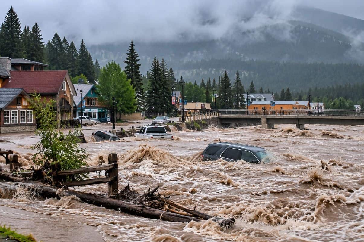
Colorado, New Mexico, Utah and Arizona are confronting a dangerous flooding emergency after intense rainfall triggered rooftop rescues, mandatory evacuations and serious road disruption across the Four Corners region. Farmington in New Mexico and Pagosa Springs in Colorado have experienced particularly severe conditions, with swollen rivers threatening homes, campgrounds and transport routes. Emergency teams have deployed helicopters, boats and specialised vehicles to rescue stranded residents, while authorities continue monitoring rising waterways. The flooding has also raised concerns for tourists planning national park visits, camping holidays and scenic road trips. Travellers should avoid evacuation zones, check official highway updates and confirm accommodation access before departure.
Four Corners Travel Alert Intensifies as Severe Flooding Strikes the American Southwest
The Four Corners region of the United States has experienced a serious flooding emergency following repeated periods of heavy rainfall that intensified between 22 and 23 October 2026. Communities across Colorado, New Mexico, Utah and Arizona have faced dangerous river conditions, inundated properties and roads that became difficult or impossible to use. According to reporting distributed by the Associated Press, some already saturated areas received approximately four inches of rainfall after Wednesday, while the Pagosa Springs region of southern Colorado recorded more than five inches. The accumulation of water caused rivers and drainage systems to rise rapidly, placing additional pressure on emergency services and local infrastructure. Although the National Weather Service indicated that the heaviest rainfall had ended in some locations by Friday morning, river flooding continued across parts of southwestern Colorado, northern New Mexico and northern Arizona. This created ongoing risks for residents and travellers because downstream flooding can persist after storms have moved away.
Farmington Flood Emergency Forces Approximately 600 New Mexico Households to Evacuate
Farmington, one of the principal population centres in the Four Corners region, became a major focus of emergency operations as rising water levels along the San Juan and Animas rivers threatened residential neighbourhoods and surrounding infrastructure. Local authorities ordered approximately 600 households to evacuate, while access to certain riverside areas was restricted because of dangerous conditions. Emergency personnel from the New Mexico National Guard used helicopters, boats and amphibious vehicles to reach residents stranded by floodwaters, including people who required rescue from rooftops. Some homes reportedly experienced water depths of three to four feet, demonstrating the severity of the flooding and the difficulty of reaching affected properties safely. San Juan County officials warned that river levels had exceeded forecasts and that floodwaters could continue moving downstream towards communities within the Navajo Nation. For travellers, the emergency created serious concerns about accommodation access, local road conditions and the safety of routes near swollen waterways.
Pagosa Springs and South Fork Face Dangerous Flooding Across Southwestern Colorado
Southwestern Colorado experienced extensive flooding as heavy rainfall pushed rivers beyond safe levels and forced emergency authorities to introduce evacuation measures in vulnerable communities. Around Pagosa Springs, a destination recognised for its hot springs, mountain scenery and outdoor recreation, rising water along the San Juan River created significant concerns for homes, roads and visitor infrastructure. Mandatory evacuation orders were issued along several waterways, while authorities in Archuleta County advised some residents to shelter in place because surrounding roads had become unsafe. Emergency responders also worked to rescue two people and three dogs stranded inside a partially submerged recreational vehicle. In nearby Rio Grande County, flooding affected campground areas and roads around South Fork, including locations near Fun Valley Family Resort. Photographs distributed by the Associated Press showed water surrounding trailers and partially submerged vehicles along Highway 160. Colorado Governor Jared Polis declared a disaster emergency covering 11 counties, reflecting the scale of the regional response.
Advertisement
Advertisement
Utah Flooding Damages Homes and Recreational Vehicles as Local Emergency Declared
Southwestern Utah also experienced serious flooding, particularly around the city of Hurricane, where local authorities declared an emergency after muddy water entered residential and recreational areas. Reports indicated that approximately 80 homes and 50 recreational vehicles were affected, with floodwaters moving through neighbourhood streets and creating hazards for residents and visitors. The situation raised particular concerns for travellers staying in recreational vehicle parks and campgrounds, where temporary accommodation can be especially vulnerable to rapidly rising water. Elsewhere in Utah, the National Weather Service issued flood warnings affecting areas along the San Juan River, including locations near Bluff and Mexican Hat. Rising river levels created additional risks at low-water crossings, riverside roads and other flood-prone locations. Visitors planning journeys through these communities should confirm road accessibility and accommodation conditions before travelling, while avoiding any attempt to cross flooded streets, washes or river channels.
Arizona Storm Damage Creates Additional Hazards for Tourists and Local Communities
Arizona experienced severe weather during the same period, with powerful storms damaging residential properties, bringing down trees and disrupting electrical infrastructure. The Associated Press reported at least one injury following storm-related damage, while northern parts of the state remained within areas identified by federal weather information as potentially vulnerable to continuing flood conditions. Although the most serious river flooding was reported in New Mexico and Colorado, Arizona’s desert landscape presents particular dangers when intense rainfall causes normally dry washes and drainage channels to fill rapidly. Water can travel considerable distances from the location where rain originally falls, making seemingly dry roads and crossings hazardous without much warning. Travellers exploring northern Arizona should therefore monitor National Weather Service forecasts and official highway information before setting out. Clear skies should not be interpreted as confirmation that rivers, washes or low-lying routes have returned to safe conditions.
Advertisement
Advertisement
National Parks and Scenic Road Trips Face Growing Flood Risks Across Four Corners
The Four Corners region attracts visitors interested in national parks, archaeological heritage, desert landscapes, mountain recreation and scenic driving routes, making the flooding particularly relevant to outdoor tourism. National Weather Service flood-watch coverage issued on 23 October included areas associated with Arches, Canyonlands and Natural Bridges in Utah, alongside vulnerable river basins in southwestern Colorado. These locations can experience dangerous flash flooding when rainfall enters narrow canyons, washes and drainage systems, sometimes affecting areas far from the original storm. Recent wildfire burn scars may also increase the risk of rapid runoff and debris movement. However, inclusion within a regional flood watch does not establish that every national park or attraction has closed. Visitors should check individual National Park Service notices before departure and avoid entering narrow canyons, low-water crossings or exposed hiking routes when flood warnings remain in effect. Outdoor excursions should be postponed wherever local authorities identify immediate safety risks.
Saturated Ground and Rising Rivers Explain Why Flooding Continued After Rainfall Eased
The continuing flood emergency illustrates how repeated storms can create dangerous conditions even after the heaviest rainfall has stopped. According to National Weather Service meteorologists, parts of the American Southwest had experienced several periods of substantial moisture during preceding weeks, leaving the ground increasingly saturated and reducing its ability to absorb additional rainfall. When soil becomes saturated, water flows more readily into streams, rivers and drainage systems, increasing the likelihood of rapid rises and downstream flooding. Some of the moisture affecting the region was associated with Pacific tropical weather systems moving inland, contributing to unusually wet conditions across parts of the Southwest. In southern Colorado, flooding along the San Juan River reportedly exceeded forecasts and surpassed levels associated with a major flood during the previous year. These developments demonstrate why river forecasts and emergency warnings remain essential for travellers, even when rainfall has eased and local weather appears to be improving.
Four Corners Road Travel Becomes Dangerous as Flooded Highways and Campgrounds Disrupt Journeys
Road safety has become one of the most important concerns for travellers moving through Colorado, New Mexico, Utah and Arizona during the flooding emergency. Floodwaters can conceal damaged road surfaces, debris, washed-out bridges and unstable ground, making even familiar routes dangerous when rivers rise or drainage systems overflow. Visitors planning road trips should check official transport information immediately before departure rather than relying on previously published journey times or navigation applications alone. The National Weather Service advises motorists never to drive through floodwater, while pedestrians should avoid attempting to cross moving water or approach swollen riverbanks. Travellers staying in hotels, holiday rentals or campgrounds near affected waterways should follow evacuation instructions issued by local authorities. Where emergency officials advise sheltering in place because surrounding roads are unsafe, visitors should remain in secure locations until safe routes become available. Official state transport services provide updated information about closures, restrictions and alternative routes.
Airports and Regional Tourism Businesses Face Uncertainty as Flooding Disrupts Ground Access
The flooding has created operational challenges for communities that depend on road-based tourism, camping holidays and outdoor recreation, although the available reporting does not establish widespread airport closures or a nationwide suspension of commercial aviation. Travellers arriving through regional airports should nevertheless verify flight schedules and ground transport arrangements because flooded roads can prevent passengers from reaching hotels, campgrounds and attractions even when flights continue operating normally. Destinations such as Pagosa Springs and South Fork rely on visitors interested in mountain scenery, fishing, camping and outdoor activities, making disruptions to transport infrastructure particularly important for local businesses. Flooded recreational facilities and damaged access roads may affect accommodation providers, restaurants, excursion operators and other tourism services until conditions improve. However, no verified figures establish the total value of tourism revenue losses, hotel cancellations or visitor displacement resulting from the emergency. Assessing the longer-term economic impact will require additional information from local authorities and tourism organisations.
Conclusion: Four Corners Flood Emergency Demands Urgent Travel Precautions Across Four US States
The severe flooding across Colorado, New Mexico, Utah and Arizona has created a dangerous emergency for residents and travellers throughout the Four Corners region. Rooftop rescues, mandatory evacuations, submerged vehicles and damaged roads demonstrate the seriousness of the situation, while continuing river rises threaten additional communities even after rainfall has eased. Farmington, Pagosa Springs and South Fork are among the destinations experiencing significant disruption, with campgrounds and riverside areas facing particular risks. Travellers should avoid evacuation zones, monitor official flood warnings and confirm road and accommodation access before departure. Although the full economic impact remains uncertain, protecting affected communities, restoring transport connections and ensuring safe visitor access will be essential to the region’s recovery.
Advertisement
