
Storm Austen Puts UK Travel on High Alert as Cornwall, Devon, Kent and Sussex Face Powerful Winds, Rail Disruption and Ferry Cancellations

Published
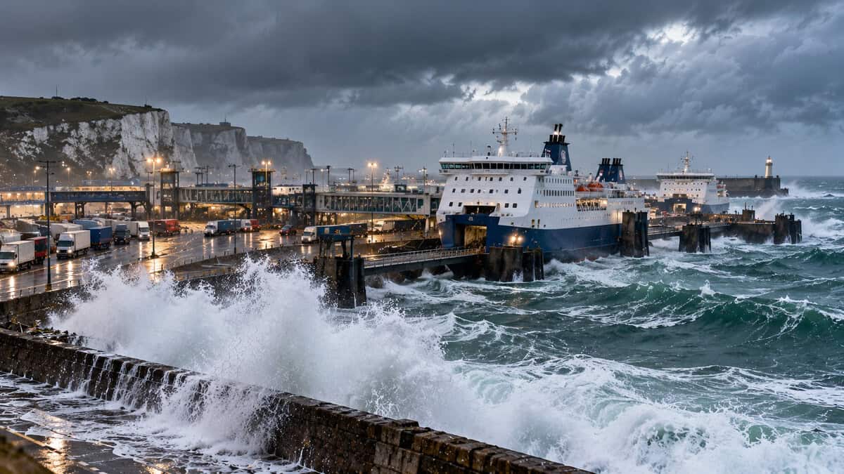
Storm Austen is sweeping across southern England on Friday, 23 October 2026, bringing powerful winds, heavy rainfall and serious transport risks to Cornwall, Devon, Kent, Surrey, East Sussex and West Sussex. The first named storm of the 2026–27 season has prompted the UK Met Office to issue amber and yellow wind warnings as an intense Atlantic low-pressure system moves across Britain. Gusts could reach 80 mph in exposed southwestern areas, while widespread winds of 45–60 mph threaten railway infrastructure, coastal ferry services, road networks and aviation operations. Confirmed changes to Great Western Railway services and cancellations of Scillonian III ferry sailings demonstrate the storm’s immediate impact on tourism and regional connectivity, while travellers across the South East face potential disruption to Southern, Thameslink and cross-Channel connections.
Storm Austen Puts Southern England on Alert as Powerful Atlantic Winds Threaten Travel Across Major Destinations
Storm Austen has placed a large part of southern Britain under severe weather warnings, raising concerns for domestic travellers, international visitors and transport operators. The Met Office officially named the storm on Tuesday, 20 October, identifying an Atlantic low-pressure system that was expected to strengthen rapidly under the influence of the jet stream.
Advertisement
Advertisement
By Thursday evening, the weather system was approaching southwest England, bringing increasing winds and heavy rainfall. The most dangerous conditions were forecast for Friday morning, particularly across Cornwall, the Isles of Scilly and western Devon. The storm is especially significant because it arrives during autumn, when many trees still carry leaves. Strong winds can therefore place greater pressure on branches and roots, increasing the risk of fallen trees affecting transport infrastructure.
Met Office Warns of 80 mph Wind Gusts and Heavy Rain as Amber and Yellow Weather Alerts Cover Britain
The Met Office has issued several wind warnings as Storm Austen crosses the country. An amber warning covers Cornwall, the Isles of Scilly and parts of west Devon between 01:00 and 10:00 BST on Friday, 23 October. Wind gusts of 60–70 mph are expected, with approximately 80 mph possible around exposed headlands.
Advertisement
Advertisement
A wider yellow warning highlights strong winds and transport disruption across southwest England and Wales. An additional yellow warning covers a broad area of England and Wales between 10:00 and 21:00 BST, with gusts forecast at 45–55 mph. The Met Office has also forecast rainfall of approximately 20–30 mm in many affected areas, with higher totals possible over western uplands and farther north. These figures are forecasts rather than confirmed rainfall and wind observations.
Storm Austen: Official Weather Warnings and Travel Risks
| Weather indicator | Forecast information | Implications for travellers |
|---|---|---|
| Storm dates | 22–23 October 2026 | Disruption possible during Thursday night and Friday |
| Amber warning | 01:00–10:00 BST, 23 October | Highest wind risk in Cornwall, Isles of Scilly and west Devon |
| Strongest gusts | Around 80 mph in exposed southwestern locations | Dangerous coastal conditions and possible infrastructure damage |
| Widespread strong winds | Around 45–60 mph, depending on location | Rail delays, difficult driving and possible service cancellations |
| Rainfall | 20–30 mm forecast in many places | Surface-water flooding and reduced road visibility |
| Wider Friday warning | 10:00–21:00 BST | Further transport disruption possible |
| Official information | Met Office |
Kent, Surrey and Sussex Rail Networks Face Major Risks as Southern and Thameslink Passengers Prepare for Delays
Rail travel across southeast England remains vulnerable as strong winds threaten tracks, overhead equipment and signalling infrastructure. Southern and Thameslink provide important connections between London, Gatwick Airport, Brighton and other destinations across Sussex and Surrey. Routes identified in disruption reports include Haywards Heath–Three Bridges, Lewes–Brighton, Uckfield–Crowborough and the Angmering area towards Worthing. These corridors are particularly important for commuters, airport passengers and visitors travelling between London and the south coast.
Advertisement
Advertisement
Fallen trees can block railway tracks, damage electrical equipment and force trains to operate at reduced speeds. However, the reported tree obstructions and specific route closures have not been independently confirmed through current official Southern or Thameslink notices reviewed for this article. They should therefore not be treated as verified cancellations. The Met Office has confirmed that falling trees and branches are among the principal transport hazards associated with Storm Austen. Travellers should check individual train services before departure, particularly when making connections with flights or other transport.
Cornwall and Devon Suffer Confirmed Rail Changes as Great Western Railway Limits Long-Distance Services
Southwest England has experienced some of the storm’s clearest confirmed transport impacts. According to an official update published by Penzance Council, Great Western Railway announced reduced services across Devon and Cornwall for Friday, 23 October. Long-distance trains were scheduled to operate between London Paddington and Plymouth only, with local trains providing connections between Plymouth and Penzance.
The operator warned that fewer trains would run, journeys could take longer and services might become busier than usual. Passengers were also advised that some early-morning services on Saturday, 24 October, could be cancelled while railway teams inspected infrastructure for storm damage. The changes affect one of southwest England’s important tourism corridors, linking London with destinations such as Plymouth, Truro and Penzance. The restrictions highlight how extreme weather in one region can affect visitors travelling from other parts of the country.
Dover–Calais and Newhaven–Dieppe Ferry Routes Face Rough Seas as Cross-Channel Travel Comes Under Pressure
Severe coastal winds are creating additional uncertainty for passengers using ferry connections between England and France. The Dover–Calais route provides an important crossing for motorists and freight operators, while Newhaven–Dieppe connects Sussex with Normandy.
According to DFDS, the normal crossing time is approximately 100 minutes between Dover and Calais and four hours between Newhaven and Dieppe. High winds, rough seas and heavy spray can influence ferry departure schedules, port operations and passenger boarding procedures. Complete suspension of both routes was reported in the supplied disruption information. However, official ferry operator notices independently confirming those blanket cancellations were not available in the sources reviewed. Consequently, the status of individual departures should be verified directly with the relevant operator.
Isles of Scilly Ferry Cancellations Confirm Severe Maritime Disruption as Scillonian III Suspends Sailings
One of the most significant confirmed maritime disruptions concerns the passenger ferry linking Penzance with the Isles of Scilly. Official information published by Penzance Council confirms that Scillonian III sailings scheduled for Friday, 23 October, and Saturday, 24 October, were cancelled because of severe weather conditions. The operator cited strong winds and dangerous sea conditions, with wave heights of up to five metres forecast for Saturday.
Advertisement
Advertisement
Passengers booked for the cancelled Saturday service were automatically transferred to sailings scheduled for Monday, 26 October. A further advisory was issued for Monday because rough sea conditions could make journeys uncomfortable or extend travel times. The cancellations directly affect island tourism, including visitors travelling to accommodation, holiday properties and local attractions.
London Gatwick Airport and Channel Islands Flights Face Possible Delays as Storm Austen Tests Aviation Operations
London Gatwick Airport is another important transport gateway exposed to the effects of Storm Austen. The airport supports international and domestic connections and serves as a major entry point for visitors travelling to London, Brighton and the South East. Strong winds can influence aircraft movements, runway operations and airport ground services. Weather at connecting airports can also affect departures and arrivals.
Regional services linking Britain with the Channel Islands may experience disruption when weather conditions deteriorate at either end of a journey. The supplied information refers to selected flight cancellations, particularly on Channel Islands routes. However, specific cancellations have not been independently established from official airport or airline operational records reviewed for this report. Passengers should therefore consult live flight information rather than assume that an entire route or destination has been suspended.
Fallen Trees and Dangerous Crosswinds Threaten Roads Across Kent, Sussex, Surrey and Devon
Road networks are also exposed to Storm Austen, particularly in coastal counties and areas containing tree-lined routes. Kent, East Sussex and West Sussex face risks from fallen branches, damaged trees, surface water and flying debris. Strong winds can make driving difficult for high-sided vehicles, including coaches, delivery vehicles and motorhomes. In Devon, the county council warned that the Taw Bridge in Barnstaple and Torridge Bridge in Bideford might need to close if wind conditions became unsafe.
The authority urged motorists to review journeys and remain alert to changing conditions on exposed roads. Across the wider affected region, local authorities may need to respond to blocked carriageways, damaged signs and fallen vegetation.
UK Power Networks and Emergency Response Teams Face Infrastructure Risks as Storm Damage Threatens Local Services
Storm Austen also presents challenges for electricity distribution and essential services. The Met Office has warned that strong winds could damage electricity infrastructure, cause short-term power cuts and affect connected services, including mobile communications. Falling branches can damage local power lines, while loose structures and debris create further hazards for repair teams.
Advertisement
Advertisement
The supplied reports indicate that UK Power Networks had response crews dealing with weather-related incidents in the South East, although widespread electricity failures were not reported at that stage. These claims could not be independently confirmed against a current official outage summary. The broader risk remains important for hotels, restaurants, transport terminals and visitor attractions, many of which depend on uninterrupted electricity and communications.
Storm Austen Moves Towards the North Sea but Storm Boelo Brings Another Major Weekend Weather Threat
Conditions across southern England are expected to improve gradually as Storm Austen moves eastwards into the North Sea on Friday evening. However, the unsettled weather pattern is not expected to end immediately. The Met Office has already named Storm Boelo, a separate Atlantic low-pressure system forecast to affect Northern Ireland, Scotland and northern England during the weekend of 24–25 October.
A yellow wind warning for northern areas runs from 18:00 on Saturday until 21:00 on Sunday. Storm Boelo could bring gusts of 55–65 mph widely, with approximately 70–80 mph possible in exposed coastal locations. Further rain and wind are also possible early next week before conditions potentially become calmer across southern Britain later in October.
Advertisement
