
Image generated with Ai
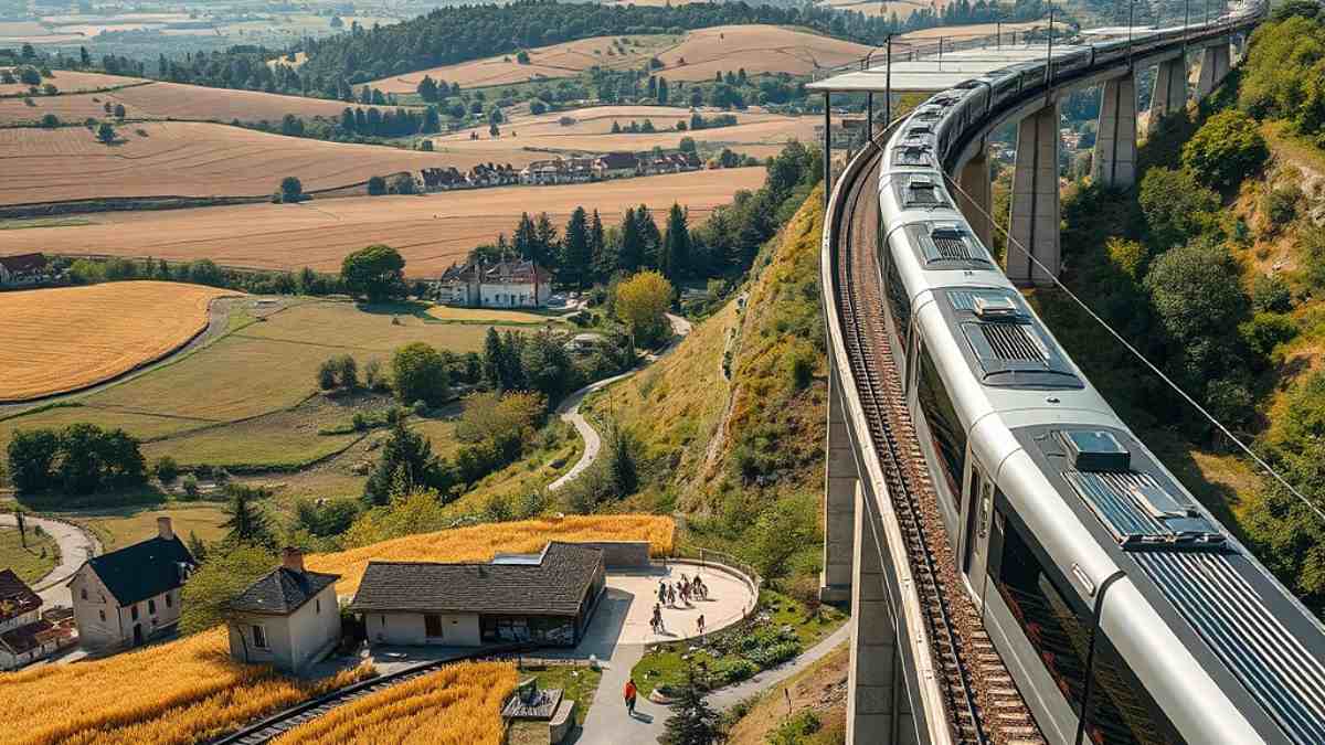
The most extensive infrastructural project ever attempted in Europe has redefined regional mobility as it transforms suburban train networks into the foremost cultural portals in the world. The Grand Paris Express has reconnected Parisian city centers with its surrounding rural frontiers through innovative architecture destinations transport systems. Beyond just being transportation logistics, the system contains sixty-eight customized stations which serve as cultural nodes and mixed-use spaces. With the introduction of monumental artworks and fast travel routes, the project has ensured that domestic and international tourism activities revolve around the peri-urban agriculture ecosystems in order to make sustainable day trips possible.
For more than a century, metropolitan transit design operated on a purely mechanistic ethos. Stations were conceived as functional circulation funnels engineered to process human mass transit at peak hours, disperse footfall into adjacent streets, and minimize dwell times. The Grand Paris Express (GPE), under the supervision of the French state enterprise Société des grands projets (SGP), systematically dismantles this legacy assumption. By commissioning sixty-eight completely new, architecturally bespoke stations across two hundred kilometres of automated, driverless orbital tracks, the French government has transformed transit infrastructure into an autonomous leisure attraction. This structural shift inaugurates the era of architectural destination transit, where the physical terminal serves as an independent cultural, retail, and gastronomic destination capable of generating travel demand on its own merits.
The geopolitical and spatial reality of greater Paris has long suffered from severe centralisation. For decades, the historic core bounded by the Boulevard Périphérique commanded international tourism, cultural funding, and hospitality investments, while the surrounding suburban departments remained disconnected transit deserts or industrial dormitories. Travellers journeying between outer suburbs were historically forced to transit inward through the centre of Paris, placing immense strain on legacy networks like the RER and Métro. The Grand Paris Express directly resolves this structural asymmetry by encircling the capital with high-capacity orbital corridors—Lines 14, 15, 16, 17, and 18—that bypass the city centre entirely.
Within this spatial reorganization, transit-oriented development (TOD) operates not merely as an urban density tool, but as a deliberate tourism diversification strategy. The Société des grands projets has rejected standard off-the-shelf modular engineering. Instead, every station district is developed as an expansive mixed-use public realm incorporating civic squares, pedestrian esplanades, botanical terraces, and high-density commercial ecosystems. Rather than racing through sterile subterranean concourses, domestic day-trippers and international cultural tourists now purposefully travel outward to explore signature civic architecture, monumental site-specific artworks, regional culinary markets, and sustainable retail environments.
Advertisement
Advertisement
The cultural integrity of the Grand Paris Express is rooted in a binding institutional policy known as the Tandem Artistic Program (Programme des Tandems), orchestrated under the cultural direction of José-Manuel Gonçalvès in collaboration with Le Centquatre-Paris and artistic consultancies. Under this statutory mandate, each of the sixty-eight stations is designed as a co-equal partnership between a globally renowned architect and an acclaimed contemporary visual artist. Unlike conventional infrastructure schemes where art is commissioned as an afterthought to decorate finished concrete walls, the Tandem programme requires architects and artists to collaborate from the initial conceptual sketching phase. This guarantees that art installations are integrated into the load-bearing engineering, structural shafts, lighting schemes, and spatial volumes of the stations.
Through this unprecedented public commissioning framework, the railway network constitutes a continuous subterranean and aerial contemporary art museum spanning the entire Île-de-France region. Two landmark developments—Saint-Denis – Pleyel in the north and Villejuif – Gustave Roussy in the south—exemplify how spatial choreography elevates public transit into destination architecture.
Positioned at the pivotal junction of Lines 14, 15, 16, and 17, the Saint-Denis – Pleyel station functions as the northern primary nexus of the Grand Paris Express, designed to accommodate over 250,000 daily passengers upon full network build-out. Conceived by master Japanese architect Kengo Kuma (Kengo Kuma & Associates), the building challenges subterranean conventions through natural materials and passive illumination. Kuma structured the station around a dramatic central glass well descending twenty-eight metres beneath the ground, wrapping the exterior and interior atrium with an intricate lattice of vertical larch wood louvres (brise-soleil). The timber slats filter sunlight down to the lowest train platforms, referencing traditional Japanese woodwork while providing visual warmth and spatial orientation within an immense civil engineering complex.
Connecting directly to the station concourse is the Franchissement Urbain Pleyel (FUP), an architectural bridge engineered by Marc Mimram. Spanning forty-eight active railway tracks—the densest rail corridor in continental Europe—the structure unites historically divided neighbourhoods in Seine-Saint-Denis with wide pedestrian avenues, dedicated cycling tracks, and landscaped civic rest zones.
Suspended within Kuma’s towering timber atrium is Les Vénus dionysiennes, a monumental permanent art installation by French visual artist Prune Nourry. The piece comprises 108 female figures, each standing 1.7 metres high, inspired by prehistoric Paleolithic Venus figurines that symbolize universal fertility and earth creation myths. Nourry created the work through a community project titled “La Terre qui m’est Chair”, collecting varied soil samples from hundreds of female residents, community leaders, and local workers throughout Saint-Denis. These mineral clays, river sands, and local earth strata were integrated into the textural surfaces of the sculptures. The installation anchors the transit hall as a monument to community memory, regional diversity, and civic pride.
In the southern sector, the Villejuif – Gustave Roussy station, serving Line 14 and the forthcoming Line 15 South, represents an engineering achievement led by French architect Dominique Perrault. Sunk nearly fifty metres deep to avoid subterranean geological constraints and interface with the Gustave Roussy oncology research campus, the station is carved out as an open vertical cylinder seventy metres in diameter.
Perrault rejects the sensation of underground confinement by crowning the vast shaft with an Ethylene Tetrafluoroethylene (ETFE) glass cushion canopy. Supported by a network of structural cables tied into an open central “eye”, the transparent roof floods the lowest platforms with natural daylight and lateral air circulation. Above ground, two overlapping stainless steel mesh discs covering 3,273 square metres shelter the public forecourt while deflecting solar heat. Below, thirty-two escalators and glass-walled walkways criss-cross the shaft, lined with 1,808 square metres of silver-plated aluminium wire screens designed with Gaëlle Lauriot-Prévost that reflect incoming sunlight against the raw concrete walls.
At level -9, Chilean artist Iván Navarro collaborated with Perrault to install an expansive permanent ceiling installation consisting of 58 circular neon and mirrored light-boxes. Arranged as an astronomical sundial, the mirrors reflect light into endless visual corridors, creating the illusion of an infinite starry sky deep inside the subterranean cavern. This interplay of daylight and neon mirrors turns a transfer point into a mesmerizing spatial experience that draws architecture and design enthusiasts from across the globe.
The architectural vision of the Grand Paris Express is backed by an ambitious real estate master plan. Through a strategic partnership with the regional public land agency Établissement public foncier d’Île-de-France (EPF Île-de-France), the Société des grands projets manages over 1 million square metres of constructible land surrounding the sixty-eight stations. Rather than allocating land to monofunctional office complexes, the master development plan coordinates commercial, residential, and civic functions to guarantee active public hubs outside commuter transit hours.
The TOD property allocation comprises several integrated pillars:
This mixed-use urban approach supports the French state’s environmental mandate of Zero Net Land Take (zéro artificialisation nette – ZAN) by recycling brownfield land and concentrating urban density directly adjacent to mass transit lines. In doing so, it creates independent suburban town centres that capture consumer spending and establish self-sustaining leisure destinations.
Grand Paris Express Strategic Corridors Network Lines Involved Primary Architectural Typology Core Cultural & Commercial Assets Primary Destination Travel Profile Northern Metropolitan Node Lines 14, 15, 16, 17 Multi-tiered timber atrium, pedestrian mega-bridge Community cultural centres, artisan food halls, civic plazas Contemporary architecture, urban arts, civic heritage Southern Subterranean Matrix Lines 14, 15 South Deep vertical shaft, kinetic light canopy Oncology research amenities, public science exhibitions, retail concourses Scientific tourism, subterranean architectural exploration Saclay Agricultural Plateau Line 18 Elevated viaduct, origami folded glass, terracotta Scientific visitor centres, farm-gate tasting pavilions, bike hubs Agritourism, academic heritage, farm-to-table culinary travel Plaine de France & Valois Plains Line 17 Semi-submerged landscape glass pavilion, open-air platforms Agro-ecological demonstrator parks, regional craft retail, trailheads Agro-ecology, rural farm stays, nature reserve exploration
International tourism across Île-de-France has long been heavily concentrated in central Paris, placing significant pressure on historical districts like the Marais, Montmartre, and the Seine riverbanks. This historic overtourism contrasts sharply with the peripheral realities of the region. Despite possessing expansive natural reserves, protected farming valleys, and centuries of agricultural heritage, the Île-de-France countryside remained largely out of reach for non-motorised visitors. Legacy commuter trains were organized on radial tracks focused entirely on channeling suburban workers into central Parisian terminals, leaving lateral journeys into rural areas cumbersome and time-consuming.
The Grand Paris Express fundamentally breaks this spatial isolation. By running high-speed, automated lines across the suburban ring, the network cuts regional transit times dramatically. More significantly, the outward paths of Line 18 in the southwest and Line 17 in the northeast extend directly past the traditional urban boundary into working agricultural landscapes.
This transport integration underpins dedicated agritourism corridors. With automated trains running every few minutes and accessible via standard regional transit ticketing, day-trippers and eco-tourists can transition effortlessly from dense urban cores to agricultural landscapes. The Grand Paris Express allows visitors to disembark directly at heritage stone villages, organic farms, and regional nature parks without driving a car. By connecting metropolitan rail travel with local agricultural supply chains (circuits courts), the network establishes a framework for decentralised ecotourism that redistributes visitor spending across rural communes while protecting regional open spaces.
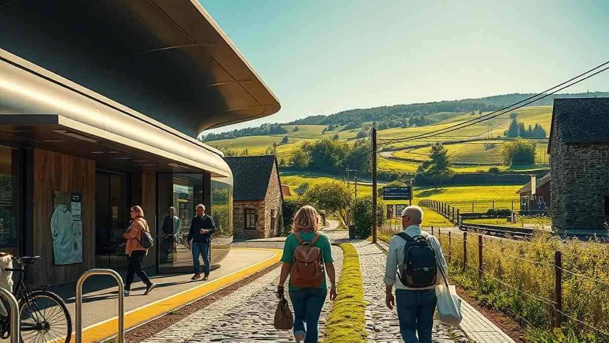
Image generated with Ai
Stretching 35 kilometres from Massy-Palaiseau through the scientific campus of Paris-Saclay to the royal city of Versailles, Line 18 highlights how transit infrastructure can balance technological innovation with pastoral preservation.
The line rolls out in three phases:
The Plateau de Saclay is an elevated agricultural plateau celebrated since antiquity for its fertile loam soils, which support productive cereal and wheat crops. To shield this natural resource from speculative real estate expansion, the French government instituted the Zone de Protection Naturelle, Agricole et Forestière (ZPNAF) under Law No. 2010-597 and Decree No. 2013-1298. This binding land protection ring-fences 4,115 continuous hectares of farmland, pastures, and forests from future development.
As a result, Line 18 acts as a distinct environmental boundary. To the south of the transport spine sits the Paris-Saclay research campus; to the north lie preserved farming plains, protected woodlands, and historic agricultural villages. This deliberate juxtaposition establishes the stations along Line 18 as primary access points for scientific, environmental, and rural leisure excursions.
The architectural design of the Saclay stations reflects their open landscape context. Conceived by Atelier Novembre and Benthem Crouwel Architects, the elevated aerial station of Christ de Saclay (serving Saint-Aubin and Villiers-le-Bâcle) rises above a 7-kilometre concrete viaduct—the longest aerial rail viaduct built in contemporary France. The station structure features an origami-inspired folded envelope wrapped in glass, sheet steel, and natural terracotta tiles. The exterior terracotta louvres reference the rich clay soils of the surrounding fields, anchoring the aerial terminal within its agricultural setting.
Inside Christ de Saclay, German visual artist Ulla von Brandenburg executed the station’s Tandem commission, titled Paysage chromatique en mouvement. Drawing inspiration from historical Saint-Simonian philosophy and traditional patchwork textile techniques, von Brandenburg applied broad, shifting ribbons of color across the station’s interior walls, ceilings, and structural columns. The vibrant geometric patterns reflect the seasonal colours of the surrounding farming landscape—shades of wheat gold, rapeseed yellow, and summer greens—creating a fluid aesthetic link between the interior terminal and the rural views outside.
In nearby Orsay, the elevated Université Paris-Saclay (Orsay-Gif) station, designed by the same architectural team, acts as an open panoramic viewing platform looking out across the Yvette Valley and the agricultural borders of Gif-sur-Yvette and Villiers-le-Bâcle. At the Palaiseau operational centre, visual artist Fatiha Zemmouri collaborated with JFS Architectes to erect a 15-metre stone and glass installation exploring geological strata and pastoral horizons. Along the platforms of Massy-Palaiseau, illustrator Stéphane Oiry covered the concourse walls with graphic narratives celebrating the scientific and agricultural evolution of the plateau.
From Christ de Saclay and Orsay-Gif, travellers can walk or cycle directly into agricultural heritage sites that were previously hard to reach without a car.
Extending twenty-seven kilometres northeast from Saint-Denis – Pleyel across the Plaine de France to the edge of Seine-et-Marne, Line 17 will serve nine stations, linking major commercial hubs with rural territories.
The line opens in three phases:
The Triangle de Gonesse consists of 750 hectares of fertile open land positioned between Le Bourget and Charles de Gaulle airports. Historically renowned for supplying grain to Parisian bakeries, the agricultural plain was originally threatened with complete development under the EuropaCity private commercial master plan.
Following sustained public opposition and a strategic shift in national environmental policy, the commercial mega-development was cancelled in favour of peri-urban farming preservation. The area is now anchored by the CARMA project (Coopération pour une Alternative Rurale, Métropolitaine et Agricole). This initiative reimagines 400 hectares of the plain as an integrated agro-ecological park dedicated to organic market gardening, soil research, circular food systems, and culinary ecotourism.
The Gonesse station, designed by Jacques Pajot of Atelier Novembre, directly supports this ecological model. Situated where Line 17 transitions from underground tunnels to an aerial viaduct, the station is designed as a transparent, 119-metre pavilion constructed of exposed board-formed concrete and expansive glass panels that follow the rolling topography.
For the station’s interior, Portuguese visual artist Joana Vasconcelos developed a monumental textile installation in collaboration with Pajot. The artwork combines traditional hand-woven crochet, regional fabrics, and integrated LED lighting elements. The suspended installation honors the historic textile and market-gardening traditions of the Val-d’Oise, creating a visual transition between mass rail transit and local agrarian craft.
Visitors arriving at Gonesse can explore experimental agroforestry plots, participate in heritage bread-baking workshops using flour grown in surrounding fields, and sample local produce that supports school meal programs across Île-de-France.
At the northern terminus of Line 17, the quiet farming village of Le Mesnil-Amelot in Seine-et-Marne transforms into an essential regional gateway. Surrounded by open sugar-beet, cereal, and oilseed rape fields, the village now hosts an airy, 4,000-square-metre timber and glass station designed by Explorations Architecture (led by architect Benoît Le Thierry d’Ennequin).
Suspended from the high ceilings of the station concourse is Paperplane Sculptures, a permanent installation by Austrian-Italian artist Esther Stocker. Comprising five large painted metal paper aeroplanes measuring between 3.5 and 6 metres across, the sculptures are decorated with bold geometric black gridlines that echo the building’s steel roof beams. The installation playfully references the station’s proximity to Charles de Gaulle Airport while celebrating the human desire to explore open landscapes.
Le Mesnil-Amelot serves as the primary southern rail gateway to the Parc Naturel Régional Oise-Pays de France. Spanning 67,000 hectares across 70 communes in the Val-d’Oise and Oise departments, this protected regional park contains 20,000 hectares of historic royal forests (including Chantilly, Halatte, and Ermenonville), sandstone quarries, and pristine wetlands along the Nonette River.
Direct zero-emission electric buses and cycling trails link the station terminal to prominent cultural and rural sites:
| Comparative Metric | Line 18: Plateau de Saclay Corridor | Line 17: Plaine de France & Valois Corridor |
| Primary Agrarian Hub Communes | Gif-sur-Yvette, Villiers-le-Bâcle, Saint-Aubin | Gonesse, Le Mesnil-Amelot, Bonneuil-en-France |
| Regulatory Environmental Framework | ZPNAF (4,115 ha legally protected farmland) | CARMA Urban-Agri Park & PNR Oise-Pays de France |
| Architectural Tandems Featured | Christ de Saclay: Atelier Novembre + Ulla von Brandenburg | Gonesse: Jacques Pajot + Joana Vasconcelos Mesnil-Amelot: Explorations Arch. + Esther Stocker |
| Primary Structural Engineering Format | 7 km elevated continuous aerial viaduct | Semi-submerged landscape portals and aerial terminals |
| Agricultural Specialisations | Durum wheat, organic market gardening, dairy, rapeseed | Sugar beets, brewing grain, agroforestry, heirloom wheat |
| Core Outdoor & Leisure Experiences | Canal-bank biking along Rigoles du roi, Foujita Museum | Forest trekking (PNR Oise), Royaumont Abbey, equestrian trails |
| Integrated Travel Time from Suburb Core | Massy-Palaiseau to Christ de Saclay: 9 minutes | Saint-Denis – Pleyel to Le Mesnil-Amelot: 25 minutes |

Image generated with Ai
Developing high-capacity transit and cultural infrastructure at this scale requires innovative financial engineering. The European Investment Bank (EIB) has served as an essential institutional financing partner for the project. Building on early investments, the EIB finalized a landmark €3 billion green loan dedicated to constructing the western section of Line 15, adding to multi-billion-euro climate commitments previously directed toward Lines 14, 16, 17, and 18.
This climate financing is tied to strict Environmental, Social, and Governance (ESG) standards, verifying that the construction of stations and surrounding areas adheres to low-carbon building protocols, circular material reuse, and strict land protection. Private capital and institutional hospitality developers have followed this public investment, acquiring sites around emerging suburban stations.
Strategic market analyses by Choose Paris Region, the regional economic development agency, document a notable outward shift in hospitality investment. Under the regional economic plan “Impact 2028”, Île-de-France provides structured grants and planning support to encourage decarbonised tourism, rural lodging development, and high-quality “bleisure” (business and leisure) facilities outside Paris’s central ring.
Hospitality groups and ecotourism companies are investing in station-adjacent projects:
By pairing green infrastructure financing with high-quality rural hospitality, regional authorities have established a sustainable economic model that delivers resilient returns for investors while protecting agrarian landscapes.
The deployment of automated orbital metro lines opens valuable commercial opportunities for the travel trade. For decades, Destination Management Organisations (DMOs) and tour operators have relied on rigid, repetitive central Paris itineraries that struggle with congestion, street closures, and coach parking limits. The Grand Paris Express allows operators to package high-margin, carbon-neutral day excursions that combine contemporary architecture with authentic agricultural immersion.
By utilizing standard regional Navigo transit ticketing and digital QR passes, operators eliminate coach charter costs, reduce travel emissions, and offer clients a rich blend of cutting-edge modern design and authentic rural heritage.
The progressive completion of the Grand Paris Express across the late 2020s and into the early 2030s will permanently reshape the social and economic geography of greater Paris. By 2031, when all sixty-eight stations and 200 kilometres of track are operational, Île-de-France will feature one of the most comprehensive and modern automated orbital rail transit rings in the world.
This multi-decade infrastructure effort provides crucial lessons for regional governance and territorial planning. By mandating the Tandem Artistic Program and funding substantial mixed-use transit-oriented development, the French government demonstrated that public infrastructure can be functional without being generic or visually austere. Integrating public art and signature architecture into transit spaces transforms everyday commuting into a rich cultural experience and gives each suburban hub a distinct identity.
Equally significant is the project’s approach to land conservation. By coupling rapid rail investment with strict legal protections—such as the ZPNAF on the Plateau de Saclay and the CARMA agricultural transition across the Triangle de Gonesse—authorities have proven that transit expansion does not require sacrificing agricultural heritage or green space. Instead, mass transit can act as a shield against suburban sprawl by focusing urban density around rail stations while preserving working farmland for future generations.
As global travellers seek out authentic, low-impact travel alternatives that move beyond crowded city landmarks, the Grand Paris Express stations will serve as welcoming gateways. By turning suburban railway stations into cultural attractions and linking them directly to regional terroirs, France has created an enduring model for polycentric tourism, demonstrating how public transit can celebrate art, support rural economies, and foster meaningful community exploration.
The monumental rollout of the Grand Paris Express represents a lasting triumph in sustainable territorial planning and leisure mobility across Europe. By redefining transit stops as civic landmarks, architectural destination transit seamlessly bridges metropolitan creativity with pristine agrarian heritage. Outer station districts along Lines 17 and 18 are no longer peripheral transit nodes; they are independent epicentres of public art, gastronomy, and ecotourism. As global travel steadily pivots towards decarbonised journeys and authentic local discovery, these polycentric networks unlock France’s agrarian landscapes. This holistic vision proves that modern transport infrastructure can protect rural environments while fostering lasting regional economic prosperity.
The Grand Paris Express is altering the way that tourists experience Île-de-France, creating suburban railway stations into portals for visitors to enjoy art, agriculture, and history. This network, which links urban hubs with natural preserves, fosters sustainable tourism practices, aids in economic development, and allows tourists to explore destinations other than Paris, all while maintaining the unique nature of the region.
Advertisement
Tags: agritourism, architectural destination transit, Dominique Perrault, Gonesse, Grand Paris Express
Advertisement
Advertisement













Thursday, September 3, 2026

Thursday, September 3, 2026
Thursday, September 3, 2026
Thursday, September 3, 2026
Thursday, September 3, 2026

Wednesday, September 2, 2026
Thursday, September 3, 2026

Thursday, September 3, 2026


