

Denali National Park Just Got Easier After Years of Limited Access as Alaska Joins California’s Death Valley in Major Tourism Reopenings

Published
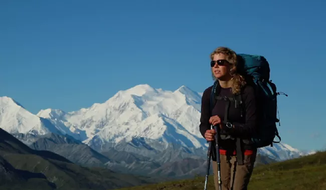
Image Credit: National Park Service
Denali National Park Just Got Easier After Years of Limited Access as Alaska Joins California’s Death Valley in Major Tourism Reopenings because major infrastructure work is restoring access to important visitor areas after natural hazards disrupted travel. In Alaska, the new Pretty Rocks Bridge allows hikers and cyclists to travel beyond Mile 43, while full public bus service along the 92-mile Denali Park Road is expected in summer 2027. In California, Death Valley has reopened Lower Wildrose Road after nearly three years of flood-related closure. These Major Tourism Reopenings do not remove every restriction, but they reconnect visitors with landscapes, viewpoints and attractions that were difficult to reach. Together, Alaska and California show how investment in resilient infrastructure is reshaping access to America’s national parks.
Advertisement
Advertisement
What Has Changed After Five Years of Restricted Denali Access?
The most important development is the completion of the Pretty Rocks Bridge near Mile 45 of Denali Park Road. Since August 2021, buses and most visitors had been forced to stop around East Fork at Mile 43 because the road beyond that point was unsafe.
The closure removed practical road access to several of the park’s best-known western destinations, including Eielson Visitor Center, Wonder Lake and Kantishna.
Advertisement
Advertisement
That began to change on 27 August 2026, when hikers and cyclists were allowed to cross the completed bridge and continue farther west. Public buses still ended at Mile 43 for the rest of the 2026 season, but the National Park Service expects full bus service to resume in summer 2027.
Private vehicles will remain restricted during summer, generally travelling only as far as Savage River at Mile 15.
Advertisement
Advertisement
Why Did the Pretty Rocks Landslide Force Such a Long Closure?
The Pretty Rocks landslide had been active for decades, but its movement accelerated dramatically as ice-rich permafrost thawed.
Before 2014, the slope generally moved only inches per year. By 2017, movement had increased to inches per month. In 2018, it was measured in inches per week, and by 2019 the landslide was shifting inches per day.
By 2021, movement reached up to 0.65 inches per hour. In August of that year, some sections were moving downhill by more than 10 inches per day.
Those figures made routine road maintenance increasingly unsafe and ineffective. National Park Service research links the acceleration principally to thawing permafrost associated with rising temperatures, while increased precipitation also contributed to instability.
That combination eventually forced the agency to abandon repeated road repairs and pursue a permanent bridge solution.
How Significant Is the New Pretty Rocks Bridge?
The project is far more substantial than an ordinary road repair.
Advertisement
Advertisement
| Bridge detail | Official figure |
|---|---|
| Length | About 475 feet |
| Height | About 50 feet |
| Width | 24 feet |
| Project cost | About US$230 million |
| Thermosiphons installed | 23 |
| Landslide location | Around Mile 45 |
| Completion | 2026 |
| Expected full bus reopening | Summer 2027 |
The steel truss bridge spans the unstable slope rather than sitting directly on moving ground.
A particularly important engineering feature is the installation of 23 thermosiphons, which help keep the ground frozen beneath the eastern end of the bridge. The National Park Service expects the structure to provide approximately a 50-year solution for maintaining road access through the Pretty Rocks area.
How Much More of Denali Could Travellers See in 2027?
The scale of the reopening is considerable because Denali Park Road stretches 92 miles from the park entrance to Kantishna.
The closure at Mile 43 removed access to more than half of the road corridor.
| Destination | Approximate location |
|---|---|
| Savage River | Mile 15 |
| Teklanika River | Mile 29–30 |
| East Fork | Mile 43 |
| Polychrome area | Around Mile 46 |
| Toklat River | Mile 53 |
| Eielson Visitor Center | Mile 66 |
| Wonder Lake | Around Mile 85–86 |
| Kantishna | Mile 92 |
When buses return, visitors should once again gain road access to alpine tundra, important wildlife habitat, higher-elevation viewpoints and remote western wilderness.
Eielson Visitor Center sits at around 3,733 feet, while Highway Pass reaches roughly 3,980 feet, the highest point on the road.
Advertisement
Advertisement
Why Is Wonder Lake So Important for Denali Visitors?
Wonder Lake, around Mile 85, is one of the western locations that became difficult to reach after the 2021 closure.
The area is known for views of Denali when weather conditions are clear. Nearby Reflection Pond, around Mile 85.5, is also recognised as a major photographic location.
Beyond scenery, the area provides access to hiking, waterfowl habitat and backcountry terrain. During the road closure, western access became much more complicated, while private lodges near Kantishna generally depended on air access.
The expected return of bus service in 2027 therefore changes trip planning considerably.
Instead of treating Mile 43 as the practical end of a standard road journey, visitors may again be able to plan full-day excursions far into Denali’s western reaches and access one of the park’s most visually distinctive areas by organised road transport.
How Large Is Denali National Park and Preserve?
Denali’s scale helps explain why one reopened road connection matters so much.
Advertisement
Advertisement
The park and preserve cover approximately 6,075,030 acres, or around 9,492 square miles.
Official figures show:
- 92 miles of park road;
- 35.5 miles of official trails;
- 38 mammal species;
- 172 recorded bird species;
- 19 fish species;
- 758 vascular plant species;
- 2.146 million acres of federally designated wilderness.
Denali itself rises to 20,310 feet, making it the highest mountain in North America.
Because the park is so large and formal trail mileage is relatively limited, Denali Park Road functions as far more than a transport route. For most visitors, it is the principal organised corridor into the park’s interior, wildlife habitat and remote landscapes.
Restoring that corridor therefore changes the practical experience of visiting the park.
Why Does the Reopening Matter for Alaska Tourism?
Denali is also economically important.
Advertisement
Advertisement
National Park Service figures show 543,300 recreational visits in 2025, representing a 16.53% increase from 2024.
In 2024, visitors spent more than US$600 million in communities around the park. That spending supported more than 5,600 jobs and generated nearly US$880 million in total economic output.
Those figures demonstrate that road access has consequences well beyond the park itself.
Accommodation providers, transport companies, guides, private lodges and other tourism businesses can all benefit when visitors are able to spend longer periods exploring deeper into Denali.
The return of western bus access in 2027 could therefore restore visitor flows to areas that had been significantly harder to reach during the Pretty Rocks closure.
Can Travellers Drive the Full 92-Mile Road Themselves?
No. Denali’s road-access system will remain carefully controlled.
Advertisement
Advertisement
During the normal summer season, private vehicles are generally allowed only as far as Savage River at Mile 15.
Beyond that point, most travellers need to use transit or tour buses, cycle or walk.
The road also becomes more rugged as it progresses west. The first 15 miles are paved. Miles 15 to 31 are generally two-lane gravel, while Miles 31 to 92 become a narrower, more rustic one-lane gravel road.
This system is intentional. Limiting private traffic helps protect wildlife, reduce congestion and preserve wilderness conditions.
Therefore, the major 2027 development is not unrestricted driving. It is the restoration of organised bus access to parts of Denali that have been inaccessible to most visitors for several years.
What Should Travellers Know Before Planning a 2027 Visit?
The National Park Service expects the primary 2027 summer season to run approximately from mid-May through mid-September.
Advertisement
Advertisement
The most important advance-planning date is 1 December 2026, when 2027 bus and campground reservations are scheduled to open.
Travellers hoping to reach Eielson, Wonder Lake or western sections of the park should pay close attention to booking availability because restored access could increase demand considerably.
The National Park Service is also continuing road repairs and deferred maintenance west of Pretty Rocks. Visitors should therefore avoid assuming that every campground, facility or service will automatically return to its exact pre-2021 operating pattern.
For the remainder of fall 2026, hikers and cyclists travelling far beyond East Fork must still prepare for limited services, long distances and reduced emergency support.
Comment From Anup Keshan, Founder and Editor-in-Chief of Travel And Tour World
“Denali’s deeper reopening could significantly improve how travellers experience one of Alaska’s most remarkable protected landscapes. Restoring road access towards Eielson, Wonder Lake and Kantishna means visitors may once again explore areas that have been difficult to reach for several seasons. The Pretty Rocks Bridge also demonstrates how tourism infrastructure must increasingly adapt to complex environmental conditions. For travellers, 2027 could provide a substantially broader Denali experience, but preparation remains essential. Visitors should check bus schedules, facility openings, road conditions and park regulations before travelling, especially when planning longer journeys into the remote western sections of this extraordinary national park.”
Conclusion: Why Has Denali Access Become Easier After Years of Restrictions?
Seeing More of Alaska’s Denali National Park Just Got Easier After Years of Limited Access because the Pretty Rocks Bridge has restored the crucial connection lost after the 2021 landslide.
Advertisement
Advertisement
The cause was rapidly accelerating ground movement linked principally to thawing permafrost. The answer was a 475-foot bridge costing about US$230 million, designed to bypass the unstable slope rather than repeatedly repair it.
The reason this matters is scale. Public buses are expected to return along the full 92-mile Denali Park Road in summer 2027, potentially restoring practical road access to Eielson Visitor Center, Wonder Lake and Kantishna.
Conclusion
Denali National Park Just Got Easier After Years of Limited Access as Alaska Joins California’s Death Valley in Major Tourism Reopenings because both parks are restoring visitor access after severe natural damage disrupted key routes. Alaska’s Pretty Rocks Bridge addresses the landslide that closed the Denali Park Road beyond Mile 43, while Death Valley’s Lower Wildrose Road reopened after flood destruction. The two projects differ in scale and engineering, yet the result is similar: travellers can once again reach areas that had been restricted for years. These Major Tourism Reopenings also highlight the growing importance of resilient park infrastructure. For visitors, restored roads mean broader itineraries, while continued closures show that conditions and regulations still need to be checked before departure.
Image Credit: National Park Service
Advertisement
