
US Issues New Travel Advisory For Mexico As Category 3 Hurricane Trudy Drives Flight Waivers, Port Closures, And Severe Weather Warnings

Published
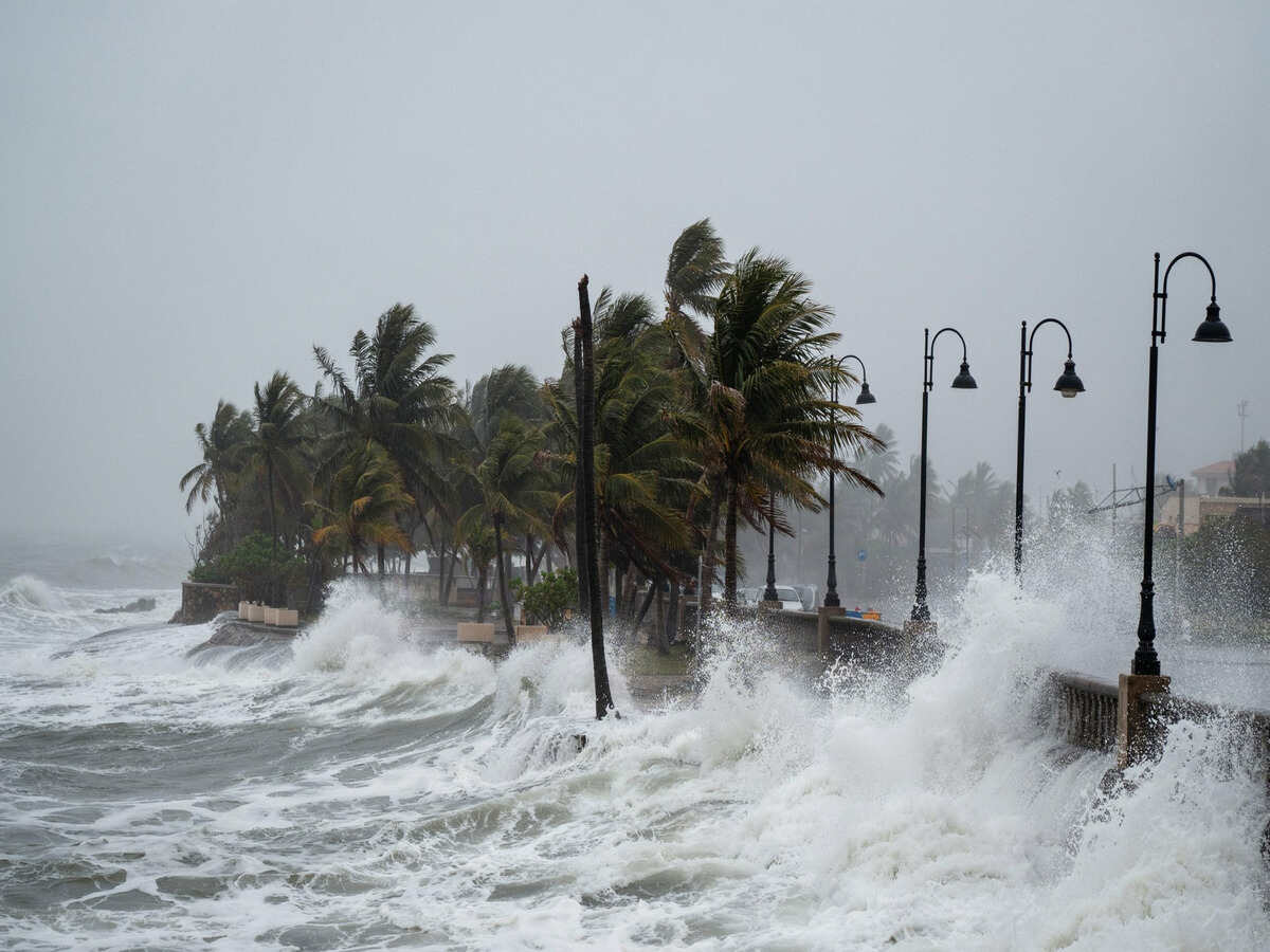
U.S. Urges Travelers To Avoid Mexico’s Pacific Coast As Category 3 Hurricane Trudy Approaches Amid Flight Disruption. The United States Department of State has released an important travel warning for individuals who plan to visit or stay on Mexico’s Pacific coast. Expected to intensify and approach the southwestern coastlines, the imminent Category 3 Hurricane Trudy is expected to unleash dangerous weather conditions in several states of Mexico during the weekend. The developing hurricane has already caused airlines to grant flight waivers and ports to be closed, among other dangers.
In light of the escalating threat, the U.S. Department of State has urged all travelers, tourists, and residents throughout the region to exercise extreme caution, stay tuned to official alerts, and modify their travel itineraries as major resort corridors prepare for the storm’s arrival.
Overview of Hurricane Trudy & Regional Threat Level
Hurricane Trudy has rapidly gathered strength over the warm waters of the Pacific, transforming into a formidable Category 3 major storm as it moves toward the Mexican mainland.
- Primary Impact Zones: The threat encompasses four key states along Mexico’s Pacific seaboard: Guerrero, Michoacán, Colima, and Jalisco.
- Official Watches & Warnings: Official meteorological agencies have put extensive stretches of the coast under active Hurricane Watches and Tropical Storm Warnings.
- Major Resort Corridors Affected: Critical international tourism hubs—including Puerto Vallarta, Manzanillo, Zihuatanejo, and Acapulco—are directly within the storm’s path or outer rainband sweep.
Heavy Rainfall, Life-Threatening Flooding, and Mudslide Risks
Beyond destructive winds, Hurricane Trudy’s most dangerous element is its extreme precipitation footprint. Rainbands associated with the hurricane are dropping immense volumes of water across coastal plains and mountain ranges alike.
Advertisement
Advertisement
- Torrential Downpours: Expected rainfall totals range from 4 to 8 inches, with localized pockets receiving up to 15 inches of water through the weekend.
- Hazardous Mountainous Terrain: High-volume rainfall onto already saturated soils across the Sierra Madre del Sur creates an imminent danger of catastrophic flash flooding.
- Severe Mudslides: Steep, mountainous terrain poses a immediate risk of sudden, destructive mudslides capable of sweeping away infrastructure, cutting off remote villages, and covering main highways.
Marine Hazards: Rogue Waves, Severe Undertows, and Beach Closures
Coastal conditions have deteriorated rapidly ahead of the storm’s arrival. Naval authorities and emergency managers have placed strict bans on maritime activity to prevent water-based casualties.
- Massive Swells: Hazardous sea conditions are generating towering waves ranging between 13 to 16 feet (4 to 5 meters) along the coastline.
- Deadly Ocean Currents: Intensified storm energy is driving lethal rip currents, powerful undertows, and unpredictable rogue waves that can sweep individuals off shorelines without warning.
- Port & Shoreline Shutdowns: Key coastal ports are entirely closed to small craft, fishing vessels, and excursion boats. Red flags fly across all major beaches, completely prohibiting swimming and watersports.
Widespread Flight Waivers & Airline Schedule Disruptions
Air travel throughout the Mexican Pacific travel corridor is facing major turbulence. Major domestic and international airlines are taking proactive measures to assist passengers stranded or facing delayed flights.
Advertisement
Advertisement
- Flexible Change Policies: Major carriers—including Aeroméxico, Volaris, WestJet, and several U.S. airlines—have issued flexible travel waivers. Passengers can rebook flights without change fees or paying fare differences.
- Puerto Vallarta (PVR) Impacts: As a primary travel hub under active watches, terminal operations remain functional, but severe delays and cancellations are mounting as peak storm conditions roll in.
- Manzanillo (ZLO) & Zihuatanejo (ZIH): Airports closest to the hurricane’s core face elevated risks of flight groundings, diversions, and temporary runway closures.
- Cascading Delays: Upstream aircraft connections out of hubs like Mexico City and Guadalajara are causing ripple-effect schedule changes across international networks.
Resort Operations, Excursions, and Guest Safety Protocols
Hotels and resort properties from Jalisco down to Guerrero are shifting into emergency response mode to safeguard thousands of international vacationers.
- Suspension of Tours & Activities: All outdoor excursions—including catamaran trips, snorkeling expeditions, ziplining, and guided hikes—are fully suspended until safety permits.
- Indoor Protocols: Resorts are instructing guests to remain indoors, clear off outdoor balconies, and stay far away from exterior glass windows during wind peaks.
- On-Site Sheltering: Coastal properties have designated interior emergency shelter areas and secured backup generators in anticipation of power grid failures or localized flooding.
Overland Transportation & Highway Conditions
Traversing roads along the southwestern coast poses severe dangers as water levels rise and hillsides become unstable.
Advertisement
Advertisement
- High-Risk Roadways: Mountain highways connecting coastal resorts to interior cities are extremely vulnerable to landslides, fallen trees, and rockfalls.
- Transit Disruptions: Regional long-distance bus service and airport shuttles are experiencing significant schedule delays or route cancellations due to flooded bypasses and washed-out bridges.
- Travel Recommendation: Tourists are strongly advised to avoid driving on rural routes or attempting to cross flooded road dips and swollen river beds.
Official Directives & Government Emergency Guidance
The U.S. State Department and local emergency management agencies are actively broadcasting safety advisories to protect residents and visitors.
- Heed Local Authorities: All individuals in affected zones must follow instructions from Mexico’s civil protection agency (Protección Civil) and local law enforcement.
- Comply with Evacuation Orders: If designated living or hotel zones receive mandatory evacuation directives, compliance should be immediate without delay.
- Stay Informed via Official Channels: Track continuous meteorological updates via the National Hurricane Center (NHC) and Mexico’s National Meteorological Service (SMN).
Essential Checklist for Travelers in the Affected Zone
For those currently located in the path of Hurricane Trudy, taking swift preparation steps is critical to safety and well-being.
- Contact Air Carriers Promptly: Check your flight status online before traveling to any airport, and utilize rebooking waivers if your flight is affected.
- Maintain Communication Supplies: Fully charge all portable power banks, cell phones, and electronic devices while power grids remain functional.
- Secure Document Copies: Keep physical copies and digital backups of passports, visas, insurance policies, and critical health records in waterproof bags.
- Assemble Emergency Provisions: Maintain a personal kit containing bottled water, non-perishable foods, flashlights, extra batteries, and essential prescription medications.
- Know Emergency Numbers: Keep local emergency contacts on hand. In Mexico, dial 911 for assistance. U.S. citizens requiring emergency consular aid can contact the U.S. Embassy in Mexico City or the U.S. Consulate General in Guadalajara.
The U.S. State Department released a travel warning for Mexico due to Category 3 Hurricane Trudy causing significant travel delays and disruptions.
In light of the Category 3 Hurricane Trudy that is affecting Mexico’s Pacific Coast, it is a good example of the ever-changing weather conditions during hurricane season in Mexico. By following the travel warnings issued by officials, staying indoors, and putting safety above traveling plans, one will manage to survive this event.
Advertisement
