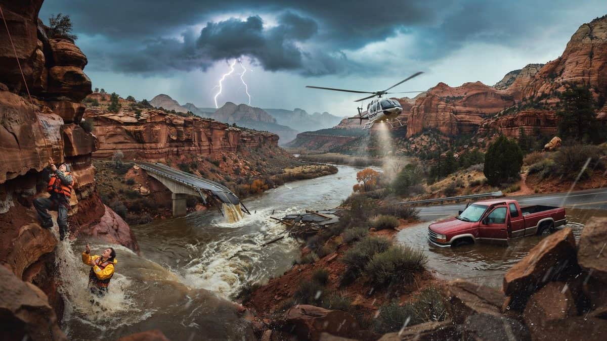
Image generated with Ai
America’s deadliest flash floods reveal a century of disaster, from Rapid City to the Grand Canyon, showing why travel remains at risk as violent weather strikes communities and tourism sites.
America’s deadliest flash floods have repeatedly exposed the danger facing travel and tourism across the country. From Rapid City to the Grand Canyon, history shows how quickly extreme rainfall can turn scenic destinations into disaster zones. In 1972, Rapid City suffered one of America’s worst flash floods, while Big Thompson Canyon faced another devastating catastrophe in 1976. Now, the Grand Canyon has entered that history after a major August 2026 flash flood destroyed bridges, disrupted river access and forced 62 evacuations. Moreover, officials warn that further storms could trigger more flooding. Therefore, America’s flash flood history remains a powerful warning for travellers today.
Advertisement
America’s flash flood history is marked by sudden destruction, lost lives and enormous economic damage, from the 1972 Rapid City disaster and 1976 Big Thompson Canyon flood to the latest Grand Canyon emergency.
The United States has a long and devastating history of flash flooding, with major disasters repeatedly striking communities, roads, campgrounds, national parks and popular tourism destinations. The latest emergency at Grand Canyon National Park has again exposed the danger, after a significant flash flood on August 29, 2026, forced evacuations, destroyed infrastructure and prompted the National Park Service to seek information about approximately 15 people who may be missing or unaccounted for.
Advertisement
Flash floods are among the most dangerous weather hazards in the United States because they can transform streams, roads, washes and canyon corridors within minutes or hours. NOAA data covering 1996 through 2017 recorded 74,814 flash-flood events across the country, with approximately 1.2% associated with fatalities and 1,399 deaths recorded during that period, demonstrating that the hazard is both widespread and persistent.
The danger is particularly significant for travel and tourism because many of America’s most popular outdoor destinations are located near rivers, mountains, canyons and exposed drainage systems. Visitors may arrive expecting a scenic hiking, camping or sightseeing experience, yet rainfall occurring miles away can rapidly send water downstream into areas where skies may appear relatively calm.
| Year | Location | Event type | Reported deaths | Why it matters |
|---|---|---|---|---|
| 1890 | Rapid City, South Dakota | Flash flood | Not specified in cited event | Bridges destroyed and city flooding |
| 1972 | Rapid City, South Dakota | Flash flood | 237–238 | One of America’s most deadly flash floods |
| 1976 | Big Thompson Canyon, Colorado | Flash flood | 145 | Major disaster in a scenic tourism corridor |
| 1990 | Shadyside, Ohio | Flash flood | 26 | Four inches of rain in under two hours |
| 1997 | Fort Collins, Colorado | Flash flood | 5 | Major urban/economic impact |
| 2013 | Colorado Front Range | Flash flood/flooding | 8 | About $2 billion in damage |
| 1998 | Zion, Utah | Flash flood | — | Virgin River flow surged dramatically |
| 2015 | Texas and surrounding states | Extreme rainfall/flash flooding | — | More than $1 billion in damage associated with event |
One of the most important chapters in America’s flash flood history occurred on June 9, 1972, when severe thunderstorms generated catastrophic flooding across Rapid City and the eastern foothills of South Dakota’s Black Hills. The National Weather Service records that as much as 15 inches of rain fell near Nemo and Sheridan Lake, while an average of about 10 inches fell across a 60-square-mile area, producing a peak flow on Rapid Creek of 50,600 cubic feet per second.
The consequences were extraordinary, with 238 people killed, about 3,000 injured, 1,335 homes destroyed and roughly 5,000 automobiles destroyed, while estimated damage reached $165 million in 1972 dollars. Water levels rose as much as 3.5 feet in only 15 minutes, and 15 of the 23 bridges over Rapid Creek were destroyed, illustrating how quickly flash flooding can overwhelm infrastructure and cut off travel routes.
Four years later, Colorado experienced another historic flash flood that remains one of the country’s most important flood disasters involving a tourism corridor. On July 31, 1976, a nearly stationary thunderstorm system produced exceptionally heavy rainfall over the Big Thompson watershed, with 12 to 14 inches falling on slopes in the western part of the canyon and sending a powerful torrent through the narrow valley.
The National Weather Service says the flood crest travelled approximately 7.6 miles between Drake and the canyon mouth in around 30 minutes, with the water reaching about 19 feet in places. The disaster killed 143 people, injured 150 and caused roughly $39 million in damage, while U.S. Highway 34, the only road out of the canyon at the time, was washed away, leaving a particularly important lesson for tourism and road-based travel.
The Big Thompson disaster demonstrated that outdoor recreation areas can become deadly when visitors camp or travel close to waterways during severe storms. Many of the people killed were campers whose campsites were positioned near the river, showing how a landscape that appears ideal for tourism can become hazardous when intense rainfall combines with confined terrain.
The same risk remains relevant today because America’s tourism economy depends heavily on national parks, scenic highways, rivers, hiking trails and wilderness areas. A traveller does not necessarily need to be standing beneath the heaviest rainfall to face danger, because runoff from higher ground can rapidly converge into streams and narrow valleys.
Flash flooding is not limited to dramatic western canyons, and the 1990 Shadyside disaster in Ohio provides another example of how quickly intense rainfall can become deadly. Historical National Weather Service records identify June 14, 1990, as a major flash-flood event in which approximately four inches of rain fell in less than two hours, producing a powerful wall of water and killing 26 people.
The event is important because it demonstrates that travel and tourism risks exist in towns and populated areas as well as remote wilderness. Roads, bridges, vehicles and low-lying neighbourhoods can all become vulnerable when rainfall exceeds the capacity of local waterways and drainage systems, meaning travellers cannot assume that a developed destination is automatically protected from flash flooding.
Colorado again entered America’s flash-flood history in 1997 when Fort Collins experienced a destructive event that caused five deaths and approximately $190 million in damage at the time. The disaster demonstrated that flash flooding can create enormous economic consequences even when the death toll is substantially lower than the historic disasters of Rapid City and Big Thompson Canyon.
For the travel industry, economic damage can extend well beyond buildings and vehicles because roads, bridges, utilities, trails, accommodation facilities and attractions can all be disrupted. Tourism destinations can therefore experience a prolonged recovery period after the water disappears, particularly when access routes or essential infrastructure require extensive reconstruction.
The September 2013 Colorado Front Range flooding provides another important benchmark, with National Weather Service historical comparisons placing damage at approximately $2 billion and recording eight deaths. The event demonstrated how widespread flooding can affect communities and infrastructure across a large region rather than remaining confined to one narrow canyon or isolated drainage basin.
For modern tourism, this distinction matters because destinations are interconnected through highways, airports, hotels, attractions and supply chains. When severe flooding damages transportation or utilities, the consequences can spread beyond the immediate flood zone and affect visitor arrivals, tours, outdoor activities and local businesses.
America’s national parks represent one of the clearest intersections between flash-flood history and tourism. Many parks feature steep mountains, exposed rock, narrow canyons and seasonal waterways, creating conditions in which intense rainfall can rapidly become concentrated runoff. Zion National Park, the Grand Canyon and other western parks therefore require visitors to treat weather information as an essential part of travel planning.
The Grand Canyon’s current emergency is a particularly stark example because the August 29, 2026, flash flood struck Bright Angel Canyon and the Phantom Ranch area, while at least 62 people had been evacuated by the morning of August 30. The National Park Service reported that nearly all footbridges spanning Bright Angel Creek were destroyed, while Phantom Ranch, Bright Angel Campground, the Phantom Ranch Canteen and cabins and the entire North Kaibab Trail were closed until further notice.
The latest Grand Canyon emergency also shows how a flash flood can create multiple tourism problems simultaneously. Beyond the immediate threat to people, flooding can destroy bridges, damage trails, introduce debris into rivers and disrupt facilities that support visitors, creating a chain reaction across the tourism system.
The National Park Service has also asked for information about approximately 15 individuals who may have been missing or unaccounted for after the event. Officials specifically sought information about hikers and backpackers who may have been travelling along the North Kaibab Trail, staying at Bright Angel Campground or visiting the Box area north of Phantom Ranch.
America’s flash flood history also reveals another recurring danger: people attempting to drive through floodwater. A NOAA-supported study examining 1,075 flash-flood fatalities recorded between 1996 and 2014 found that more than 60% of the fatalities were vehicle-related, making vehicles one of the most important circumstances associated with flash-flood deaths.
This finding is particularly important for travel because visitors frequently encounter floodwater while driving through unfamiliar regions. A road that appears passable can become dangerous when water begins moving across it, while darkness, unfamiliar terrain and rapidly changing weather can make it difficult for drivers to judge the depth and force of floodwater.
Flash flooding is particularly prominent across parts of the Southwest, Southern Plains and Northeast, according to NOAA’s national analysis. Arizona and southern California, central Texas, Oklahoma, Arkansas, Missouri, New York and Pennsylvania have been identified among areas with significant flash-flood activity and fatalities.
Texas is particularly notable because of its combination of intense thunderstorms, atmospheric moisture and extensive development, while the Southwest presents a different hazard through desert washes, canyons and rugged terrain. For travel and tourism, these regional differences mean that flood preparedness cannot rely on one universal pattern because the mechanism and warning signs can vary substantially from one destination to another.
Technology has improved dramatically since the Rapid City flood of 1972, when meteorologists had substantially fewer forecasting and communication tools than are available today. The National Weather Service notes that Rapid City’s warning capabilities, staffing and access to weather data have changed significantly since the disaster, while subsequent mitigation efforts included development of a floodway and restrictions on development along vulnerable parts of Rapid Creek.
Yet better forecasting cannot eliminate the physical hazard itself. Mountains still channel water, canyon walls still concentrate runoff, roads still cross streams and visitors can still underestimate how quickly conditions change, which means effective travel safety depends on combining technology with responsible decisions.
The historical record provides a straightforward lesson for travellers: never treat a flash-flood warning as a minor inconvenience. The disasters at Rapid City, Big Thompson Canyon, Shadyside, Fort Collins and the Grand Canyon demonstrate that flooding can move rapidly, destroy infrastructure and turn recreational landscapes into dangerous environments.
Tourism businesses also have a role in reducing risk by communicating weather warnings clearly, maintaining emergency procedures and directing visitors away from closed routes. Tour operators, accommodation providers, park authorities and destination management organisations can help travellers respond before conditions become critical rather than relying solely on emergency action after flooding begins.
America’s flash-flood history is not a story confined to one notorious disaster or one particular region. It is a continuing pattern in which extreme rainfall interacts with geography, infrastructure, human behaviour and increasingly crowded travel destinations.
The current Grand Canyon emergency therefore belongs within a much larger historical record. From the 238 deaths recorded in Rapid City’s 1972 disaster to the 143 lives lost in the Big Thompson Canyon flood and the continuing flash-flood threat across America’s national parks, the evidence shows that spectacular landscapes can also contain severe weather risks.
For travel and tourism, the central message is clear: America’s outdoor destinations remain hugely valuable, but visitors must respect their environmental risks. Checking weather forecasts, following official warnings, avoiding closed trails and never driving through moving floodwater are not optional extras; they are fundamental parts of responsible travel.
The Grand Canyon flash flood has turned deadly, with one person confirmed dead and about 15 people still missing as search crews race through damaged areas. Meanwhile, 62 people have been evacuated after powerful floodwaters swept through the canyon, destroying bridges, damaging infrastructure and disrupting travel. The tourism impact is also significant because several important visitor areas and trails have been closed until further notice. However, the South Rim remains open to day visitors, although officials have urged conservation of limited water reserves. As thunderstorms remain possible, travel and tourism plans around the Grand Canyon require careful attention to official safety warnings and changing conditions.
The Grand Canyon is facing a serious travel disruption after a powerful flash flood swept through the inner canyon on Saturday, killing one person and leaving about 15 others unaccounted for, according to information provided by AccuWeather and park officials. The incident has rapidly become a major tourism concern because the affected area includes popular hiking, camping and river-access locations that normally attract travellers seeking one of the United States’ most iconic outdoor experiences.
The body of a 46-year-old man was discovered Sunday night near Crystal Rapids along the Colorado River, while authorities continued efforts to establish the whereabouts of people who may have been hiking, camping or travelling through the Bright Angel Creek corridor. The scale and remoteness of the incident have made the response particularly challenging, because the affected parts of the canyon cannot be reached by ordinary road access and are instead accessible through hiking routes, mule travel or rafting along the Colorado River.
At least 62 people had been evacuated from Phantom Ranch and the lower North Kaibab Trail by Sunday morning, with additional evacuations planned from Phantom Ranch and Cottonwood Campground as authorities assessed the situation. For travel and tourism operators, the development demonstrates how quickly weather conditions can alter access to remote attractions, particularly where visitors depend on narrow trails, bridges, river corridors and limited infrastructure.
The flooding destroyed nearly all footbridges crossing Bright Angel Creek, removing critical connections across the waterway and complicating both search operations and evacuation efforts. Authorities are particularly seeking information about people who may have travelled along the North Kaibab Trail, stayed at Bright Angel Campground or entered an area known as the Box, north of Phantom Ranch, making visitor accountability a central part of the ongoing emergency response.
The flooding developed during monsoon-season conditions after deep atmospheric moisture moved towards the Grand Canyon area through a southwesterly flow aloft, according to AccuWeather meteorologist Heather Zehr. A combination of atmospheric conditions allowed thunderstorms to produce bursts of extremely heavy rainfall, while the canyon’s steep walls and confined terrain funnelled the resulting water downstream, creating the rapid rises and swift currents that make flash floods especially dangerous for hikers and campers.
Three to four rounds of rain reportedly delivered a couple of inches of precipitation over several hours, with rainfall across steep terrain rapidly draining towards Bright Angel Creek. Water was accompanied by mud, rocks and debris, transforming what can ordinarily be a challenging but manageable hiking environment into a rapidly changing hazard, underscoring why weather awareness is essential for travel and tourism in mountainous and canyon destinations.
The flooding caused widespread damage to trails, bridges, utilities and other infrastructure throughout the inner canyon, creating consequences that extend beyond the immediate emergency response. Phantom Ranch, Bright Angel Campground, the Phantom Ranch Canteen and cabins, and the entire North Kaibab Trail were closed until further notice, while the Black and Silver bridges across the Colorado River were also shut.
The closures are particularly important for tourism because these facilities and routes support visitors undertaking some of the Grand Canyon’s best-known hiking and overnight experiences. River traffic was also halted after metal structures and other debris were swept into the Colorado River, while rangers provided instructions to rafting groups already inside the canyon, demonstrating the wider disruption affecting multiple forms of adventure travel.
One of the most serious consequences for the wider tourism system is damage to the Transcanyon Waterline, a crucial infrastructure asset supplying water to the park. The line was not operational on Monday, leaving the South Rim with limited reserves and prompting officials to introduce measures intended to protect available supplies while repair and recovery needs were assessed.
Beginning Monday, overnight hotel accommodation was halted and camping was restricted to dry camping, while the South Rim remained open for day visitors. Officials nevertheless urged residents and visitors to conserve water, creating a situation in which travel remains possible in some parts of the destination but normal tourism services and visitor expectations have been significantly affected.
The immediate flooding emergency has not eliminated the threat of further severe weather, with additional thunderstorms forecast around the Grand Canyon through early Monday evening and another afternoon thunderstorm considered possible on Tuesday. The continued risk means travellers cannot assume that reopening or movement within one part of the park automatically indicates safe conditions elsewhere, particularly in an environment where rainfall can occur upstream and rapidly affect canyon corridors.
The danger extends beyond the precise location where rain is falling because water from storms several miles away can quickly funnel into narrow canyons and normally dry washes. For tourism businesses, guides and independent travellers, this makes upstream weather monitoring just as important as checking conditions at the immediate destination, since a wall of water can travel downstream faster than people can escape.
The latest incident provides a stark reminder that iconic tourism destinations can remain vulnerable to sudden natural hazards even when visitors arrive during an established travel season. The Grand Canyon’s dramatic terrain is a major reason it attracts travellers from around the world, but those same steep walls, narrow corridors and remote trails can intensify the consequences of heavy rainfall and make evacuation substantially more complicated.
For visitors planning future travel, the central lesson is not necessarily to avoid canyon tourism, but to understand the environment before entering remote areas. Checking official park announcements, monitoring weather across surrounding hills and mountains, carrying appropriate supplies and respecting trail closures can reduce exposure to rapidly developing hazards, while flexible itineraries can help travellers respond when access conditions change.
The current disruption also highlights the importance of resilient infrastructure for tourism destinations. Bridges, trails, water systems, accommodation facilities and river routes are not separate elements when a remote national park operates as a visitor economy; damage to one component can quickly affect the others and force authorities to restrict services across a much wider area.
“The Grand Canyon remains one of the world’s most powerful travel and tourism destinations, but this tragic flash flood shows why safety, preparedness and responsible travel must remain central to every visitor experience. Our thoughts are with the affected families and everyone still unaccounted for. The evacuation of dozens of people demonstrates the importance of rapid emergency coordination, while the damage to bridges, trails and water infrastructure shows how natural disasters can affect an entire tourism ecosystem. Travellers should follow official guidance, respect closures and monitor weather conditions before entering remote areas. Protecting visitors, communities and destinations must always come before tourism activity, particularly when severe weather creates rapidly changing risks.”
— Anup Kumar Keshan, Editor-in-Chief, Travel And Tour World
The Grand Canyon incident carries implications beyond one destination because adventure travel increasingly places visitors in environments where natural conditions can change within minutes. Tourism authorities therefore face the continuing challenge of balancing access with safety, especially when destinations depend on complex infrastructure and attract travellers who may underestimate hazards associated with remote landscapes.
For the travel industry, the event also reinforces the value of clear communication before and during a trip. Accurate closure information, emergency notifications, weather alerts and practical guidance can help travellers make informed decisions, while tourism businesses can reduce disruption by maintaining contingency plans for sudden trail closures, accommodation restrictions and transport interruptions.
America’s deadliest flash floods show that travel and tourism remain exposed to a hazard that can escalate with astonishing speed. From Rapid City to the Grand Canyon, the historical record demonstrates how extreme rainfall, steep terrain and vulnerable infrastructure can combine to create catastrophic conditions. The 1972 Rapid City disaster killed 238 people, while the 1976 Big Thompson Canyon flood claimed 143 lives and destroyed critical travel infrastructure. The latest Grand Canyon emergency adds a modern warning, with bridges destroyed, major trails closed and 62 people evacuated after flooding on August 29, 2026. Therefore, travellers must treat weather warnings, trail closures and evacuation instructions as essential safety measures, not inconveniences. America’s tourism appeal remains enormous, but its landscapes demand respect. History makes the answer unmistakable: spectacular destinations can become dangerous within minutes when flash floods strike.
The cause is straightforward: intense rainfall can overwhelm waterways and drainage systems, while mountains, canyons and narrow valleys rapidly funnel water into areas where travellers may be present. The answer is equally clear: travel plans must respond to official weather warnings, park closures and evacuation instructions rather than fixed itineraries. The reason is proven by America’s history. Rapid City suffered 238 deaths in 1972, while the Big Thompson Canyon flood killed 143 people in 1976. Today, the Grand Canyon again demonstrates the threat, with destroyed footbridges and major visitor closures after its August 2026 flash flood.
Advertisement
Tags: america, flash floods, Grand Canyon, Rapid City, Tourism
Advertisement
Advertisement













Friday, September 4, 2026

Friday, September 4, 2026

Friday, September 4, 2026

Thursday, September 3, 2026

Wednesday, September 2, 2026

Friday, September 4, 2026

Friday, September 4, 2026