

Australia and More Nations Transform Regional Road Trips with Community-Led Heritage Tourism and Accessible Hidden Gems

Updated
Published
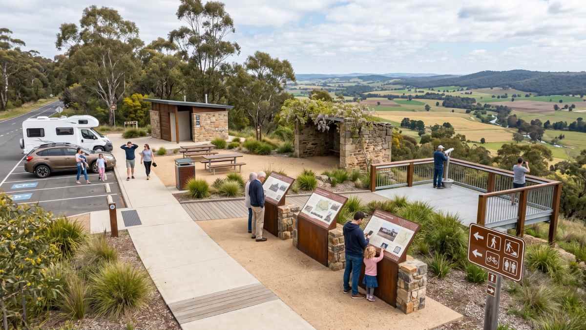
There have been several structural changes witnessed within self-drive tourism across Australia, New Zealand, and the Pacific region. Non-urban corridors, which used to be perceived merely as links from one urban location to another, have now turned out to be the main distribution channels for regional economic gains. In order to take advantage of new customer preferences for leisurely exploration, publicly-owned sites like lookouts, pioneer parks, and hiking trails have been enhanced via micro-destination development. With the help of collaborative governance, slow interpretation of heritage, accessibility for all, and destination hygiene, transit stops turn into valuable cultural attractions.
Background: The Structural Shift in Oceania’s Drive Tourism
Across the vast highway networks of Australia, New Zealand, and the broader Pacific region, self-drive travel has been shifted from a passive transit mechanism into a primary driver of regional economic distribution. Historically, non-metropolitan travel corridors were operated as simple connecting routes between major urban centres or coastal resorts. In this traditional model, regional towns and roadside lookouts were utilized merely as fuel stops or brief physical rest areas, with minimal economic yield being captured and limited engagement with local cultural heritage being offered.
Advertisement
Advertisement
This legacy dynamic is being subjected to profound structural changes. With consumer preferences being redirected toward authentic regional discovery, meaningful, unhurried, and immersive experiences outside congested primary tourist hubs are increasingly sought by domestic travellers. Unprecedented value has consequently been placed upon secondary destinations, niche heritage sites, and community-curated cultural landscapes. To ensure dispersing visitor expenditure is captured, micro-destination activation is being adopted by local government authorities, regional tourism organisations, First Nations groups, and local volunteer networks.
Targeted, low-cost physical and interpretive upgrades to small-scale public assets—including roadside lookouts, historic reserves, pioneer trails, and natural landmarks—are encompassed by micro-destination activation. Through collaborative stewardship, the implementation of slow heritage storytelling frameworks, and the enforcement of universal design accessibility standards, transient highway traffic is converted into long-dwell cultural stops. When high standards of destination hygiene are maintained—including well-kept public amenities, legible wayfinding, and clean roadside facilities—travel routes are positively influenced, overnight stays are extended, and sustainable economic returns are generated across regional Australia and New Zealand.
Advertisement
Advertisement
Collaborative Stewardship: Regional Advisory Councils and Co-Management Models
The long-term sustainability of regional tourism infrastructure is underpinned by governance frameworks through which municipal funding and local community care are bridged. Maintenance backlogs, vandalism, and neglect are frequently suffered by isolated roadside stops and rural heritage sites when management is carried out purely through top-down municipal approaches. Conversely, when structured partnerships are established between local councils, volunteer user groups, heritage societies, and Indigenous trusts, public assets are benefited by ongoing local oversight, reduced operational friction, and aligned capital investment.
Municipal Budget Allocations and Community Partnerships in Regional New South Wales
How micro-capital allocations activate local heritage assets through structured collaborative stewardship is demonstrated by municipal funding mechanisms in regional New South Wales. Targeted grant streams under the Community Investment Policy and Community Strategic Plan are utilized by Griffith City Council in the Riverina to support localized infrastructure projects. Capital improvements that directly enhance public amenity and site legibility are enabled through council funding programs, including annual Community Grants and Quick Turnaround Grants.
Advertisement
Advertisement
A prominent example of this community-led governance model is provided by the ongoing management of Scenic Hill and the Hermit’s Cave heritage complex in Griffith. Located on a lookout ridge overlooking the city, a historic series of stone shelters, stairways, living areas, and painted motifs constructed by Italian immigrant Valerio Ricetti is featured at Scenic Hill. The site has been heritage-listed and is coordinated through council management alongside local user groups. Through community initiatives like the “Our Hill” Scenic Hill Master Plan, residents are engaged to guide site improvements, trail connections, and heritage storyboards. Local ownership is fostered through community involvement in site maintenance and signage design, whereby vandalism is mitigated and path safety is preserved for visitors.
Bicultural Co-Management Frameworks in New Zealand
In New Zealand, micro-destination stewardship is anchored by formal co-management agreements entered into by local District Councils and iwi or hapū advisory boards. Following the Te Arawa Lakes Settlement Act 2006, environmental, cultural, and recreational assets across 14 regional lakes are jointly managed by the Te Arawa Lakes Trust, the Rotorua Lakes Council, and the Bay of Plenty Regional Council.
Advertisement
Advertisement
Site management and public communication are actively shaped by this bicultural co-governance model. Under the Rotorua Reorua (Bilingual Rotorua) policy, dual-language storyboards and trail wayfinding that elevate te reo Māori alongside English are co-designed by the council and the trust. Furthermore, environmental safety communications—such as public health advisories regarding toxic algal blooms across Lake Ōkaro, Lake Maraetai, and Lake Ohakuri—are coordinated jointly between municipal councils, Toi Te Ora Public Health, and iwi stewards. It is ensured through this co-management approach that public safety is maintained while traditional land stewardship is honoured.
Heritage Trail Restoration in Tasmania and the Derwent Valley
Similar collaborative models are operated across regional Tasmania, where municipal councils are partnered with community-led trail networks to restore historic timber-town footpaths and convict heritage corridors. In the Derwent Valley and regional hinterlands around Hobart, regular track maintenance and historical vetting for roadside interpretation markers are conducted by local volunteer associations. High infrastructure standards are maintained across low-yield travel corridors without municipal budgets being overextended.
Micro-Heritage Storytelling and Cultural Curation: Slow Heritage Interventions
Brief roadside stops are converted into long-dwell cultural sites through self-guided, low-tech interventions such as curated interpretation panels, dual-language signage, and QR-assisted audio guides. Through this approach, known as slow heritage, travellers are encouraged to engage deeply with local human narratives rather than geographic lookouts being passed through in haste.
Narrative Distillation: The Interpretive Framework
To ensure passing travellers are engaged, complex regional histories must be distilled into clear, highly readable narratives. Roadside panels are structured around a concise narrative arc supported by historical photography, diagrams, and digital extensions:
Advertisement
Advertisement
- Core Hook: An engaging statement highlighting a unique local historical event, person, or natural feature.
- Primary Narrative: A clear explanation of the site’s historical, agricultural, or cultural context without dense jargon.
- Modern Relevance & Digital Link: A conclusion linking past events to the contemporary landscape, accompanied by a QR code linking to detailed audio oral histories or archive documents.
Visitor behavior is significantly influenced when structured narrative panels are implemented. Static geographic lookouts are typically observed to retain visitors for brief intervals. In contrast, extended dwell times are achieved at lookouts equipped with curated, human-centered storyboards, whereby the likelihood of local cafes, shops, and service stations being patronized is heightened.
Interpreting Multi-Layered Histories in the Riverina and Outback Corridors
A compelling example of multi-layered heritage curation is provided by the Riverina region of New South Wales. Established as part of the Murrumbidgee Irrigation Area (MIA) vision planned by architects Walter Burley Griffin and Marion Mahony Griffin, the landscape was reshaped through large-scale water infrastructure. River water was directed through canal networks via the construction of Burrinjuck Dam, Berembed Weir, and Blowering Dam to establish an agricultural district.
Multiple distinct social groups are encompassed within the human narrative of this landscape. Following World War I, soldier settlement blocks were allocated to returning servicemen who faced severe economic challenges and compounding debt loads, leading to a historic protest march to WC&IC offices in 1923 led by S. Broome. Concurrently, fruit orchards, vineyards, and farms were established by waves of Italian immigrants arriving in the 1920s and post-WWII eras, through which deep cultural roots were established.
These historical layers are unified through integrated heritage walking trails such as those across Scenic Hill. How living areas, garden terraces, and stone stairways were built out of the cliff face over several decades by Valerio Ricetti is detailed on interpretive panels at the Hermit’s Cave complex. Scenic lookouts are converted into cultural destinations when individual human experiences are linked to broader regional history.
Outback and Remote Heritage Corridors
Similar interpretative strategies are deployed across remote driving routes. In Broken Hill and Dubbo, mining heritage and pioneer narratives are integrated into self-guided town walks. In Alice Springs, First Nations songlines are blended with early telegraph station communications history, allowing dual perspectives on landscape usage to be presented.
Across New Zealand’s South Island, along highway corridors near Nelson and Hokitika, West Coast goldfield history is highlighted alongside traditional pounamu (greenstone) gathering routes on community-designed panels. A richer understanding of regional heritage is offered to domestic road-trippers when Indigenous cultural perspectives are integrated with early industrial history.
Advertisement
Advertisement
Universal Design and Accessible Outdoor Infrastructure: Inclusive Interpretation
Physical accessibility, visual legibility, and inclusive design principles must be integrated into public sites when regional infrastructure is upgraded. It is ensured through universal design guidelines that outdoor heritage trails, lookouts, and public amenities remain accessible to all visitors, including aging travellers, multi-generational families, and individuals with mobility or visual impairments.
Technical Compliance: Australian Standard AS 1428
In Australia, public infrastructure design is governed by Australian Standard AS 1428 (Design for Access and Mobility), specifically AS 1428.1-2021. Safety and usability across public assets are ensured when these standards are applied to regional outdoor lookouts and heritage trails:
- Visual Indicator Strips: An unbroken, solid, opaque visual strip must be featured on glazed viewing panels, safety doors, and transparent barriers on lookouts, with the lower edge positioned above finished floor levels.
- Luminance Contrast: Contrast against surrounding background surfaces or natural environments must be achieved by visual strips, raised text, symbols, and signage graphics.
- Pathways and Circulation: Continuous accessible paths of travel with designated clear widths and wheelchair passing bays must be provided. Moderate walkway gradients and threshold ramps must be maintained, with step tolerances strictly limited.
- Clear Doorway Openings: Specified minimum clear opening widths must be provided at access points along public trail facilities.
Universal Design Implementations in Victoria and Canterbury
Universal design principles are being embedded into public parklands and trail networks across regional Victoria and Canterbury. Coastal paths and parklands in Bendigo, Ballarat, Geelong, and along the Surf Coast are being retrofitted with high-contrast signage, step-free viewing platforms, and accessible resting bays.
In New Zealand, accessible trail design has been prioritised within post-earthquake reserve upgrades by the Selwyn District Council in Canterbury. The construction of an accessible viewing platform adjacent to the Ashley Rakahuri Estuary car park was approved, and the completion of an accessible lookout trail was supported alongside the Ashley Gorge Advisory Group. Furthermore, at Harts Creek near Lake Ellesmere (Te Waihora), step-free access to a camouflaged bird hide viewing platform across wetland terrain is provided by boardwalks along a low-intensity walking track. Regional natural sites can thus be safely enjoyed by visitors of all physical capabilities.
Drive-Tourism Economic Impact and Destination Hygiene
Measurable economic returns are generated across regional drive markets by small-scale infrastructure upgrades. A significant market segment in Australia and New Zealand is constituted by domestic road-trippers. Driving routes, dwell times, and regional economic performance are directly influenced when roadside lookouts are enhanced, public amenities are maintained, and clear signage is installed.
Macroeconomic Impact and Domestic Drive Expenditure
The central role of domestic travel is highlighted by data from Tourism Research Australia (TRA). Substantial visitor expenditure is projected across both overnight trip spending and day trip spending nationally.
Advertisement
Advertisement
In regional sub-markets, self-drive travel functions as a vital economic engine. In Queensland’s Southern Queensland Country region—covering Toowoomba, the Granite Belt, Stanthorpe, and the Darling Downs—substantial annual visitor expenditure is contributed, directly sustaining regional employment and Gross Regional Product. Economic contributions are predominantly driven by intrastate travel and supplemented by domestic day trips.
Destination Hygiene Metrics and Highway Detour Rates
The decision of self-drive travellers to detour from primary highways onto secondary regional routes is heavily influenced by perceived destination hygiene. In regional destination management, physical maintenance, cleanliness, legibility, and visual presentation of public infrastructure are denoted by destination hygiene:
- Signage Clarity & Maintenance: Spontaneous highway detour rates onto secondary heritage trails are increased when high-legibility, standard-compliant tourist attraction signs are maintained.
- Public Amenity Standards: Higher ratings on digital platforms such as Google Maps and TripAdvisor are directly correlated with clean, modern rest stops and accessible toilet facilities. Higher review scores are consistently achieved by sites where high physical presentation is maintained.
- Organic Digital Promotion: Content capture and online sharing are encouraged by well-maintained signage, accessible platforms, and storyboards, whereby organic social media geotagging is generated and prospective travellers are guided toward regional touring routes.
A self-reinforcing economic loop is generated by upgraded micro-infrastructure in touring regions like the Granite Belt in Queensland, the East Coast circuit in Tasmania, and the Hawke’s Bay hinterland loop in New Zealand. Travellers are encouraged to linger at well-maintained roadside stops, leading to increased patronage of local bakeries, farm gates, cafes, and accommodations.
Regional Micro-Destination Implementation Framework
| Region & Jurisdiction | Governance & Advisory Framework | Asset Focus & Accessibility Upgrades | Strategic Outcome |
| Riverina, NSW (Griffith) | Griffith City Council & Scenic Hill Users Group | Hermit’s Cave complex, trail connections, and heritage storyboards | Transit traffic is converted into cultural dwell stops; vandalism is mitigated. |
| Rotorua, NZ | Rotorua Lakes Council & Te Arawa Lakes Trust | Rotorua Reorua dual-language wayfinding and environmental safety signage | Public health messaging is unified while traditional bicultural stewardship is honoured. |
| Selwyn District, NZ | Selwyn District Council & Local Advisory Groups | Ashley Rakahuri Estuary platform and Harts Creek step-free bird hide trail | Universal access across wetland and river reserves is established. |
| Granite Belt, QLD | Southern Queensland Country Tourism & Local Councils | Granite Belt Trail lookouts, Amiens Legacy Centre, and hygienic rest nodes | Highway detours are stimulated; local farm-gate and boutique expenditure is increased. |
Policy Implications, Industry Impact, and Future Outlook
Ongoing alignment between state tourism organisations, local government authorities, and grassroots community stakeholders is required for the strategic activation of micro-destinations across Oceania. As domestic drive travel expands, sustainable, accessible, and community-led infrastructure development must be prioritized within regional planning.
To ensure economic yield and community benefit are maximized across regional touring corridors, four strategic policy recommendations are proposed:
- Streamline Micro-Capital Funding Channels: Small-scale municipal grant streams should be expanded—modeled after programs like Griffith City Council’s Community Grants—enabling agile funding to be accessed by volunteer user groups and heritage trusts for site maintenance, signage updates, and path repairs.
- Mandate Universal Accessibility Audits: Compliance with Australian Standard AS 1428.1-2021 or New Zealand Universal Design Guidelines should be required for all outdoor regional tourism projects seeking state or federal funding.
- Formalize Bicultural Co-Management: Formal co-management structures should be expanded, drawing on precedents like the Te Arawa Lakes Trust, to ensure cultural narrative interpretation and land stewardship are guided by First Nations and Māori traditional owners.
- Deploy Hybrid Interpretation Infrastructure: Accessible physical panels should be combined with digital QR-assisted audio extensions, allowing rich oral histories to be accessed without physical landscapes being cluttered.
Highway transit routes can be transformed into high-value cultural corridors when investments are directed into community stewardship, accessible design, and curated storytelling.
Advertisement
Advertisement
Conclusion: Long-Term Viability of Regional Touring Networks
Routes for regional tourism become cultural corridors of high profitability due to the creation of microdestinations. It is when the approach of co-management of destinations, universal designs, and hygiene becomes the priority of local municipalities that the time spent and expenditures of tourists will be increased. In such a way, sustainability will be guaranteed.
Advertisement
