
Atlanta Aligns with Birmingham, Nashville, New York City, Boston and More as Sharp Weather Divide Brings Heavy Rain to the Southeast and Mid-Atlantic Across the US

Updated
Published
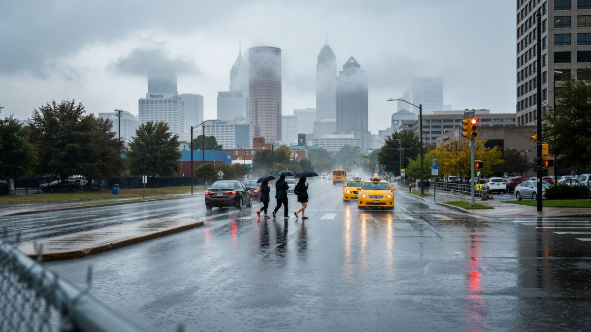
Image generated with Ai
Atlanta, Birmingham, Montgomery, Mobile, Jackson, Chattanooga, Nashville, Greenville, Charlotte, Charleston, Savannah, Raleigh, Richmond, Norfolk, Washington DC, Baltimore, Philadelphia, New York City and Boston face a sharp US weather divide this weekend. Heavy rain and heavy rain threats could affect the Southeast and Southeast coast, while the Mid-Atlantic may see storms move east. Meanwhile, New York City and Boston could enjoy a drier break. Atlanta, Birmingham and other major cities remain under close watch as thunderstorms develop. However, travellers should not assume conditions will be the same everywhere. This detailed US weather report explains what is coming, where risks are highest, and how weekend travel could change.
ATLANTA, BIRMINGHAM, CHARLOTTE and WASHINGTON DC are among the US cities preparing for a much wetter weekend as a slow-moving weather system pulls deep Gulf moisture across the Southeast and towards the Mid-Atlantic. Forecasters are warning of heavy rain, thunderstorms and localised flash-flooding risks, with some areas expected to receive several rounds of storms.
The weather picture will not be the same across the eastern United States. While Alabama, Georgia, Florida, the Carolinas and parts of the Mid-Atlantic face an increasingly unsettled weekend, much of the northern Northeast is expected to see a relative break from the wet weather. New York City could have a mostly sunny Saturday, while Boston is also forecast to remain largely dry through much of the weekend.
The sharp contrast is being created by a broad frontal system moving slowly across the region. Moisture from the Gulf of Mexico is being drawn northwards, giving thunderstorms access to a large supply of water. The US Weather Prediction Center has identified the central Gulf Coast, Mississippi, northern Alabama, northern Georgia and parts of the Tennessee Valley as the main areas of concern for excessive rainfall on Saturday.
Advertisement
Advertisement
For people travelling across the region, the difference could be significant. A weekend beach trip in the Florida Panhandle may be disrupted by thunderstorms and dangerous rip currents, while a road journey through Alabama or Georgia could face periods of intense rain and reduced visibility. At the same time, visitors to New York or Boston may find much more comfortable conditions.
Southeast Faces the Strongest Rainfall Threat
The greatest concern is currently focused across the southern United States, where the combination of moisture, thunderstorms and a slow-moving front could create conditions for very heavy rainfall.
Advertisement
Advertisement
The Weather Prediction Center has placed parts of the central Gulf Coast, Mississippi, northern Alabama and northern Georgia under a Slight Risk of excessive rainfall for Saturday. The risk also reaches into the Tennessee Valley. Forecasters say deep moisture will spread along and ahead of the frontal boundary, creating the potential for organised storms and high rainfall rates.
This does not mean that every location inside the risk area will experience flooding. Instead, the designation means that some locations have a greater chance of receiving rainfall that could exceed the amount the ground and drainage systems can handle.
That distinction is important because thunderstorms can produce very different conditions over short distances. One part of a city may receive only light rain, while another area could experience a much stronger storm within the same period.
The Weather Prediction Center’s Excessive Rainfall Outlook is designed to identify areas where rainfall could exceed flash-flood guidance within 25 miles of a point. Local National Weather Service offices then provide more detailed information for individual communities.

Image generated with Ai
Gulf Moisture Is Fueling the Storms
The main reason behind the weekend threat is the amount of moisture moving north from the Gulf of Mexico.
The Weather Prediction Center expects atmospheric moisture across parts of the Southeast to become unusually high. Precipitable water values could reach around two to two-and-a-half standard deviations above normal in parts of the region. That gives developing thunderstorms a large amount of water to work with.
Advertisement
Advertisement
The front moving through the area adds another important ingredient. It provides a boundary where warm, humid air can rise and thunderstorms can develop.
The result could be repeated rounds of showers and storms rather than one short period of rain. If storms repeatedly move over the same location, rainfall can build up quickly and increase the risk of flash flooding.
The Weather Prediction Center has also stressed that there is still some uncertainty over the exact location of the heaviest rainfall. Small-scale interactions between thunderstorms can change where the strongest rain develops.
Saturday Could Be the Critical Day for Alabama and Georgia
Saturday is expected to be particularly important across Alabama and northern Georgia.
In Birmingham, Alabama, the National Weather Service forecasts an 80% chance of precipitation on Saturday, with another 80% chance on Sunday. Showers and thunderstorms are possible during the period.
Birmingham’s location is important because northern Alabama sits within the area highlighted by the Weather Prediction Center for a higher excessive-rainfall risk. The combination of frequent storms and already wet ground could create difficult driving conditions in some locations.
Advertisement
Advertisement
Further south, Montgomery is also expected to become increasingly wet. The National Weather Service forecasts a 70% chance of rain on Saturday, rising to 90% on Sunday, with showers and possible thunderstorms.
In Atlanta, the weekend forecast is also becoming increasingly unsettled. The National Weather Service gives the city a 20% chance of showers and thunderstorms on Friday, increasing to 80% on Saturday and 90% on Sunday.
That makes Atlanta one of the most important cities to watch from a travel perspective.

Image generated with Ai
Atlanta Weather Could Affect Air Travel
The rainfall threat around Atlanta matters beyond the city itself because Hartsfield-Jackson Atlanta International Airport is a major connection point for domestic and international travellers.
Thunderstorms can interrupt normal airport operations. Aircraft may need to avoid storm cells, while ground operations can also slow when severe weather approaches an airport.
The Federal Aviation Administration said on 1 October that thunderstorms could cause delays in Florida and that low clouds could slow traffic in Atlanta. The agency also advises travellers to check directly with their airline for flight-specific information.
Advertisement
Advertisement
This does not mean that all flights through Atlanta will be delayed or cancelled. The impact will depend on where and when thunderstorms develop. However, travellers with tight connections may want to allow additional time because weather-related disruptions can spread through a busy aviation network.
Florida Panhandle Faces Rain and Beach Hazards
The weather threat also extends towards the Gulf Coast and Florida Panhandle.
The National Weather Service office in Mobile and Pensacola says widespread showers and thunderstorms are expected from Friday through Monday. It has identified a Level 2 of 4 Slight Risk for flash flooding on Saturday and Sunday.
The situation is particularly relevant for visitors heading to coastal destinations. The National Weather Service in Tallahassee is also warning of a high rip-current risk along parts of the Florida Panhandle, with the risk expanding across local beaches. Showers and thunderstorms are expected across the coastal area during the weekend.
That creates a double concern for tourists. Heavy rain can disrupt beach and outdoor plans, while rougher surf and rip currents can make swimming dangerous even during periods when the rain temporarily stops.
Panama City Beach and South Walton are among the coastal areas being watched closely. The local marine forecast indicates a high rip-current risk through the weekend alongside showers and thunderstorms.
Advertisement
Advertisement
Mississippi and Tennessee Also Face Repeated Storms
The rainfall corridor stretches beyond Alabama and Georgia.
In Jackson, Mississippi, the National Weather Service forecasts a 70% chance of showers on Sunday, with thunderstorms possible. The chance of rain continues into Monday.
Further east, Chattanooga, Tennessee, is expected to see a 70% chance of precipitation on Saturday and Saturday night, rising to 80% on Sunday. Showers and possible thunderstorms are expected to continue into Sunday night.
Nashville, however, shows how quickly conditions can vary within the wider region. The National Weather Service forecasts an 80% chance of showers and thunderstorms on Friday, followed by lower rain chances through the weekend and a return to sunny weather on Monday.
This difference highlights why broad regional forecasts cannot replace local updates. The storm system will move and change, and individual cities can experience very different conditions depending on the exact position of the frontal boundary.
Carolinas Could See the Rain Shift East
The rainfall threat is expected to spread farther east as the weekend progresses.
Advertisement
Advertisement
In Charlotte, North Carolina, the National Weather Service forecasts a 60% chance of showers and thunderstorms on Saturday, rising to 90% Saturday night. Sunday carries an 80% chance of showers.
The pattern is even wetter around Greenville, South Carolina. The city has a 70% chance of precipitation on Saturday, a 90% chance Saturday night and an 80% chance Sunday.
Along the coast, Charleston, South Carolina, has a 70% chance of showers and thunderstorms on Saturday and Saturday night, followed by an 80% chance on Sunday. The National Weather Service says rainfall on Saturday could reach between 0.1 and 0.25 inches, with higher amounts possible in thunderstorms.
The forecast also points to a wet weekend for Savannah, Georgia. The city has an 80% chance of precipitation on Saturday and Sunday, after already facing a high chance of rain on Friday.
For visitors, this could be a difficult weekend for outdoor sightseeing. Walking tours, beach visits and other open-air activities may need to be moved around periods of heavy rain.
Raleigh and Virginia Become More Important on Sunday
As the frontal system moves east, the focus gradually shifts towards the Mid-Atlantic.
Advertisement
Advertisement
In Raleigh, North Carolina, the National Weather Service forecasts a 50% chance of showers on Saturday, rising to 70% Saturday night and 90% Sunday. Rainfall on Saturday night could reach around a quarter to half an inch, with higher amounts possible in thunderstorms.
Richmond, Virginia, is also expected to become wetter. The National Weather Service forecasts a 60% chance of precipitation on Saturday, 70% Saturday night and 80% Sunday.
In Norfolk, Virginia, the chance of rain reaches 80% on Sunday and remains high into Sunday night.
The Weather Prediction Center expects the Marginal Risk for excessive rainfall to extend farther into the Mid-Atlantic and Southeast coast on Sunday. However, forecasters have highlighted greater uncertainty around the exact location of the heaviest rain at this stage.
Washington DC Could See a Wet Sunday
The capital region is expected to sit near the northern edge of the main rainfall area.
In Washington DC, Friday night has a 50% chance of rain, while Saturday is expected to be quieter with only a 20% chance. The chance rises to 60% on Sunday, when showers and a possible thunderstorm are expected.
Advertisement
Advertisement
This gives visitors a potentially better Saturday than Sunday.
The difference is important for tourists planning to visit the National Mall or other outdoor attractions. A flexible itinerary could allow visitors to make better use of the quieter period before the weather becomes more unsettled.
Nearby Baltimore also becomes wetter on Sunday. The National Weather Service gives the city a 60% chance of showers, mainly after 2pm. Monday is expected to turn mostly sunny.
Philadelphia, New York and Boston Get a Relative Break
Farther north, the weather story changes significantly.
Philadelphia is forecast to have a mostly sunny Saturday after a chance of showers Friday night. The chance of rain rises to 50% on Sunday.
In New York City, Saturday is expected to be mostly sunny after a 40% chance of rain Friday night. Sunday has a 40% chance of rain after 2pm, followed by mostly sunny weather on Monday.
Advertisement
Advertisement
Boston looks even quieter. The National Weather Service forecasts sunny weather on Saturday and mostly sunny conditions on Sunday, with only a 30% chance of showers Sunday night.
This does not mean the Northeast will be completely free of rain. Instead, it represents a major improvement compared with the Southeast.
For travellers, the difference could be noticeable. While visitors in the South may need to plan around thunderstorms and possible flooding, people visiting New York and Boston could have much more freedom to explore outdoors.
Why the Northeast Is Drying Out While the South Gets Wetter
The contrasting forecast is being driven by the movement of the frontal system.
The southern part of the system has access to deep Gulf moisture. That moisture helps produce showers and thunderstorms across the Southeast.
As the system moves east, the rainfall area expands towards the Carolinas and Mid-Atlantic. But farther north, the strongest part of the system does not bring the same level of moisture and storm activity.
Advertisement
Advertisement
That is why cities only a few hundred miles apart can have very different weekend forecasts.
The Weather Prediction Center expects the main southern-stream upper trough and its associated wet frontal system to move slowly east from the south-central United States. It also warns that forecast uncertainty remains above average because smaller-scale interactions between storms can influence the location of the heaviest rainfall.
Roads Could Become a Bigger Problem Than the Rain Itself
For most travellers, the biggest practical concern may not be the storm itself but what happens after several storms pass through.
Heavy rainfall can reduce visibility, create standing water and make roads difficult to use. In areas where several storms move across the same location, the risk of local flooding can increase.
This is particularly important across Alabama, Mississippi, northern Georgia and parts of Tennessee, where the official excessive-rainfall risk is higher.
Travellers driving through these areas should not rely only on a morning forecast. Conditions can change within hours, especially when thunderstorms develop.
Advertisement
Advertisement
The same applies to coastal travellers in Florida and the Carolinas. A temporary break in the rain does not necessarily mean beach conditions have become safe.
The Weekend Forecast Is Not Yet Set in Stone
Despite the broad weather pattern being clear, the exact location of the heaviest rain remains uncertain.
The Weather Prediction Center says forecast guidance has above-average spread. Small changes in how storms interact could alter the position of the strongest rainfall.
That means the current city forecasts should be treated as a developing picture rather than a final timetable.
The greatest confidence is in the broad pattern: the Southeast is expected to become wetter, the rainfall threat should move east, and the northern Northeast should see a relative break.
The details will become clearer as the system approaches.
Advertisement
Advertisement
A Sharp Weather Divide Could Shape Weekend Travel
The eastern United States is heading into a weekend of two very different weather stories.
Across the Southeast, heavy rain and thunderstorms could create problems from the Gulf Coast through Alabama, Georgia, the Carolinas and into parts of Tennessee. Some areas face an elevated risk of excessive rainfall and flash flooding, while coastal Florida also faces dangerous rip currents.
The threat then shifts east towards the Mid-Atlantic on Sunday. Washington DC, Baltimore, Richmond and Norfolk could see increasing rain chances, although the expected risk is generally lower than in the core Southeast rainfall zone.
Meanwhile, Philadelphia, New York and Boston are set for a relative weather break, particularly on Saturday. New York could remain mostly sunny for much of the day, while Boston is expected to see sunny conditions.
For travellers, the key message is to look beyond the national forecast and check the city-level picture before setting out. A journey through the Southeast could involve heavy rain, thunderstorms, flooded roads or coastal hazards, while a trip farther north may encounter much calmer conditions.
The weather system will continue to evolve through the weekend, and the exact location of the heaviest rain can still change. But one trend is already clear: the Southeast is preparing for a stormy weekend, while the Northeast gets a valuable window of calmer weather.
Advertisement
