
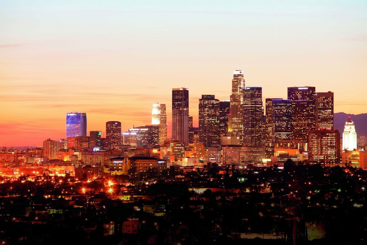
Los Angeles has developed a Game Route Network marking 369 miles of routes designated for Olympic and Paralympic traffic for 2028. The network comprise of 134 miles of local streets and 236 miles of freeways and connects athlete accommodations to competition and operational sites. Vehicles associated with the Games will have priority, and normal users may not have access to or be restricted to use of some lanes or streets. The network is along major corridors of Southern California (I-405, I-5, I-10, I-105, I-110, I-101 and I-210). However, the large closure of streets may not be the only concerning factor for travelers. The biggest concern will be the shift to regional travel that includes more walking and use of transit and shuttles.
The California Department of Transportation, or Caltrans, is developing a permit-controlled LA28 Games Route Network for the 2028 Games. The network will separate accredited Olympic and Paralympic movement from ordinary traffic on strategically important corridors.
Advertisement
The latest plans show that the system will not simply shut down entire motorways. Instead, authorities will temporarily dedicate selected lanes, roads, ramps and traffic-control infrastructure to Games operations. The approach aims to preserve everyday movement while giving athletes and other accredited personnel predictable journeys between venues.
That distinction matters for visitors. A traveller driving through Los Angeles will not necessarily encounter a closed motorway. However, the number of lanes available to ordinary traffic could change, while certain exits and local streets could operate under special restrictions.
Advertisement
Advertisement
Caltrans documents also indicate that the arrangements will be temporary. The current traffic-control plan envisages LA28 markings and signs being installed from 1 June 2028 to 1 September 2028, covering both the Olympic and Paralympic period.
| Network element | Current planning figure |
|---|---|
| Total Games Route Network | Approximately 369 miles |
| Freeway component | About 236 miles |
| Local-street component | About 134 miles |
| Olympic Games | 14–30 July 2028 |
| Paralympic Games | 15–27 August 2028 |
| Temporary LA28 traffic devices | 1 June–1 September 2028 |
| Wider Games region | Los Angeles, Orange and San Diego counties |
The network will connect the Olympic Village, accommodation locations, competition venues and other critical Games facilities. Its geography therefore reaches well beyond a single downtown sporting district.
For motorists, the most consequential element is the freeway component. Planning documents identify major Los Angeles corridors including I-5, I-10, I-101, I-105, I-110, I-210 and I-405, alongside several state routes.
The wider Southern California system also reaches into Orange County and San Diego County. Current planning material identifies routes including I-5, SR-55, SR-57, SR-73, SR-91 and I-405 in Orange County, plus I-5 in San Diego County.
Advertisement
Advertisement
The precise lane treatment will vary. Caltrans has considered converting existing HOV or toll lanes, general-purpose lanes and other roadway capacity into Games-dedicated lanes. Dynamic ramp metering, traffic-signal coordination and queue-management technology are also part of the operational toolkit.
That means the impact could differ dramatically between two motorists travelling on the same freeway. One direction might retain several general lanes, while another section could face a tighter traffic envelope during periods of intense Games movement.
The I-405 deserves particular attention because it already functions as one of Southern California’s most strategically important north-south corridors. It also connects major travel generators, including LAX, West Los Angeles, the UCLA area, the South Bay and Orange County.
Caltrans explicitly identifies I-405 as part of the Games Route Network. Existing construction planning also shows that Games preparations must coexist with major highway works before the sporting event begins.
For visitors staying around Santa Monica, West Los Angeles, Beverly Hills or the UCLA area, the implications could therefore extend beyond Olympic venue trips. Airport transfers, hotel movements, business travel and sightseeing journeys could all encounter altered traffic patterns.
The important point is timing. The network will operate during a concentrated international event, when demand will rise across multiple corridors simultaneously. A modest reduction in ordinary road capacity can therefore have larger consequences when several venue clusters become active on the same day.
The impact will not stop at the freeways. Sunset Boulevard near UCLA is among the prominent local corridors identified in current reporting on the network.
This is especially significant because UCLA will serve as the Olympic Village. Athletes will remain there for several weeks, creating a constant movement requirement between accommodation and competition sites.
The route design reflects a fundamental Olympic requirement: athletes cannot travel like ordinary commuters. Competition schedules are fixed, venues are geographically dispersed and security arrangements impose additional constraints.
The dedicated network therefore creates a controlled mobility spine around the Games. For residents and tourists, however, that spine could temporarily change the way they cross neighbourhoods surrounding UCLA and other major venues.
Motorists will need to learn a new visual language before the Games begin. Caltrans has developed a special light-blue LA28 identification system for signs and pavement markings.
The markings will identify priority lanes and restrictions associated with the Games Route Network. Some signs are expected to carry the words “PERMIT ONLY”, making the distinction from ordinary lanes explicit.
This is more than cosmetic signage. Authorities want drivers to recognise the Olympic designation quickly while travelling at freeway speeds.
Current reporting says motorists entering restricted Olympic lanes without the required authorisation could face a fine approaching $300. Travellers renting cars should therefore pay close attention to temporary signage rather than assuming a familiar HOV or express lane remains available.
Los Angeles is pursuing an unusual solution to a familiar problem. Rather than building a vast new highway system for a three-month sporting window, authorities are trying to make the existing network operate differently.
That fits the broader LA28 mobility philosophy. SCAG’s latest strategic plan focuses on transportation-demand management, regional communications, wayfinding, mobility programmes and regulatory measures. The objective is to change travel behaviour rather than depend entirely on additional road capacity.
The region must continue serving nearly 19 million residents while accommodating visitors, Games personnel and freight. It must also maintain access to Southern California’s major ports and commercial supply chains.
Consequently, the Olympics represent a regional logistics exercise rather than a conventional sporting-event traffic plan.
Metro expects approximately one million additional trips every day during the Games. That figure explains why the road strategy cannot operate in isolation.
The agency is developing a Games Enhanced Transit Service, or GETS, to supplement normal bus and rail operations. The temporary network will connect stations, park-and-ride locations and venue areas through additional buses and shuttles.
Metro also wants ticketed spectators to reach competition venues by public transport, walking or cycling wherever practical. That ambition is central to the strategy because every visitor who leaves a private vehicle behind creates additional capacity for essential journeys.
| Pressure | Planned response |
|---|---|
| Olympic vehicle movements | Dedicated Games Route Network |
| Around 1 million extra daily trips | Games Enhanced Transit Service |
| Venue-area congestion | Bus priority and mobility hubs |
| Private-car demand | Travel-demand management |
| Wayfinding confusion | LA28 signs and regional information |
| Freight disruption | Dedicated freight planning |
| First/last-mile problems | Walking, cycling and local connections |
The strategy therefore depends on several systems working simultaneously. A dedicated Olympic lane alone cannot solve a regional congestion problem.
The 2026 FIFA World Cup has provided Los Angeles with a useful real-world experiment before LA28 arrives.
Metro’s special World Cup service generated 212,865 rides directly to and from Los Angeles Stadium and 15 parking and transit hubs during the eight matches held in Los Angeles and Orange counties. The tournament also increased overall Metro use.
That experience has strengthened the argument for a transit-heavy Olympics. Transportation experts have pointed to the World Cup as evidence that visitors can shift towards buses and trains when service is frequent, clearly organised and connected to major venues.
However, the Olympics will present a different scale and rhythm. Olympic competitions run across many venues and disciplines, while spectators, workers, media and athletes move according to different schedules.
The World Cup therefore offers confidence, not a guarantee.
Los Angeles also has an unusually relevant historical benchmark. During the 1984 Olympics, the region achieved strong public-transport use despite having a far smaller rail network.
Metro notes that Los Angeles had no rail transit, commuter rail or bus-only lanes when it hosted the 1984 Summer Games. Today, the region has an established rail and bus network, including almost 50 miles of bus-only lanes.
The difference is strategically important. Organisers are not starting from the same transportation base as 1984.
Instead, LA28 planners are attempting to combine rail, buses, dedicated lanes, mobility hubs and active transport with temporary Games-only road controls.
Metro’s wider Olympic preparation programme includes 28 projects valued at approximately $20 billion. The agency currently reports 39% of those projects as completed, 25% under construction and 36% in design.
That investment matters for travellers because the Olympic transportation plan is not limited to temporary restrictions. Bus-priority corridors, station improvements, pedestrian infrastructure and cycling connections are intended to remain after the Games.
The long-term ambition is therefore bigger than moving athletes on time. Los Angeles wants the event to accelerate a structural shift in how people move around the region.
For international visitors, that could ultimately mean a more useful public-transport network after the Olympic crowds disappear.
The Games Route Network will also receive a technological upgrade. Caltrans planning includes closed-circuit television cameras, wireless communications, traffic-signal improvements and active traffic-management gantries.
These systems will help authorities monitor traffic conditions and adjust operations. Dynamic ramp metering and signal synchronisation could help manage queues when Games vehicles create sudden demand on particular corridors.
Some infrastructure will have a legacy beyond the Games. Caltrans’ broader programme includes permanent technology installations that can improve traffic monitoring after LA28.
That makes the Olympic network more than a temporary traffic experiment. It is also becoming a testbed for smarter regional road management.
Tourists are not the only people who need reliable roads. Los Angeles and surrounding counties depend on enormous freight flows, including movements linked to the region’s major ports.
SCAG has therefore incorporated freight transportation-demand management into its Games planning. The aim is to keep commercial deliveries moving while visitor demand peaks.
This will matter to hotels, restaurants, retailers, airports and attractions. A road network that moves visitors efficiently but disrupts deliveries could simply transfer congestion from one part of the tourism economy to another.
Businesses may consequently need to adjust delivery windows, employee schedules and routing well before July 2028.
For visitors, the most important lesson is simple: do not plan an LA28 itinerary around driving alone.
Travellers staying outside central venue clusters should examine rail connections, shuttle options and hotel locations before booking. Airport transfers deserve particular attention because LAX sits within a region where several Games-related corridors converge.
Rental-car users should also avoid assuming that a familiar route will function normally during the Games. Temporary lane assignments, Olympic restrictions and special-event traffic controls could alter journey times substantially.
Sightseeing itineraries should likewise allow more flexibility. A traveller attempting UCLA, downtown Los Angeles, Inglewood and Long Beach in one day could face a very different mobility environment from today’s.
Despite the headline-grabbing mileage figure, the final operating blueprint is not yet frozen.
Caltrans’ own documents acknowledge that security reviews can result in changes to the Games Route Network. SCAG also states that its Games mobility map is a planning document and will continue to evolve as new information becomes available.
That means travellers should treat today’s route map as a strong planning signal rather than a final road-closure timetable.
The operational details will become more useful as authorities determine precisely which lanes operate exclusively, when restrictions begin each day, which ramps face controls and how enforcement works.
The transportation strategy also depends on delivering projects and services on schedule. Congress approved $94.3 million in mobility-related funding for Metro’s Games preparations, supporting work including GETS, station improvements, mobility hubs and Games Route Network design.
Caltrans has meanwhile moved the physical GRN programme towards procurement. Its contracting records show a $163.388 million Games Route Network Improvements job-order contract advertised in July 2026.
The delivery timetable matters because the Games have a fixed opening date. Unlike ordinary infrastructure programmes, authorities cannot simply postpone the deadline if a component slips.
The eventual disruption will depend on something broader than the Olympic lanes themselves. Travel behaviour will determine whether the strategy succeeds.
If spectators embrace rail, buses and shuttles, authorities can dedicate road capacity to Games movements while preserving a workable network for residents. If too many visitors continue using private cars, the remaining general-traffic lanes could absorb substantial additional pressure.
SCAG’s latest strategy therefore emphasises employer engagement, off-peak travel, freight coordination, communications and shared mobility. The goal is to influence when and how people travel before congestion becomes a crisis.
That is perhaps the most important point for travellers. LA28 will not simply change roads. It will attempt to change the behaviour of an entire metropolitan region for several weeks.
The safest assumption for international travellers is that Los Angeles will operate under a special mobility regime during the Games.
The Olympic period runs from 14 to 30 July 2028, followed by the Paralympics from 15 to 27 August. Special LA28 traffic-control devices are currently planned to operate across a wider window from 1 June through 1 September.
Visitors should therefore expect temporary restrictions, special signs, dedicated transport services and heavier demand around venue clusters. They should also build additional time into airport transfers and cross-city journeys.
At the same time, the situation is not necessarily a recipe for permanent gridlock. Los Angeles is deliberately trying to prevent that outcome through transit expansion, dedicated Games movement and demand management.
Planning for the 2028 Olympics in California may create one of the most extensive systems of roadways for public transportation in the United States. Fortunately for the organisers of the Olympics, the LA Metro system anticipates an increase of up to 1 million additional trips per day from current levels.
The biggest gamble is having millions of spectators and residents adjust the ways in which they travel while priority use of space is reserved for Games traffic. The 1984 Olympic Games and the 2014 FIFA World Cup demonstrate the increased use of public transportation for spectators.
Travellers will have to prepare more than ever before. The best travel itinerary for the LA28 Olympic Games will depend more on transportation system superiority, rather than speed of travel. The contest will depend on how travellers utilise the public transportation system of Los Angeles (a combination of trains, shuttles, and scheduled buses) and timings of travel that allow efficient connections to be made on foot. The outcome of this shift in public transportation may sustain travel efficiencies long after the Olympic Games have concluded.
Advertisement
Tags: Games Route Network, LA28, Los Angeles Olympics 2028, Los Angeles traffic, Olympic road closures
Advertisement
Advertisement












Saturday, September 5, 2026

Saturday, September 5, 2026
Saturday, September 5, 2026

Saturday, September 5, 2026

Saturday, September 5, 2026

Saturday, September 5, 2026

Saturday, September 5, 2026

Saturday, September 5, 2026



