
Mediterranean Holiday Plans at Risk as Extreme Rain and Flooding Sweep Through Top Tourist Hubs Like Crete, Cyprus, and More

Published
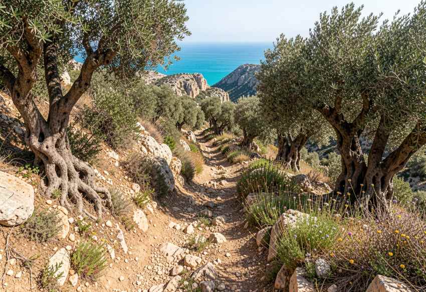
Severe weather is disrupting several popular Mediterranean destinations, with Crete emerging as the hardest-hit tourism hotspot, while southern France, Cyprus, Sardinia, Sicily, coastal Turkey and parts of the northern Adriatic are also facing heavy rain, thunderstorms, flooding risks and strong winds. The impacts vary sharply by destination. Some areas are dealing with damaged roads, flooded communities and disrupted excursions, while others remain under weather warnings with a risk of short-term travel delays. Travelers heading to the Mediterranean should therefore monitor local forecasts, transport updates and civil protection notices rather than assume the entire region is experiencing the same level of disruption.
Popular Mediterranean Destinations Facing Severe Weather
| Popular destination | Country | Recent/active period | Severe-weather threat | Official severity / evidence | Main effects recorded or expected | Likely travel and tourism impact | Current assessment |
|---|---|---|---|---|---|---|---|
| Crete – Heraklion, Chania, Rethymno, Lasithi, Ierapetra | Greece | 30 Sept–early Oct 2026 | Torrential rain, flash floods, thunderstorms, landslides, strong winds | Greek Civil Protection repeatedly warned of powerful rain and thunderstorms; Copernicus emergency mapping was activated after flooding damaged infrastructure and transport networks. | Flooded roads, damaged bridges, mudslides, power cuts, property damage, vehicles swept away, extensive agricultural damage | Very high: road closures, difficult airport transfers, inaccessible rural attractions, ferry disruption and outdoor-tour cancellations | Most seriously affected Mediterranean tourism hotspot researched |
| Samaria Gorge and western Crete | Greece | 1–5 Oct | Extreme rainfall and flooding | Workers became stranded inside Samaria Gorge as floodwaters covered trails; western Crete continued receiving substantial rainfall. | Trails flooded, access compromised, mountain streams swollen | Very high for hiking tourism; gorge visits and excursions vulnerable to closure | Major outdoor-tourism disruption |
| Lasithi Plateau and eastern Crete | Greece | Early Oct | Exceptional rain, flooding and mud | About 440 mm of rainfall in two days was reported on the Lasithi Plateau; large areas were inundated. | Mud-covered farmland, damaged local infrastructure, swollen reservoir inflows | Serious disruption to sightseeing, rural driving and excursions | Severe |
| Gulf of Lion – Hérault, Gard, Languedoc | France | 29 Sept–early Oct | Mediterranean rain episode, violent storms, flash flooding | Gard and Hérault were placed under red rain-flood vigilance during the late-September episode. Météo-France described the event as remarkable, with torrential rainfall, flooding and sudden river rises. | Flood-prone roads, overflowing waterways, dangerous driving conditions | Potential road and rail problems affecting travellers around Montpellier, Nîmes and the wider Languedoc coast | High recent impact |
| Montpellier and surrounding Hérault tourism zone | France | Late Sept–early Oct | Torrential rain and thunderstorms | Hérault was among the red-alert areas during the Mediterranean episode; further stormy weather returned around the Gulf of Lion in early October. | Local flooding and sudden water accumulation | Outdoor attractions, beach plans and road travel can be disrupted rapidly | Elevated risk during Mediterranean rain episodes |
| Corsica | France | 5–7 Oct | Thunderstorms and heavy rain | Météo-France reported renewed thunderstorms over Corsica with locally significant rainfall, including sustained rainfall on the east of the island. | Localised flooding and difficult mountain/coastal driving possible | Hiking, boat trips and road touring vulnerable to short-notice disruption | Active unsettled conditions |
| Cyprus – northwest, inland and mountain districts | Cyprus | 6 Oct 2026 | Heavy thunderstorms, hail, strong gusts | Cyprus Department of Meteorology issued a yellow thunderstorm warning, forecasting rainfall rates locally above 35 mm per hour, hail and strengthening winds. | Local flooding, lightning and sudden hazardous driving conditions possible | Short-term disruption to road trips and outdoor activities; coastal resorts less uniformly affected | Active official warning |
| Sardinia | Italy | Early Oct | Thunderstorms, locally heavy rainfall, rough seas | Italy’s Civil Protection forecast thunderstorms over Sardinia, with locally moderate to potentially high rainfall totals in western parts; Sardinian authorities also issued adverse-weather notices. | Localised surface flooding, difficult roads and rougher marine conditions | Boat trips and coastal travel can face disruption; western and northern areas deserve greater attention | Moderate/elevated |
| Sicily | Italy | Late Sept–early Oct | Thunderstorms and hydrogeological risk | Sicily’s Civil Protection published repeated hydrogeological-risk notices between late September and early October. Italy’s national Civil Protection also maintains ongoing warning bulletins. | Flash-flood and drainage problems possible during intense cells | Local road closures and excursion disruption possible, particularly in flood-prone terrain | Recurring weather-risk environment |
| Sicily, Sardinia and Calabria | Italy | Major event in Jan 2026; continuing recovery relevance | Extreme winds, intense rainfall, storm surge | Italy declared a 12-month emergency following January 2026 extreme weather that produced flooding, landslides, coastal damage and damage to transport infrastructure in Sicily, Sardinia and Calabria. | Roads, infrastructure, coastline and services damaged | Shows the growing vulnerability of major southern Italian destinations to powerful Mediterranean cyclonic episodes | Important 2026 severe-weather precedent |
| Antalya | Türkiye | Sept 2026 | Heavy rain, thunderstorms and flash-flood risk | Turkish Meteorological Service warned repeatedly of locally strong rain around Antalya, including 20–50 kg/m² in eastern Antalya and heavier episodes elsewhere in the southwest. | Flash floods, landslides, lightning and transport disruption possible | Resort transfers, excursions and coastal roads can be interrupted during intense thunderstorms | Significant recent risk |
| Muğla – Bodrum, Marmaris, Fethiye region | Türkiye | 27–28 Sept | Severe thunderstorms and heavy rainfall | Turkey’s meteorological authority forecast 21–50 kg/m² in Muğla, warning of flash floods, flooding, hail, lightning and transport disruption. | Local flash flooding and dangerous road conditions | Potential disruption for Dalaman transfers, coastal driving, boating and resort excursions | Strong recent warning |
| Izmir / Aegean tourism region | Türkiye | Late Sept | Thunderstorms, heavy rain and strong winds | Official forecasts called for locally strong rainfall around parts of the Izmir region and winds of around 40–60 km/h, with flooding and travel disruption among the listed risks. | Flooding, hail, lightning and wind | Road trips and ferry/coastal activities vulnerable | Recent elevated risk |
| Slovenian Adriatic – Koper, Piran, Portorož area | Slovenia | Forecast around 8 Oct | Heavy rain and thunderstorms | ARSO forecast 25–50 mm of rain in 24 hours for southwest Slovenia, alongside thunderstorms, intense local rainfall and possible flash flooding. | Torrential streams, surface flooding and overflowing watercourses possible | Road travel, coastal touring and outdoor sightseeing could face short-term interruption | Emerging near-term risk |
| Croatian Dalmatia – Split/Dubrovnik coast | Croatia | 6 Oct | Currently quieter after previous wind events | Croatia’s DHMZ showed no general weather warnings on 6 October. A previous September warning for Middle and South Dalmatia had gusts of 65–100 km/h and explicitly warned that some ferry lines might not operate. | Earlier rough-sea/ferry risks; currently much calmer | Normal travel conditions currently more likely than in Crete or southern France | Not a major current severe-weather hotspot |
| Mallorca, Menorca and Ibiza | Spain | 6–7 Oct | Showers and thunderstorms | AEMET forecasts showers and thunderstorms but no current marine warning for the Balearic coastal waters through the relevant period. | Short-lived rain and thunder may disrupt outdoor plans | Flights and ferries are not presently under the same level of weather pressure as Crete | Watch rather than severe |
| Valencia, Alicante and Murcia coast | Spain | 6–7 Oct | Overnight showers and thunderstorms | AEMET forecasts thunderstorms along the Valencia, Alicante and Murcia coast but states that no coastal warning conditions are expected. | Local wet roads and temporary storm disruption possible | Generally limited unless storms intensify | Low-to-moderate current concern |
Why Is Crete Facing the Most Serious Weather Disruption?
Crete currently stands out as the Mediterranean destination facing the most severe weather-related disruption. Intense rainfall has affected several parts of the Greek island, including Heraklion, Chania, Rethymno and Lasithi. Flooding has damaged roads, affected local infrastructure and created difficult driving conditions in both urban and rural areas.
The Lasithi Plateau recorded especially heavy rainfall, with around 440 millimeters reported over a two-day period. Such rainfall can overwhelm drainage systems, swell streams and cut access to smaller villages. Mountain routes are particularly vulnerable because water, mud and debris can quickly block roads.
The tourism impact is significant because Crete depends heavily on road travel between resorts, airports, beaches and inland attractions. Even when airports remain operational, travelers may struggle with transfers if access roads become flooded.
Advertisement
Advertisement
Outdoor activities are also exposed. Hiking routes, mountain excursions and rural sightseeing can be suspended when authorities consider conditions unsafe.
How Are Floods Affecting Outdoor Tourism Across Crete?
Outdoor tourism has become one of the most vulnerable sectors during the current severe weather in Crete. Hiking areas, gorges and mountain roads can become dangerous very quickly when intense rain falls across steep terrain. Samaria Gorge and other well-known walking destinations are particularly sensitive because narrow passages and water channels can fill rapidly.
Advertisement
Advertisement
Flooding also creates problems beyond the trails. Roads connecting tourist villages to mountain attractions can become blocked by mud, fallen rocks or running water. This can force tour operators to cancel excursions even if rainfall has already stopped.
Visitors staying in coastal resorts may see relatively calm local conditions while inland areas remain hazardous. That contrast can create confusion, especially for travelers planning day trips independently.
Authorities generally prioritize safety when there is a risk of flash flooding. Travelers should avoid entering gorges, riverbeds or steep rural areas during active weather warnings. Rental car users should also avoid attempting to cross flooded roads, where water depth and road damage can be difficult to judge.
Why Has Southern France Become Another Major Weather Concern?
Southern France has also faced serious Mediterranean weather, especially around Hérault and Gard. These areas experienced intense rain, thunderstorms and sudden flooding during a powerful Mediterranean rainfall episode. Red-level rain and flood warnings were issued, reflecting the potential for dangerous conditions.
The affected region is important for tourism because it includes major travel corridors near Montpellier, Nîmes and the Languedoc coast. It also sits close to the Camargue and routes linking the Mediterranean coast with Provence.
Heavy rain can disrupt road travel, regional trains and access to smaller coastal or rural destinations. Flash floods are particularly dangerous because they can develop rapidly when storms remain over the same location.
Advertisement
Advertisement
The tourism effect may be temporary in some areas, but the risk is highly localized. One town may experience only heavy showers while another nearby location faces flooded streets or rising rivers.
Travelers should therefore rely on municipal alerts, regional transport notices and Météo-France warnings before starting road trips during unstable weather.
What Is Making Corsica Vulnerable to Severe Weather?
Corsica is vulnerable because of its combination of steep mountains, narrow valleys and exposed coastline. During periods of intense Mediterranean thunderstorms, heavy rain can quickly create dangerous conditions across both inland and coastal areas.
Recent weather patterns have brought renewed thunderstorms and significant rainfall to parts of the island. Eastern Corsica is particularly exposed when moist air is pushed against the island’s mountainous terrain, increasing rainfall over a relatively small area.
This matters for tourists because Corsica’s road network includes winding mountain routes, bridges and narrow coastal roads. Heavy rain can make driving difficult and increase the risk of rockfalls, standing water and temporary closures.
Boat trips, sailing excursions and hiking can also be affected by strong winds and thunderstorms.
Advertisement
Advertisement
Corsica remains a popular destination for independent travelers, many of whom rely on rental cars. That makes weather awareness especially important. Visitors should build flexibility into itineraries and avoid assuming that conditions in Ajaccio, Bastia or coastal resorts will reflect conditions in the mountains.
Why Is Cyprus Under Increased Thunderstorm Risk?
Cyprus has faced an elevated thunderstorm threat, with official warnings covering heavy rain, hail and strong wind gusts. Rainfall rates above 35 millimeters per hour have been possible in some areas, creating a risk of localized flooding.
Thunderstorms in Cyprus can be intense but highly uneven. Coastal resort areas may experience only brief rain while inland or mountain districts receive much heavier downpours.
The main travel concern is road safety. Sudden storms can reduce visibility, flood low-lying roads and create hazardous driving conditions within minutes. Visitors exploring the Troodos Mountains or inland villages may face a higher risk than those remaining along the coast.
Lightning and hail can also disrupt outdoor sightseeing and excursions.
For tourists, the key is to monitor short-term forecasts rather than depend only on daily weather summaries. Mediterranean thunderstorms can develop quickly, and conditions may change between morning and afternoon.
Advertisement
Advertisement
Cyprus remains open to tourism, but travelers should treat active warnings seriously and be prepared to adjust road trips or outdoor plans.
How Are Sardinia and Sicily Being Affected?
Sardinia and Sicily are both exposed to autumn Mediterranean storms, although the severity can vary considerably by region. Sardinia has faced thunderstorms, locally heavy rainfall and rougher sea conditions, while Sicily has remained under recurring hydrogeological monitoring because of the risk of heavy rain and localized flooding.
These islands are especially sensitive to short, intense rainfall because dry ground and steep terrain can produce rapid surface runoff.
For tourists, that can mean flooded streets, temporary road closures and disruption to coastal excursions. Ferry and boat services can also face delays when strong winds create rough seas.
Sicily has already experienced damaging extreme weather earlier in 2026, including storms that affected infrastructure and coastal areas. Sardinia has also dealt with severe conditions during previous episodes.
This history matters because weakened infrastructure can remain vulnerable during later storms.
Advertisement
Advertisement
Travelers should check local civil protection bulletins, particularly before driving through rural districts or planning excursions to mountain areas, archaeological sites or exposed coastal locations.
Why Are Turkey’s Mediterranean and Aegean Resorts at Risk?
Turkey’s Mediterranean and Aegean coasts are also experiencing periods of severe weather risk, especially around Antalya, Muğla and Izmir. Official forecasts have warned of locally heavy rainfall, thunderstorms, hail and strong winds.
These regions include some of Turkey’s most popular tourism centers, including Antalya, Bodrum, Marmaris and Fethiye. Their popularity means that even localized storms can affect large numbers of visitors.
Flash flooding is one of the biggest concerns. Resort areas with steep hills behind the coast can receive rapid runoff during intense rain. Streets, underpasses and low-lying roads can flood quickly.
Storms may also affect airport transfers, especially around Dalaman and Antalya, where many travelers rely on road transport between airports and coastal resorts.
Boat tours and ferry services are another vulnerable sector when winds strengthen.
Advertisement
Advertisement
The weather does not necessarily make the entire Turkish coastline unsafe, but travelers should check local warnings before driving or joining excursions during unstable conditions.
Is the Slovenian Adriatic Facing an Emerging Threat?
The Slovenian Adriatic is facing an emerging weather risk as forecasts point to heavy rain, thunderstorms and the possibility of flash flooding in southwest Slovenia. Areas around Koper, Piran and Portorož are among the country’s most important coastal tourism destinations.
Forecast rainfall totals of 25 to 50 millimeters within 24 hours may not appear extreme compared with the totals seen in Crete, but local conditions can still become dangerous if thunderstorms concentrate rain over a small area.
The region’s short rivers and streams can respond quickly, increasing the possibility of sudden flooding.
Road travel may also become difficult during intense rain, especially on routes connecting the coast with inland Slovenia and neighboring Italy or Croatia.
Tourism disruption would most likely be short-term and localized. However, travelers staying along the Slovenian coast should remain aware of official alerts because severe thunderstorms can develop rapidly.
Advertisement
Advertisement
Flexible schedules are particularly useful for travelers planning outdoor sightseeing, cycling or day trips.
Are Croatia and the Balearic Islands Facing the Same Level of Danger?
No. Croatia and Spain’s Balearic Islands are not currently facing the same level of severe-weather disruption as Crete or parts of southern France. Conditions remain more stable overall, although thunderstorms and strong winds can still occur.
Croatia’s Dalmatian coast has experienced strong wind episodes in recent weeks, including conditions capable of disrupting ferry services. However, recent official warnings have been less severe than those affecting Greece or southern France.
The Balearic Islands, including Mallorca, Menorca and Ibiza, have also seen forecasts for showers and thunderstorms, but there has not been an equivalent widespread severe-weather emergency.
This distinction is important for travelers and tourism reporting.
The Mediterranean is a large region, and weather conditions differ sharply from one destination to another. A major flood emergency in Crete does not mean that Mallorca, Dubrovnik or Split is experiencing the same conditions.
Advertisement
Advertisement
Travelers should avoid broad assumptions and instead check destination-specific forecasts, ferry notices and transportation updates.
Why Is Autumn Such a Dangerous Weather Period in the Mediterranean?
Autumn is one of the Mediterranean’s most volatile weather periods because the sea often remains warm while cooler air begins moving south from Europe. This temperature contrast can create highly unstable atmospheric conditions.
Warm seawater provides moisture. When that moisture rises into colder air, powerful thunderstorms can form. If the weather system moves slowly, storms can repeatedly develop over the same location.
That is when rainfall becomes especially dangerous.
Flash floods can form in dry riverbeds and narrow valleys. Urban drainage systems can become overwhelmed. Mountain slopes may become unstable. Strong winds can also create rough seas and interrupt ferry traffic.
Climate patterns and warmer sea temperatures can increase the amount of moisture available to storms, although each severe-weather event has different causes.
Advertisement
Advertisement
For tourists, the practical lesson is straightforward. Autumn Mediterranean travel remains attractive, but weather flexibility is increasingly important. Travelers should monitor short-term warnings and avoid rigid outdoor itineraries during unstable periods.
What Should Travelers Do Before Visiting Affected Mediterranean Destinations?
Travelers do not necessarily need to cancel Mediterranean trips because of severe weather, but they should prepare more carefully. The first step is checking official weather warnings for the exact destination rather than relying only on general weather apps.
Visitors should also monitor airlines, ferry companies and local transport operators. A destination may remain accessible while specific roads, excursions or ferry routes are temporarily disrupted.
Rental car users should be especially cautious. Flooded roads should never be crossed, even when the water appears shallow. Fast-moving water can hide damaged pavement or carry vehicles away.
Travel insurance is also worth reviewing before departure. Policies differ in how they treat weather disruption, cancellations and missed connections.
Most importantly, travelers should maintain flexible plans.
Advertisement
Advertisement
Crete currently deserves the greatest attention, followed by southern France and other areas under active weather alerts. Conditions can improve quickly, but severe Mediterranean storms can also intensify with limited warning.
Crete currently faces the greatest disruption, while southern France, Cyprus, Italy and coastal Turkey remain vulnerable to further storms. The answer for travelers is careful planning rather than panic. Check official weather alerts, ferry schedules, road conditions and airline updates before moving between destinations. Avoid flooded roads and exposed coastal areas during warnings. The reason is simple. Mediterranean storms can be highly localized yet extremely powerful. Flexible itineraries and reliable information can reduce disruption and improve safety.
Advertisement
