

New Zealand Sparks a Cruise Tourism Revolution as Auckland and More Put Local Shops First to Boost Independent Businesses

Published
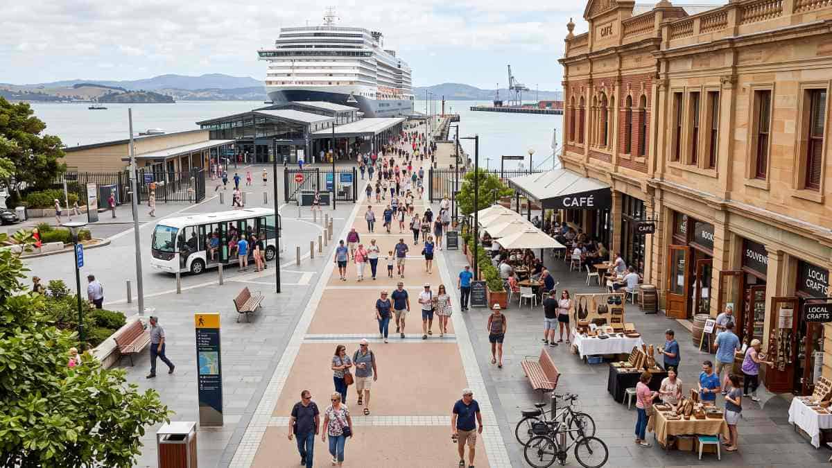
For years, regional cruise tourism has been characterised by massive financial leakage where funds generated through passengers’ expenditure are leaked out of port towns through multinational corporations and off-shore tours monopoly firms. In Australia and New Zealand, there has been a formal process of implementation of an operational process called the sovereign port-to-pavement model. It has seen the creation of city transit circuits, spatial navigational systems, and merchant associations through which the footfalls coming out of the cruise ships can be led into autonomous shopping centres.
The Emergence of the Port-to-Pavement Cruise Framework
For more than three decades, an extraction-heavy shore excursion model was operated across regional Oceania by the international cruise sector. Under conventional operating agreements, disembarking guests were directed by global cruise corporations into tightly controlled commercial corridors, wherein partnerships were maintained with wholesale excursion aggregators who chartered fleets of coaches to transport passengers directly from wharf aprons to isolated attractions. Severe economic leakage was produced by this legacy framework, with the majority of total shore excursion spending being siphoned off through shipboard commissions, foreign ticketing platforms, and offshore intermediaries. The environmental, municipal, and traffic burdens of large maritime arrivals were absorbed by tier-two coastal communities, while negligible economic benefit was received by local high streets.
Advertisement
Advertisement
A structured rejection of this extractive approach is represented by the emergence of an intentional port-to-pavement cruise strategy across Australia and New Zealand. A deliberate shift in visitor transit planning is being executed by regional local government authorities and independent business associations. Through the establishment of municipal micro-transit loops, spatial navigation networks, and commission-free merchant coalitions, passenger foot traffic is redirected into historic commercial centres. The disembarkation terminal is thereby transformed from a closed transit transfer station into an open pedestrian gateway.
The municipal transition is supported by empirical expenditure research conducted across regional New South Wales ports. It has been demonstrated by Destination NSW that substantial direct onshore spend is delivered by independent cruise passengers. When capital is retained within an independent local retail and hospitality ecosystem, circulation through municipal supply chains is achieved, allowing higher employment and gross regional product multipliers to be generated. Rather than passenger dispersal being accepted as an unguided process, foot-traffic corridors are actively engineered by municipal economic development units. Direct financial retainage is secured and spending is decentralised across diverse independent retail sectors through local tax mechanisms and public-realm spatial data.
Advertisement
Advertisement
Newcastle’s Passenger Experience Project: The Premier Australian Case Study
The vanguard of this regional economic transformation is represented by the City of Newcastle, New South Wales. Commercial cruise visits were programmed across the cruise schedule, anchored by regular calls from major international vessels such as the Crown Princess, with multi-million-dollar direct capital injections projected for the regional economy. When faced with an influx of maritime visitors, the traditional model of passengers being immediately transported out of the local government area on chartered wine country excursions was rejected by municipal leaders. Instead, the Passenger Experience Project was coordinated by the council alongside local stakeholders.
The initiative was developed through structured collaboration between the City of Newcastle, Destination NSW, the Newcastle Tourism Industry Group, the Newcastle Visitor Centre, and commercial business chambers, with earlier urban welcome frameworks pioneered in Darwin and Port Adelaide being consciously adapted. An integrated urban transit pipeline is operated by the project, connecting the cruise disembarkation apron directly to the historic East End shopping and cultural precinct.
Advertisement
Advertisement
Passengers are collected directly from the Visitor Information Centre and transferred to the intersection of Hunter Street and Watt Street by a dedicated shuttle bus operating on a continuous loop during port days. Visitors are deliberately deposited at the threshold of Newcastle’s East End, where a unified merchant alliance is formed by independent boutiques, specialty cafes, craft purveyors, and cultural operators.
To capture daily expenditure without micro-retailers being subjected to exorbitant booking commissions levied by international cruise operators, curated digital and print passenger guides are distributed by the East End alliance. Exclusive bundled retail promotions, local dining guides, and self-guided walking trails are accessed by visitors via terminal QR codes and printed arrival collateral. Crucially, active promotion is maintained across digital visitor channels throughout the year, allowing seasonal cruise operations to be converted into permanent municipal brand exposure for participating small businesses.
Advertisement
Advertisement
Cross-Port Comparative Infrastructure: Dispersal Architectures across Oceania
The mechanics of passenger dispersal, last-mile transit efficiency, and expenditure capture are adjusted according to the distinct geographical and infrastructural environments of Oceania. Operational strategies have been tailored by municipal authorities in Australia and New Zealand to resolve spatial bottlenecks and direct pedestrian flows into independent retail hubs.
Hobart, Tasmania: High-Density Waterfront Pedestrianisation and the Two-Ship Rule
Oceania’s leading benchmark for direct pedestrian connectivity between berthing quays and historic commercial districts is represented by Hobart. Transit cruise vessels are processed alongside Macquarie Wharf by the Tasmanian Ports Corporation (TasPorts), operating primarily from the Macquarie Wharf No. 2 Passenger Terminal on Franklin Wharf. A distinct operational advantage is provided by the terminal’s immediate geographic proximity to the central business district.
Passenger density is managed and the public domain is protected through the enforcement of an operational Two Cruise Ship Policy by TasPorts, whereby simultaneous berthing is strictly limited to two vessels. On active cruise days, Franklin Wharf is closed entirely to through-traffic by TasPorts and local authorities, transforming the quayside into a dedicated pedestrian esplanade. Arriving passengers are guided past Constitution Dock and Victoria Dock directly into Salamanca Place via this safety and urban flow intervention.
At Salamanca Place, foot traffic is welcomed into an established merchant collective housed in historic Georgian sandstone warehouses featuring local artisan studios, galleries, and hospitality venues. Pedestrian traffic is subsequently routed into Battery Point via the historic Kelly Steps or step-free, mobility-graded paths along Runnymede Street. This pedestrian priority is further reinforced by the Macquarie Point Urban Design Framework, through which Indigenous cultural markers, active transport links, and continuous public realm access are embedded along the Derwent River foreshore.
Advertisement
Advertisement
Geelong, Victoria: Intermodal Corio Bay Connections and UNESCO Creative Nodes
In Victoria, passenger dispersal is managed within an evolving industrial waterfront by the City of Greater Geelong. Passenger dynamics were restructured following the opening of the dedicated Spirit of Tasmania passenger and freight terminal at the Port of Geelong, which is operated alongside seasonal international cruise visits.
Because terminal facilities are situated in North Geelong along Corio Bay, incoming passengers are dispersed across the wider bayfront and into Central Geelong under the Geelong on the Rise Economic Development Plan. Visitors are guided toward the Eastern Beach Reserve, an art deco waterfront promenade with a protected sea bath enclosure, and the adjacent Eastern Park, which houses the Geelong Botanic Gardens.
By leveraging its designation as Australia’s sole UNESCO City of Design, coordinated wayfinding signage and intermodal connections are utilised by the municipality to channel passenger expenditure into the Little Malop Street culinary precinct and the redeveloped Geelong Arts Centre, ensuring visitor spending is circulated through local creative and dining establishments.
Port Adelaide, South Australia: Restoring Rail Arteries to Circumvent Central Bypass
A proven model for overcoming the spatial disconnection between remote deep-water wharves and urban centres is presented by the historic precinct of Port Adelaide Enfield. Primary cruise calls are berthed at the Port Adelaide Passenger Terminal at Outer Harbor, situated northwest of central Adelaide. Historically, express rail services were operated past Port Adelaide directly into Adelaide station, causing the maritime township’s commercial quarter to be bypassed.
To resolve this economic diversion, partnerships were established between the City of Port Adelaide Enfield and state transport authorities to link heritage preservation, suburban rail infrastructure, and urban revitalisation. The Port Dock railway line was officially reopened by the state, delivering a modern terminus and integrated bus interchange in the centre of Port Adelaide. During major cruise days, passengers are dispersed into Port Adelaide’s historic centre via targeted local shuttles and coordinated rail timetables. The South Australian Maritime Museum, the National Railway Museum, and an expanding precinct of craft breweries and dining venues are explored by visitors, ensuring expenditure is retained within the local coastal municipality.
Tauranga and Mount Maunganui, New Zealand: The Dual-Zone Management Model
On the east coast of New Zealand’s North Island, a dual-zone management structure designed to distribute foot traffic between competing retail environments is operated in Tauranga. Vessels are berthed directly at the Port of Tauranga’s Salisbury Avenue Gate, which opens into the Mount Maunganui township, allowing retail boutiques, oceanfront cafes, and the base trails of Mauao to be reached within a short walk.
Advertisement
Advertisement
However, pedestrian congestion along coastal paths was generated by substantial visitor volumes. In response, a coordinated dual-zone dispersal system was implemented by Tourism Bay of Plenty—a council-controlled organisation joint-funded by Tauranga City Council and Western Bay of Plenty District Council. On high-capacity ship days, a pop-up terminal is established adjacent to the wharf gates and a dedicated Hop-On Hop-Off shuttle service is operated on a regional circuit.
Simultaneously, regional bus services are scheduled at frequent intervals by the Bay of Plenty Regional Council to transport passengers across the harbour bridge to The Strand in the downtown Tauranga central business district. Underpinning this infrastructure, a competitive Shore Excursion Licence Request for Proposal framework is operated by Tourism Bay of Plenty, ensuring shore tours are managed by regional independent operators rather than multinational excursion desks.
Auckland, New Zealand: Spatial Flow Management on Waitematā Harbour
Oceania’s largest metropolitan hub for high-density, multi-ship urban integration is provided by Auckland. With cruise ships berthed at Queens Wharf and Princes Wharf on Waitematā Harbour, large volumes of international passengers are positioned directly against the downtown retail and commercial core.
Direct connections to central transit infrastructure are leveraged as a major advantage. Waitematā Station, situated in the historic Chief Post Office, is located directly opposite Queens Wharf and near Princes Wharf. Upon exiting the terminals, arriving visitors are immediately introduced to Te Komititanga, a pedestrian plaza connecting Quay Street to lower Queen Street and the multi-level Commercial Bay shopping and hospitality centre.
Spatial monitoring sensors and dynamic pedestrian routing are deployed along the widened Quay Street boulevard by Auckland Transport and Tātaki Auckland Unlimited. Crowds are distributed eastward toward Spark Arena and westward across the Wynyard Quarter pedestrian bridge to the New Zealand Maritime Museum and Viaduct Harbour. Supported by the heavy-rail City Rail Link, concurrent multi-ship visits are managed without pedestrian gridlock, allowing spending to be dispersed across distinct city-centre retail quarters.
| Port City & Jurisdiction | Terminal Gateway & Berth Location | Primary Transit & Dispersal Mode | Commercial Focus & Merchant Collective | Core Policy & Governance Tool |
|---|---|---|---|---|
| Newcastle, NSW (Australia) | Channel Berth & Visitor Information Centre Entrance | Continuous loop shuttle; Hunter & Watt Street hub | East End Collective; independent retail and dining partners | Special Business Rates contestable funding pool |
| Hobart, TAS (Australia) | Macquarie Wharf No. 2 (MAC 2) | Pedestrianised Franklin Wharf; continuous foreshore promenade | Salamanca Place arts quarter; Battery Point heritage loop | TasPorts Two Cruise Ship Berthing Limit Policy |
| Geelong, VIC (Australia) | Port of Geelong Spirit Terminal | Intermodal bayfront shuttles; Eastern Beach pedestrian corridor | Central Geelong creative spaces; Little Malop Street precinct | Geelong on the Rise Economic Development Plan |
| Port Adelaide, SA (Australia) | Outer Harbor Passenger Terminal | Reopened Port Dock rail line; direct feeder bus links | Historic maritime core; South Australian Maritime Museum | State transport department timetable coordination |
| Tauranga, BOP (New Zealand) | Salisbury Avenue Gate, Mount Maunganui | Hop-On Hop-Off shuttle bus; scheduled regional bus lines | Dual-zone retail: Mount Maunganui & Tauranga CBD Strand | Tourism Bay of Plenty Shore Excursion RFP Licensing |
| Auckland, AKL (New Zealand) | Queens Wharf & Princes Wharf | Waitematā Station rail hub; Te Komititanga pedestrian plaza | Commercial Bay, Viaduct Harbour, Wynyard Quarter | Ports of Auckland multi-berth framework; City Rail Link |
Last-Mile Transit Mechanics: Frequency Thresholds and Dwell-Time Conversion
The operational foundation of successful passenger dispersal relies on the mitigation of urban transit friction. It has been noted by transport economists and behavioural researchers that independent passenger movement is governed by an inverse relationship with transit waiting times. Strict all-aboard departure deadlines are faced by cruise passengers; when transit headways are extended, passenger anxiety is escalated, causing self-guided exploration to be abandoned in favour of official ship tours.
Advertisement
Advertisement
Operational certainty is created when transit loops are maintained at frequent, regular intervals. Arriving visitors are reassured that journeys into the host community can be made without the risk of missing ship departures. In Newcastle, a reliable link between the industrial port precinct and the East End shopping hub is established through the continuous shuttle service. Similarly, transit redundancy is maintained in Tauranga across core regional routes, ensuring independent travellers remain confident.
It is confirmed by urban retail data that passenger dwell times within commercial districts are directly extended by high-frequency micro-transit. When journeys are not rushed by infrequent transport, brief exploratory walks are transitioned into sustained shopping and dining visits. Arriving visitors in Newcastle are dispersed through Hunter and Watt Streets, patronising independent apparel boutiques, artisanal cafes, and commercial art galleries. A steady, predictable patron flow is thereby delivered to micro-retailers that lack the physical capacity or marketing budgets to handle mass-market coach tours.
Spatial Artificial Intelligence and Inclusive Pedestrian Wayfinding
A central innovation in independent passenger conversion is the application of spatial artificial intelligence, as demonstrated by the Newcastle Accessible Tourism AI Mapping Project. An older demographic is observed among cruise guests, with a significant segment requiring mobility aids, step-free access, or low-gradient walking paths. Physical barriers—including steep terrain, worn cobblestones, absent curb cuts, and narrow footpaths—are frequently presented by historic port towns, deterring mobility-impaired visitors from venturing beyond the wharf.
These challenges are resolved through targeted geospatial modeling by the Newcastle Accessible Tourism AI Mapping Project. Pedestrian topography across Hunter Street, Watt Street, and connecting corridors is audited through computer-vision sensors and automated spatial analysis. Physical roadway dimensions are examined, including:
- Footpath widths, paving textures, and surface irregularities.
- Longitudinal gradients, cross-slope deviations, and curb-ramp transitions.
- Tactile ground surface indicators and accessible crossing facilities.
- Street tree canopy shade coverage, rest stop seating intervals, and accessible public facilities.
Real-time pedestrian routes tailored for visitors using manual wheelchairs, powered scooters, prams, or those with limited stamina are generated through this data analysis.
Clear operational benefits are delivered by this data-driven navigation system:
Advertisement
Advertisement
- Expansion of the Accessible Retail Audience: Verified, step-free routes are provided, encouraging senior and mobility-restricted guests who might otherwise remain onboard to explore the town centre on foot.
- Mitigation of Public Liability and Medical Incidents: Trips and falls across heritage streetscapes are reduced through audited navigation, lowering emergency service demands during major port calls.
- Prioritisation of Municipal Infrastructure Upgrades: Broken pavement slabs and missing curb ramps are identified by spatial AI datasets, enabling targeted repairs to be executed by municipal work crews prior to peak arrivals.
- Balancing of Pedestrian Density: Pedestrian flows are distributed across parallel commercial streets by algorithmic routing, mitigating overcrowding along primary waterfront walkways.
In Hobart, a comparable principle is applied to manage pedestrian flows between Macquarie Wharf and Battery Point. Instead of foot traffic being channelled exclusively toward the steep, heritage Kelly Steps, mobility-restricted travellers are steered along the step-free Runnymede Street corridor by wayfinding signage and digital guides, preserving visitor safety while sustaining commercial engagement in heritage areas.
Municipal Fiscal Architecture: Special Business Rates and Merchant Syndicates
Dedicated, sustainable funding is required to maintain high-frequency micro-transit loops and spatial navigation systems. Local political opposition can be sparked if general municipal revenue is allocated toward cruise-specific transport, particularly if civic infrastructure is perceived to be burdened without community returns being delivered.
Targeted business improvement levies are therefore employed by municipal authorities to overcome this financial challenge. In Newcastle, the Passenger Experience Project and its associated AI accessibility initiatives are financed via the Special Business Rates (SBR) framework of the City of Newcastle. Under the Local Government Act, an SBR levy is collected specifically from commercial property assessments located within designated business improvement districts, including the City Centre, Darby Street, Hamilton, Mayfield, New Lambton, and Wallsend commercial areas.
SBR funds are legally quarantined for the promotion, beautification, and economic development of participating commercial precincts. Capital is distributed through an open, competitive annual grant process across high-priority projects. Through this governance architecture, promotional and transit initiatives are directly funded and overseen by the local commercial communities they serve.
Hyper-local merchant alliances, such as the East End Collective, are supported by this public financing structure. While traditional cruise excursion contracts demand heavy wholesale cuts or substantial sponsorship fees that price out small businesses, independent non-commission digital collateral is developed by local merchant syndicates using municipal grant funding. By coordinating operating hours, curating walking maps, and offering bundled purchases across multiple storefronts, promotional scale comparable to major concessionaires is achieved while full transaction revenue is retained locally.
Suburban Decentralisation: Protecting the Waterfront from Overtourism
A significant risk of overtourism is introduced by accelerating cruise passenger volumes, which can congest historic harbourfronts and strain public amenities. When arriving crowds are concentrated entirely along narrow waterfront strips, overcrowding, transit bottlenecks, and commercial displacement are experienced by local residents.
Advertisement
Advertisement
Waterfront liveability is protected under the Newcastle SBR investment model by balancing city-centre cruise marketing with extensive suburban cultural investments. Community initiatives across western and suburban communities are funded through the grant pool, ensuring regional tourism benefits are extended beyond the water’s edge:
- Monthly Community Activations: Live music performances are paired with artisan food stalls and local business pop-ups across suburban retail centres.
- Wallsend Frights: A major seasonal festival through which regional families are drawn into the Wallsend commercial town centre.
- New Lambton Fair: A suburban street festival integrating regional food vendors, community performances, and local heritage storytelling.
- Winterheat Festival & Creative Arts Programming: Evening light celebrations designed to maintain trade during the cooler shoulder season across downtown and neighbourhood hubs.
Visitor activity is balanced across the wider local government area through this suburban dispersal model. Harbourfront overcommercialisation is prevented by staging major public events throughout suburban hubs while arriving cruise passengers are directed into walkable downtown retail streets. Tourism spending is circulated through outer-ring commercial districts, allowing broad community support for maritime visitor initiatives to be maintained.
Longitudinal Value Creation: Converting Single-Day Port Calls into Multi-Day Stays
The true economic return of the port-to-pavement model is recognised to extend far beyond the initial single-day port call. In modern destination marketing, a low-cost, low-risk sampler is provided by a cruise visit. When an independent passenger is disembarked into an accessible, distinct, and walkable urban neighbourhood, the port call is utilised as an effective experiential teaser.
This dynamic is evaluated by tourism researchers through the teaser-to-return conversion rate, whereby the lifetime customer value of single-day visitors who return as overnight leisure travellers within subsequent years is tracked. While personal attachments to host port towns are rarely formed by passengers on mass coach tours, personal relationships with local store owners, regional dining offerings, and cultural scenes are established by independent visitors.
Annual cultural programming—including events such as the Winterheat Festival, Newcastle Food Month, and the New Lambton Fair—is featured directly in print and digital marketing provided to arriving cruise guests. By connecting transient cruise visitors with broader municipal event calendars, a sustained pipeline of repeat, high-yield domestic and international leisure visitors is constructed by the port city.
Strategic Horizon: The Next Generation of Regional Cruise Infrastructure
As Oceania’s cruise sector evolves, a tested template is offered by the port-to-pavement framework for secondary maritime gateways seeking to reclaim their local visitor economies. The former reliance on closed offshore tour monopolies is being replaced by an integrated urban management model:
Advertisement
Advertisement
- Real-Time Spatial Digital Twins: Accessible mapping platforms are being expanded into live digital twins, through which foot-traffic density, street temperatures, and merchant capacity are monitored, allowing digital wayfinding routes to be adjusted dynamically.
- Zero-Emission Micro-Transit Fleets: Fossil-fuel shuttle vehicles are being transitioned to municipal electric bus fleets and low-emission urban loops, funded through local rating structures to minimise the environmental footprint of port days.
- Decentralised Merchant Technology: Municipal open-access shopping platforms are being developed to facilitate direct table bookings, artisan studio ticketing, and non-commission payment processing for local merchants.
- Community-Led Co-Investment: Competitive business-rate programs are being expanded to ensure seasonal tourism infrastructure is directly funded and guided by local business communities.
As has been shown throughout Newcastle, Hobart, Geelong, Port Adelaide, Tauranga, and Auckland, it is possible to retain the value of cruise tourism within the region by employing effective urban design and policies on the part of the city. By making provision for easy access, transit routes, and business alliances, money will be kept where it creates jobs for independent businesses.
There has been a clear break from the passive approach to extractive models in the region’s port cities within Oceania. Using regular micro-transits, predictive spatial artificial intelligence, and merchant syndicates within municipalities, economic sovereignty has been ensured. The transient visitors that make these transits have become permanent overnight advocates for maritime tourism.
Advertisement
