

Sudan and Other Airspace Disruptions Force Historic Flight Reroutings Across Africa, Reshaping Europe–South Africa Aviation

Published
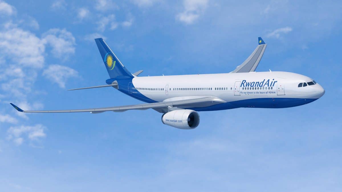
African airspace disturbances on major continental routes due to geopolitical turbulence have rapidly transformed the geometrical configuration of global aviation. Long-haul flights that connect Europe and Southern Africa are under tremendous operational pressure because direct flights over the equator through the Sahel region and Horn of Africa have been discontinued. The routine practice of high-altitude flights over sovereign airspaces has been replaced with operational difficulties of rising costs, sea voyages and electronic interference. It is very important to understand this transformation from the point of view of airlines, cargo companies and corporations, since route economics and fleet management across the globe are undergoing transformation due to the increased number of diversions.
Historical Precedents and the Breakdown of Saharan Corridors
Open, predictable transit corridors connecting European capitals to Southern Africa have long been relied upon by commercial aviation across the African continent. For over five decades, the primary trans-equatorial airways were utilized as the backbone of north-south long-haul flying. Direct lines across the Sahara Desert and the Central African Basin were routinely traversed by wide-body airliners transiting between London, Paris, Frankfurt, and Amsterdam and the primary commercial centres of Johannesburg and Cape Town. Predictable upper-air meteorological conditions, minimal track mileage, and optimal fuel-burn parameters were offered by these paths, underpinning the profitability of overnight long-haul flights.
This navigational stability began to be eroded as civil air navigation structures across the Sahel and the Horn of Africa were dismantled by cascading geopolitical crises. Open corridors were transformed into an operational impasse by the rapid deterioration of civil air traffic management across the central Sahara. Lateral detours diverting hundreds of nautical miles off course must now be planned by airlines that previously calculated flight profiles based on straight-line great-circle tracks. An unprecedented peacetime reallocation of airspace is represented by this structural reconfiguration, whereby vast geographical exclusion zones are forced to be managed by dispatchers and civil aviation authorities.
North-south intercontinental flying has been divided by the resulting high-altitude bypass into two isolated tracks: a Western Atlantic coastal route tracking offshore down West Africa, and an Eastern Red Sea corridor following the Nile approaches and the East African coastline. Complex traffic-flow patterns are created by this geographical split, causing unprecedented pressure to be placed on secondary air navigation service providers and shifting regional hub economics.
Advertisement
Advertisement
Conflict Zones and Regulatory Mandates in the Sahel and Horn of Africa
The navigational realignment was most severely catalyzed by the collapse of air traffic services within the Khartoum Flight Information Region (HSSS FIR). Following the outbreak of armed conflict in Sudan, operations were suspended by the Khartoum Area Control Centre, leaving millions of square kilometres of strategic upper airspace without certified air traffic control. In response, restricted area HSR5 was established by the Sudan Civil Aviation Authority, effectively closing the sovereign sky from ground level to unlimited altitude. Civilian operations were rapidly safeguarded by international civil aviation regulators. Conflict Zone Information Bulletin CZIB-2023-01R8 was issued by the European Union Aviation Safety Agency (EASA), advising that operations at any flight level within the Khartoum FIR should be avoided by all commercial operators.
An emergency contingency framework was coordinated by the International Civil Aviation Organization (ICAO) through its Middle East regional office to establish narrow bypass corridors. While ICAO Contingency Route 6 was eventually established via waypoint ALEBA near the Egyptian border to permit limited humanitarian and commercial overflights, routine trans-equatorial airway waypoints—including NUBAR, ENABU, ATMUL, and SISID—remain closed for standard transit. Flights entering this contingency track are subjected to strict longitudinal separation minimums of ten to twenty minutes, resulting in significant airborne holding delays and the throttling of traffic capacity.
Advertisement
Advertisement
This crisis is compounded by overlapping restrictions across the Sahel belt. Sudden sovereign airspace closures and risk bulletins issued by international regulators have been experienced across the Niamey FIR in Niger, the Bamako FIR in Mali, and the N’Djamena FIR in Chad. In Mali, commercial flights below Flight Level 260 are prohibited under EASA CZIB-2017-01R21 due to low-altitude surface-to-air missile threats. When combined with long-standing avoidance mandates over the Tripoli FIR in Libya (CZIB-2017-02R20) and the Sana’a FIR in Yemen (CZIB-2017-07R20), a continuous, impassable geopolitical air barrier stretching over 4,000 kilometres from the Red Sea to the Atlantic Ocean is formed.
Operational and Economic Penalties on the Europe to South Africa Axis
Severe logistical penalties are imposed on international airlines when navigating around this central continental barrier. Drastic flight reroutings must be implemented by operators flying between Western Europe and Southern Africa when routes are directed around the Sahel and Sudan. Spanish, Moroccan, and Senegalese airspace (Dakar Oceanic FIR) are navigated by carriers diverting along the Atlantic corridor, skirting the West African coastline before tracking south-east past Angola. Conversely, Egypt is overflown by aircraft choosing the eastern routing, followed by navigation through the narrow Red Sea airway system off Saudi Arabia (Jeddah FIR), and transit through the Nairobi and Dar es Salaam FIRs.
Advertisement
Advertisement
Between 1,200 and 2,000 nautical miles are added to a standard one-way sector by these diversions. Long-haul journeys are extended by 1.5 to 2.5 hours in terms of block flight time. For modern wide-body aircraft such as the Airbus A350-900, Boeing 787-9, and Boeing 777-300ER, an increase in jet fuel consumption of 3,000 to 5,500 litres per sector is caused by this extended airborne time. Operating expenses are inflated amid volatile global oil prices, and a compounding penalty known in flight dispatch as the cost of carrying fuel is triggered: a significant percentage of supplemental fuel must be consumed by aircraft simply to carry the heavier contingency fuel reserves required for the longer detour.
A direct commercial penalty is created by the physical limits of aircraft Maximum Take-Off Weight (MTOW) and structural landing weight: stringent payload restrictions. Reserve fuel is forced to be prioritized over revenue cargo and passenger seats on ultra-long-haul sectors operating near maximum structural range. Belly-hold cargo capacity is often restricted, preventing freight revenue from being maximized on high-demand passenger flights.
African export economies are directly harmed by this payload throttling. It is indicated by data from the African Airlines Association (AFRAA) and the United Nations Economic Commission for Africa (UNECA) that approximately 65% of African perishable exports—including cut flowers from Kenya and high-value agricultural produce from South Africa—are transported in the cargo holds of scheduled passenger aircraft. When underfloor cargo is capped by passenger carriers to carry diversion fuel, perishable supply chains are backed up at processing facilities, spot freight rates are elevated, and export earnings are diminished across key regional economies.
| Flight Route Sector | Baseline Routing Path | Rerouted Avoidance Trajectory | Nautical Mile Variance | Block Time Variance | Mean Fuel Penalty (Litres) |
| London (LHR) – Johannesburg (JNB) | Direct via Niamey / N’Djamena FIRs | Atlantic Coastal via Dakar / Luanda | +1,380 NM | +1 hr 45 min | +4,100 L |
| Paris (CDG) – Cape Town (CPT) | Direct via Algiers / Niamey / Congo Basin | Atlantic Offshore Corridor | +1,520 NM | +1 hr 55 min | +4,450 L |
| Frankfurt (FRA) – Johannesburg (JNB) | Direct via Tripoli / Khartoum FIRs | Red Sea via Cairo / Nairobi | +1,250 NM | +1 hr 35 min | +3,650 L |
| Amsterdam (AMS) – Nairobi (HKJK) | Direct via Cairo / Khartoum FIR | Red Sea Bypass via Jeddah FIR | +890 NM | +1 hr 10 min | +2,800 L |
| Zurich (ZRH) – Johannesburg (JNB) | Direct via Tripoli / Chad / DRC | Eastern Maritime / Red Sea | +1,180 NM | +1 hr 30 min | +3,500 L |
Bilateral Exclusion Zones and Intra-African Trade Bottlenecks
The Great Lakes Standoff and Fleet Allocation Inefficiencies
While lengthy oceanic detours are being managed by intercontinental carriers, severe bilateral airspace restrictions are faced by regional African aviation. Regional skies have been fragmented by diplomatic standoffs and cross-border security disputes, creating operational chokepoints by which regional air connectivity is threatened. The most acute disruption of this nature is observed in Central Africa, where sweeping overflight and landing bans were implemented by the Democratic Republic of Congo (DRC) against aircraft registered or operated from Rwanda.
Advertisement
Advertisement
This regulatory closure was enacted following heightened hostilities in North Kivu and the operational encirclement of Goma International Airport (GOM). In response, Rwandan air carriers were prohibited by the Congolese Civil Aviation Authority from entering the Kinshasa FIR. Immediate operational consequences were experienced by Rwanda’s national airline, RwandAir. Congolese airspace had historically been utilized by RwandAir as its primary east-west trunk corridor to link its Kigali hub with West and Central African destinations such as Brazzaville, Douala, Libreville, Abuja, and Lagos. Access to this central airspace having been denied, regional routes—including Kigali–Brazzaville–Douala and Kigali–Abuja–Accra—had to be suspended, while costly circumvention tracks were established around the periphery of the DRC.
On the Kigali to Libreville route, block flight times were extended from 3 hours 25 minutes to 4 hours 25 minutes by the required avoidance vector. The deployment of larger Boeing 737-800 aircraft was necessitated, burning an additional 3,000 litres of Jet A-1 fuel per flight and adding approximately $1,500 in direct fuel costs per sector. Across a standard five-flight weekly schedule, more than $700,000 in unbudgeted annual operating costs was added on a single regional route.
Systemic fleet inefficiencies are introduced into regional airline operations by these detours. Short-to-medium sectors of 1.5 to 2.5 hours are optimized for regional narrow-body aircraft, such as the Embraer E190 and Bombardier CRJ-900. When forced into multi-hour diversions around closed airspaces, strict payload and range limits are encountered by these regional jets, compelling airlines to substitute larger, less efficient aircraft or cancel thin secondary routes entirely. Seats-per-mile costs are elevated, daily aircraft rotation counts are reduced, and passenger ticket prices are driven up across Central and West Africa.
Jurisdictional Fractures and Radio Interference in the Horn of Africa
Further east, in the Horn of Africa, airspace management has become entangled with disputes over sovereignty and territorial integrity. Following decades of United Nations-administered air traffic management through the Civil Aviation Caretaker Authority for Somalia (CACAS), sovereign control over the Mogadishu FIR was re-established by the Federal Government of Somalia from its Area Control Centre in Mogadishu. However, Mogadishu’s sovereign overflight authority was contested by the self-declared Republic of Somaliland, with unilateral control over its airspace being asserted by the Somaliland Civil Aviation and Airports Authority based at Egal International Airport in Hargeisa.
This jurisdictional clash was escalated into an air navigation safety hazard. Conflicting air traffic control instructions broadcast simultaneously by Mogadishu Control and Hargeisa Control have been documented by civil aircraft transiting the upper airspace of northern Somalia and Somaliland. Contradictory altitude clearances and vectoring assignments were received by commercial airliners on identical VHF communication frequencies in multiple instances, causing mid-air collision risks to be increased and formal ICAO alerts to be triggered. Formal NOTAM warnings regarding unlawful and unauthorized VHF interference within the Mogadishu FIR were subsequently issued by Mogadishu Control. These jurisdictional ambiguities must now be navigated by international carriers routing between the Middle East, East Africa, and Southern Africa, with wider lateral tracks over the Gulf of Aden being opted for by some operators to avoid dual-ATC commands.
Concurrently, within the adjacent Addis Ababa FIR (HAAA), localized exclusion zones and flight restrictions below FL290 have been maintained by the Ethiopian Civil Aviation Authority in northern sectors near Tigray, Afar, and Amhara. Heightened caution within northern Ethiopian airspace is advised by international safety agencies, including Germany’s Federal Aviation Office (LBA) and EASA, due to risks from military engagements and anti-aircraft weaponry. An obstacle course across the Horn of Africa is created by these compounding restrictions, forcing regional operators into circuitous routes and eroding the operational benefits envisioned under liberalized continental aviation agreements.
Advertisement
Advertisement
Electronic Warfare and Satellite Navigation Degradation at Altitude
Tactical Realities of High-Altitude Spoofing in North-East Africa
Beyond kinetic combat zones and political overflight bans, an invisible operational hazard is confronted by international commercial aviation: the proliferation of high-altitude military electronic warfare. As airlines are diverted into the Eastern Red Sea bypass corridor to circumnavigate Saharan closures, their flight paths are brought into the electronic operations theatre of the Middle East, the Red Sea, and North-East Africa. Over the maritime corridors off Port Sudan, the Sinai Peninsula, Alexandria, and the Red Sea approaches to Djibouti and Asmara, severe radio frequency interference targeting satellite navigation is being encountered by flight crews.
Global Navigation Satellite System (GNSS) interference is manifested in two distinct technical forms: jamming and spoofing. While weak satellite signals are overpowered with white noise during GNSS jamming to cause a total loss of GPS lock, synthetic, counterfeit radio frequency signals mimicking authentic satellite constellations (such as GPS, Galileo, and GLONASS) are transmitted during GNSS spoofing. These counterfeit signals are decoded as authentic by the aircraft’s satellite receivers, causing false positioning, navigation, and timing data to be injected into the primary avionics architecture.
An exponential increase in intentional GNSS manipulation has been documented in civil aviation, as reported in safety alerts published in EASA Safety Information Bulletin SIB No. 2022-02R3, FAA Safety Alert for Operators (SAFO) 24002, and the IATA GNSS Interference Risk Assessment. Over one million distinct instances of GPS signal loss and manipulation were registered by flight data processed through IATA’s Flight Data Exchange (FDX) programme, with significant incident clusters being concentrated along Eastern Mediterranean, Red Sea, and Middle Eastern corridors. False positions are generated by spoofing systems, shifting cockpit displays by up to 80 nautical miles from an aircraft’s actual geographical location.
Cockpit Vulnerabilities and Operational Mitigation Procedures
The consequences of GNSS manipulation on modern commercial flight decks are technically intricate and hazardous. Inputs from satellite receivers, Inertial Reference Units (IRUs), and ground-based navigation aids are continuously integrated by advanced multi-sensor Flight Management Systems (FMS) using Kalman filtering algorithms. When a spoofed signal slowly drifts away from the true aircraft track, the anomaly may fail to be detected by the hybrid FMS, resulting in the aircraft’s internal navigation position being gradually updated with false data. An un-commanded “map shift” is caused, where the aircraft is depicted by the synthetic display as being perfectly on course while the airframe is drifted toward sovereign military zones or hazardous terrain.
Simultaneously, false Terrain Awareness and Warning System (TAWS) and Enhanced Ground Proximity Warning System (EGPWS) alerts are triggered by corrupted GPS altitude and lateral inputs, sounding loud audio alarms that command emergency pull-up climbs at cruising levels. The aircraft’s transponder is also corrupted by desynchronization, causing false telemetry to be transmitted by Automatic Dependent Surveillance-Broadcast (ADS-B Out) broadcasts. Flight track splits or erroneous collision alerts are then experienced on air traffic control displays in Cairo, Jeddah, or Khartoum, disrupting tactical traffic separation. Furthermore, the aircraft’s internal master clock is desynchronized by corrupted satellite time-stamping, resulting in Controller-Pilot Data Link Communications (CPDLC) connections being dropped and digital air-to-ground messaging being severed.
Operational countermeasure protocols have been established by aviation regulatory bodies—including the FAA via its GPS/GNSS Interference Resource Guide and EASA via updated SIB directives—to manage these vulnerabilities. Verification that ground-based radio navigation aids along the route and diversionary alternates are fully functional and documented in aeronautical publications must be completed by flight dispatchers operating through vulnerable sectors. Aircraft must not be dispatched into designated interference zones without operational conventional navigation capabilities.
Advertisement
Advertisement
Flight crews are trained to manually deselect GNSS updating within the FMS architecture upon entering known spoofing sectors within the Cairo FIR, Addis Ababa FIR, or Jeddah FIR. The flight computer is decoupled from compromised satellite signals by this configuration, forcing the aircraft to rely entirely on self-contained Inertial Reference Systems (IRS/IRU) augmented by conventional terrestrial radio beacons, specifically Distance Measuring Equipment pairs (DME/DME) and Very High Frequency Omnidirectional Range stations (VOR/DME). If anomalous navigation behaviour is experienced on the flight deck—such as sudden map shifts, unprompted clock jumps, or inconsistent wind-vector displays—raw conventional navigation data must immediately be cross-checked, air traffic control must be advised of degraded navigation capability, and primary radar vectors must be requested to maintain track adherence. Decades of satellite-based airspace modernisation across north-eastern Africa have effectively been rolled back by this reliance on legacy radio navigation under high-altitude electronic warfare.
The Economics of Diversionary Hubs and Technical Refuelling Infrastructure
West and East African Gateways Absorbing Intercontinental Traffic
Non-stop flight scheduling between Europe and Southern Africa has been disrupted by the compounding challenges of 2,000-nautical-mile diversions, heavy headwind patterns over the Atlantic Ocean, and stringent Maximum Take-Off Weight limits. Scheduled or unscheduled technical refuelling stops are being conducted by airlines when fuel burn is pushed beyond safe reserve margins by extended flight vectors—or when excessive cargo and passenger offloading would be forced by carrying the required diversion fuel.
Secondary African airports have been elevated into critical intercontinental transit nodes by this operational shift. Heavy wide-body diversions, positioning flights, and technical transit operations are now being handled by facilities that historically served primarily domestic or regional routes.
A surge in technical stops from long-haul carriers operating along the West African coastal corridor has been captured by Kotoka International Airport (DGAA) in Accra, Ghana, strategically situated on the Gulf of Guinea. Operated by Ghana Airports Company Limited (GACL), a 3,400-metre runway capable of handling Boeing 777 and Airbus A350 operations is offered by Accra, complete with open-access refuelling services.
Dr. António Agostinho Neto International Airport (FNBJ), located in Bom Jesus near Luanda, Angola, was opened to commercial traffic as one of the largest newly constructed aviation facilities on the continent. An ultimate throughput of 15 million passengers and 130,000 metric tonnes of cargo annually is accommodated in the facility’s design, featuring dual parallel runways (4,000 metres and 3,800 metres) specifically constructed to accommodate Airbus A380 and Boeing 747-8 wide-body airframes. As international operations were transitioned to the hub by flag carrier TAAG Angola Airlines, the airport emerged as a key strategic waypoint for Atlantic bypass flights requiring refuelling and crew changes before Southern Africa is crossed.
A strategic eastern relief valve along the northern periphery of Lake Victoria is served by Entebbe International Airport (HUEN), managed by the Uganda Civil Aviation Authority (UCAA). Unscheduled diversions and refuelling stops are handled by Entebbe for operations navigating south around Sudanese airspace through Egyptian and Kenyan tracks.
Advertisement
Advertisement
Vital coastal runway capacity for wide-body flights navigating down the eastern littoral corridor is provided by Moi International Airport (HKMO) in Mombasa, Kenya, when peak-hour congestion is faced by the primary hub at Nairobi Jomo Kenyatta (HKJK).
Jet Fuel Supply Chain Pressures and Crew Duty Complications
Revenue windfalls are provided to secondary airport authorities through landing fees, ground-handling service surcharges, navigation usage fees, and Jet A-1 fuel sales by the unexpected influx of diverted and technical transit wide-body aircraft. However, severe operational strains are created across local supply chain ecosystems by this sudden surge.
An immediate uplift of 40,000 to 80,000 litres of aviation fuel is required for the commercial refuelling of an Airbus A350-900 or Boeing 777-300ER performing a technical stop. At secondary airports where fuel hydrants, on-site storage tanks, and refueller bowser fleets are scaled for regional twin-turboprops and narrow-body aircraft, local fuel reserves can be drained within hours by several unscheduled wide-body arrivals. In regions reliant on imported refined petroleum, fuel rationing, sudden increases in local jet fuel crack spreads, and extended ground turnaround times exceeding three hours per technical stop are caused by localized supply shortages.
Furthermore, global airline crew scheduling is disrupted by technical stops. Long-haul flight crews are operated under strict statutory Flight Time Limitations (FTL) administered by regulatory agencies such as EASA and the FAA. When total duty periods are pushed past maximum limits by flight vector diversions, crews can legally become “out of hours” while on the ground during a technical stop. Operating carriers are forced to deplane passengers, secure ground transportation, and source short-notice hotel accommodation in secondary hub cities where large hotel capacities near the airport are often lacking. An operation losing tens of thousands of dollars can result from an otherwise profitable intercontinental rotation due to the associated aircraft ground time, passenger accommodation costs, and ferry positioning of relief crews.
Continental Policy Gridlock: SAATM, AfCFTA, and Seamless Airspace Initiatives
Protectionism and Regional Bilateral Discord Stalling Liberalisation
The policy goals of continental economic integration are directly undercut by the ongoing operational fragmentation of African airspace. The Single African Air Transport Market (SAATM) was established by the African Union (AU) as a flagship initiative under Agenda 2063, aiming for intra-African air transport to be fully liberalized through the removal of bilateral restrictions, the granting of reciprocal Fifth Freedom traffic rights, and the unification of the continental regulatory framework. This aviation liberalization is designed as the transport backbone of the African Continental Free Trade Area (AfCFTA), whereby cross-border commerce, industrial supply chains, and business tourism are to be facilitated.
However, progress has been stalled by the proliferation of conflict zones, bilateral airspace closures, and protectionist traffic rights disputes. Although the commitment to implement SAATM has been signed by 38 African Union member states, it is revealed by institutional surveys from the African Airlines Association (AFRAA) that regulatory architectures have been fully harmonized and anti-competitive bilateral barriers abolished by only 10 states. When diplomatic disputes arise, sovereign airspace rights are often weaponized by governments, leading to Bilateral Air Services Agreements (BASAs) being suspended and overflight permissions being revoked at short notice.
Advertisement
Advertisement
Entire regional trade blocs are isolated by this regulatory friction. Tickets costing more than comparable intercontinental itineraries are frequently faced by business travellers transiting between Central African economic centres and East African financial capitals, caused by artificial route detours and limited carrier competition. Further cost barriers are added by high aviation taxes, sovereign passenger safety levies, and exorbitant jet fuel charges across secondary African airports, reducing average African airline passenger load factors to 75%—well below the global average of 83.5%. The expansion of intra-African trade is undermined by the resulting increase in operating expenses, leaving the promise of AfCFTA constrained by fragmented skies.
Technical Modernisation and the Long-Term Outlook for African Skies
The modernization of air traffic infrastructure alongside cooperative airspace governance is required if the crisis of redrawn flight corridors is to be overcome. A framework for a Continental Seamless Airspace initiative, budgeted at approximately $420 million, has been established by the African Union and the African Civil Aviation Commission (AFCAC). Fragmented national air traffic management systems are intended to be integrated into six to eight Regional Air Traffic Management Centres by 2035 under this initiative.
The technical foundation of this initiative relies on the deployment of Performance-Based Navigation (PBN), satellite-augmented Automatic Dependent Surveillance-Broadcast (ADS-B) constellations, and integrated Controller-Pilot Data Link Communications (CPDLC) compliant with the ICAO Aviation System Block Upgrades (ASBU) roadmap. Direct, fuel-optimized tracks based on real-time atmospheric wind conditions rather than rigid ground-beacon airways could be filed by flight planners if free-routing airspace were implemented across regional air navigation service providers, modelled on Eurocontrol’s Free Route Airspace (FRA).
However, technological upgrades cannot be successfully realized without underlying geopolitical and regulatory impasses being resolved. Dispute resolution mechanisms must be strengthened by ICAO and AFCAC to insulate civil aviation corridors from bilateral diplomatic clashes. De-escalating airspace disputes, establishing robust civil-military coordination platforms, and investing in resilient ground navigation and alternative Positioning, Navigation, and Timing (PNT) infrastructure will be critical if civil aviation is to be protected against electronic warfare. Circuitous bypass tracks will continue to be navigated by commercial airlines, with the financial and operational costs of an increasingly fragmented sky continuing to be borne, until coordinated airspace management and open-skies policies are institutionalised across the continent.
Conclusion
As is seen in the perpetual reconfiguration of transcontinental aviation corridors, the continuous disruption of African airspace has transformed from being a fleeting tactical problem to a permanent structural one. With the sovereignty of corridors being stripped through kinetic warfare and diplomatic stalemate, long-term flight corridors will need to be maneuvered, significant monetary costs absorbed, and covert electronic warfare dealt with through vulnerable regions by international airlines. While fueling needs have been successfully met at alternative airports, vulnerabilities in the supply chain have been highlighted through the strain caused. The modernization of the communication infrastructure of the region, as well as the renewal of the open skies agreement within the continent, will be crucial for sustained recovery in the sector.
Advertisement
