
Hawaii Teams Up With Arizona and More as Powerful Weather Threats Challenge Unites States Travel Plans

Published
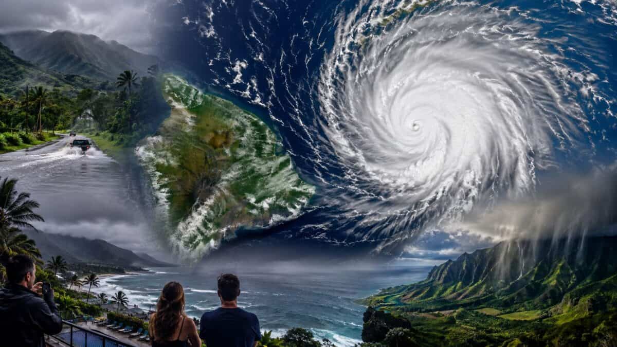
Image generated with Ai
Hawaii Teams Up With Arizona and more as powerful weather threats challenge United States travel plans, creating fresh concerns for travellers. From Hawaii’s coastal hazards to Arizona’s rainfall risks, powerful weather is reshaping journeys across the United States. Meanwhile, travellers are watching changing conditions before planning flights, road trips, beach visits and outdoor adventures. Travel And Tour World brings these developments together to explain how Hawaii, Arizona and more destinations are responding. As powerful weather threats continue to affect travel plans, visitors need reliable information before moving between destinations. Read the full story for essential United States travel updates, safety guidance and timely destination information.
Hurricane Nolo and Severe Weather Across the United States: Detailed Travel Impact Guide for September 2026
Hurricane Nolo Leaves Hawaii With Continuing Coastal Hazards
Hurricane Nolo has moved away from the main Hawaiian Islands, but its effects remain important for travellers. The National Weather Service said major Hurricane Nolo was moving west away from Hawaiʻi, while trailing moisture and ocean swells continued to influence conditions.
Advertisement
Advertisement
At 5 p.m. HST on September 27, Nolo had maximum sustained winds of 145 mph, making it a Category 4 hurricane. The National Hurricane Center placed the system about 380 miles south-southwest of Honolulu and reported a minimum central pressure of 939 millibars. Nolo was moving west-northwest at 12 mph.
Earlier, at 3 a.m. UTC on September 28, Nolo had maximum sustained winds near 125 knots, equivalent to 145 mph or 230 km/h. The storm was located near 16.3°N and 160.3°W.
Advertisement
Advertisement
Although the hurricane centre stayed offshore, Hawaiʻi experienced dangerous rainfall, winds, surf and flooding concerns. The federal emergency declaration covers Honolulu, Hawaiʻi, Maui and Kauaʻi counties and provides eligible emergency protective assistance at a 75% federal cost share.
For travellers, the most important change is that the immediate hurricane threat has shifted away from the main islands, but ocean conditions can remain hazardous after the centre passes.
Advertisement
Advertisement
The National Weather Service issued a high-surf advisory for south-facing shores throughout the Hawaiian Islands and west-facing shores of the Big Island. Forecast surf reached 7 to 10 feet along affected south-facing shores and 6 to 8 feet along west-facing Big Island shores.
These conditions can create strong breaking waves and powerful currents. Visitors should therefore avoid swimming, surfing or approaching exposed shorelines when warnings remain active.
Big Island Roads Remain a Major Consideration for Tourists
Hawaiʻi’s transportation network has been particularly important during Nolo because the storm combined heavy rain, wind, flooding and debris risks.
The federal emergency declaration specifically identifies emergency debris clearance and temporary emergency access along Highway 11 through Kaʻū among the activities eligible for assistance.
The Hawaiʻi Department of Transportation also discouraged nonessential travel on Hāna Highway in East Maui because the narrow route is vulnerable to fallen trees, rocks and flooding.
For visitors, this means a scenic driving itinerary may require significant flexibility. Routes around mountainous terrain can become unsafe when rainfall destabilizes slopes or blocks lanes.
Advertisement
Advertisement
Tourists should check official road information immediately before departure rather than relying on conditions observed earlier in the day.
Hawaiʻi’s Emergency Response Remains Active
Hawaiʻi’s state emergency response system was placed on full activation during the event.
The governor’s office said the federal declaration supports emergency electrical-grid restoration, debris removal, transportation, communications, fuel, water, meals and other response logistics. It also includes direct federal assistance for eligible emergency operations.
The state had already closed selected government offices, public schools and University of Hawaiʻi facilities on Hawaiʻi Island before Nolo’s closest approach. Maui County closures were subsequently included as the storm progressed. Officials said the closures were intended to keep people off roads and allow emergency personnel to operate safely.
For international visitors, these measures are useful indicators of how seriously local authorities are treating conditions.
A holiday itinerary should not override a government road closure, evacuation instruction or coastal warning.
Advertisement
Advertisement
Detailed Hurricane Nolo Statistics
| Nolo indicator | Recorded information |
|---|---|
| Peak reported maximum sustained wind | 145 mph / 230 km/h |
| Saffir-Simpson classification at peak reported intensity | Category 4 |
| Minimum central pressure | 939 mb |
| Movement on Sept. 27 evening | WNW at 12 mph |
| Approximate position at 5 p.m. HST Sept. 27 | 16.3°N, 160.3°W |
| Distance from Honolulu at that advisory | About 380 miles south-southwest |
| Federal declaration | Pre-landfall Presidential Emergency Declaration |
| Counties covered | Honolulu, Hawaiʻi, Maui and Kauaʻi |
| Federal cost share for eligible Public Assistance Category B | 75% |
| South-facing Hawaiian surf forecast | 7–10 feet |
| Big Island west-facing surf forecast | 6–8 feet |
| Main continuing visitor concern | Large surf, rip currents, local travel disruption |
Sources: National Hurricane Center, National Weather Service, Hawaiʻi Governor’s Office.
New York Faces Continuing Coastal Flooding and Rain
New York is dealing with a separate weather system rather than Hurricane Nolo. The National Weather Service reported that the nor’easter was weakening on September 28 but continued to produce rain and minor coastal flooding.
The New York City and surrounding coastal area remained under a coastal flood advisory during Monday’s high-tide period. The National Weather Service expected up to one foot of inundation above ground level in vulnerable waterfront locations in parts of Manhattan, Staten Island and Brooklyn, as well as nearby New Jersey counties.
A separate advisory covering parts of southern Westchester, the Bronx, Long Island and southern Connecticut indicated one to two feet of inundation above ground level in vulnerable locations.
For tourists, this can affect waterfront walks, parks, ferry access, low-lying roads and transportation connections.
Visitors staying in Manhattan should pay particular attention to conditions around waterfront areas rather than assuming that the storm’s weakening means all local impacts have ended.
Advertisement
Advertisement
The National Weather Service forecast additional rain bands through the day as the low-pressure system slowly moved northeast and weakened.
Travellers should therefore allow additional time for road journeys and check public transportation information before leaving hotels.
New Jersey Remains Under a State of Emergency
New Jersey has been one of the states most directly affected by the East Coast nor’easter.
Governor Mikie Sherrill declared a state of emergency across eight counties effective at 5 p.m. on September 25. The counties listed by the state were Atlantic, Burlington, Cape May, Cumberland, Middlesex, Monmouth, Ocean and Salem.
The storm brought coastal flooding, heavy rainfall, strong winds and difficult travel conditions.
For tourists, the Jersey Shore is particularly relevant because coastal communities are exposed to high water, waves and wind.
Advertisement
Advertisement
The National Weather Service continued to issue coastal flood advisories for portions of New Jersey on September 28. Up to one foot of inundation was expected in vulnerable waterfront areas around the Hudson, Bergen, Essex and Union county areas.
Visitors should be cautious around boardwalks, beaches, waterfront parking areas and low-lying roads.
A state of emergency also means travellers should monitor official state transportation and emergency-management information before moving between destinations.
The New Jersey governor’s website directs residents and visitors toward the state’s emergency preparedness, transportation and transit information resources.
Massachusetts Deals With Flooding and Coastal Hazards
Massachusetts has also faced significant effects from the nor’easter.
The National Weather Service Boston/Norton office maintained a flood watch covering numerous Massachusetts counties through late September 28. The affected area included Boston, Worcester, Plymouth, Barnstable, Nantucket, Dukes and several other regions.
Advertisement
Advertisement
The same weather system produced flood warnings in portions of southeastern and central Massachusetts. The National Weather Service warned that flooding of rivers, creeks, streams and other low-lying areas was occurring or imminent in locations including parts of Bristol, Norfolk, Plymouth and Worcester counties.
This matters for visitors because Massachusetts combines major urban destinations with exposed coastal communities.
Boston travellers may encounter wet roads, slower traffic and disruption around waterfront areas. Cape Cod, Nantucket and Martha’s Vineyard visitors face additional exposure to coastal conditions.
The National Weather Service also reported that coastal communities experienced powerful winds during the storm. Independent reporting citing weather-service observations recorded gusts above 70 mph at Wellfleet in Massachusetts.
Travellers should check ferry, airport and road conditions before making connections to coastal islands.
Rhode Island Remains Under Flood Monitoring
Rhode Island is another important destination for travellers monitoring the nor’easter.
Advertisement
Advertisement
The National Weather Service maintained a flood watch for Rhode Island through the night of September 28. The affected locations included Providence, Newport, Bristol, Washington, Kent and Block Island.
The Providence forecast office also listed a coastal flood statement alongside the flood watch.
The combination of rainfall and coastal water levels can affect roads, waterfront attractions and low-lying neighbourhoods.
Newport is particularly relevant for tourism because its attractions and historic areas are closely connected with the coastline.
Block Island is also exposed to changing marine conditions.
Travellers should check ferry operators and local transportation authorities before travelling to or from island destinations.
Advertisement
Advertisement
A storm-related delay can affect an entire itinerary when visitors have connecting flights or hotel reservations elsewhere.
The safest approach is to build additional time into travel schedules and avoid assuming that ferry or road services will operate according to normal timetables during a coastal storm.
Connecticut Continues to Monitor Coastal Flooding
Connecticut experienced rain, wind and coastal flooding concerns as the nor’easter weakened.
The National Weather Service issued coastal flood advisories for southern Fairfield and southern New Haven counties. The advisory warned of one to two feet of inundation above ground level in vulnerable shoreline areas.
New Haven was under a coastal flood advisory on September 28. The local forecast called for a 100% chance of showers during the daytime period, with north winds and gusts reaching around 25 mph.
Bridgeport also experienced wet and windy conditions, with the National Weather Service reporting northeast winds around 20 km/h and gusts around 25 mph during the morning observation period.
Advertisement
Advertisement
For visitors, the main risks involve waterfront flooding, reduced visibility and difficult road conditions.
Coastal travellers should avoid driving around barricades or through water of unknown depth.
The National Weather Service specifically advised travellers to allow extra time where coastal flooding could affect roads.
Virginia Sees Coastal Flooding Along the Eastern Shore
Virginia is also experiencing coastal effects from the broader East Coast storm system.
The National Weather Service issued coastal flood advisories for portions of Virginia’s Eastern Shore on September 28. Areas including Accomack County and communities around Chincoteague were included in the advisory.
The advisories were connected to elevated water levels around vulnerable coastal locations.
Advertisement
Advertisement
Although conditions were improving, visitors travelling through the Eastern Shore still needed to monitor local coastal flooding information.
Chincoteague is particularly relevant from a tourism perspective because it is a popular coastal destination.
Visitors should be cautious around beaches, waterfront roads and low-lying access points when advisories are active.
Virginia’s situation is different from Hawaiʻi because the state is dealing with the East Coast nor’easter rather than Nolo.
That distinction is important when communicating travel information accurately.
Southwest Weather Adds Another Travel Concern
The United States is also dealing with another developing weather pattern across the Southwest.
Advertisement
Advertisement
The National Weather Service reported that moisture associated with Hurricane Polo was spreading into the Four Corners region and contributing to a multi-day heavy-rain event.
New Mexico was under flood watches on September 28, with some areas expected to remain under watch through September 30.
The national forecast discussion identified a moderate risk of excessive rainfall extending across parts of the Southwest and Four Corners region.
Forecasters expected heavy rain and flash-flood potential to continue into portions of the southern High Plains.
The forecast area included southeastern Arizona, New Mexico and parts of Texas, including the Texas Panhandle and northwest Texas.
This creates a separate travel consideration for visitors planning road trips through desert and mountain areas.
Advertisement
Advertisement
Flash flooding can occur even in locations that appear dry under normal conditions.
Visitors should therefore avoid crossing flooded washes or low-water crossings and should follow local road closures.
New Mexico Faces Multi-Day Flood Risk
New Mexico is particularly important in the broader national weather picture.
The National Weather Service placed portions of the state under flood watches beginning September 28, with some watches extending into September 30.
The risk is linked to a combination of tropical moisture and upper-level atmospheric systems.
The forecast discussion warned that heavy rainfall could continue across the Southwest before spreading farther into the southern and central Plains.
Advertisement
Advertisement
For visitors, destinations such as Santa Fe and other high-desert communities should be monitored for localized flooding.
Road travellers need to remember that rainfall does not have to occur directly at their location to create dangerous water flows downstream.
Travellers should also be aware that mountain roads can become hazardous when heavy rain interacts with steep terrain.
Texas Enters the Broader Heavy-Rain Picture
Texas is expected to become involved as moisture moves east from the Southwest.
The National Weather Service forecast discussion identified the Texas Panhandle and northwest Texas as areas where heavy rainfall could become concentrated as tropical moisture interacts with atmospheric forcing.
The forecast also indicated that moisture would move farther into the southern and central Plains.
Advertisement
Advertisement
For travellers, this is especially relevant for long-distance road journeys.
Conditions can change considerably between cities because the rainfall pattern is expected to be uneven.
Visitors driving across Texas should check local National Weather Service forecasts and state transportation information before starting long trips.
Low-water crossings, drainage channels and rural roads require particular caution during flash-flood events.
Arizona Also Faces Heavy-Rain Potential
Arizona is another state included in the developing Southwest weather pattern.
The National Weather Service identified portions of northern Arizona within a low-end flooding threat during the initial stage of the event. It subsequently identified southeastern Arizona within a broader moderate risk area for excessive rainfall.
Advertisement
Advertisement
The forecast linked this moisture to the wider circulation associated with Hurricane Polo and an upper-level low moving through the Southwest.
Travellers visiting Arizona’s desert attractions should therefore monitor local flash-flood alerts.
A major travel concern is that desert terrain can experience rapid water movement after intense rainfall.
Tourists should never enter flooded roads, washes or normally dry channels.
Current U.S. Weather Impact Table for Travellers
| State / Area | Weather system | Main hazard | Official status / information | Traveller concern |
|---|---|---|---|---|
| Hawaiʻi | Hurricane Nolo | High surf, strong winds, flooding impacts | Federal emergency declaration; high-surf advisories | Beaches, roads, outdoor activities |
| New York | East Coast nor’easter | Coastal flooding, rain | Coastal flood advisories | Waterfronts, roads, urban transport |
| New Jersey | East Coast nor’easter | Coastal flooding, wind, rain | State of emergency in eight counties | Shore destinations, roads, transit |
| Massachusetts | East Coast nor’easter | Flooding, rain, coastal impacts | Flood watch and flood warnings | Boston, Cape Cod, islands |
| Rhode Island | East Coast nor’easter | Flooding and coastal hazards | Flood watch and coastal statement | Newport, Providence, Block Island |
| Connecticut | East Coast nor’easter | Coastal flooding, rain, wind | Coastal flood advisories | Shoreline communities |
| Virginia | East Coast nor’easter | Coastal flooding | Eastern Shore coastal flood advisories | Chincoteague, coastal roads |
| New Mexico | Polo-related moisture / Southwest system | Heavy rain, flash flooding | Flood watches | Desert and mountain roads |
| Arizona | Polo-related moisture / Southwest system | Excessive rainfall, flooding | Excessive-rainfall risk | Desert attractions and roads |
| Texas | Southwest tropical moisture | Heavy rain and flash flooding | Increasing rainfall risk | Long-distance driving |
Sources: National Weather Service, National Hurricane Center, Hawaiʻi Governor’s Office, New Jersey Governor’s Office.
Side-by-Side Weather Statistics
| Metric | Hawaiʻi / Nolo | Northeast / Nor’easter | Southwest / Tropical Moisture |
|---|---|---|---|
| Primary weather driver | Hurricane Nolo | Nor’easter | Moisture associated with Polo and upper-level systems |
| Peak Nolo wind reported | 145 mph | N/A | N/A |
| Nolo minimum pressure | 939 mb | N/A | N/A |
| Hawaiʻi south-shore surf | 7–10 ft | N/A | N/A |
| Big Island west-shore surf | 6–8 ft | N/A | N/A |
| New York coastal inundation | Up to 1–2 ft in vulnerable locations | Yes | N/A |
| Massachusetts flood watch | Active Sept. 28 | Yes | N/A |
| Rhode Island flood watch | Active Sept. 28 | Yes | N/A |
| Connecticut coastal advisory | Active Sept. 28 | Yes | N/A |
| Virginia coastal advisory | Active Sept. 28 | Yes | N/A |
| New Mexico flood watch | Through Sept. 30 in some areas | N/A | Yes |
| Excessive-rainfall risk | Tropical impacts | Northeast rainfall | Moderate risk across portions of Southwest |
The systems are geographically and meteorologically distinct. They should not be described as one nationwide hurricane event.
Advertisement
Advertisement
What Travellers Should Check Before Departing
International visitors travelling in the United States should check official weather and transportation information shortly before departure.
For Hawaiʻi, the National Weather Service, Central Pacific Hurricane Center and Hawaiʻi Emergency Management Agency remain the key sources for hurricane and surf information.
For road travel, state transportation agencies should be checked before beginning journeys through affected areas.
Visitors should also monitor airport and airline notifications because weather disruptions can occur even when airports remain operational.
Coastal tourists should treat high-surf and coastal-flood advisories seriously.
A beach that appears calm from a distance can still have powerful currents or changing wave conditions.
Advertisement
Advertisement
Travellers should never cross flooded roads, remove barriers or enter closed trails.
The Wider Travel Picture Across the United States
The simultaneous weather threats demonstrate why travellers need destination-specific information rather than relying on a single national forecast.
Hawaiʻi’s situation is dominated by the aftermath of Hurricane Nolo and continuing ocean hazards.
The Northeast is dealing with a separate nor’easter that has produced flooding, rain and coastal impacts.
The Southwest is preparing for another period of heavy rain linked partly to tropical moisture associated with Hurricane Polo.
For global tourists, the practical message is straightforward.
Advertisement
Advertisement
Travel conditions can differ dramatically between states even on the same day.
A traveller flying from New York to Hawaiʻi, for example, could encounter two completely different weather systems during the same journey.
Likewise, visitors driving through Arizona, New Mexico or Texas need to monitor local flood information even if their destination itself appears dry.
Official warnings should take priority over planned sightseeing schedules.
Flexibility remains particularly important for coastal holidays, island trips, road journeys and outdoor excursions during periods of severe weather.
Official Data Sources for Ongoing Traveller Monitoring
| Official source | Information available |
|---|---|
| National Hurricane Center | Hurricane position, intensity, forecasts and advisories |
| National Weather Service | Flood, wind, coastal and rainfall warnings |
| Hawaiʻi Emergency Management Agency | Hawaiʻi emergency updates |
| Hawaiʻi Department of Transportation | Highway and transportation conditions |
| Hawaiʻi Governor’s Office | Emergency declarations and government response |
| New Jersey Governor’s Office | State emergency information |
| State transportation agencies | Road closures and travel restrictions |
| Local emergency-management agencies | Local evacuation and shelter information |
These sources provide the most appropriate basis for real-time travel decisions because conditions can change faster than published travel guides or general tourism websites.
Advertisement
Advertisement
Final Traveller Takeaway
Hurricane Nolo has created a significant weather-related travel story for Hawaiʻi, but the storm should not be confused with the separate weather emergencies affecting other parts of the United States.
Hawaiʻi has dealt with hurricane-force conditions, heavy rainfall threats, flooding concerns and large ocean swells.
The Northeast has simultaneously faced a powerful nor’easter affecting New York, New Jersey, Massachusetts, Rhode Island, Connecticut and Virginia.
Meanwhile, the Southwest has entered another period of heavy-rain and flash-flood potential involving New Mexico, Arizona and Texas.
For travellers, the most useful approach is to check conditions at the exact destination and along every transport connection.
Road closures, coastal flooding, high surf and outdoor-area restrictions can change an itinerary within hours.
Advertisement
Advertisement
Visitors should keep accommodation and transport plans flexible, avoid hazardous water and shoreline areas, and follow official instructions.
The latest official weather information should always be checked immediately before travelling.
Conclusion
As powerful weather threats continue to challenge United States travel plans, Hawaii, Arizona and other destinations remain under close watch. Travellers should stay flexible and check official weather, road and airport updates before starting their journeys. Hawaii’s coastal conditions and Arizona’s rainfall risks show how quickly travel plans can change during severe weather. Travel And Tour World urges visitors to follow government guidance, avoid hazardous areas and allow extra time for disrupted journeys. By staying informed, travellers can make safer decisions while navigating changing conditions across the United States. The latest official updates should remain the first stop before every trip.
Advertisement
