
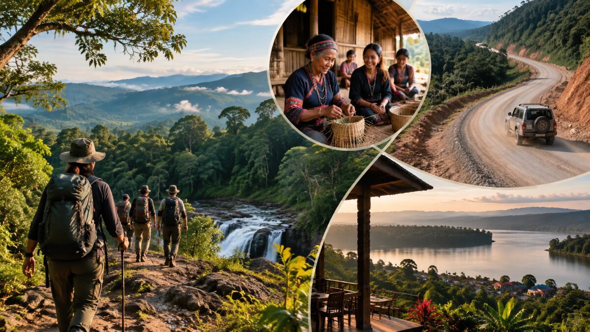
Image generated with Ai
Cambodia is approaching a decisive sustainable-tourism test in Virachey National Park. The government is integrating National Road 78.5, running from Banlung towards the remote Dragon’s Tail tri-border area, into its north-eastern infrastructure planning just as Indigenous communities complete a five-year ecotourism roadmap for Virachey. The opportunity is significant: easier access could direct more travellers and tourism income towards one of Cambodia’s least-visited protected landscapes. The risk is equally important. Unless access, visitor volumes and commercial development remain tied to community management and biodiversity safeguards, greater accessibility could alter the low-volume trekking model that currently distinguishes Virachey.
Unlike destinations struggling to reverse overtourism after visitor numbers have already exceeded local capacity, Virachey has an opportunity to establish tourism controls before major accessibility changes occur.
Advertisement
According to the International Union for Conservation of Nature, fewer than 100 tourists currently visit Virachey National Park in a typical month. Yet Cambodia is simultaneously considering a much stronger transport connection into the frontier landscape. The Cambodian government confirmed on 12 August 2026 that National Road 78.5 is being integrated into planning from Banlung towards the Dragon’s Tail, the remote meeting area of Cambodia, Laos and Vietnam.
Earlier official Cambodian government planning information describes the proposed road as approximately 166 kilometres long and nine metres wide, running from Banlung through Taveng towards the tri-border area. An IUCN ecotourism assessment states that roughly 100 kilometres of the planned route could pass through Virachey National Park parallel to the Vietnamese frontier.
Advertisement
That combination makes Virachey different from a conventional infrastructure-led tourism story. The central question is not simply whether travellers will gain easier access. It is whether Cambodia can increase accessibility without allowing accessibility itself to become the dominant tourism product.
Indicator Current or planned position Sustainable travel significance Virachey visitation Fewer than 100 tourists per month according to IUCN Tourism remains exceptionally low-volume Main official wilderness trek 7 days/6 nights or 8 days/7 nights Length encourages immersive rather than rapid sightseeing Main staging point Banlung, Ratanakiri Local gateway captures accommodation and guiding demand National Road 78.5 concept About 166 km from Banlung towards Dragon’s Tail Could fundamentally reduce frontier isolation Road width identified in official planning 9 metres Indicates a substantial transport corridor rather than only a trekking trail Estimated section affecting Virachey landscape About 100 km according to IUCN assessment Makes conservation-sensitive road design especially important Indigenous Community Protected Areas Five covering about 20,000 hectares Gives local governance a direct role in tourism development Identified ecotourism attractions More than 30 Creates potential to spread demand instead of concentrating visitors
According to Cambodia’s Ministry of Tourism, the official Virachey National Park Community-Based Ecotourism Initiative revolves around multi-day guided journeys rather than short sightseeing excursions.
Its flagship Phnom Veal Thom wilderness itinerary lasts seven days and six nights or eight days and seven nights. The product combines a village homestay, extended wilderness trekking, montane grasslands, a park ranger and an Indigenous guide. Shorter programmes include the Kalang Chhouy Sacred Mountain trek and O’Lapeung trek, involving forest camping, village stays and river-based activities.
The Ministry currently lists five homestays, four English-speaking ranger guides and 11 community guides within the Virachey community tourism offer. That operational structure is important because the product is built around local knowledge and guided access rather than independent high-volume visitation.
Advertisement
Advertisement
Banlung is central to that model. Cambodia’s official tourism information identifies the Ratanakiri provincial capital as the principal staging point for reaching Virachey, around 50 kilometres away. The same information indicates that access from Banlung can take roughly one hour by car in favourable dry-season conditions but several hours during the wet season as road conditions deteriorate.
Poor accessibility therefore creates inconvenience, but it also unintentionally regulates visitor volume. Improved transport could remove that constraint. Sustainable tourism policy will then have to replace geography as the principal mechanism controlling how quickly tourism expands.
The timing of the infrastructure push matters because Virachey’s tourism governance model has just entered a new phase.
IUCN reported in July 2026 that an ecotourism assessment, five-year roadmap, destination identity and community guide materials have been completed for Virachey and transferred to Community Protected Areas and government partners.
Five Community Protected Areas — O’Tung, O’Kham Pha, O’Tabok, Mondul Yorn and O’Chay — are involved. Together they cover around 20,000 hectares of forest, rivers and grasslands under Indigenous stewardship. More than 30 potential tourism attractions were identified across these areas.
The human dimension is unusually significant. IUCN estimates that more than 85 per cent of approximately 35,000 people living within and around Virachey identify as Indigenous, principally from communities including Kavet, Brao, Lun and Kreung groups.
The new five-year roadmap includes development of Indigenous-operated tourism enterprises, creation of a co-managed destination-management structure and increased visitor numbers through community-managed experiences. A destination identity known as Krong Yong Trails has also been developed around Virachey’s natural landscapes, cultural knowledge and Indigenous heritage.
The important sustainable-travel issue is therefore not whether Virachey should receive more tourists. The current strategy clearly anticipates growth. The more consequential question is who controls that growth, where money is retained and whether visitor movement remains connected to Community Protected Areas instead of being diverted towards roadside commercial development.
As of 4 September 2026, National Road 78.5 should not be reported as a completed or fully opened tourist highway.
According to the Cambodian Office of the Council of Ministers record dated 12 August, the road is being integrated into national planning from Banlung towards the Dragon’s Tail. Previous official planning identified a 166-kilometre corridor, while earlier government direction envisaged preparation towards construction around 2027.
However, the direction of policy is clear: Cambodia wants stronger domestic access across its north-eastern territory.
The wider network also involves National Road 7, which links towards Stung Treng and the north-eastern provinces, while government planning considers additional connections involving Laos and other regional transport infrastructure. The August 2026 government update was delivered in Stung Treng city, placing Stung Treng directly within the wider connectivity strategy surrounding the north-east.
Stung Treng should therefore be understood differently from Banlung. Banlung is the direct operational gateway for Virachey trekking. Stung Treng is a strategic regional transport centre within the broader north-eastern road network and also gives its name to one of the two provinces across which Virachey extends.
Improved roads are not inherently incompatible with sustainable tourism.
They can reduce transport costs, make community businesses easier to supply, improve emergency access, extend tourist stays across north-eastern Cambodia and make remote tourism enterprises commercially viable. Communities that currently receive very few visitors could gain new income from guiding, homestays, transport, handicrafts and nature-based experiences.
But easier access can also change where tourism revenue flows.
If travellers can reach previously remote landscapes rapidly without using community guides, village accommodation or longer trekking programmes, visitor numbers could rise while community income per traveller falls. Roadside accommodation and external tour operators could capture spending that currently remains embedded in locally managed itineraries.
There is also a destination-brand risk. Virachey presently competes through scarcity, wilderness, difficulty and cultural immersion. Converting the journey into a conventional drive-through attraction could increase raw visitor numbers while weakening the experience that makes the destination commercially distinctive.
This is the central information-gain angle for the travel trade: Virachey does not simply need more tourism. It needs higher-value access where visitor growth remains economically connected to conservation and Indigenous management.
Cambodia’s environmental legislation provides an important framework for managing that transition.
According to the Ministry of Environment’s Environmental and Natural Resources Code, authorities responsible for tourism and environmental management are required to develop legal instruments covering sustainability controls for tourism development and ecotourism management inside natural protected areas.
The code also provides for community-based ecotourism entrance fees that can support natural-resource protection and conservation. It prohibits protected-area ecotourism development that severely alters the original character or environmental functions of a site and restricts activities involving damaging clearance of natural resources.
That means Virachey does not need to choose between infrastructure and conservation as mutually exclusive options. The more sophisticated policy challenge is integrating road planning with protected-area zoning, visitor management, community concessions, trail capacity, waste controls and economic benefit-sharing before demand accelerates.
Sustainable tourism control Why it matters once access improves Community-led booking Keeps visitor expenditure connected with local enterprises Licensed ranger and Indigenous guiding Protects safety, cultural interpretation and environmental compliance Defined trail capacities Prevents sudden concentration around fragile sites Protected-area zoning Separates access corridors from conservation-sensitive tourism zones Waste and sanitation requirements Prevents roadside development from transferring costs to communities Community revenue tracking Tests whether increased arrivals actually improve local livelihoods Seasonal access management Protects trails and ecosystems during difficult wet-season conditions Wildlife-sensitive routing Reduces disturbance around biodiversity-rich areas Transparent concession rules Limits displacement of community enterprises by outside operators
The sustainable-tourism opportunity becomes more significant when placed against Cambodia’s national visitor economy.
Official Ministry of Tourism statistics continue to show a tourism sector seeking stronger geographic and product diversification, while Cambodia is promoting nature, community experiences and Green Season travel alongside its established cultural attractions. The Ministry also lists community-based ecotourism as a model intended to generate alternative local income while giving communities an incentive to conserve natural and cultural resources.
Virachey can therefore serve as more than another attraction in Cambodia’s destination portfolio. It could become a test case for whether remote infrastructure development can be designed around a tourism economy that values longer stays, lower densities, local ownership and biodiversity.
For international tour operators, that would provide a product markedly different from Cambodia’s conventional temple circuits: multi-night expedition travel built around forest landscapes, Indigenous knowledge, homestays and conservation.
For Banlung, it could strengthen the city’s position as a highland tourism gateway. For Stung Treng, stronger north-eastern connectivity could encourage wider circuit development linking river landscapes, community tourism and frontier provinces rather than concentrating visitor movement around a single destination.
The coming years may determine whether Virachey develops as another accessible nature destination or as something more difficult to reproduce: a high-value Indigenous-led wilderness economy.
Cambodia’s infrastructure strategy can make the north-east easier to reach. Virachey’s new ecotourism roadmap can make tourism more commercially viable. Its Community Protected Areas can anchor benefits locally. Environmental legislation can provide sustainability controls.
The success of those elements will depend on sequencing.
If road access advances first and tourism governance follows afterwards, commercial pressure could reshape the destination before communities establish sufficient control over visitor flows and investment. If zoning, community enterprises, booking systems, trail management and conservation financing advance alongside infrastructure, Virachey could demonstrate a different model.
For sustainable travel, the most significant development in Cambodia’s north-east is therefore not simply the prospect of a new road. It is the narrow policy window now opening before that road changes the economics of reaching one of the country’s most remote protected landscapes.
Advertisement
Advertisement
Advertisement













Friday, September 4, 2026

Friday, September 4, 2026

Friday, September 4, 2026
Friday, September 4, 2026

Thursday, September 3, 2026

Wednesday, September 2, 2026
Friday, September 4, 2026