 Somudranil Sarkar Somudranil Sarkar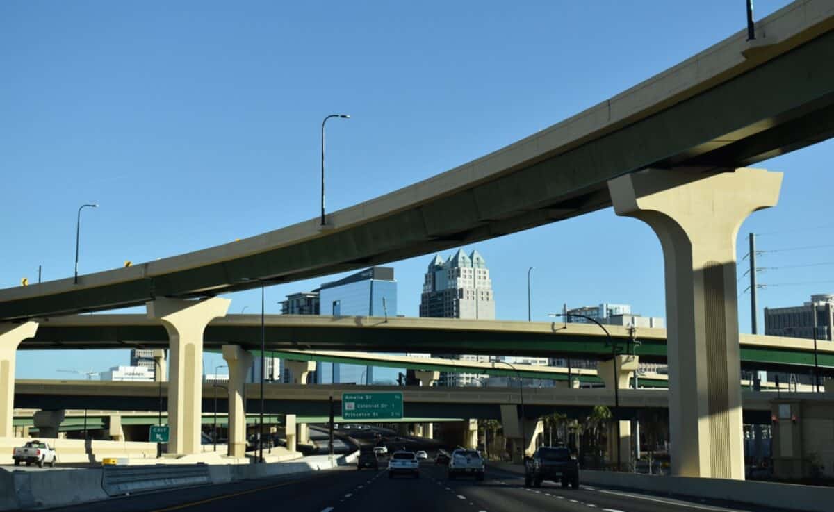
Image generated with Ai
The safety risks associated with some stretches of the US highway system are considerable. In 2026, knowing which US highways are most dangerous will be valuable for the millions of commuters and interstate travelers. The Bipartisan Infrastructure Law has funded massive projects to improve road safety. Meanwhile, the National Roadway Safety Strategy is still being implemented, and many fatalities caused by traffic remain a crisis for the entire country. According to the US government, thousands of fatalities are caused each year by outdated infrastructure and distracted and speeding driving. This report analyzes fatal corridors of traffic with the latest statistics on safety and ongoing initiatives from the US government that aims to improve safety for motorists.
The United States Interstate Highway System, originally conceived in the 1950s as a revolutionary network for national defence and economic expansion, has grown into one of the most heavily trafficked transportation grids on the planet. While these massive concrete arteries have successfully connected disparate states and facilitated unprecedented economic growth, they have also become the site of a profound public health crisis. The evolution of the most dangerous US highways is directly tied to the exponential increase in vehicle miles travelled (VMT), the proliferation of commercial heavy goods vehicles (HGVs), and a decades-long normalisation of high-speed commuting.
Historically, road safety in the United States has lagged behind many peer nations in Europe and Asia. For much of the late 20th and early 21st centuries, American infrastructure design prioritised vehicular speed and capacity over the safety of vulnerable road users and passenger vehicle occupants. Wide lanes, complex multi-tier interchanges, and a heavy reliance on personal automobiles created an environment where driver error frequently resulted in catastrophic outcomes. The National Highway Traffic Safety Administration (NHTSA) developed the Fatality Analysis Reporting System (FARS) to rigorously track these incidents, providing a nationwide census of fatal injuries suffered in motor vehicle traffic crashes.
As the population expanded, so too did the congestion and the subsequent crash rates. The COVID-19 pandemic introduced a particularly alarming anomaly in road safety data. While overall traffic volumes plummeted during 2020 and 2021, the fatality rate paradoxically spiked. Empty roads encouraged reckless speeding and impaired driving, pushing annual traffic deaths well above the 40,000 threshold. Since then, the federal government, operating through the United States Department of Transportation (USDOT), has been locked in a fierce battle to reverse these trends and reclaim the safety of the most dangerous US highways. Through comprehensive data collection, highway safety professionals now possess a remarkably detailed geographical map of where the majority of vehicular tragedies occur, allowing for highly targeted federal and state interventions.
Advertisement
Advertisement
When evaluating highway danger, federal authorities and independent safety analysts examine a variety of metrics, primarily focusing on the total number of fatalities per mile, the frequency of fatal crashes, and the density of severe traffic incidents per 100 million VMT. Based on continuous data assessments, a select few interstates repeatedly dominate the list of the most dangerous US highways.
Interstate 4, which spans 132 miles across Central Florida from Tampa, through Orlando, and terminating in Daytona Beach, consistently ranks as the most lethal highway corridor in the nation when adjusted for fatalities per mile. The sheer volume of traffic on I-4 is staggering, as it serves as the primary artery for millions of international and domestic tourists navigating towards major theme parks. This tourist density results in a chaotic mix of highly stressed local commuters and confused visitors relying heavily on GPS navigation. Frequent lane changes, sudden stops due to unpredictable congestion, and ongoing massive construction programmes contribute to a uniquely hazardous driving environment. Florida’s notorious torrential downpours further exacerbate these risks, turning the asphalt into a high-speed hydroplaning zone.
Spanning the entire length of the Eastern Seaboard from Miami, Florida, to the Canadian border in Maine, Interstate 95 is a vital economic lifeline and one of the most dangerous US highways by sheer volume of fatal accidents. While the northern stretches are frequently plagued by severe winter weather, including blizzards and black ice, the southernmost segment in Florida is notably deadly. The high density of traffic passing through Miami, Fort Lauderdale, and West Palm Beach creates a volatile environment. Furthermore, studies have highlighted the severe environmental and health impacts for communities living near I-95, as the highway accommodates roughly 150,000 vehicles daily, emitting dangerous ultrafine particulate matter that poses severe long-term respiratory and cardiovascular risks to nearby residents.
Stretching from Santa Monica, California, to Jacksonville, Florida, I-10 holds the grim distinction of recording some of the highest total crash fatalities over its entire span. The danger profile of I-10 is deeply tied to its geography. The route features incredibly long, monotonous stretches through the deserts of California, Arizona, New Mexico, and Texas. This environment induces “highway hypnosis,” severe driver fatigue, and frequent incidents of falling asleep at the wheel. Furthermore, I-10 is a premier route for cross-country commercial freight. The deadly combination of sleep-deprived passenger vehicle drivers interacting with massive 18-wheel HGVs at high speeds makes the corridor passing through Maricopa County, Arizona, and Riverside County, California, statistically terrifying.
Despite being fully contained within the borders of a single state, Interstate 45—connecting the mega-cities of Dallas and Houston—frequently tops lists of the most dangerous US highways per mile. The stretch running directly through Houston is particularly notorious. Texas consistently ranks at the top of national statistics for speeding-related traffic fatalities, recording over 1,484 speeding-related deaths in recent annual data. I-45 suffers from outdated interchange designs, extremely aggressive commuter driving behaviours, and a high incidence of alcohol-impaired driving during late-night hours. The rapid population boom in Texas has simply outpaced the highway’s physical capacity to safely handle the daily vehicular load.
While not an interstate, Highway 99 in California’s San Joaquin Valley is routinely cited in federal and state reports as the “deadliest highway in America”. Running through the agricultural heartland of the state, this highway is plagued by immense commercial farm traffic, densely packed vans transporting agricultural labourers, and horrific winter phenomena known as “Tule fog”—a thick ground fog that reduces visibility to absolute zero. The infrastructure is relatively antiquated compared to modern interstates, often lacking adequate central dividers or modern lighting, rendering it exceptionally dangerous during nighttime hours and the chaotic rush of the harvest season.
To comprehend the scale of the issue on the most dangerous US highways, one must closely analyse the latest official datasets published by the NHTSA and the Federal Highway Administration (FHWA). The data reveals a complex narrative: while absolute numbers remain historically high, a downward trajectory has successfully been established following the pandemic.
In 2022, there were 42,514 people killed in motor vehicle traffic crashes, reflecting a fatality rate of 1.33 per 100 million VMT. By 2023, the NHTSA’s finalised FARS data demonstrated a crucial turning point. There were 40,901 traffic fatalities across the United States, representing a 4.3% decrease from the previous year, and bringing the fatality rate down to 1.26 per 100 million VMT. This marked a significant milestone, representing the second consecutive year-to-year decrease since 2021.
The positive momentum has continued steadily into the current timeframe. Official early estimates from the NHTSA projected that 39,345 people died in traffic crashes throughout 2024, representing an additional 3.8% decrease compared to 2023. Notably, this was the first time since 2020 that annual roadway fatalities fell below the grim threshold of 40,000. Furthermore, preliminary estimates for the first half of 2024 showed a 3.2% decline in fatalities (an estimated 18,720 deaths) compared to the first half of 2023, even as Americans collectively drove 13.1 billion more miles (a 0.8% increase in VMT). This pushed the fatality rate down further to 1.17 fatalities per 100 million VMT.
State-by-state variations remain stark. In recent statistical breakdowns, Massachusetts exhibited the lowest fatality rate per 100,000 population (4.90), while Mississippi unfortunately led the nation with a staggering rate of 24.90 fatalities per 100,000 population. These vast regional discrepancies highlight why identifying the most dangerous US highways is largely dependent on state-level infrastructure funding, local enforcement of seatbelt laws, and cultural attitudes towards impaired driving.
Recognising that tens of thousands of deaths on the most dangerous US highways is unacceptable, the federal government has launched unprecedented initiatives. In January 2022, U.S. Transportation Secretary Pete Buttigieg formally announced the National Roadway Safety Strategy (NRSS), outlining a bold, comprehensive plan to systematically address the fatality crisis. The NRSS established a long-term, ambitious goal of reaching zero roadway fatalities, fundamentally changing how the USDOT approaches traffic safety.
“Reversing the rise in roadway deaths has been a top priority for this Department, so we’re encouraged to see continued reductions in traffic fatalities—yet the overall proportions of this issue remain at crisis levels and there is much more work to do,” Secretary Buttigieg stated.
The financial backbone of this strategy is President Biden’s Bipartisan Infrastructure Law (BIL). This historic legislation provided a monumental infusion of capital specifically earmarked for roadway safety. This includes a brand new $6 billion Safe Streets and Roads for All programme, which provides direct funding to local and regional municipalities to implement safety plans. Additionally, the BIL injected $4 billion in supplementary funding into the Highway Safety Improvement Program (HSIP) and provided hundreds of millions for behavioural research and interventions.
In a robust regulatory move, the NHTSA has recently finalised a significant number of safety initiatives. Most notably, a new federal requirement mandates that all new passenger cars and light trucks must come equipped with advanced automatic emergency braking (AEB) systems by 2029. This technological mandate is explicitly designed to prevent rear-end collisions—one of the most common crash types on the congested stretches of the most dangerous US highways.
A core tenet of the NRSS is the formal adoption of the “Safe System Approach” across all levels of the USDOT. This represents a paradigm shift in American traffic engineering. Historically, the burden of safety was placed entirely on the individual driver, operating under the assumption that educating drivers to behave perfectly would eliminate crashes. The Safe System Approach, however, acknowledges the reality of human vulnerability and human error.
The approach is built upon a five-pronged model:
By building redundant safety measures into the environment of the most dangerous US highways, the Safe System Approach ensures that when a driver inevitably makes a mistake, that mistake does not result in a loss of life.
The influx of federal funding and the overarching guidance of the NRSS have massive policy implications for state Departments of Transportation (DOTs). States containing the most dangerous US highways are now being held to higher standards of accountability regarding how they utilise federal formula funding. The FHWA has actively updated the Manual on Uniform Traffic Control Devices (MUTCD) to promote safety improvements in repaving and rehabilitation projects, effectively forcing state engineers to prioritise safety over sheer vehicle throughput.
At the legislative level, states are increasingly deploying automated enforcement technologies to tackle excessive speeding and red-light running, particularly in urban corridors where pedestrian fatalities are concentrated. The NHTSA continues to partner closely with the law enforcement community to enhance traffic enforcement targeting impairment and a lack of seatbelt use, which remains disproportionately fatal. In fact, recent data showed that unrestrained passenger vehicle occupant fatalities constitute a massive portion of highway deaths, prompting stricter “Click It or Ticket” campaigns across state lines.
The toll exacted by the most dangerous US highways extends far beyond the tragic loss of human life; it represents a colossal economic drain on the American economy. Motor vehicle crashes cost American society hundreds of billions of dollars annually. These costs are distributed across medical and emergency services, lost workplace productivity, property damage, legal and court expenses, and profound congestion costs resulting from major highway shutdowns.
When an arterial route like I-10 or I-95 is closed for hours to clear a fatal collision, the disruption to the national supply chain is immense. Freight logistics become severely delayed, compounding costs for businesses and consumers alike. Furthermore, the high frequency of crashes on these corridors directly impacts regional insurance premiums, creating a financial burden on millions of safe drivers who merely happen to reside in high-risk geographic zones like Florida or Texas. The USDOT’s investment in the Safe Streets and Roads for All programme is not just a moral imperative, but a highly calculated economic intervention designed to curb these massive systemic financial losses.
The commercial trucking industry is acutely affected by the dangers present on the most dangerous US highways. Heavy goods vehicles are disproportionately involved in catastrophic multi-vehicle pile-ups, particularly in adverse weather conditions. Wyoming, for instance, records the highest percentage of fatal crashes involving large trucks (22%) due to the perilous winter conditions and high crosswinds on Interstate 80. The Federal Motor Carrier Safety Administration (FMCSA) is aggressively enforcing hours-of-service regulations to combat driver fatigue and is advocating for the mandatory inclusion of AEB systems and speed limiters on commercial fleets.
Simultaneously, the automotive industry is undergoing a rapid evolution driven by these safety statistics. The NHTSA is actively updating its New Car Assessment Program (NCAP) to include more advanced driver assistance systems (ADAS) technologies, such as blind spot detection, lane keeping assistance, and pedestrian automatic emergency braking. Automakers are heavily investing in these technologies, using the grim realities of the most dangerous US highways as the primary testing ground for next-generation safety sensors and eventual autonomous driving capabilities.
The public impact of highway danger is deeply intertwined with tourism and business operations. Florida’s Interstate 4 is the prime example of this collision between local commerce and visitor safety. Millions of families rent vehicles annually in Orlando with little to no familiarity with the aggressive local driving culture, placing them directly into a high-risk matrix. The constant spectre of accidents damages the tourism experience and forces local businesses to account for chronic employee tardiness due to severe I-4 gridlock.
Furthermore, environmental justice is a massive component of the public impact. As previously mentioned, the communities living within 100 metres of heavily trafficked routes like I-95 suffer disproportionately from ultrafine particle pollution, leading to elevated rates of cardiovascular disease, asthma in children, and premature mortality. The NRSS recognises that roadway safety is inextricably linked with equity and climate goals, noting that traffic deaths and the associated environmental pollutions disproportionately affect communities of colour and lower-income neighbourhoods adjacent to the most dangerous US highways.
Looking toward the latter half of the 2020s, the future of American road safety hinges on the continued execution of the Bipartisan Infrastructure Law and the relentless application of the Safe System Approach. The gradual, consecutive quarterly declines in traffic fatalities throughout 2023 and 2024 provide cautious optimism that the federal strategy is beginning to bear fruit.
However, achieving the ultimate goal of zero fatalities will require more than just federal funding. It necessitates a fundamental cultural shift in how American society views driving. The normalisation of speeding and smartphone distraction must be systematically eradicated through a combination of public education, strict enforcement, and, most importantly, forgiving infrastructure design. As vehicle-to-everything (V2X) communication technologies mature, cars will soon be able to natively communicate with the infrastructure of the most dangerous US highways, receiving real-time warnings about hazards, black ice, and congestion miles before human eyes can perceive them. Until these technological utopias are fully realised, cautious driving, strict seatbelt adherence, and a collective commitment to road safety remain the most potent weapons against the tragedies unfolding on American interstates.
Advertisement
Tags: Bipartisan Infrastructure Law, Interstate 4, Most Dangerous Highways, NHTSA, Roadway Safety Strategy
Advertisement
Advertisement













Friday, September 4, 2026

Friday, September 4, 2026
Friday, September 4, 2026

Friday, September 4, 2026

Thursday, September 3, 2026

Wednesday, September 2, 2026

Friday, September 4, 2026

Friday, September 4, 2026


