
Atlanta Aligns Los Angeles, and Chicago to Face Thanksgiving 2026 Travel Nightmare as Epic Gridlock Might Destroy Touristy Fever

Published
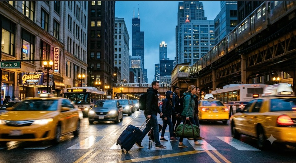 Image generated with Ai
As the Thanksgiving 2026 travel congestion peaks, millions of Americans are preparing for what official transit authorities and the Bureau of Transportation Statistics predict will be a historically crowded holiday. Navigating the Wednesday before Thanksgiving requires strategic planning, especially for those traversing densely populated airport hub neighborhoods and major metropolitan highway corridors. This year, weather variables and increased flight volumes compound the challenge, transforming local access roads into severe bottlenecks. Understanding these verified traffic patterns is absolutely essential for minimizing delays. Whether you are driving or flying, staying informed about these localized gridlock zones ensures families can arrive together safely.
The Anatomy of the 2026 Thanksgiving Travel Rush
Thanksgiving is historically the most demanding period for the United States transportation infrastructure. In 2026, the convergence of post-pandemic travel enthusiasm, returning corporate travel, and unpredictable late-November weather patterns has created an unprecedented scenario. According to verified reports from transportation analysts and early holiday data, the Wednesday preceding Thanksgiving (November 25, 2026) is projected to be the single most challenging day for motorists and airline passengers alike. [1, 2]
Advertisement
Advertisement
This year, the focus shifts slightly from macro-level highway statistics to micro-level neighborhood gridlock. The ripple effects of massive traffic volumes do not merely slow down interstate highways; they completely inundate the residential and commercial neighborhoods surrounding major transit hubs. Official data from the Bureau of Transportation Statistics (BTS) and the Federal Highway Administration (FHWA) indicates that local arterial roads will bear the brunt of the overflow.
Background: How We Reached Peak Gridlock
To understand the Thanksgiving 2026 travel congestion, we must look at the trajectory of American travel habits over the last five years. Following record-breaking air travel numbers in 2024 and 2025—where the Transportation Security Administration (TSA) routinely screened over 3 million daily passengers during peak holiday weekends—the infrastructure has been operating near maximum capacity. [1]
Advertisement
Advertisement
The Federal Aviation Administration (FAA) and the Department of Transportation (DOT) have continually warned that when the national airspace system runs at capacity, minor disruptions lead to major ground-level delays. When flights are delayed, curbside pickups and drop-offs stall. This transforms the immediate zip codes around major airports into parking lots.
Latest Official Developments and Forecasts
As of October 2026, official inter-agency preparations are underway to mitigate the expected surge. The National Highway Traffic Safety Administration (NHTSA) alongside the USDOT has launched comprehensive safety campaigns, specifically warning drivers about the hazardous combination of peak congestion, winter weather, and impaired driving associated with “Blackout Wednesday.” [3]
Advertisement
Advertisement
The Wednesday Bottleneck: November 25, 2026
While Thanksgiving Day itself (November 26, 2026) remains the quietest day to travel, the Tuesday and Wednesday prior are the undisputed peaks for outbound journeys. The Federal Highway Administration notes that commuter traffic overlapping with early holiday departures creates “structural congestion”—a state where road networks simply lack the physical space to accommodate the volume of vehicles. [2]
Government Announcements and Policy Implications
In response to the data, local and federal authorities have implemented several temporary policies to ease the burden:
Advertisement
Advertisement
- Suspension of Non-Emergency Roadworks: The FHWA has strongly advised state DOTs to pause all non-essential highway construction projects from November 24 through December 1.
- Increased Transit Law Enforcement: The NHTSA’s “Buzzed Driving Is Drunk Driving” campaign will see increased highway patrol presence, not only to deter impaired driving but to rapidly clear minor fender-benders that traditionally cause miles of backup on crowded corridors. [3]
- Airport Traffic Management: The FAA continues to collaborate closely with major airlines to ensure scheduling realism, aiming to prevent the cascading gate holds that leave thousands of cars idling on airport approach roads. [1]
Airport Hub Neighborhoods: The Ground Zero of Gridlock
The neighborhoods directly adjacent to the country’s largest connecting airports face severe localized gridlock at the curb, bag drop, and surrounding service roads. Areas around these specific hubs will push past standard operational throughput. [1, 2]
College Park & East Point (Atlanta, GA)
Neighborhoods surrounding the Hartsfield-Jackson Atlanta International Airport are at extreme risk this year. Known as the world’s busiest airport, its surrounding infrastructure in College Park and East Point is easily overwhelmed. A wetter-than-average storm pattern hitting the Southern Tier is expected to delay connecting flights. When the skies back up, the ground stops moving, creating a cascading backlog on Camp Creek Parkway and I-285 interchanges. [1]
Westchester & El Segundo (Los Angeles, CA)
The gridlock stemming from Los Angeles International Airport (LAX) extends heavily into these residential and commercial blocks. With ongoing modernization projects inside the LAX horseshoe, overflow traffic routinely paralyzes Sepulveda and Lincoln Boulevards. Travelers attempting to bypass the main arterial routes often filter into Westchester, causing neighborhood-level standstills. [1]
O’Hare & Des Plaines (Chicago, IL)
The residential corridors tracking toward Chicago O’Hare International Airport will experience severe bottlenecking as millions of commuters and travelers converge simultaneously on Wednesday afternoon. The intersections merging onto I-190 and Mannheim Road are historical flashpoints for delays.
Advertisement
Advertisement
Metro Highway Corridors & Structural Bottlenecks
Transportation analytics highlight that cities where residential dense neighborhoods intersect with critical holiday corridors will experience standstill traffic. State highway administrations confirm that certain chokepoints are mathematically guaranteed to fail under holiday load. [2]
Downtown & Westside Los Angeles (The 405 Corridor)
Neighborhoods flanking the 405 Freeway remain among the hardest hit in the country. Experiencing severe bumper-to-bumper delays starting as early as Tuesday afternoon, the congestion spills over into local streets as navigation apps route drivers through residential zones in vain attempts to save time. [1, 2]
San Francisco Bay Area Corridors
Neighborhoods close to main bridges and exit corridors face a late-month peak weather risk. The approaches to the Bay Bridge and the I-80 corridor toward Sacramento become heavily congested. Increasing rain and local storms projected by meteorological agencies are expected to slow down road transit significantly, compounding the traditional holiday rush. [1]
The I-95 Northeast Corridor
Running from Washington D.C. through Baltimore, Philadelphia, and up to New York, this corridor represents the most densely populated travel artery in the US. Traffic data from previous years indicates that the Washington D.C. to Baltimore stretch alone can see travel times increase by over 80% during peak Wednesday hours. [4]
Weather-Impacted Regions
While the Northeast and Great Lakes are currently experiencing warmer, lower-risk profiles for snow in late 2026, specific regional weather patterns will stall local transit in other parts of the country. [1]
Pacific Northwest & Mountainous Areas
Neighborhoods in the wet, precipitation-heavy corridors of the Northwest and higher elevations will navigate wet road conditions and mild-to-moderate snow showers. The DOT heavily advises travelers in the Cascades and the Rockies to prepare for sudden pass closures and chain requirements, which immediately back up traffic into adjacent gateway towns. [1, 2]
Advertisement
Advertisement
Southern Tier Storms
The Old Farmer’s Almanac and official meteorological forecasts indicate that a storm pattern moving across the South will not only impact aviation but will make highway driving treacherous. Heavy rains reduce highway capacity by forcing lower speeds and increasing following distances, which immediately translates to longer traffic queues. [1]
Economic and Industry Impact
The economic implications of the Thanksgiving 2026 travel congestion are substantial.
Tourism and Business Disruption
For the tourism and hospitality sectors, delayed arrivals mean disrupted itineraries and logistical challenges for hotels and rental car agencies. However, the surge in travel is generally a massive economic boon. The Bureau of Labor Statistics (BLS) notes that the transportation and warehousing sectors see significant temporary employment spikes during this season to handle the increased load of passengers and simultaneous holiday freight.
Fuel Consumption and Logistics
Millions of cars idling in traffic dramatically increases nationwide fuel consumption. Furthermore, commercial trucking companies must carefully route their holiday freight shipments around these known passenger vehicle bottlenecks to maintain supply chain integrity leading into Black Friday.
Public Impact and Safety Guidance
The public impact of this congestion goes beyond mere inconvenience; it is a profound safety concern. The NHTSA reports that Thanksgiving Eve is historically one of the most dangerous nights on the road, driven by high traffic volumes, driver fatigue, and impaired driving. [3]
Official Statements and Recommendations
Authorities urge the public to adopt the following strategies:
Advertisement
Advertisement
- Travel Off-Peak: If possible, travel on Thanksgiving Day itself or early Tuesday morning.
- Utilize Real-Time Data: Rely on official state DOT 511 applications rather than solely on crowd-sourced GPS apps, as official apps provide direct information on road closures and active plowing operations.
- Plan for Airport Delays: Arrive at least three hours early for domestic flights, particularly if departing from Atlanta, LAX, or Chicago O’Hare.
Future Outlook
As the US population grows and the desire for travel remains robust, Thanksgiving congestion will likely remain a persistent infrastructural challenge. The DOT’s long-term strategic plans focus heavily on improving public transit interconnectivity and expanding rail options to alleviate the burden on the Interstate Highway System. Until these multi-decade projects come to fruition, travelers must rely on data-driven planning and patience to navigate the holiday rush.
Advertisement
