
Puerto Vallarta Alongside Manzanillo and More as Mexico’s Pacific Coast Faces Hurricane Trudy Threats, Dangerous Waves and Uncertain Holiday Plans!

Published
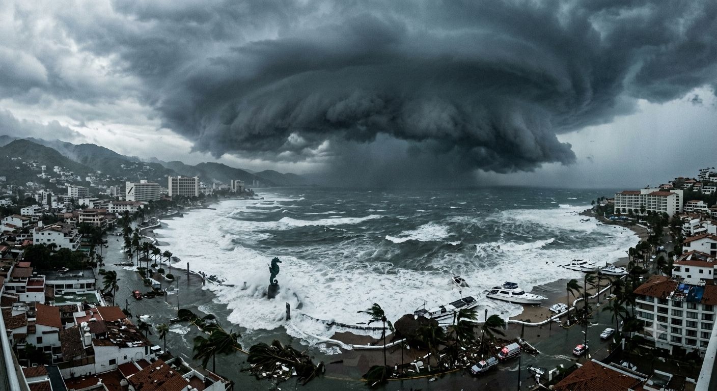
Puerto Vallarta follows Manzanillo and more as Mexico’s Pacific Coast faces growing concerns over Hurricane Trudy threats, dangerous waves and uncertain holiday plans. From sunlit beaches to exciting coastal adventures, these destinations attract travellers seeking unforgettable Mexican escapes. However, changing weather conditions could affect beach activities, boat excursions and carefully planned holidays. Therefore, visitors should monitor official weather alerts before exploring Puerto Vallarta, Manzanillo and other Pacific Coast destinations. As Hurricane Trudy raises fresh concerns, dangerous waves and potential travel disruptions deserve attention. Travel And Tour World urges global travellers to read the entire story for essential travel updates, safety guidance and practical holiday planning advice.
Hurricane Simon and Tropical Storm Trudy Put Mexico’s Pacific Coast Destinations Under Weather Pressure as Rainfall, High Waves and Travel Disruptions Become Major Concerns
Mexico’s Pacific coastline is an important destination for international holidaymakers, offering beach resorts, marine excursions, historic towns and coastal road trips. However, the overlapping weather threats from Hurricane Simon and Tropical Storm Trudy have placed several coastal states under heightened weather scrutiny in October 2026. Official bulletins issued by Mexico’s National Water Commission (CONAGUA) documented exceptionally heavy forecast rainfall, powerful winds and dangerous waves associated with Simon. Meanwhile, the US National Hurricane Center (NHC) warned that Trudy could strengthen significantly as it approached southwestern and west-central Mexico.
Advertisement
Advertisement
For tourists, the important distinction is that Simon generated documented severe weather conditions, while Trudy’s eventual effects depend on its evolving track and intensity. The following destination-by-destination assessment combines official forecast measurements with reported impacts, while distinguishing the two storms and avoiding unsupported claims about damage.
Hurricane Simon and Tropical Storm Trudy: Key Statistics for Travellers
The strongest numerical evidence available comes from CONAGUA’s October 10–11 bulletins and the NHC’s October 13–14 advisories. These records show how rapidly conditions changed during Simon’s passage and how Trudy subsequently developed farther south over the eastern Pacific.
Advertisement
Advertisement
| Indicator | Hurricane Simon | Tropical Storm Trudy |
|---|---|---|
| Official status in the cited reports | Category 4 on October 10–11, later weakening | Tropical storm in the October 14 morning advisory |
| Maximum sustained winds in the cited snapshot | 240 km/h on October 10; 215 km/h on October 11 | 95 km/h on October 14 |
| Highest reported gusts in the cited snapshot | 295 km/h on October 10; 260 km/h on October 11 | Not specified in the cited October 14 summary |
| Central pressure | Not stated here as a single comparable value | 998 millibars on October 14 |
| Reported position | Near Manzanillo and later west of Playa Pérula and Cabo Corrientes | Approximately 600 km south of Acapulco |
| Key forecast concern | Extreme rainfall, strong winds and dangerous coastal waves | Potential strengthening and additional wind, rain and coastal hazards |
| Official coastal watches and warnings | Varied by location and reporting time | None in effect in the cited October 14 morning advisory |
| Main travel implication | Flooding risks, dangerous surf and possible transport interruptions | Monitor changing forecasts and prepare for possible disruption |
Sources: CONAGUA’s October 10 Simon bulletin; CONAGUA’s October 11 Simon bulletin; NHC’s October 14 Trudy advisory.
These are dated observations, not current measurements for October 15. Travellers should check the latest advisories before making decisions.
Advertisement
Advertisement
Detailed Comparison of Rainfall, Wind and Wave Hazards
CONAGUA classified forecast rainfall by expected accumulation over a 24-hour period. Its October 10 bulletin projected more than 250 millimetres in parts of Michoacán and Colima, 150–250 millimetres in coastal and eastern Jalisco, and 75–150 millimetres in southwestern Guerrero. These were forecast ranges, not verified rainfall totals for every locality.
| Destination region | Simon-related rainfall forecast | Wind information in official bulletins | Wave or coastal hazard |
|---|---|---|---|
| Jalisco | More than 250 mm in coastal and western areas in the October 11 bulletin | Sustained winds of 210–230 km/h were reported for coastal areas in that bulletin, with gusts of 240–250 km/h | Earlier forecasts indicated waves of 6–8 metres; a later bulletin warned of 8–10 metres |
| Colima | More than 250 mm in the October 10 bulletin; 150–250 mm in the October 11 afternoon bulletin | Coastal winds and gusts varied by reporting time; an earlier bulletin forecast sustained winds of 90–110 km/h with gusts of 120–130 km/h | Waves of 6–8 metres in the earlier bulletin; storm tide of 1–2 metres was forecast for the coast |
| Michoacán | More than 250 mm in coastal and western areas in the October 10 bulletin | Coastal sustained winds of 60–80 km/h with gusts of 90–110 km/h in the October 10 forecast | Waves of 4–6 metres |
| Guerrero | 75–150 mm in southwestern areas in the October 10 bulletin | Conditions varied by locality and reporting period | Waves of 2–3 metres in the earlier coastal forecast |
| Nayarit | 50–75 mm in southern areas in the October 10 bulletin; 75–150 mm in parts of the south in the October 11 bulletin | Coastal wind forecasts varied with Simon’s movement | Dangerous surf and rough coastal conditions |
| Sinaloa | 50–75 mm in southern areas in the October 11 bulletin | Gusty winds were forecast along southern coastal areas | Coastal conditions required continued monitoring |
Sources: CONAGUA rainfall forecast, October 10; CONAGUA coastal conditions, October 11; CONAGUA wave forecast, October 11.
The regional comparison shows why coastal conditions should not be assessed through a single nationwide forecast. Jalisco and Colima faced particularly severe wind and wave forecasts, while rainfall threats extended south into Guerrero and west into Michoacán and Nayarit. Forecast values represent different observation times and should not be combined as though they were simultaneous measurements.
Destinations Facing the Most Significant Weather Concerns
1. Puerto Vallarta and Cabo Corrientes, Jalisco
Puerto Vallarta is one of Mexico’s best-known Pacific holiday destinations, with beach resorts, waterfront restaurants, boat excursions and access to the surrounding coastline. Simon’s proximity to Jalisco made this region particularly important for travellers to monitor. On October 11, CONAGUA reported that the hurricane was approximately 70 kilometres west of Playa Pérula and 90 kilometres south of Cabo Corrientes, with sustained winds of 215 km/h and gusts of 260 km/h. The same bulletin forecast more than 250 millimetres of rainfall in coastal and western Jalisco.
These figures describe the wider regional weather threat rather than verified conditions at every Puerto Vallarta hotel. Travellers should confirm beach access, boat departures, road conditions and accommodation arrangements with local authorities and providers.
2. Manzanillo, Colima
Manzanillo is a major port and a coastal destination known for fishing, beaches and marine recreation. Simon passed relatively close to this area during its strongest reported phase. At 00:00 local time on October 10, CONAGUA placed the hurricane approximately 225 kilometres south of Manzanillo, with sustained winds of 220 km/h and gusts of 270 km/h. Later that morning, the agency reported sustained winds of 240 km/h and gusts of 295 km/h while the centre was approximately 185 kilometres south-southwest of Manzanillo.
Advertisement
Advertisement
The October 10 forecast included rainfall exceeding 250 millimetres in Colima and waves of 6–8 metres along the relevant coastal areas. Such conditions can endanger maritime activities and create coastal flooding risks. Visitors should confirm port restrictions, excursion cancellations and access to beaches before travelling.
3. Playa Pérula and the Southern Jalisco Coast
Playa Pérula and nearby coastal communities offer quieter alternatives to Mexico’s larger resort centres. However, smaller coastal settlements can be vulnerable to heavy rainfall, rough surf and road interruptions. CONAGUA’s October 11 afternoon bulletin placed Simon approximately 70 kilometres west of Playa Pérula, moving north-northwest at 9 km/h. Sustained winds were estimated at 215 km/h, with gusts of 260 km/h. The agency forecast extraordinary rainfall exceeding 250 millimetres across coastal and western Jalisco.
Gob.mx The bulletin establishes a serious regional hazard but does not quantify damage to Playa Pérula itself. Visitors staying in small guesthouses or travelling along coastal roads should follow local civil protection instructions and avoid exposed beaches when waves are dangerous.
4. Michoacán’s Pacific Coast
Michoacán’s coastline includes fishing communities, beaches and ecotourism areas that may be less familiar to international visitors than Puerto Vallarta. Nevertheless, Simon’s rainfall forecasts identified coastal and western Michoacán among the areas facing the most severe precipitation threat. CONAGUA forecast more than 250 millimetres of rainfall in these areas on October 10. Coastal winds were forecast at 60–80 km/h, with gusts of 90–110 km/h, while waves could reach 4–6 metres.
Heavy rainfall can cause flooding, dangerous runoff and landslides, particularly where roads cross steep terrain. Tourists should confirm road access and local warnings before travelling between coastal settlements or visiting rural attractions. The forecast figures do not establish how much rain each community ultimately received.
5. Acapulco and the Guerrero Coast
Acapulco remains a significant beach destination and a gateway to other attractions in Guerrero. The region also featured prominently in Trudy’s early forecast information. In its October 14 morning advisory, the NHC located Trudy approximately 600 kilometres south of Acapulco, with sustained winds of 95 km/h and a minimum central pressure of 998 millibars. At that reporting time, no coastal watches or warnings were in effect. The agency nevertheless advised people in southwestern and west-central Mexico to continue monitoring the storm.
Advertisement
Advertisement
nhc.noaa.gov Separately, CONAGUA’s October 10 forecast associated Simon with 75–150 millimetres of rainfall in southwestern Guerrero and waves of 2–3 metres along relevant coastal areas. These are two different storm assessments, not evidence that Trudy had already damaged Acapulco. Travellers should check the latest local alerts before swimming or arranging boat trips.
6. Nayarit’s Southern Coast
Southern Nayarit contains coastal communities, surf areas and holiday accommodation that depend on road access and safe marine conditions. Simon’s circulation affected the broader regional forecast even as the storm’s position changed. CONAGUA initially forecast 50–75 millimetres of rainfall in southern Nayarit on October 10, followed by a 75–150 millimetre forecast range for southern areas in its October 11 afternoon bulletin. That later bulletin also forecast sustained winds of 100–120 km/h, with gusts of 130–140 km/h, along the relevant Nayarit and Colima coastal areas.
These figures demonstrate the potential for significant disruption, but they do not confirm damage at every resort. Travellers should verify road conditions, tour schedules and beach restrictions before setting out.
7. Sinaloa’s Southern Coast
Sinaloa’s southern coastal region was included in CONAGUA’s October 11 weather assessment as Simon moved along the Mexican Pacific. The agency forecast 50–75 millimetres of rainfall in central and southern parts of the state in its October 11 evening bulletin, while also warning of strong winds along sections of the coast.
Gob.mx The available figures are forecast measurements, not a confirmed final rainfall total. For tourists, the main considerations include rough seas, possible flooding on local roads and changes to fishing or boat excursions. Visitors should not assume that conditions in Sinaloa match those farther south in Jalisco or Colima. They should use current municipal warnings and transport updates when planning coastal journeys.
8. Southwestern and West-Central Mexico Under Trudy’s Forecast Track
Trudy introduced an additional area of uncertainty for travellers across southwestern and west-central Mexico. The NHC’s October 13 discussion forecast that the system could approach the coast as a major hurricane later in the week, while explicitly noting uncertainty about the precise location and magnitude of potential impacts. On October 14, the storm’s reported position was approximately 600 kilometres south of Acapulco and 980 kilometres southeast of Manzanillo, with sustained winds of 95 km/h.
Advertisement
Advertisement
+1 Those distances are important for understanding the storm’s position at the time, but they do not establish a future landfall location. Travellers across the region should monitor updated forecasts rather than cancelling or continuing trips based on an outdated projected path.
How Simon and Trudy Differ for Travel Planning
| Travel consideration | Simon | Trudy |
|---|---|---|
| Evidence available in the cited reports | Severe wind, rainfall and wave forecasts issued during its passage near western Mexico | Developing tropical storm with forecast strengthening |
| Geographic focus | Jalisco, Colima, Michoacán, Guerrero, Nayarit and parts of Sinaloa featured in dated bulletins | Southwestern and west-central Mexico identified as areas to monitor |
| Rainfall information | Regional forecast ranges published by CONAGUA | Potential heavy rainfall was a concern, but precise local totals were not established in the cited advisory |
| Coastal recreation | High waves and dangerous sea conditions were forecast in several areas | Future surf and coastal impacts depended on the storm’s track and intensity |
| What travellers should do | Confirm recovery of local transport, beaches and excursions | Monitor the latest forecasts and prepare for changing plans |
Sources: CONAGUA’s Simon assessment and NHC’s Trudy forecast discussion.
What International Tourists Should Check Before Travelling
The most useful preparation is destination-specific. Travellers should check official weather alerts, contact accommodation providers, confirm flight and road arrangements, and review cancellation policies for marine excursions. Visitors should also keep travel documents and essential medicines accessible, avoid floodwater and follow evacuation instructions where issued.
Official updates are available through the National Hurricane Center at nhc.noaa.gov and Mexico’s National Meteorological Service at smn.conagua.gob.mx.
Conclusion
In conclusion, Puerto Vallarta, Manzanillo and more destinations along Mexico’s Pacific Coast require close attention as Hurricane Trudy raises concerns about dangerous waves, heavy rainfall and uncertain holiday plans. Although the actual impacts will depend on the storm’s movement and intensity, travellers should remain flexible and prioritise safety. Therefore, visitors should monitor official weather advisories, confirm accommodation arrangements and check coastal activity restrictions before setting out. By staying informed, tourists can make responsible decisions and adjust their itineraries when necessary. Travel And Tour World encourages global travellers to follow verified updates and plan their Mexican Pacific Coast holidays with care.
Advertisement
