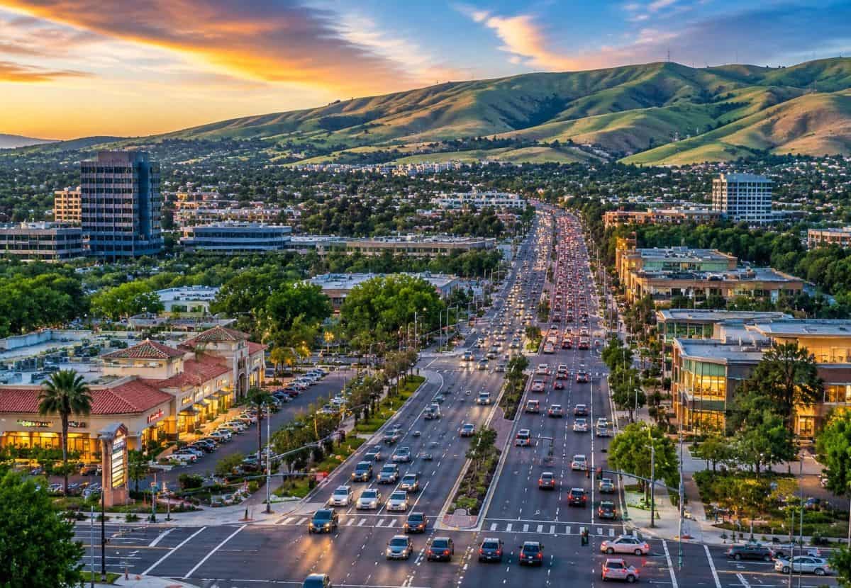
Image generated with Ai
It begins with the morning haze on Mount Diablo. With a breeze to warm the morning, pine needles and dirt begin to release their scents. Then, as the morning peace curates and relaxes the soul, the serenity of the morning fills the canyons with noise. Traffic begins to fill the narrow canyon roads and began to park on the grass that was once kept softer by nature. The canyons beyond the parking lots that are dense with congestion, lose fragments of their nature one grass parking spot at a time. In the distance wilderness that is pressured beyond its limits, search and rescue teams are being called tokeep the wild safe, however they lack training, supplies, and equipment for such an overstretched task. The demands of nature lovers begin to strain the peace and tranquility of Contra Costa Counties Wilderness.
The infinite limit of patience is reached when one begins to notice the effects of the overuse. There is a great human pull that becomes obvious when one endeavors to leave a sign. There is a great divide between the duty of leaving a fragment unexplored and the human desire to experience the wild.
Advertisement
What Is the True Scale of Visitation Pressure Facing Mount Diablo State Park and the East Bay Regional Parks Network Today in California?
Data from the East Bay Regional Park District indicates that regional parks across Alameda County and Contra Costa County accommodate over 25 to 30 million annual visits. Meanwhile, Mount Diablo State Park alone draws over 1 million annual visitors into its compact 20,000-acre core. These massive numbers demonstrate the intense popularity of the region’s public open spaces among Bay Area residents seeking outdoor recreation and pristine landscapes.
Advertisement
Advertisement
Because visitation spikes heavily on weekends and during seasonal peaks—such as spring wildflower blooms in Mitchell Canyon and clear autumn days—infrastructure built for baseline regional use routinely experiences severe capacity strain. Staging areas quickly fill beyond capacity, causing excessive traffic congestion and overcrowding that impacts the surrounding rural communities of Contra Costa County.
How Does Uncontrolled Foot Traffic Cause Severe Ecological Degradation and Habitat Loss Across Walnut Creek and Marsh Creek Watersheds in Contra Costa County?
High foot and mountain bike traffic creates unauthorized “social trails” that cut through protected natural flora. This illegal off-trail traffic causes severe soil compaction, destroys native plant species, and accelerates watershed erosion into vital local waterways like Walnut Creek and Marsh Creek. The physical damage to fragile ecosystems degrades topsoil stability and disrupts key vegetation networks essential for native wildlife.
Intensive recreational use also disturbs delicate nesting habitats for threatened species monitored under the East Contra Costa County Habitat Conservation Plan, including the California red-legged frog, the Alameda whipsnake, and various native raptors. Increased sedimentation from eroded trails compromises stream water quality across the Marsh Creek watershed, further putting native aquatic life and biological diversity under severe ecological stress.
Why Are Backcountry Rescues and Wildfire Risks in High-Hazard Wildland-Urban Interface Zones Escalating Emergency Costs Around Mount Diablo?
Remote medical evacuations and heat-illness rescues on steep trails around Mount Diablo’s peak or isolated EBRPD terrain require complex multi-agency emergency responses. Helicopter airlifts from isolated backcountry locations can exceed $50,000 per incident, putting administrative and operational strain on local fire districts and sheriff’s departments. These expensive emergency operations divert critical municipal resources and public safety focus away from routine community services.
Furthermore, overcrowded open spaces dramatically increase human-caused wildfire risks in high-hazard zones. Unregulated parking along narrow, dry-brush corridors blocks emergency access vehicles and complicates evacuation routes for residential communities along the wildland-urban interface. Irresponsible parking along narrow mountain access roads creates dangerous choke points, severely threatening both visitors and local homeowners during fast-moving wildfire emergencies.
What Financial Burdens and Maintenance Deficits Are Local Municipalities and Taxpayers Forced to Absorb Across Contra Costa County?
Heavy vehicular traffic at park entry points causes rapid deterioration of local county-maintained access roads, parking lots, and staging areas. Local road networks around Mount Diablo State Park suffer from accelerated wear and tear, requiring frequent repairs and resurfacing that strain county transportation budgets. Municipal engineering teams must constantly repair access infrastructure damaged by continuous high-volume day-tripper traffic.
High visitor turnover strains public restrooms, trash collection systems, and stormwater infrastructure. This increases municipal operational expenditures funded directly by local tax dollars rather than dedicated visitor fees. Consequently, local taxpayers end up subsidising the maintenance costs generated primarily by non-resident visitors without sufficient fee-capture mechanisms to offset the operational deficit.
How Are Local Policies and Frameworks Solving the Overtourism Crisis Across California’s Protected Open Spaces in Contra Costa County?
To mitigate these pressures while preserving public access, local agencies utilize framework goals from the Contra Costa County 2045 General Plan, the Climate Action and Adaptation Plan (CAAP), and regional land-use policies. Implementing timed-entry reservation systems during peak wildflower seasons helps distribute visitor density evenly throughout the week. Strategic shuttle-only access corridors and automated vehicle counters effectively control traffic flow into high-hazard wildland-urban interface zones.
Municipalities are also introducing regional park impact fees on commercial tour providers to build dedicated funding streams for emergency rescue services and park maintenance. Furthermore, expanding land acquisitions via the East Contra Costa County Habitat Conservancy helps secure contiguous habitat corridors, mitigating the fragmentation of wild spaces caused by social trails and high foot traffic.Impact Category Hidden Cost Policy & Technical Solution Direct Policy Source Trail & Soil Erosion Watershed siltation & habitat loss Timed-entry reservation systems & temporary trail closures during rainy/muddy periods California State Parks / EBRPD Policies Wildfire & Safety Risk Restricted emergency access & ignition hazards Strict WUI parking enforcement, shuttle-only corridors during peak fire season, and automated license plate counters Contra Costa County General Plan (Health & Safety Element) Fiscal Strain on Local Taxpayers Unfunded park maintenance & emergency rescue services Regional park impact fees on commercial tour providers and targeted parking revenues dedicated to search-and-rescue funds Contra Costa County Public Works & Park Use Ordinance Habitat Disruption Fragmentation of protected species corridors Expansion of protected land acquisitions via the East Contra Costa County Habitat Conservancy East Contra Costa County Habitat Conservation Plan (HCP/NCCP)
Escalating Wildfire Risks and Multi-Agency Response Costs in High-Hazard Wildland-Urban Interface Zones
The convergence of over a million annual visitors along narrow dry-brush access routes, such as South Gate Road and North Gate Road, dramatically escalates public safety risks across the Mount Diablo corridor. Severe traffic congestion and unauthorized roadside parking choke critical emergency ingress and egress points, impairing the mobility of response units from the Contra Costa County Fire Protection District. During peak periods, vehicles parked on dry grass significantly increase ignition hazards within designated high-hazard wildland-urban interface zones, threatening surrounding residential communities.
Simultaneously, isolated backcountry incidents severely tax municipal operational budgets and emergency capabilities. Complex search-and-rescue operations or medical airlifts for heat-related illnesses near Mount Diablo’s summit routinely require multi-agency coordination. With single helicopter evacuations frequently exceeding $50,000 per mission, local fire districts and sheriff departments absorb substantial operational expenditures. These escalating costs strain public safety resources that are primarily funded to serve routine municipal needs.
Watershed Erosion, Soil Compaction, and Creek Siltation Across Walnut Creek and Marsh Creek Drainage Basins
High volumes of foot traffic and off-trail mountain biking generate extensive networks of unauthorized “social trails” cutting through protected terrain. This unregulated traffic destroys native vegetation cover and accelerates soil compaction, preventing natural rain absorption. As topsoil destabilises, heavy rainfall drives systemic runoff into the Walnut Creek Watershed and Marsh Creek Watershed drainage systems, carrying massive sediment loads into critical local waterways.
The resulting stream turbidity degrades sensitive freshwater habitats and disrupts fundamental aquatic food chains. Increased siltation covers gravel spawning beds, smothers benthic organisms, and impairs water quality across key drainage basins. Over time, continuous soil loss alters natural hydrological flow patterns, making local stream banks vulnerable to severe bank erosion during seasonal storm events.
Habitat Fragmentation and Species Preservation Challenges Under the East Contra Costa County Habitat Conservation Plan
The 174,018-acre Inventory Area governed by the East Contra Costa County Habitat Conservation Plan faces mounting challenges from human disturbance. Uncontrolled off-trail hiking, litter accumulation, and unauthorized nighttime park access sever vital biological corridors. These intrusions fragment contiguous ecosystems required by protected species for foraging, seasonal migration, and successful breeding across local nature reserves.
Disturbance directly threatens vulnerable wildlife species monitored under regional preservation frameworks, including the California red-legged frog, the Alameda whipsnake, and the San Joaquin kit fox. Constant human presence displaces native fauna from essential nesting and hunting grounds, undermining ongoing conservation initiatives. Without strict compliance with reserve rules, the long-term viability of key wildlife populations across the county remains severely compromised.
Transportation Maintenance Deficits and Pavement Degradation Along County-Maintained Park Staging Corridors
The East Bay Regional Park District system accommodates between 25 million and 30 million annual visits, generating heavy vehicular throughput across regional staging areas. Feeder routes such as Ygnacio Valley Road, Clayton Road, and Morgan Territory Road experience continuous heavy traffic from non-resident day-trippers. This constant flow causes rapid pavement degradation, rutting, and structural fatigue on rural access roads that were never engineered for such high traffic volumes.
Maintaining these staging corridors creates a growing fiscal deficit for local public works departments. Because local property taxes rather than state park entry fees fund local road repairs, county taxpayers absorb the financial burden of repairing access infrastructure damaged by regional visitors. Consequently, municipal maintenance budgets are stretched thin, diverting funds from standard local road improvements.
Sacramento–San Joaquin River Delta Coastline Stress, Micro-Trash Influx, and Estuary Water Quality Depletion
High-density motorized boating and intense shoreline visitation inflict substantial environmental stress along the Sacramento–San Joaquin River Delta coastline. Heavy watercraft traffic churns up shallow benthic sediments, causing localized turbidity that blocks sunlight from aquatic vegetation. Additionally, unmanaged waste, petroleum residue, and fuel spills from recreational vessels directly contaminate sensitive estuary waters.
Accumulations of micro-plastics and synthetic trash collected from public boat launches and delta shorelines threaten marine life and waterfowl. Toxic residues lower localized water quality metrics and disrupt delicate estuarine ecosystems. The combination of shoreline erosion caused by boat wakes and chemical runoff threatens native fish populations, impairing overall ecological balance within the Delta basin.
Microclimate Alterations, Botanical Trampling, and Wildflower Sanctuary Strain in Mitchell Canyon Core Areas
Seasonal peaks in visitor numbers create severe botanical stress within the 20,000-acre core reserve of Mount Diablo State Park. Weekend surges during spring wildflower blooms bring crowds to Mitchell Canyon and Rock City, leading to widespread trampling off established paths. Off-trail foot traffic damages rare endemic flora, including sensitive species like the Mount Diablo fairy lantern.
Beyond direct physical damage, soil compaction from crowds alters delicate microclimates within shady canyon drainages. Hardened soil reduces moisture retention and prevents seed germination, gradually shifting native plant composition. As delicate botanicals disappear from heavily visited zones, invasive plant species often take root, permanently altering the botanical structure of protected sanctuaries.
Sanitation Infrastructure Deficits, Refuse Accumulation, and Stormwater System Overburden During Peak Seasons
During peak summer weekends, refuse accumulation far exceeds the capacity of standard rural waste containers at park staging points. Overflowing trash leads to widespread windblown litter across park entry points and surrounding wildlands. Municipal sanitation crews are forced to spend significant extra hours on weekend cleanups to prevent garbage from spilling into surrounding natural habitats.
This refuse burden directly impacts local stormwater infrastructure. Rain washes unmanaged litter and organic waste into drainage networks, clogging culverts and contaminating downstream water collection systems. County agencies incur substantial operational expenditures to clear public restrooms, manage waste systems, and filter urban runoff before it reaches larger water bodies.
Mobile Source Emissions, Idling Bottlenecks, and Air Quality Impacts Along Regional Park Entry Points
Long queues at park entry kiosks, such as the South Gate and North Gate entrances, create significant vehicular bottlenecks during weekend mornings. Non-resident day-trippers idle for extended periods waiting to enter or searching for scarce parking spots, concentrating mobile-source tailpipe emissions along quiet suburban-rural borders.
These localized air pollution spikes elevate fine particulate matter and greenhouse gas levels in tranquil residential zones. The accumulation of mobile source emissions conflicts directly with the carbon-reduction mandates set forth in the Contra Costa County Climate Action and Adaptation Plan. Idling bottlenecks not only degrade local air quality but also create unnecessary noise and exhaust burdens for adjacent rural neighborhoods.
Encroachment on Working Lands, Grazing Lease Disruption, and Agricultural Buffer Strain Under the 2045 General Plan
Over-visitation frequently spills across park boundaries onto surrounding agricultural buffers and private cattle ranches. Uninformed visitors often trespass past clear boundary lines, cut fences, leave gates open, and disturb grazing livestock. These unauthorized intrusions compromise private grazing leases and disrupt working cattle operations that serve as vital ecological buffers around public parklands.
This ongoing encroachment creates friction between private landowners and public recreation users, contradicting the protective mandates outlined in the Conservation, Open Space, and Working Lands Element of the Contra Costa County 2045 General Plan. Mitigating these disruptions requires increased county patrols and infrastructure repairs, highlighting the need to protect agricultural working lands from recreational encroachment.
The Final Horizon
From Mount Diablo, where the fog covers the Bay, you can’t see the wild spaces of California. There are golden hills, winding creeks and magnificent, ancient oaks. We think of these places as places to play or the background of the game on the map. We’re wrong. They are real. They are healing places.
Love and saving them won’t help. We’ll increase pressures on the beauty of nature unless we preserve them. The first step is more than regulation and the payment of the city’s fees. The required changes will tell how seriously we will preserve Contra Costa County. Every choice and every act means something. The act of staying on the trails preserves them. Respecting the boundaries means we can preserve these spaces forever. Contra Costa County will remain preserved and unspoiled for years to come.
Frequently Asked Questions
The primary driver is the intense concentration of visitors traveling from the broader San Francisco Bay Area to natural landmarks like Mount Diablo State Park and EBRPD trails on weekends and during seasonal wildflower blooms.
High foot traffic creates unauthorized social trails that destroy vegetation and compact the soil. This disrupts critical nesting and breeding grounds for protected species like the California red-legged frog and the Alameda whipsnake.
Local authorities enforce strict parking bans along narrow corridors near the wildland-urban interface to ensure emergency vehicles maintain clear access. Shuttle services and automated vehicle limits are also deployed during high-risk fire seasons.
Advertisement
Advertisement
Advertisement












Tuesday, September 1, 2026

Tuesday, September 1, 2026

Tuesday, September 1, 2026

Tuesday, September 1, 2026

Tuesday, September 1, 2026

Tuesday, September 1, 2026

Tuesday, September 1, 2026