
Colorado Stands Alongside Texas and Many Others in Reinventing the American Road Trip

Published
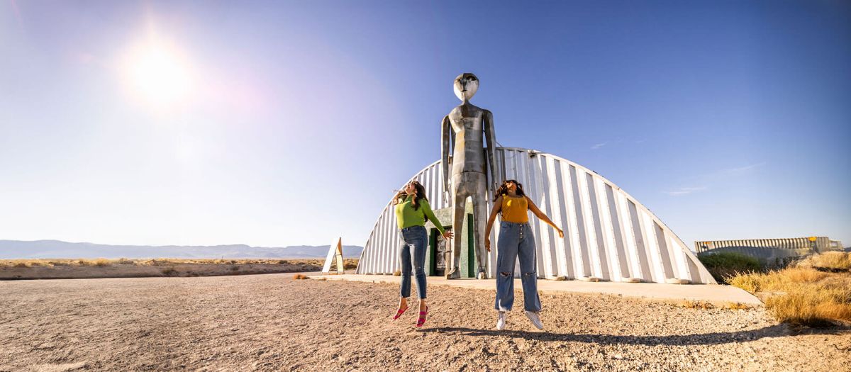
State tourism directors across California, Arizona, Utah, Colorado, Texas, New Mexico, and Nevada have launched coordinated multi-state scenic corridors. This marks an intentional departure from mid-century motorway tourism toward decentralized, heritage-led overland journeys. State tourism offices now direct drivers into protected scenic byways, regional agricultural networks, and sovereign tribal lands.
Federal infrastructure investments and visitor-dispersal strategies actively steer travelers away from congested national park gateways. Consequently, state agencies are reinventing the American road trip for travelers who prioritize cultural engagement and environmental stewardship over driving speed.
The post-war highway boom prioritised vehicular speed and uniform roadside commerce. Today, that framework faces structural obsolescence. Long-distance motorists increasingly bypass congested four-lane highways, choosing secondary roads that highlight the distinct ecological boundaries of the American West.
State tourism coalitions have formalized these routes into integrated cross-border corridors. These itineraries deliberately weave together high-desert craft distilleries, restored mid-century architecture, and dark-sky preserves. This shift transforms regional road transport from a fuel-burning commute into an extended cultural residency.
Advertisement
Advertisement
The Regional Corridor Network
| Geographic Region | Anchor State & Route | Ecological & Cultural Focus | Target Waypoint |
| Pacific & Sierra | California: US Route 395 | Alpine passes, hot springs, restored neon motels | Mono Basin to Lone Pine |
| Great Basin | Nevada: US Route 50 | High-elevation desert, night-sky astronomy, mining towns | Great Basin National Park |
| Colorado Plateau | Utah: Scenic Byway 12 | Sandstone canyonlands, slickrock ridges, fruit orchards | Boulder Mountain to Capitol Reef |
| Southern Rockies | Colorado: Highway 12 | Subalpine ecosystems, industrial history, micro-distilleries | Cuchara Pass to Trinidad |
| Southwest High Desert | Arizona: Route 89A | Red-rock canyons, riparian belts, artisan colonies | Oak Creek Canyon to Jerome |
| Upper Rio Grande | New Mexico: High Road | Century-old adobe plazas, Pueblo cuisine, textile arts | Chimayó to Taos Pueblo |
| Chihuahuan Borderland | Texas: US Route 90 | Chihuahuan Desert, contemporary arts, ranch cookery | Marfa to Terlingua & Big Bend |
Moving Beyond Gateway Choke Points
National park congestion reached unprecedented peaks over the past decade. Iconic destinations like Zion, Arches, and Grand Canyon introduced vehicle registration permits and compulsory shuttle systems to control crowding.
In response, state tourism bureaus developed sophisticated visitor dispersal models. Agencies direct travel demand toward less fragile surrounding environments. Utah’s state-wide stewardship campaign steers motorists away from crowded park entrances into vast state reserves like Goblin Valley and Kodachrome Basin.
Advertisement
Advertisement
Likewise, Colorado encourages travelers to exit the Interstate 70 ski corridor. Drivers explore the West Elk Loop, supporting small fruit farms and high-elevation vineyards in the North Fork Valley.
Nevada applies this approach across the Great Basin. The state routes independent motorists along designated arts and heritage pathways on Route 95 and State Route 447. This initiative converts rural expanses into outdoor cultural exhibits, directing commercial revenue into historic mining towns.
Advertisement
Advertisement
Data from the U.S. Travel Association reveals that travelers allocate larger shares of leisure budgets to rural communities than at any point in the post-interstate era. Regional dispersal mitigates environmental damage while supporting rural economies that highway development historically overlooked.
The Cross-Border Route Infrastructure
| State | Primary Scenic Route | Thematic Focus | Regional Focal Point |
| California | Route 395 Corridor | Sierra ecology and motor-lodge heritage | Lone Pine to Mono Basin; eastern alpine trailheads and geothermal hot springs |
| Nevada | US Route 50 Corridor | Remote astronomy and historic mining centers | Great Basin National Park; Lehman Caves and designated dark-sky observatories |
| Utah | Scenic Byway 12 | Geologic dispersal and low-impact transit | Boulder Mountain to Capitol Reef; sandstone canyons and historic orchards |
| Colorado | Highway of Legends (CO 12) | Industrial history and high-altitude cuisine | Cuchara Pass to Trinidad; heritage coal corridors and regional distilleries |
| Arizona | Route 89A Scenic Highway | Riparian ecology and canyon landscapes | Jerome to Marble Canyon; artisan enclaves and Colorado River viewpoints |
| New Mexico | High Road to Taos (NM 76/518) | Historic architecture and agricultural heritage | Chimayó to Picuris Pueblo; traditional weaving hamlets and adobe structures |
| Texas | US Route 90 Corridor | Contemporary desert arts and ranchlands | Del Rio to Marfa and Terlingua; Big Bend wilderness and regional borders |
Native Voices Reshape Southwest Travel
Traditional road trips often romanticized western expansion while ignoring Indigenous populations. Native communities now guide regional tourism, sharing their own cultural history and ecological stewardship.
The Native American Tourism and Improving Visitor Experience (NATIVE) Act provided essential institutional support for tribal tourism programs. The American Indian Alaska Native Tourism Association reports that Native-owned hospitality and tourism enterprises contribute billions annually to the domestic economy. Indigenous tourism businesses employ tens of thousands of professionals across Indian Country.
| Operational Indicator | Program Detail | Strategic Impact |
| Legislative Foundation | NATIVE Act Federal Funding | Direct grants for tribal tourism infrastructure |
| National Leadership | AIANTA Programs | Technical guidance for sovereign cultural programs |
| Annual Economic Output | Exceeds $11.6 Billion | Diversifies tribal community economies |
| Primary Tour Format | Guided Tribal Expeditions | Low-impact vehicle access to sacred landscapes |
| Cultural Governance | Sovereign Access Permits | Regulates visitor foot traffic across sensitive ruins |
The Navajo Nation has moved away from unguided highway transit. Diné guides lead low-impact vehicle tours through Mystery Valley and Canyon de Chelly, interpreting ancestral architecture and dryland farming traditions.
Advertisement
Advertisement
Along the Rio Grande, visitors support Pueblo agricultural initiatives. Travelers purchase heirloom blue corn meal, wild-harvested teas, and traditional baked goods directly from community producers at Taos, Picuris, and Santa Clara Pueblos.
In Arizona, the Hualapai Tribe operates river-running expeditions through the western reaches of the Grand Canyon. Similarly, the Hopi Cultural Center provides guided journeys through Second Mesa. These community-run enterprises encourage travelers to engage respectfully with sovereign tribal lands.
Culinary Heritage on the Backroads
Standard highway journeys long relied on corporate fast-food franchises clustered around motorway off-ramps. Today, regional culinary trails showcase local food traditions and sustainable desert agriculture.
New Mexico highlights this movement through its historic chile corridors. Along State Road 185, travelers purchase green chiles roasted over gas flames outside local farms. Further north, roadside cafes serve heirloom red chile varieties paired with local wild game.
Tucson, Arizona, an official UNESCO City of Gastronomy, anchors the borderland food trail. Travelers trace heritage ingredients through Sonoran bakeries using wild-foraged mesquite flour, heritage white Sonoran wheat tortillas, and historic food stands along the Interstate 19 corridor.
In West Texas, US Route 90 links long-standing ranching settlements. Local pitmasters preserve traditional meat-smoking techniques over regional hardwood coals. These kitchens stand beside high-elevation vineyards cultivating Mediterranean grape varietals on dry limestone hills.
Advertisement
Advertisement
Colorado and California offer distinct seasonal culinary drives. Colorado’s West Elk Byway guides visitors through organic stone-fruit orchards and small cider mills. Meanwhile, California’s Route 395 corridor connects sheep-ranching bakeries in the Owens Valley with craft breweries utilizing Sierra snowmelt.
Clean Transit Across Desert Roads
Historic road literature celebrated the roar of internal combustion engines across empty highways. The emerging generation of overland travelers favors electric transportation.
The multi-state ChargeWest initiative has connected the Intermountain West through alternative fuel corridors. Backed by the federal National Electric Vehicle Infrastructure program, state transportation departments installed high-capacity charging plazas along remote rural routes. These multi-port facilities operate reliably across the Great Basin and the Mojave Desert.
| Technical Parameter | NEVI Corridor Standard | Operational Purpose |
| Inter-Station Distance | Maximum 50 Miles apart | Eliminates range anxiety across rural deserts |
| Charging Station Ports | Minimum 4 DC Fast Chargers | Reduces queue times at peak travel hours |
| Power Output Rating | 150 kW minimum per port | Delivers 80% battery capacity in 20-30 minutes |
| Corridor Designation | FHWA Alternative Fuel Route | Qualifies routes for federal infrastructure funds |
These fast-charging hubs directly benefit local towns. A typical 30-minute charging stop encourages drivers to step away from the highway. Motorists explore historic main streets, visit regional bookstores, and dine in local cafes.
This transition transforms driving from a hurried highway commute into a relaxed and deliberate journey. State agencies across the West continue reinventing the American road trip into a clean, culturally rich travel experience.
How Travel Policies Have Evolved
The modern travel experience in the American West reflects substantial structural and policy changes. The comparative table below outlines how state and federal management approaches have shifted across recent decades:
Advertisement
Advertisement
| Strategic Area | Historical Motorway Model (1956–2010s) | Modern Slow-Corridor Framework (2020s–Present) |
| Highway Funding Focus | Interstate capacity expansion and commercial transit | Scenic byways, active multi-use transit, and secondary roads |
| Park Management | Unrestricted vehicle entry and reactive crowd control | Timed entry reservations, shuttle transit, and perimeter dispersal |
| Indigenous Inclusion | Stereotypical highway gift shops and commercial appropriation | Sovereign-led tourism, certified native guides, and cultural centers |
| Fuel & Infrastructure | Gasoline station concessions concentrated at interstate exits | Multi-state rural electric charging networks on scenic byways |
| Culinary Promotion | National franchise corridors and standardized highway dining | State-certified farm trails, heritage crops, and regional wine corridors |
| Regional Marketing | Competitive individual state advertising campaigns | Multi-state collaborative corridors and unified regional loops |
The New Way Forward
The modern highway model demonstrates that the open road retains immense cultural value. By replacing long-distance speed runs with local corridors, travelers reconnect meaningfully with regional geography.
Western states are demonstrating that sustainable overland travel is economically practical. They provide rural communities with direct tourism revenues while protecting delicate desert ecosystems.
When drivers choose scenic diversions over the interstate, the journey becomes an insightful lesson in regional geography, culinary traditions, and cultural heritage. The western road trip remains a compelling travel experience precisely because travelers now take the time to explore it slowly.
Frequently Asked Questions
1. How does the modern slow-corridor route differ from a traditional interstate road trip?
Traditional journeys prioritise speed on four-lane motorways, bypassing local geography. The slow-corridor model redirects drivers onto scenic byways, turning historic towns, regional heritage, and landscape exploration into the destination itself.
2. Can motorists reliably complete these remote desert and mountain circuits in an electric vehicle?
Yes. Federal NEVI funding and the ChargeWest network have added high-speed DC fast chargers along remote routes like Nevada’s US 50 and Utah’s Byway 12, spacing stations roughly 50 miles apart.
3. How do visitor dispersal policies ease overcrowding at popular national parks?
State tourism boards coordinate with land agencies to redirect traffic from congested gates like Zion and Arches toward neighbouring state parks, national monuments, and byway towns, protecting fragile environments.
Advertisement
Advertisement
4. What rules should travellers follow when visiting sovereign tribal lands?
Visitors must respect tribal sovereignty by securing required tribal permits, hiring certified Indigenous guides for backcountry sites, respecting strict photography prohibitions, and purchasing directly from local artisans.
5. What are the key regional food trails across these seven states?
Signature trails include New Mexico’s Hatch-to-Chimayó green chile corridor, Tucson’s Sonoran heritage grain bakeries, the West Texas pit-smoke barbecue route, and organic orchard cideries along Colorado’s West Elk Byway.
6. What is the ideal season to undertake this western scenic byway tour?
Autumn (September to October) and spring (April to May) are best. These shoulder seasons avoid extreme summer desert heat and precede heavy winter snow closures on high alpine mountain passes.
Advertisement
