
North Carolina Joins Virginia, Maryland, Delaware and More US States Now Trembling with Late September Nor’easter Coastal Floodings and Rains

Published
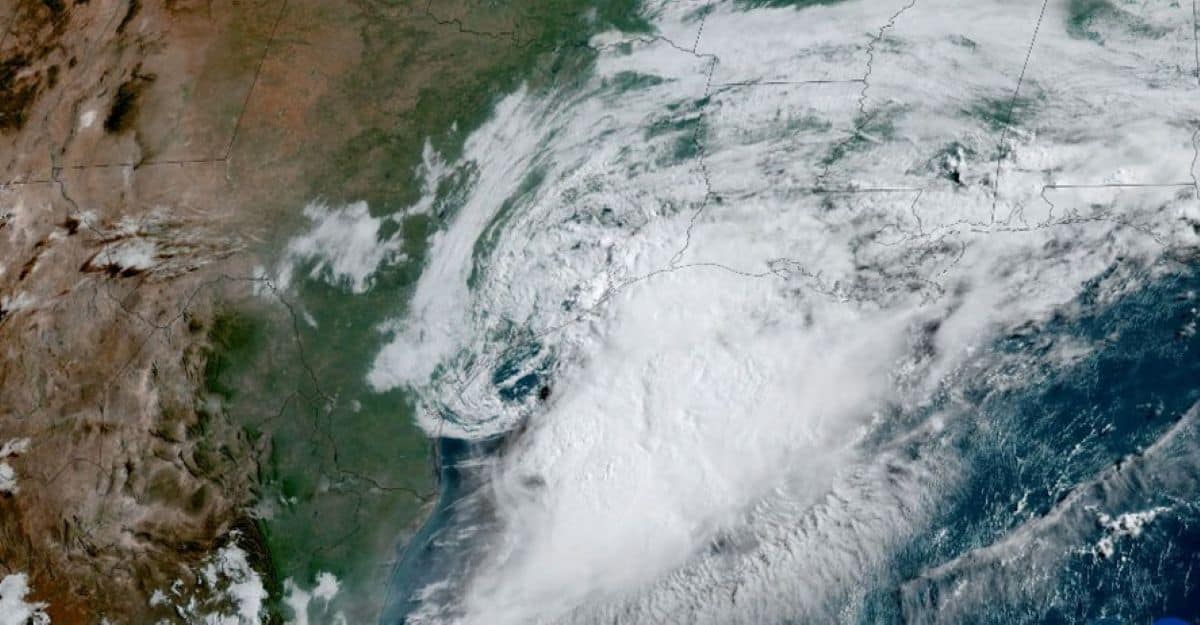
Image generated with Ai
North Carolina joins Virginia, Maryland, Delaware and more US states as late September nor’easter coastal floodings and rains raise fresh concerns across the US East Coast. Meanwhile, the developing weather system could bring heavy rain, strong winds, rough surf and rising coastal water levels.
As conditions change, vulnerable coastal communities face heightened flooding risks, particularly around high tide. The storm’s eventual track will also determine where the heaviest impacts emerge.
Therefore, travellers should watch local forecasts before heading towards exposed beaches and waterfront areas. With rains intensifying and coastal flooding possible, late September travel could face delays, difficult road conditions and changing plans.
A significant September Nor’easter is developing along the US East Coast, raising concerns about coastal flooding, beach erosion and travel disruption. The storm could bring strong winds, heavy rain and dangerous surf from eastern North Carolina and Virginia towards New England. However, the final impact will depend heavily on its track and strength. As the system develops, coastal communities may face higher water levels, especially around high tide.
Advertisement
Advertisement
Meanwhile, rough seas could create difficult conditions offshore. The full moon will also raise astronomical tide levels, adding to the coastal flooding risk. Therefore, travellers should closely monitor updated forecasts before making coastal plans.
Advertisement
Advertisement
September Nor’easter threatens coastal flooding, beach erosion and travel disruption
A significant September Nor’easter could become a major weather concern for the US East Coast this week, with coastal flooding, beach erosion, strong winds, rough seas and heavy rain among the principal threats. AccuWeather says the storm is expected to develop along the mid-Atlantic coast before potentially shifting towards Long Island and eastern New England later in the week.
For travellers, the developing system is particularly important because its eventual track could determine whether impacts remain mainly offshore or become more disruptive along the coastline. The weather system may also acquire tropical characteristics if it lingers offshore and strengthens, although the report says this remains dependent on its evolution.
What is driving the September Nor’easter?
The atmospheric pattern is being shaped by a pronounced dip in the jet stream and a blocking pattern that could cause storms moving from the Midwest to stall. A new storm is then forecast to develop near the coast or several hundred miles offshore, where it could strengthen into a potent nor’easter.
Advertisement
Advertisement
The precise position of the developing storm matters because a system that forms closer to the coast would increase the risk of damaging winds, storm surge, beach erosion and coastal flooding. Heavy bursts of rain could further worsen flooding in vulnerable locations.
Which US regions face the greatest coastal flooding risk?
Coastal flooding is expected to be a significant concern from North Carolina to Massachusetts, particularly around high tide, from Tuesday through Friday. The threat could continue along the northern mid-Atlantic coast and expand towards southeastern New England during the weekend.
Advertisement
Advertisement
The lower Chesapeake Bay, its western side and tidal rivers flowing into the bay are highlighted as areas facing major coastal flooding potential. East-to-northeast winds could push water into these locations, with the most serious conditions expected around astronomical high tides beginning on Wednesday.
Why could the full moon make flooding worse?
The full moon is expected to raise astronomical tide levels later in the week. The approaching storm could then push water levels even higher, increasing the potential for coastal flooding when strong winds coincide with high tides.
This combination is particularly relevant for coastal travel because flooding can affect roads, access routes and low-lying communities even when rainfall alone would not necessarily produce widespread disruption. Travellers heading towards exposed coastal destinations should therefore follow local weather and transport updates.
Could the storm disrupt flights and other travel?
A full-strength nor’easter could create significant travel disruption through flooding rain, powerful wind gusts and coastal flooding. The report also warns that wind-related power outages could add to the disruption, while heavy rainfall may cause urban flooding and travel delays.
Offshore conditions could become particularly hazardous. Depending on the storm’s strength, seas could become dangerously rough, potentially reaching conditions comparable with those produced by hurricanes or strong winter nor’easters. Small-craft operators are advised to monitor forecasts closely.
Advertisement
Advertisement
What happens if the storm turns back towards the coast?
The storm’s eventual track remains one of the most important factors determining its impact. AccuWeather says the system could initially move out to sea before drifting westward and returning closer to the coastline later in the week.
A stronger storm that turns towards the mid-Atlantic or New England coast would produce more significant impacts than a system that continues moving away. Southeastern Virginia and southeastern New England have been identified as areas that could experience particularly serious conditions.
What should coastal travellers do now?
Travellers should treat the forecast as an evolving situation rather than assuming that conditions will be identical across the region. Coastal trips, boating plans and journeys through low-lying areas may need additional flexibility as the storm track becomes clearer.
The main risks identified in the report are coastal flooding, beach erosion, strong winds, heavy rain, rough seas and possible travel delays. Monitoring updated local forecasts is therefore important, particularly for journeys scheduled around high tide.
The September Nor’easter represents a developing travel and coastal weather concern for the US East Coast. Its effects could extend from eastern North Carolina and Virginia towards New England, with coastal flooding, beach erosion, strong winds, heavy rain and rough seas among the principal risks. The storm’s final track remains critical. A system that strengthens offshore and turns back towards the coast could produce more significant impacts than one that continues moving away. Meanwhile, the full moon is expected to raise astronomical tide levels, potentially worsening coastal flooding around high tide. Southeastern Virginia and southeastern New England are highlighted as areas that could face particularly challenging conditions. For travellers, the key message is to remain flexible, check updated forecasts and consider local flooding and transport conditions before travelling. The weather pattern could evolve considerably through the week, making fresh forecasts essential.
Advertisement
Advertisement
Cause: A pronounced jet-stream dip and blocking pattern are helping storms stall and encouraging a new coastal system to develop. Answer: The resulting September Nor’easter could produce coastal flooding, beach erosion, strong winds, heavy rain and rough seas from the mid-Atlantic to New England. Reason: Its eventual track and strength will determine how severe the impacts become. A storm that strengthens offshore before turning towards the coastline could create substantially greater disruption. In addition, the full moon will raise astronomical tide levels, allowing storm-driven water to reach higher levels. Therefore, coastal travellers should follow updated forecasts closely throughout the week.
“Events such as this September Nor’easter demonstrate why timely weather intelligence is increasingly important for the global travel industry. Coastal destinations, airlines, transport operators, hotels and travellers all benefit when changing conditions are communicated clearly and responsibly. The developing storm also highlights the importance of preparedness, flexible travel planning and close coordination between tourism stakeholders and local authorities. While the eventual impact will depend on the storm’s track and strength, keeping travellers informed can help reduce uncertainty and support safer decisions. For the travel sector, accurate forecasting remains an essential part of building resilience, protecting visitors and maintaining confidence during periods of challenging weather.”
Advertisement
