

Japan’s New 350km Hitachinokuni Long Trail Opens a Different Way to Explore Ibaraki Beyond Tokyo

Updated
Published
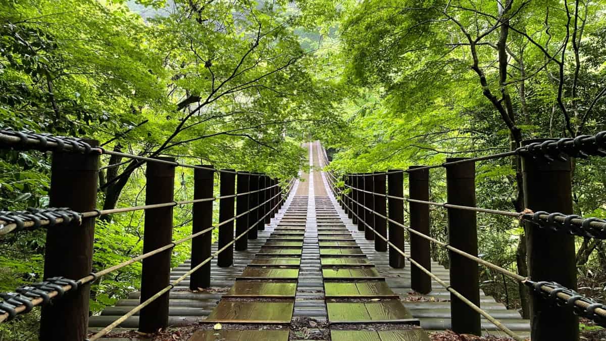
Image credit- kenpokult (official website of Hitachinokuni Long Trail)
Japan has completed the Hitachinokuni Long Trail, creating a vast circular walking route across northern Ibaraki Prefecture that connects six municipalities through mountains, rural settlements, waterfalls, historic sites and areas close to the Pacific coast. Ibaraki Prefecture officially marked the full opening on 19 September 2026, bringing years of trail development into one connected circuit. Current prefectural information describes the completed route as approximately 350 kilometres, although earlier official materials referred to a planned length of around 320 kilometres.
Advertisement
Advertisement
The trail runs through Hitachi, Hitachiota, Takahagi, Kitaibaraki, Hitachiomiya and Daigo, creating a hiking journey through landscapes often described in Japan as satoyama. These are rural environments where farming, forests, mountains and human settlements have existed together for generations.
That makes the Hitachinokuni Long Trail different from a conventional mountain trek. It is not only about remote scenery. It connects hikers with villages, shrines, old roads, historic ruins and local communities.
Advertisement
Advertisement
For travellers looking beyond Tokyo, Kyoto and Osaka, the new trail offers a slower and more active way to experience Japan.
What Is the Hitachinokuni Long Trail?
The Hitachinokuni Long Trail is a large circular hiking network across northern Ibaraki Prefecture.
Advertisement
Advertisement
The route has been developed progressively over several years. Earlier planning material described a roughly 320-kilometre trail, while the latest official information places the completed circuit at about 350 kilometres.
The trail is designed as a flexible walking network rather than a route that must be completed from one fixed starting point to another.
Hikers can choose individual sections, connect several areas or attempt a much longer journey depending on fitness, time and experience.
The route moves between woodland, mountain ridges, farmland, villages and historic sites. It also passes through valleys, rivers and areas influenced by the Pacific coast.
This is central to the trail’s identity. It is not simply a wilderness route. It is a journey through the cultural and natural landscapes of the former Hitachi Province.
Which Six Cities and Towns Does the Trail Connect?
The completed trail crosses six municipalities in northern Ibaraki.
Advertisement
Advertisement
| Municipality | Travel Character |
|---|---|
| Kitaibaraki | Mountains, historic routes and Pacific coastline |
| Takahagi | Valleys, waterfalls and mountain scenery |
| Hitachi | Coastal city and mountain access |
| Hitachiota | Forests, shrines and Ryujin Gorge |
| Hitachiomiya | Rural mountains and historic landscapes |
| Daigo | Fukuroda Falls, hot springs and rugged peaks |
Each municipality adds a different dimension to the journey.
Daigo is especially important because some of the most dramatic mountain sections are found there. Kitaibaraki and Hitachi bring hikers closer to the Pacific coast, while Takahagi, Hitachiota and Hitachiomiya add valleys, shrines, forests and rural communities.
Together, these destinations create one of the most varied long-distance walking routes near the greater Tokyo region.
Why Is This Trail Different From Japan’s High-Mountain Routes?
The Hitachinokuni Long Trail is not a high-altitude expedition.
Much of the route crosses relatively low mountains, often between roughly 300 and 600 metres.
However, low elevation does not mean easy walking.
Advertisement
Advertisement
Some sections involve continuous climbing and descending. Others include rocky ground, steep slopes and narrow paths.
The physical challenge comes from repeated terrain changes rather than extreme altitude.
This makes the route very different from climbing Mount Fuji or hiking in the Japanese Alps.
Another advantage is that the area is generally less affected by heavy snowfall than many higher mountain regions.
That allows sections of the trail to be walked during more months of the year.
However, hikers still need to prepare for changing weather, slippery ground and winter cold.
Advertisement
Advertisement
What Can Hikers See in the Central Area?
The Central Area is one of the most demanding and scenic parts of the trail.
It covers sections around Daigo, Hitachiomiya and Hitachiota.
One of the biggest attractions is Fukuroda Falls, one of Ibaraki Prefecture’s best-known natural landmarks.
The waterfall can be experienced from conventional viewing areas, but trail sections also provide elevated perspectives across the surrounding valley.
Another important landscape is the rugged Okukuji Nantai mountain area.
The mountains here may not be extremely high, but the terrain can be steep and physically demanding.
Advertisement
Advertisement
Some sections include repeated climbs and descents over a short distance.
The Central Area also includes Ryujin Gorge, known for deep valleys and dramatic scenery.
Historic ruins, temples and mountain worship sites add cultural interest.
This region shows clearly why hikers should not judge difficulty by elevation alone.
What Does the Northeast Section Offer?
The northeastern part of the trail brings together mountains and Pacific-influenced landscapes.
Hikers pass through upland terrain around peaks including Eizomuro and Hanazono.
Advertisement
Advertisement
The area also includes older routes that once connected coastal and inland communities.
Some trails follow paths historically used for transporting goods, including salt.
Other features date back to the Edo period, giving hikers a direct link to Japan’s historical transport networks.
The coastal influence becomes more visible in this section.
This creates one of the trail’s strongest contrasts.
A walker can move from forests and mountain paths towards landscapes shaped by the nearby Pacific Ocean.
Advertisement
Advertisement
For international visitors, that mixture can be particularly memorable because the environment changes quickly without requiring a long transfer.
What Can Travellers Expect in the Southeast?
The southeastern sections include areas around Takahagi and Hitachi.
One of the main natural highlights is Hananuki Valley.
The valley is known for forest scenery, waterfalls and seasonal colour.
Autumn can be particularly attractive as the leaves change across the hillsides.
From the valley, routes climb towards mountains such as Tsuchidake.
Advertisement
Advertisement
Historic ruins, woodland and river scenery add variety.
Some southeastern sections were opened before the final completion of the entire trail.
These earlier trail sections helped establish the wider route and demonstrate how the project has developed over several years.
For travellers interested in autumn hiking, the Southeast Area can be especially rewarding.
However, popular scenic areas can attract more visitors during peak foliage periods.
What Makes the Southwest Area Different?
The Southwest Area passes through Hitachiomiya City.
Advertisement
Advertisement
This section has a more rural and ecological character.
It takes hikers through forested mountains and quieter landscapes.
The area supports varied plant life, including seasonal flowering species.
Historic mining activity also forms part of the region’s story.
Parts of Hitachiomiya were once associated with gold mining.
This creates an interesting contrast between natural scenery and evidence of older economic activity.
Advertisement
Advertisement
The trail therefore becomes more than a nature walk.
It also reveals how local communities used mountains, forests and natural resources over time.
What Can Hikers Discover in the Northwest?
The Northwest Area reaches towards Mount Yamizo.
This part of the trail combines mountain scenery with sacred sites.
Historic shrines connected with mountain worship add a spiritual dimension.
At higher points, hikers can look towards neighbouring mountain landscapes in Fukushima and Tochigi.
Advertisement
Advertisement
These cross-prefectural views help show northern Ibaraki’s geographical position.
It sits between the greater Tokyo region and the more mountainous landscapes farther north.
The Northwest Area may particularly appeal to travellers interested in shrines, rural history and quieter mountain environments.
Can Travellers Walk the Entire Trail?
Yes, but completing the full route is not required.
The trail has been designed so hikers can begin and end at different points.
This makes sectional walking practical.
Advertisement
Advertisement
A traveller with one or two days can choose a short segment.
A visitor with a week could combine several sections.
Experienced long-distance walkers may plan a much longer multi-stage journey.
Terrain varies considerably.
One day may involve steep mountain paths.
Another may include village roads, woodland and historic tracks.
Advertisement
Advertisement
Accommodation is available in towns around the trail, but hikers should not assume there will be shelters or campsites on every section.
Planning is therefore essential.
Walkers should know where they intend to finish before sunset.
How Easy Is It to Reach From Tokyo?
The trail’s proximity to Tokyo is one of its strongest travel advantages.
Some trailheads can be reached in around two hours from the capital depending on the rail connection and destination.
The Daigo and Fukuroda area takes longer.
Advertisement
Advertisement
Travellers can take JR services from Tokyo towards Mito and then transfer to the Suigun Line.
Road access is also possible.
Depending on traffic and the chosen section, some Central Area destinations can be reached from Tokyo in roughly two and a half to three hours.
This accessibility gives the trail two different uses.
It can be the main focus of a dedicated hiking holiday.
It can also be added to a longer Tokyo itinerary.
Advertisement
Advertisement
That makes it particularly attractive for international visitors who want to experience rural Japan without travelling far into the country’s interior.
Is the Trail Suitable Year-Round?
The trail can be walked in different seasons, but conditions vary significantly.
Spring
Spring brings fresh vegetation and flowering plants.
Temperatures are generally comfortable, but weather can change quickly.
Rain protection and layers are still important.
Summer
Summer can be hot and humid.
Advertisement
Advertisement
Some inland areas become extremely warm.
Hikers should carry sufficient water, use sun protection and avoid underestimating heat exposure.
Autumn
Autumn is likely to be one of the most popular seasons.
Forested valleys and mountain slopes develop strong seasonal colour.
However, typhoons can affect rivers, roads and public transport.
Popular areas around Fukuroda Falls can also become crowded.
Advertisement
Advertisement
Winter
The trail’s relatively low elevation means it is less affected by deep snow than Japan’s high mountains.
However, winter still brings cold conditions.
Hikers need proper clothing and should check forecasts before setting out.
What Equipment Should Hikers Carry?
The Hitachinokuni Long Trail should be treated as a real hiking route.
Waterproof trekking shoes or boots are strongly recommended.
Some sections are rocky, steep or slippery.
Advertisement
Advertisement
Hikers should carry sufficient food and water.
Refuelling points can be limited.
A printed map and compass are useful backups.
Smartphones are convenient, but mobile signals may weaken in valleys or remote sections.
Official route data can also be downloaded for GPS navigation.
Travellers should check trail updates before departure.
Advertisement
Advertisement
Wildlife advisories may also be relevant.
Asiatic black bears are present in parts of Japan, including areas around northern Ibaraki.
Hikers should pay attention to local warnings and follow official safety advice.
Why This Matters
The full opening of the Hitachinokuni Long Trail gives Japan a major new rural tourism experience close to Tokyo.
That matters because international tourism in Japan remains heavily concentrated in a relatively small number of famous cities and attractions.
A long-distance walking route can help spread visitors across a wider region.
Advertisement
Advertisement
Hikers stay in local accommodation.
They buy food in small towns.
They use regional transport.
They visit shrines, museums, restaurants and rural businesses.
That distributes tourism spending more widely.
The trail also introduces travellers to the idea of satoyama.
Advertisement
Advertisement
These are not untouched wilderness landscapes.
They are places shaped by generations of interaction between people and nature.
Fields, forests, settlements, shrines and mountain paths all form part of the experience.
For travellers interested in slower tourism, that can be more meaningful than moving quickly between famous landmarks.
What Travellers Should Know
The Hitachinokuni Long Trail is flexible, but flexibility does not remove the need for preparation.
Before Walking
- The full trail opened on 19 September 2026.
- Current official information places the completed route at around 350 kilometres.
- Earlier materials referred to a planned length of about 320 kilometres.
- The route crosses six municipalities.
- Hikers can start and finish at multiple points.
- Some Central Area sections are steep and physically demanding.
- Food and water points can be limited.
- Download digital route data before walking.
- Carry a printed map as a backup.
- Plan to leave mountain sections before dark.
- Check weather and trail conditions before departure.
- Summer requires strong heat precautions.
- Winter still requires cold-weather equipment.
- Public transport can be useful for reaching trailheads.
- Some sections have limited parking.
- Do not assume campsites or shelters are available everywhere.
- Check wildlife advisories before entering mountain areas.
Frequently Asked Questions
How long is the Hitachinokuni Long Trail?
Current official information describes the completed route as approximately 350 kilometres.
Advertisement
Advertisement
Earlier planning materials referred to a route of about 320 kilometres.
When did the full trail open?
The complete trail officially opened on 19 September 2026.
Which places does it connect?
The trail crosses Hitachi, Hitachiota, Takahagi, Kitaibaraki, Hitachiomiya and Daigo.
Do hikers need to complete the full loop?
No.
Walkers can choose individual sections and create their own itinerary.
Is the trail suitable for beginners?
Some sections are suitable for less experienced hikers.
Advertisement
Advertisement
Others include steep climbs, rocky paths and limited resupply points.
Travellers should choose sections according to their fitness and hiking experience.
A New Reason to Leave Tokyo and Walk Into Rural Japan
The Hitachinokuni Long Trail gives travellers a reason to slow down and experience Japan differently.
Instead of moving quickly between famous urban attractions, hikers spend time in landscapes where forests, farms, shrines and villages remain connected.
One day may involve Fukuroda Falls.
Another may include steep ridges and low mountain peaks.
Advertisement
Advertisement
Elsewhere, the trail approaches the Pacific coast or follows routes once used by traders and local communities.
Its location is part of the appeal.
Northern Ibaraki is close enough to Tokyo to be practical, yet far enough from the capital’s density to feel completely different.
The trail also offers flexibility.
Travellers do not need to walk hundreds of kilometres.
A short section can still provide a meaningful experience.
Advertisement
Advertisement
More ambitious hikers can link several areas into a multi-day journey.
For Japan’s tourism sector, the route also creates an opportunity to direct visitors towards less crowded rural destinations.
For travellers, the attraction is simpler.
The Hitachinokuni Long Trail combines mountains, waterfalls, rural landscapes, coast, history and local life into one connected walking network.
That makes it one of the most interesting new additions to Japan’s growing range of walking and hiking experiences.
Advertisement
