

Indonesia’s Enggano Island Faces High Waves as BMKG Forecast Raises Concerns for Ferry and Tourist Boat Travel

Updated
Published
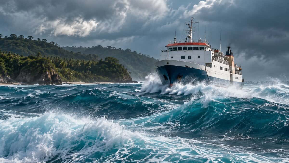
Indonesia has issued a high-wave warning covering the waters surrounding remote Enggano Island from 10 to 13 October 2026. According to the Meteorology, Climatology and Geophysics Agency (BMKG), waves are forecast to rise from approximately 2.8 metres early on 10 October to 3.4 metres by late 12 October. The alert raises maritime safety concerns for ferry passengers, fishing boats and smaller tourism vessels travelling through exposed waters. No cancellation of ferry services has been independently verified for this warning period. Travellers should obtain departure confirmation from operators and maritime authorities before undertaking sea journeys.
Indonesia’s New BMKG Warning Reveals a Growing Maritime Risk Through 13 October
The latest warning highlights the vulnerability of maritime transport serving Enggano Island, where ferry operations are an important connection with mainland Indonesia. The immediate issue is not a confirmed closure of the sea route but the potential exposure of passenger vessels to worsening sea conditions over several days.
Advertisement
Advertisement
According to the BMKG official high-wave warning, the alert applies from 07:00 Western Indonesian Time (WIB) on Saturday, 10 October, until 07:00 WIB on Tuesday, 13 October 2026.
BMKG places Enggano waters in its high-wave category, which covers seas between 2.5 and 4 metres. The alert also identifies surrounding waters within the same coastal province as vulnerable to elevated wave conditions.
Advertisement
Advertisement
The accompanying provincial assessment identifies winds generally ranging from 2 to 25 knots across the wider region. These regional figures should not be mistaken for continuous winds of that strength at any particular vessel’s position.
The geographical importance of the warning lies in the island’s separation from mainland transport infrastructure. Longer sea crossings mean that passengers and operators must assess conditions along the journey, not simply at their departure terminal.
Advertisement
Advertisement
For travel agents organising remote-island itineraries, the warning creates an immediate reason to review departure times, onward connections, overnight accommodation and contingency arrangements.
Detailed Enggano Marine Forecast Shows Waves Rising to 3.4 Metres
A closer examination of the BMKG Enggano marine forecast reveals that the most significant projected conditions occur towards the end of the forecast period.
At 01:00 WIB on 10 October, BMKG forecast waves of 2.8 metres, south-easterly winds at 10 knots and gusts reaching 19 knots. The agency’s hourly forecast then shows a developing increase in wave height on 11 and 12 October.
The detailed progression is important because a traveller looking only at the initial 2.8-metre figure could overlook the higher conditions forecast for later journeys.
| Date and time (WIB) | Forecast wave height | Wind and gust forecast | Maritime significance |
|---|---|---|---|
| 10 October, 01:00 | 2.8 m | South-east 10 kt; gusts 19 kt | Already in BMKG’s high-wave category |
| 11 October, 09:00 | 2.9 m | South-east 10 kt; gusts 21 kt | Elevated wave conditions continue |
| 11 October, 21:00 | 3.1 m | South-east 10 kt; gusts 17 kt | Forecast waves exceed 3 metres |
| 12 October, 06:00 | 3.1 m | South-east 14 kt; gusts 25 kt | Stronger gusts forecast |
| 12 October, 12:00 | 3.2 m | South-east 15 kt; gusts 22 kt | Wave heights continue increasing |
| 12 October, 21:00 | 3.4 m | South-east 14 kt; gusts 22 kt | Highest wave height in the displayed forecast |
| 13 October, 00:00 | 3.4 m | South-east 14 kt; gusts 24 kt | Elevated conditions remain at the forecast endpoint |
Source: BMKG Enggano waters marine forecast, accessed 10 October 2026. All figures are predictions rather than observations of actual sea conditions.
The detailed forecast covers 10 October at 00:00 through 13 October at 00:00, while the separate high-wave warning extends until 07:00 on 13 October. These are different validity periods and should not be confused.
Advertisement
Advertisement
Conditions may also change as BMKG issues subsequent forecasts. The 3.4-metre figure represents the highest value displayed in the consulted forecast, not a guarantee of the maximum wave height during the event.
Why Indonesia’s Remote Ferry Connection Faces Greater Exposure During High Seas
Enggano’s transport geography makes the current warning particularly significant. The island sits in the Indian Ocean, away from Indonesia’s larger domestic transport networks. Consequently, unfavourable maritime conditions can create more complicated travel decisions than those faced on short inter-island crossings.
According to PT ASDP Indonesia Ferry’s official operational information, the Bengkulu–Enggano ferry route covers 106 nautical miles and normally takes approximately 12 hours.
The state-owned ferry operator identifies KMP Pulo Tello as a vessel serving this connection. Its published capacity is 229 passengers and 22 vehicles.
These figures help explain why safe and reliable ferry services matter to the island’s accessibility.
| Transport indicator | Officially reported information | Relevance to travellers |
|---|---|---|
| Ferry route | Bengkulu–Enggano | Connects the island with the mainland |
| Route distance | 106 nautical miles | Requires planning for an extended sea crossing |
| Approximate crossing time | 12 hours | Weather can influence departure and arrival planning |
| KMP Pulo Tello passenger capacity | 229 passengers | Establishes the vessel’s published carrying capacity |
| Vehicle capacity | 22 vehicles | Supports passenger and vehicle movements |
| Passengers carried, January–June 2025 | 3,695 | Historical evidence of the route’s use |
| Vehicles carried, January–June 2025 | 574 | Demonstrates its role in vehicle transport |
Source: ASDP operational announcement dated 7 July 2025. These are historical operator figures, not verified October 2026 service statistics.
Advertisement
Advertisement
A 12-hour crossing requires more than a check of conditions at departure. Operators must consider the forecast for the whole voyage, including expected arrival conditions and the availability of safe berthing arrangements.
For passengers, this creates an important distinction between a scheduled departure and an authorised, operationally confirmed sailing.
Earlier Harbour Access Problems Expose a Second Infrastructure Concern
The October weather warning follows an earlier period when maritime access to Enggano faced a different challenge.
According to ASDP and Indonesia’s Ministry of Transportation, sedimentation and narrowing of the navigation channel at Pulau Baai affected ferry movements in 2025.
ASDP’s July 2025 operational statement confirmed the successful return of KMP Pulo Tello after work to improve access through the affected channel. The company also documented dredging activity and cooperation with port authorities to restore connections.
That earlier disruption must not be confused with the present forecast. There is no verified evidence that channel sedimentation has caused a new closure on 10 October 2026.
Advertisement
Advertisement
Nevertheless, the historical incident demonstrates why Enggano’s access requires attention to two separate operational considerations: safe sea conditions and reliable port infrastructure.
For the travel industry, a weather-related sailing delay and a harbour-access restriction may produce similar consequences for an itinerary, but they require different responses from authorities and operators.
This distinction matters when communicating accurate travel information to customers.
Small Tourism Boats Need Separate Safety Assessments During Indonesia’s Wave Alert
Smaller vessels present another important dimension of the Enggano maritime warning.
According to BMKG’s official maritime safety guidance, different vessel categories have different wind and wave exposure thresholds.
The agency identifies conditions requiring particular attention for fishing boats, ferries, barges and larger ships. These reference values help operators evaluate potential risks but do not automatically determine whether a specific vessel is legally permitted to sail.
Advertisement
Advertisement
| Vessel category | BMKG wind reference | BMKG wave reference | Implications during this alert |
|---|---|---|---|
| Fishing boats | Above 15 knots | Above 1.25 m | Forecast waves substantially exceed the reference height |
| Barges | Above 16 knots | Above 1.5 m | Cargo movements require careful assessment |
| Ferries | Above 21 knots | Above 2.5 m | Predicted seas exceed the wave reference level |
| Small tourism vessels | No separate universal category specified | Depends on vessel characteristics | Operators must use vessel-specific safety assessments |
Sources: BMKG maritime safety information and Enggano forecast. These are safety references, not automatic service-cancellation thresholds.
The forecast is therefore relevant beyond conventional passenger ferries.
Any locally operated sightseeing boat, private charter or small passenger transfer using exposed waters would need to consider changing conditions and its vessel’s operational limits.
However, there is no independently verified evidence that a particular tourism boat has been cancelled or that any operator has suspended excursions during the current warning period.
Travellers should not assume that a larger ferry’s operational clearance also establishes safe conditions for a smaller craft.
Likewise, calm-looking water close to shore does not necessarily represent conditions across a more exposed sea route.
Advertisement
Advertisement
Maritime Authorities Retain Control Over Sailing Decisions
A high-wave forecast does not automatically amount to a government order suspending maritime transport.
Indonesia’s Ministry of Transportation places operational responsibility on shipping companies, vessel masters and the relevant maritime authorities.
The ministry’s official maritime safety guidance explains that harbour masters may withhold sailing approval when weather conditions threaten safety. It also emphasises continued monitoring of BMKG forecasts, vessel readiness and compliance with safety requirements.
Consequently, an authorised departure depends on an operational assessment rather than the forecast wave height alone.
For the 10–13 October warning, the critical questions are whether vessels remain within their permitted operating limits, whether departure clearance is granted and whether conditions permit a safe crossing.
As of the information independently verified for this report, no specific October 2026 ferry cancellation, passenger stranding or emergency maritime restriction has been established.
Advertisement
Advertisement
Travel businesses should therefore avoid treating the warning as evidence of a completed disruption.
The appropriate immediate response is to obtain an updated sailing status from the operator and the relevant port authority.
New October 2026 Government Statistics Reveal an Important Alternative Transport Connection
One of the most useful findings for travellers comes from government transport statistics released shortly before the warning.
According to Statistics Indonesia’s official transport release dated 1 October 2026, Enggano Airport handled 32 flights and 350 passengers during August 2026.
The preceding July figures were 36 flights and 396 passengers. These figures establish that air transport was operating during the reported months, although they do not verify flight availability during the current October weather event.
| Transport statistic | July 2026 | August 2026 |
|---|---|---|
| Enggano Airport flights | 36 | 32 |
| Enggano Airport passengers | 396 | 350 |
Sources: Statistics Indonesia regional transport releases dated 1 September and 1 October 2026.
Advertisement
Advertisement
This evidence changes an important part of the travel assessment.
Enggano should not be described as entirely dependent on one ferry service because official statistics demonstrate that it also receives air transport.
However, the existence of an air connection does not mean that every ferry passenger can immediately transfer to an aircraft.
Flight schedules, seat availability, booking conditions, baggage allowances and airport operations all require separate confirmation.
For travel agents, the correct approach is to treat aviation as a potential contingency option, not a guaranteed replacement for the ferry.
Indonesia’s 2026 Pioneer Aviation Tariff Adds Another Travel Planning Consideration
The Ministry of Transportation’s 2026 pioneer aviation tariff schedule provides further detail about Enggano’s air connection.
Advertisement
Advertisement
Under Ministerial Decision KM 5162 of 2025, which establishes passenger tariffs for pioneer air transport in 2026, the route serving Enggano from the provincial mainland airport has a listed pioneer tariff of Rp273,000.
The figure is a government-published route tariff. It should not be represented as a verified all-inclusive fare available for every departure.
More importantly, the tariff schedule does not establish that seats are available on 10, 11, 12 or 13 October.
The practical significance is that passengers have a documented alternative transport network to investigate when marine conditions deteriorate.
Travel advisers should confirm operational flights directly before changing bookings, particularly when a journey requires coordination between air and sea transport.
For travellers carrying substantial luggage or accompanying vehicles and freight, a change of transport mode could also introduce additional practical limitations.
Advertisement
Advertisement
Indonesia’s Long-Term Transport Strategy Identifies Enggano as an Access Priority
The latest weather warning also intersects with an existing national infrastructure issue.
According to the Ministry of Transportation’s 2025–2029 regional transport strategic plan, Enggano is one of Indonesia’s outer islands with limited transport infrastructure. The document identifies weather conditions and navigation-channel sedimentation as factors affecting the stability of ferry operations.
The same planning document includes the pioneer ferry connection serving Enggano among its transport-service priorities and lists one subsidised crossing route in its annual targets from 2025 to 2029.
These targets demonstrate a policy commitment to maintaining connectivity. They do not prove that every scheduled crossing has operated or that a new infrastructure project has been completed.
The distinction is important for investors and tourism operators assessing the long-term reliability of travel access.
A route may receive continuing public support while remaining exposed to weather, vessel availability and port constraints.
Advertisement
Advertisement
The October warning provides a current example of why resilience needs to be considered alongside service provision.
Tourism Development Ambitions Increase the Importance of Reliable Island Access
Enggano’s relevance extends beyond essential passenger transport.
The regional government’s 2026 development planning identifies the island as a strategic area for tourism and capture fisheries. This places transport reliability within a broader economic and destination-development context.
The island’s marine environment creates opportunities for tourism activities, but dependable access remains an important condition for delivering those experiences.
If adverse weather forces an operator to change a sailing, a visitor may need additional accommodation, revised transfers or an alternative departure date.
Local accommodation providers and small tourism businesses may then face uncertainty over guest arrivals.
Advertisement
Advertisement
These are potential business consequences, not verified financial losses from the October warning.
No official island-specific estimate of lost tourism revenue, cancelled hotel bookings or affected visitor numbers has been established for this event.
Responsible destination reporting must maintain that distinction while explaining the commercial implications.
Original Analysis Reveals Why Forecast Timing Matters More Than a Single Wave Figure
The most important finding from the combined official evidence is that Enggano’s maritime exposure cannot be assessed using one daily headline figure.
BMKG’s detailed forecast shows changing conditions over the warning period. The higher predicted waves arrive after the initial forecast hours, while wind speeds and gusts also vary.
That progression matters because passengers often organise an itinerary around a published departure time without examining what conditions might be like several hours into the journey.
Advertisement
Advertisement
For Enggano, the published 12-hour ferry crossing makes the arrival window particularly relevant. A voyage may begin under one forecast period and continue into another.
There is a second consideration. The government transport strategy already recognises the island’s infrastructure limitations, while recent official statistics confirm that air access exists but operates within a comparatively small local transport market.
Together, these findings suggest that Enggano’s resilience depends on more than maintaining a ferry timetable. It also requires timely maritime forecasts, dependable port access, clear operator communication and workable contingency arrangements.
The potential industry lesson is significant: travel reliability at remote island destinations should be measured across the complete journey, including the ability to respond when a single transport connection becomes unsuitable.
This is an assessment of the evidence, not a claim that the October warning has already produced widespread disruption.
What Travel Businesses Should Monitor Before 13 October
The approaching end of the high-wave warning provides a defined period for reassessing travel arrangements.
Advertisement
Advertisement
BMKG’s marine forecast and warning information should remain the primary source for environmental conditions. However, operator updates and maritime authority decisions must determine the status of actual departures.
For travellers booking sea journeys, confirmation should be obtained as close as practicable to departure and checked again if the operator announces changes.
ASDP publishes corporate information and customer contact details through its official website. Its published general customer-service number is 021191.
Tour operators should also ensure that a customer understands the difference between a precautionary weather warning, a delayed sailing and a formally cancelled service.
These categories have different consequences for rebooking, transfers and accommodation arrangements.
Accurate communication is particularly important when local information circulates faster than formal operational notices.
Advertisement
Advertisement
Critical Operational Takeaways for Travel Agents and Tour Operators
– Monitor the complete warning period. The official high-wave warning remains valid until 07:00 WIB on 13 October 2026, unless BMKG updates or replaces it.
– Check later forecast hours. BMKG’s detailed forecast reaches 3.4 metres late on 12 October, making the second half of the warning particularly important for travel planning.
– Confirm ferry status individually. Do not classify a departure as cancelled without information from the vessel operator or competent maritime authority.
– Assess small tourism boats separately. Operators should consider vessel size, operating limits, crew preparedness, weather exposure and relevant safety requirements.
– Review accommodation flexibility. Travellers with onward connections should understand how a possible sailing delay could affect their itinerary.
– Investigate air transport carefully. Official statistics confirm previous flight activity at Enggano Airport, but current schedules and available seats still require verification.
Advertisement
Advertisement
– Protect essential communication channels. Agents should retain current operator contacts and ensure passengers know how to obtain local updates.
– Avoid overstating economic damage. No verified tourism cancellation total, passenger-stranding figure or financial loss has been established for this warning.
Indonesia’s Maritime Alert Highlights a Wider Challenge for Sustainable Island Tourism
Enggano’s 10–13 October 2026 warning demonstrates how a short period of elevated waves can place renewed attention on the reliability of remote-island travel.
The immediate priority is maritime safety. BMKG’s forecast provides clear evidence of potentially hazardous sea conditions, while transport operators and authorities remain responsible for determining whether individual sailings can proceed.
Beyond the warning, the broader issue concerns the resilience of Indonesia’s island connectivity. The country’s existing transport strategy recognises that remote destinations require reliable ferry services, functioning port infrastructure and alternative connections.
For tourism investors and destination planners, this makes dependable access a central part of sustainable development rather than a secondary transport concern.
Advertisement
Advertisement
The present alert does not establish a wider tourism downturn or measurable damage to international visitor growth. It does, however, highlight a practical challenge relevant to island destinations seeking to attract visitors: transport reliability must be supported by accurate warnings, operational flexibility and credible contingency planning.
As the forecast period progresses, the decisive developments will be BMKG’s updated marine conditions and any confirmed operational announcements from the responsible authorities.
For travellers considering Enggano Island, the most important advice remains straightforward: check the latest official marine forecast, verify the status of the intended crossing and never treat a scheduled departure as a guarantee of safe sailing.
Advertisement
