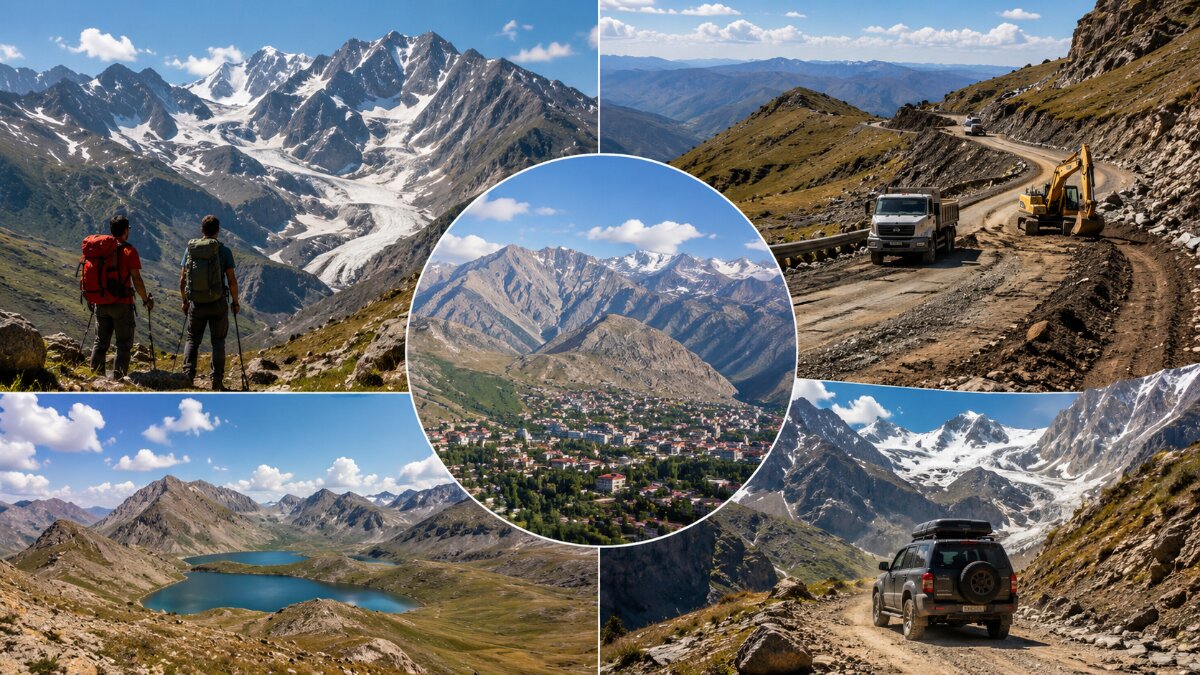
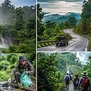
Image generated with Ai
Türkiye is preparing better road access towards Cilo-Sat Mountains National Park from Hakkâri, including widening and three kilometres of planned asphalt towards the high-altitude Sipiğane corridor. Yet the bigger September travel story is the wider access chain. DHMİ currently lists flight operations at Hakkâri Yüksekova Selahaddin Eyyubi Airport as closed, official tourism guidance still recommends high or off-road vehicles for key mountain roads, and the national park lists capacity for 4,100 visitors, 270 vehicles and 105 tents while having no permanent visitor facility or operator inside the protected area.
Cilo-Sat Mountains National Park is entering an unusually important period for Türkiye’s adventure-tourism sector. The immediate catalyst is a 15 June 2026 Hakkâri İl Özel İdaresi road programme designed to widen the approach beginning around Kırıkdağ and improve access towards Cilo-Sat and Sipiğane Plateau, at approximately 3,000 metres. The authority specifically identified three kilometres for planned asphalt surfacing and said the objective was safer, more comfortable visitor access and stronger tourism potential.
But an official-source review completed on 2 September shows why the commercial implications are considerably more complex.
According to the Ministry of Culture and Tourism‘s current Hakkâri visitor guidance, roads serving Cilo-Sat, Cennet Cehennem Valley and the glacier areas are still described as dirt roads where high-clearance or off-road vehicles are appropriate. The ministry also warns that climbing onto the glaciers is prohibited and dangerous.
Advertisement
Advertisement
Meanwhile, the latest public Hakkâri İl Özel İdaresi news stream checked for this report contains subsequent August road projects elsewhere in the province but no Cilo-Sat-specific announcement confirming completion of the June three-kilometre asphalt plan. The safest interpretation for travel sellers is therefore that the project is official and active in policy terms, but completed paved access should not yet be advertised as a verified traveller benefit.
The most consequential finding for tour operators is outside the park itself.
According to the State Airports Authority, DHMİ, Hakkâri Yüksekova Selahaddin Eyyubi Airport is currently listed as open administratively throughout the week but with its flight-operation status marked closed. The airport’s own DHMİ page displayed that position when checked for this report.
DHMİ’s provisional statistics through the end of July 2026 recorded only 4,441 passengers and 88 aircraft movements at Hakkâri Yüksekova Selahaddin Eyyubi Airport. The terminal itself was built for one million passengers annually and has a 3,200-metre runway, underlining the difference between its physical capacity and its present operational position.
DHMİ’s public operating-hours page does not state the reason for the current closed flight-operation status, so that reason should not be inferred or presented as confirmed.
For adventure-tourism businesses, however, the implication is clear. A Cilo-Sat itinerary cannot currently be built around assumed scheduled access through Yüksekova airport without reconfirmation immediately before travel.Access component Official position on 2 September 2026 B2B travel implication Yüksekova air gateway DHMİ lists flight operations as closed Do not package YKO air access without reconfirmation Cilo-Sat road project Widening plus 3 km planned asphalt Infrastructure improvement is official but final completion remains unverified Existing mountain-road guidance Dirt roads; high or off-road vehicles advised Retain suitable 4×4/high-clearance transfers National-park facilities No current facility or operator Tours require stronger self-contained logistics Visitor capacity 4,100 Group growth cannot be treated as unlimited Vehicle capacity 270 Coach and transfer planning requires capacity awareness Tent capacity 105 Camping product remains finite rather than open-ended
The two locations belong in the same commercial travel discussion for geographical reasons.
According to the General Directorate of Nature Conservation and National Parks, the Cilo glacier side is approached from Hakkâri. Its official distances place Kırıkdağ Valley 12 kilometres, Bala Plateau 30 kilometres, Sipiğane Plateau 31 kilometres and the glacier area 36 kilometres from Hakkâri centre. One road from Hakkâri leads towards the glacier sector before separating towards Sipiğane and the glaciers on one branch and Bala Plateau and Cilo Mountain on another.
The Sat Mountains side is more directly associated with Yüksekova. DKMP places the Sat Mountains and lakes about 28 kilometres from Yüksekova district centre.
This creates a twin-gateway adventure geography. Hakkâri matters for the Cilo glacier and Kırıkdağ approach. Yüksekova matters for the Sat Mountains, lakes and air-access question.
Cilo-Sat’s last mile is not the only road issue.
Karayolları Genel Müdürlüğü’s current road-work information shows controlled traffic on sections of the wider Van–Hakkâri and Yeniköprü–Yüksekova corridors. As updated at the end of August, tunnel and road works were affecting kilometres 71–79 on part of the Van–Hakkâri route, while other works were producing controlled traffic on sections leading towards Yüksekova.
That does not mean the region is inaccessible. It means transfer times should have resilience built into them.
For an international trekking group, a delayed road transfer is not equivalent to a delayed city excursion. Arrival time can determine daylight available for high-altitude movement, acclimatisation, camp preparation and whether an itinerary crosses difficult ground before weather conditions change.
This is where the Cilo-Sat development model becomes particularly unusual.
According to DKMP’s official nature-tourism database, there is currently no visitor facility inside Cilo-Sat Mountains National Park and no operator managing an establishment within it. A visitor administration centre, service unit and equipment for day-use areas are included in the park’s Long-Term Development Plan, but they remain at project stage.
At the same time, the database lists:Official Cilo-Sat planning indicator Published figure National-park area 27,500 hectares Visitor capacity 4,100 Vehicle capacity 270 Tent capacity 105 Plant taxa identified 228 Endemic plant taxa 43 Invertebrate species identified 572 National-park designation September 2020 Cilo glacier strict-protection designation July 2019
For the travel trade, the critical point is that road capacity and destination service capacity are not the same thing.
A smoother approach can make a mountain physically easier to reach. It does not automatically create toilets, waste-management points, interpretation centres, food facilities, emergency infrastructure, accommodation or managed staging areas.
That distinction should shape how international adventure itineraries are developed.
Cilo-Sat also sits inside Türkiye’s formal 2026 protected-area pricing system.
The General Directorate of Nature Conservation and National Parks places Hakkâri Cilo and Sat Mountains National Park in Category II within the Doğu Anadolu-2 geographical tariff area. Applying the ministry’s approved 2026 tariff produces the following standard charges.Entry type Category II 2026 tariff Individual visitor ₺35 Bicycle ₺35 Motorcycle / ATV ₺70 Car / pick-up / light commercial vehicle ₺105 Caravan / motor caravan ₺210 Minibus ₺315 Midibus ₺525 Coach ₺1,050
These tariffs matter less because of their absolute cost than because they demonstrate that Cilo-Sat is moving into a more formally managed visitor economy.
Tour operators should still verify the practical payment and admission procedure with the responsible DKMP regional authority before departure, particularly for organised groups and commercial vehicles.
Road expansion normally creates a simple tourism narrative: improved access leads to higher demand.
At Cilo-Sat, that equation has another side.
The national park covers 27,500 hectares across Hakkâri’s Merkez, Yüksekova and Şemdinli administrative areas. The Cilo glaciers received Strictly Protected Sensitive Area status before the wider national park designation.
DKMP’s ecological assessment records 228 plant taxa, including 43 endemic taxa, and explicitly refers to the area’s limited carrying capacity because of its short warm season. The park’s Long-Term Development Plan is intended to define use while maintaining the balance between conservation and visitor activity.
This makes Cilo-Sat fundamentally different from a mountain destination where new asphalt simply expands coach tourism.
Its strongest long-term proposition is likely to be controlled, specialist, higher-value adventure travel, not unrestricted high-volume visitation.
The infrastructure discussion is occurring alongside visible sporting use.
Hakkâri’s Provincial Directorate of Youth and Sports records that Türkiye’s 2025–2026 Wrestling Super League finals were staged at the foot of the Cilo Mountains in Cennet Cehennem Valley on 29–30 June 2026, at around 3,000 metres elevation.
An official Youth and Sports authority also recorded an 8 August 2026 ascent of the Cilo Reşko Uludoruk summit, providing another recent indication that serious high-altitude activity is continuing this summer.
Historically, Cilo-Sat has also demonstrated that major organised events can generate substantial demand. Hakkâri Governorate recorded approximately 30,000 participants across the two-day Cilo Fest in August 2024. That festival attendance figure should not be directly compared with the DKMP database’s 4,100 visitor-capacity figure because the official sources do not define them on an equivalent daily or concurrent basis. Nevertheless, the figures show why visitor-management planning matters when a remote alpine destination becomes nationally visible.
The timing also matters.
Hakkâri’s official environmental and tourism guidance identifies early June to the end of September as the most appropriate period for summer excursions and climbing in the Cilo and Sat Mountains. February and March are identified for winter climbing, while avalanche danger is highlighted outside the recommended periods.
Therefore, 30 September should not be portrayed as a formal annual closure date.
Rather, September represents the final part of the recommended summer high-altitude operating window.
That leaves operators entering the market now with a compressed combination of favourable seasonal timing, uncertain air access, evolving road infrastructure and highly sensitive environmental conditions.
The information gain for the travel industry comes from viewing the official announcements as one connected system.
Cilo-Sat is not suddenly becoming an easy-access alpine resort.
Instead, it appears to be moving from extreme remoteness towards managed accessibility.
The three-kilometre asphalt programme can reduce friction on part of the approach. The national tariff formalises visitor charging. The Long-Term Development Plan anticipates future visitor infrastructure. Yet current official guidance still points to rough-road vehicles, the park still reports no permanent visitor facility, published carrying capacity remains finite, the glaciers retain strict protection, wider regional roads contain controlled-work sections, and the nearest airport is currently listed without flight operations.
For specialist trekking companies, mountain guides, expedition organisers and experiential-tourism DMCs, that combination can actually be commercially attractive.
Scarcity and difficult access are part of Cilo-Sat’s product value. The opportunity is not necessarily to move the maximum number of people into the mountains. It is to build smaller, better-managed programmes around expert guiding, local transfers, environmental compliance, acclimatisation and meaningful stays in Hakkâri and Yüksekova.
That is a substantially more defensible adventure-tourism model than treating new asphalt as an invitation to immediate mass visitation.
Cilo-Sat’s next phase could become an important case study in how Türkiye develops remote adventure destinations without converting them prematurely into mass-tourism products.
The decisive development will not be the completion of three kilometres of asphalt alone. It will depend on whether air connectivity, regional highways, mountain‑road standards, visitor facilities and conservation management all move together.
If Yüksekova air services come back reliably if the planned visitor infrastructure keeps moving and if the road programme improves access without breaking the parks ecological limits then Hakkâri and Yüksekova could strengthen their position, in Türkiye’s specialist trekking, mountaineering, high‑altitude sports and nature‑tourism market.
Until those pieces converge, the destination should be sold for what official evidence currently supports: a spectacular but operationally demanding protected mountain environment where improving accessibility does not yet mean easy accessibility.
Advertisement
Advertisement
Advertisement











Wednesday, September 2, 2026

Wednesday, September 2, 2026

Wednesday, September 2, 2026

Wednesday, September 2, 2026
Wednesday, September 2, 2026
Tuesday, September 1, 2026
Wednesday, September 2, 2026
Wednesday, September 2, 2026