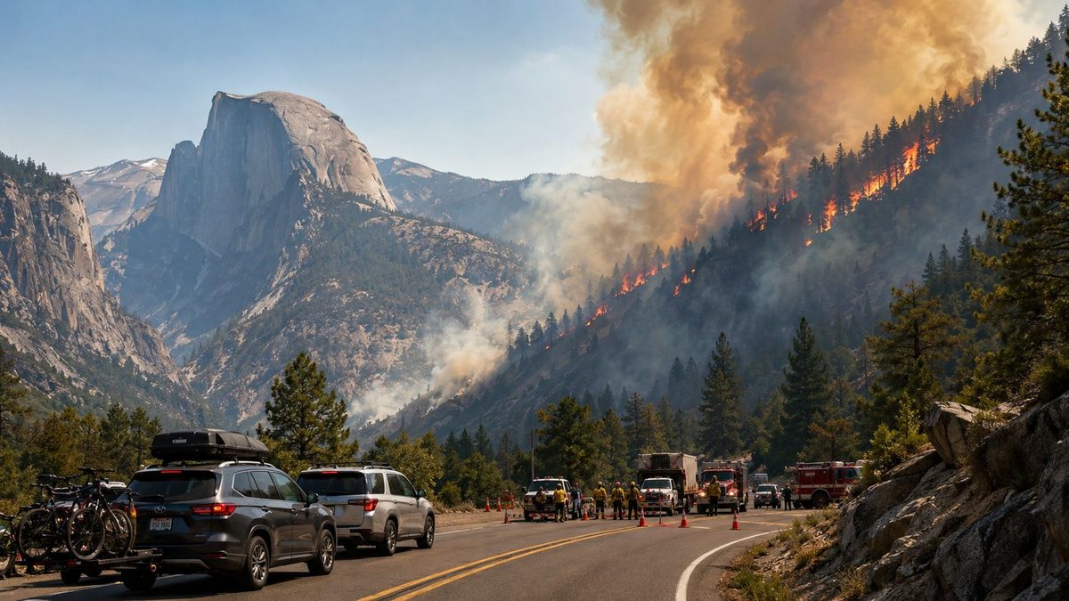
Image generated with Ai
The Colorado Fire in Mariposa County has grown to approximately 250 acres, prompting mandatory evacuations and affecting traffic near Yosemite National Park. The fire ignited after a serious crash on Highway 140 and spread quickly in steep and rugged terrain with zero containment. The Big Access Problem: The stretch of Highway 140 between Briceburg and the Bug Hostel is closed. This is a major problem for travellers headed to Yosemite via the western corridor.
CAL FIRE said the flames are threatening 45 structures and firefighters are working to contain the fire with ground crews and aircraft. The incident underscores the importance for visitors, tour operators and accommodation providers to check official wildfire and road information before travelling through California’s mountain corridors. The situation is fluid and authorities are still assessing fire behaviour, access and evacuation needs.
Advertisement
The Colorado Fire California emergency began on September 1 near the junction of Highway 140 and Colorado Road in Mariposa County. CAL FIRE recorded the incident at approximately 1.26pm, when the fire was still relatively small.
The blaze then expanded rapidly as it moved through difficult mountain terrain. CAL FIRE reported successive increases in the fire’s estimated size, reaching 171 acres before rising to approximately 250 acres later that afternoon. Containment remained at 0%, underlining the continuing challenge facing firefighters.
Advertisement
Advertisement
The fire has been running upslope, where steep gradients can accelerate its movement and complicate ground suppression. Firefighters have therefore combined crews on the ground with aircraft working above the fire perimeter.
The official cause remains under investigation. Early reports linked the ignition to a collision involving a cement mixer and a small tour bus, but the official investigation has not yet established a final cause.
According to local reporting, the bus was empty apart from its driver, who escaped without injury. The cement-truck driver was reported to be awake after the collision, although a definitive medical update was not immediately available.
The evacuation situation is currently the most important consideration for visitors and tourism businesses operating around the affected corridor. CAL FIRE has issued mandatory evacuation orders for Mariposa zones 546, 548 and 549, while additional areas remain under evacuation warnings.
A mandatory evacuation order means people inside the designated area should leave immediately. Travellers should not attempt to enter an evacuation zone to reach accommodation, campsites or recreational sites unless authorities specifically permit access.
The affected area includes Rancheria Creek Road, Briceburg and surrounding campgrounds, as well as the Octagon area. An evacuation warning has also been issued for Colorado Road between Highway 140 and Rancheria Creek, increasing the area that travellers must monitor.
Authorities have established evacuation arrangements for people displaced by the incident. New Life Calvary Chapel in Mariposa has been identified as an evacuation centre, with provisions also considered for animals.
The presence of evacuation orders demonstrates why visitors should rely on official emergency information rather than social-media posts or older travel updates. Wildfire boundaries can shift rapidly, particularly when wind, vegetation and steep terrain influence fire behaviour.
| Travel issue | Current position |
|---|---|
| Fire | Colorado Fire |
| County | Mariposa County |
| Start date | September 1, 2026 |
| Reported size | About 250 acres |
| Containment | 0% |
| Structures threatened | 45 |
| Main affected route | Highway 140 |
| Highway closure | Briceburg to the Bug Hostel |
| Mandatory evacuation | Mariposa zones 546, 548 and 549 |
| Evacuation warnings | Additional surrounding zones |
| Fire cause | Under investigation |
| Firefighting personnel | 126 |
| Engines | 14 |
| Helicopters | 4 |
| Dozers | 2 |
| Hand crews | 3 |
| Water tenders | 3 |
Figures reflect official CAL FIRE incident updates available around September 1–2, 2026.
The Highway 140 closure represents the clearest immediate travel consequence of the wildfire. The route has been closed from Briceburg to the Bug Hostel, preventing normal movement through an important western approach towards Yosemite.
The closure also affects Rancheria Creek Road, which has been shut as emergency crews work around the fire. Travellers planning road trips through Mariposa should therefore review their itinerary before setting out, even if their final destination lies beyond the immediate fire zone.
The disruption does not mean that all Yosemite access has been suspended. National Park Service information indicates that several other major routes into the park remain open, although individual road conditions can change quickly.
That distinction is important for tourism businesses. Travellers may still be able to reach Yosemite through alternative approaches, but they should confirm the status of their specific route rather than relying on assumptions.
Commercial navigation applications may also lag behind emergency road closures. Official Caltrans and National Park Service updates should therefore take priority when planning a journey during an active wildfire.
Yosemite remains one of California’s most important visitor destinations, attracting millions of travellers each year. The National Park Service recorded roughly 4.1 million visits in 2024, demonstrating the scale of the tourism economy connected to the park.
That visitor economy extends well beyond Yosemite’s boundaries. Hotels, restaurants, campgrounds, transport operators, guides and outdoor businesses in Mariposa and surrounding communities depend heavily on reliable access.
A road closure can consequently create commercial disruption even when the wildfire itself occupies a relatively limited area. Tour operators may need to modify itineraries, while accommodation providers may face delayed arrivals or last-minute cancellations.
International travellers can experience additional complications because their journeys often involve fixed hotel bookings, rental cars and pre-arranged excursions. A sudden road closure can therefore create a chain of changes across several parts of an itinerary.
The Colorado Fire illustrates an important tourism principle: fire size does not necessarily determine travel impact. A smaller wildfire can have an outsized effect when it affects a strategically important road serving a major destination.
The Colorado Fire has emerged during an active California wildfire season. CAL FIRE’s 2026 incident data show more than 5,000 wildfires and over 300,000 acres burned statewide, although figures continue to change as incidents are updated.
Several other major fires have also affected the state during the current season. The Plaskett Fire and Timber Fire, for example, have reached many thousands of acres, making them considerably larger than the Colorado Fire.
However, comparing fires solely by acreage can be misleading for travellers. Location, road access, evacuation zones and proximity to tourism infrastructure often determine the practical impact on visitors.
California therefore should not be treated as a single travel-risk destination. One region may operate normally while another faces emergency restrictions, road closures or evacuation orders.
Travellers should assess conditions at their specific destination and along their planned route. This approach allows visitors to make informed decisions without unnecessarily disrupting unaffected parts of a wider California itinerary.
Travellers heading towards Yosemite or Mariposa should check several official information channels before departure. CAL FIRE provides wildfire updates, while Caltrans supplies highway information and the National Park Service provides Yosemite-specific access details.
Checking these sources immediately before travelling is particularly important during an active incident. A road that was open earlier in the day can close quickly if fire behaviour changes or emergency operations intensify.
Visitors should also contact their accommodation if they are travelling close to the affected corridor. Hotels, campsites and local operators may have more immediate information about access restrictions or alternative arrival routes.
Travellers should never enter an evacuation zone simply because their accommodation or attraction remains accessible on an older map. Emergency instructions take priority over travel plans, particularly when authorities have issued mandatory evacuation orders.
| What travellers should check | Why it matters |
|---|---|
| CAL FIRE incident updates | Confirms fire size, containment and evacuation information |
| Caltrans road conditions | Identifies current highway closures and restrictions |
| Yosemite National Park alerts | Confirms park-specific access and road conditions |
| Accommodation provider | Establishes whether properties remain accessible |
| Tour operator | Confirms changes to excursions and transfers |
| Alternative routes | Reduces disruption if a road closes |
| Local emergency instructions | Provides the latest safety requirements |
The safest approach is to verify conditions immediately before departure and again during longer journeys. Travellers should keep their phones charged and retain access to emergency alerts while moving through wildfire-prone regions.
The firefighting response has been substantial despite the Colorado Fire’s relatively modest acreage. CAL FIRE reported 126 personnel, alongside 14 engines, four helicopters, two dozers, three hand crews and three water tenders.
The deployment reflects the operational difficulty created by the terrain. Ground crews may face steep slopes and limited access, making aircraft particularly important for reaching areas that are difficult to approach directly.
Aircraft can also provide rapid suppression support when fire activity threatens to move uphill. Their use depends on weather, visibility, smoke conditions and operational priorities across the wider region.
The authorities’ response also explains the road closures around the incident. Emergency vehicles and aircraft operations require secure access, while reducing civilian traffic can help crews move safely through affected areas.
The 45 structures currently listed as threatened should therefore be viewed as an exposure figure rather than a prediction of losses. Official incident data had not reported destroyed or damaged structures in the available updates.
For the travel industry, the incident underlines the importance of contingency planning around wildfire-prone destinations. Operators serving Yosemite should maintain alternative routes and communicate changes quickly when highways close.
Coach companies face particular challenges because larger vehicles require suitable roads and turning points. A diversion that works for a private car may not necessarily work for a coach or shuttle service.
Hotels and tourism businesses should likewise provide guests with clear arrival guidance. Simple instructions about alternative approaches can reduce confusion when visitors encounter an unexpected closure.
Outdoor operators may need to review activities affected by smoke, access restrictions or emergency operations. Hiking, camping, rafting and sightseeing programmes can all be influenced by wildfire conditions even when flames remain outside the activity area.
The broader lesson is that wildfire resilience is becoming part of destination management. Tourism infrastructure increasingly needs procedures that allow businesses to operate safely during short-notice environmental disruptions.
Travellers should not interpret the Colorado Fire as a complete closure of Yosemite National Park. The latest National Park Service conditions information indicates that several major routes and areas remain open.
Wawona Road and Big Oak Flat Road have been listed as open, while Yosemite Valley roads have also remained accessible under the latest information. However, Highway 140 faces specific restrictions because of fire activity.
This means visitors may still be able to proceed with a Yosemite trip by using a different approach. The correct route depends on the traveller’s starting point and the latest road conditions.
The distinction is particularly relevant for hotels and attractions outside the immediate evacuation area. Businesses can continue serving visitors where authorities permit access, even while a neighbouring corridor remains closed.
Travellers should nevertheless avoid unnecessary journeys near the fire. Even when an alternative route remains open, smoke, emergency vehicles and changing weather can create additional hazards.
The most reliable information during this incident comes from official emergency and transport authorities. CAL FIRE, Caltrans and the National Park Service each provide different information needed to understand the travel situation.
Travellers should check the CAL FIRE incident page for the latest fire and evacuation updates. They should also review Caltrans information before using Highway 140 or nearby state routes.
The National Park Service remains the appropriate source for Yosemite’s current access conditions. Visitors should check it immediately before entering the park because wildfire-related restrictions can change rapidly.
Travel companies should use the same official sources when communicating with customers. Clear, timely information can prevent travellers from arriving at closed roads or entering areas affected by evacuation orders.
The Colorado Fire is small in comparison to California’s largest active wildfires, but it has significant tourism implications. Within hours, the incident had spread to 250 acres, threatening 45 structures and forcing evacuations along a major Yosemite travel corridor.
The key message for visitors is not to avoid California altogether. Instead, travellers should plan for conditions at the time of travel, check road access, and be flexible when travelling to wildfire-prone destinations.
The latest park information indicates that there are alternate access routes to Yosemite. But there is a direct disruption for travellers on Highway 140 and conditions near the Colorado Fire may change.
The incident serves as a reminder to the travel trade of the importance of flexible itineraries, prompt communication with customers and good contingency planning. Most importantly, all visitors should heed mandatory evacuation orders and emergency road closures, as safety should always be a top priority during an active wildfire.
The Colorado Fire California is a wildfire burning in Mariposa County near Highway 140 and the Yosemite area. It expanded rapidly to approximately 250 acres, with zero containment reported in the latest updates.
The fire is burning near Highway 140 in Mariposa County, close to Briceburg and the Merced River corridor. Its location is significant for tourism because Highway 140 serves as an important western approach towards Yosemite National Park.
No. Highway 140 is closed through the affected section, including the stretch between Briceburg and the Bug Hostel. Travellers should check the latest Caltrans and National Park Service updates before setting out because emergency closures can change quickly.
Yosemite National Park is not completely closed because of the Colorado Fire. Several major approaches remain open according to the latest National Park Service information, although Highway 140 has specific restrictions.
Yes. Mandatory evacuation orders are in effect for several Mariposa County zones, including areas around Rancheria Creek Road, Briceburg and the Octagon area. Additional surrounding locations have been placed under evacuation warnings.
The wildfire has reached approximately 250 acres in the latest reported update. Its rapid growth from the initial reported acreage has prompted an intensive firefighting response.
Authorities have reported approximately 45 structures threatened by the fire. This figure represents properties considered exposed to the advancing wildfire and does not mean that all have been damaged or destroyed.
Advertisement
Advertisement
Advertisement












Wednesday, September 2, 2026

Tuesday, September 1, 2026
Wednesday, September 2, 2026

Wednesday, September 2, 2026

Tuesday, September 1, 2026

Tuesday, September 1, 2026

Wednesday, September 2, 2026

Wednesday, September 2, 2026